Subject: United States - Mid-Atlantic and Great Lakes
Period: 1794 (dated)
Publication:
Color: Hand Color
Size:
26 x 19 inches
66 x 48.3 cm
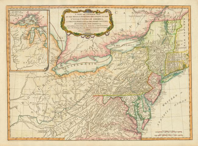
This is probably one of the most popular contemporary maps depicting the new United States. It is a derivative of the Lewis Evans map originally published by Thomas Kitchin in 1756. Evans' map contributed enormously to the cartographic knowledge of the Ohio Valley and was the first map to indicate the presence of petroleum in Pennsylvania and coal in Ohio, as well as denoting important passages through the Appalachians. The plate was changed 17 times while passing through the possession of Thomas Jefferys, Sayer & Jefferys, Sayer & Bennett, and finally, Laurie & Whittle in 1794. The coastline from Chesapeake to Narragansett Bay is carefully delineated, and substantial detail appears westward as far as present-day Indiana. The large inset, A Sketch of the Upper Parts - to show the Remainder of the Lakes, focuses on the region of the Welinis or Illinois Indian nation, with Fort Detroit noted. The map is filled with fascinating notations.
References: McCorkle #794.6; Tooley (Amer) p. 68, #30h.
Condition: B
Printed on strong heavy paper. Some minor offsetting and a small abrasion in title cartouche.