Subject: Colonial Mid-Atlantic
Period: 1662 (circa)
Publication: Altas Maior
Color: Hand Color
Size:
18.7 x 14.7 inches
47.5 x 37.3 cm
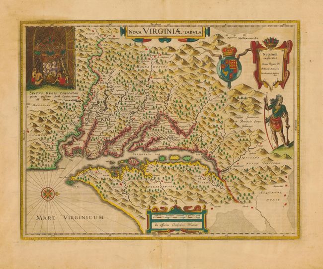
This is one of the most important 17th century maps of the Chesapeake Bay region. The map is a version of the one made in 1612 by Capt. John Smith, which was the first to depict the bay and its tributaries with any accuracy. In the upper left corner is an engraving of the great Indian chief, Powhatan, seated on his throne and surrounded by his subjects. A Susquehanna chief is depicted on the right under a coat of arms and cartouche. The plate was engraved by Jodocus Hondius II and purchased by Willem Blaeu shortly after his death. Latin text on verso.
References: Burden #193.
Condition: A
Moderate toning with fine old color. Minor printer's crease along fold. Professional repair on bottom fold and some chipped edges. Some foxing on verso.