Catalog Archive
Auction 111, Lot 108

"Partie Occidentale du Canada, Contenant les cinq Grands Lacs, avec les Pays Circonvoisins", Bonne, Rigobert

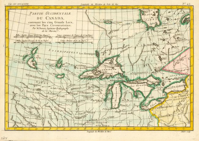
Subject: Colonial Canada & Great Lakes

Period: 1775 (circa)

Publication: Atlas de toutes les parties connues du Globe Terrestre…

Color: Hand Color

Size:
12.5 x 8.4 inches
31.8 x 21.3 cm
Download High Resolution Image
(or just click on image to launch the Zoom viewer)

Nice example of this map of the Great Lakes depicting frontier forts, missions, and fur trade routes. It covers the region from James Bay to just below Ft. Duquesne and from Lake Ontario through the Great Plains. It contains numerous Indian tribe names and forts, including Detroit, St. Louis, Toronto and Chicagou. The supposed source of the Mississippi is shown. First state, engraved by Andre.

References: Kershaw #973, Sellers and Van Ee #173.

Condition: A

Estimate: $275 - $325

Sold for: $250

Closed on 6/8/2005

Archived