Subject: United States - Mid-Atlantic
Period: 1850 (dated)
Publication: Mitchell's New Universal Atlas
Color: Hand Color
Size:
14.5 x 12 inches
36.8 x 30.5 cm
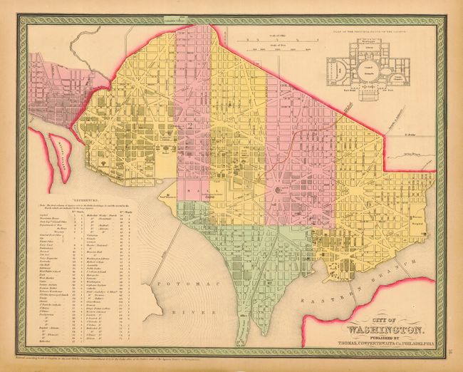
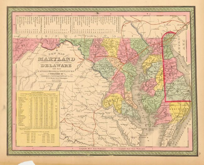
First is a detailed plan of the Capitol as it appeared in 1852 with architectural plan of the principle floor of the Capitol building at upper right. Large References table locates 75 important buildings including embassies, churches, government and military facilities, galleries, breweries, etc. The second is an attractive map with nice detail of the counties, cities, roads and railways. Table at top lists Steam Boat Routes - Baltimore to Norfolk, Baltimore to Philadelphia and Baltimore to Washington. A second table at lower left gives the population in Maryland by county subdivided in Farms, Dwellings, Families, Slaves, and Manufacturing Establishments. A nice pair, both sized approximately as given.
References:
Condition: A
Both with nice original hand coloring and some marginal toning. The latter with a chip in lower margins well away from border.