Filtered by Category:United States(Show All Categories)
Showing results for:Auction 103
Catalog Archive
128 lots
Page 1 of 3
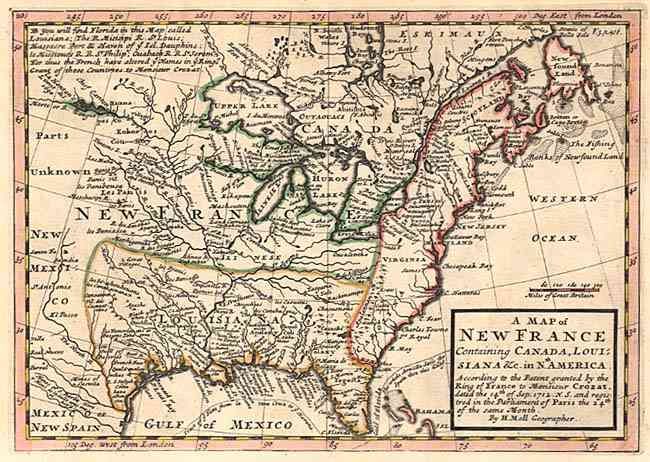
Auction 103, Lot 85
Subject: Colonial United States and Canada
Moll, Herman
A Map of New France containing Canada, Louisiana &c. in Nth. America…, 1730
Size: 10.2 x 7.4 inches (25.9 x 18.8 cm)
Estimate: $450 - $500
Sold for: $425
Closed on 6/11/2003
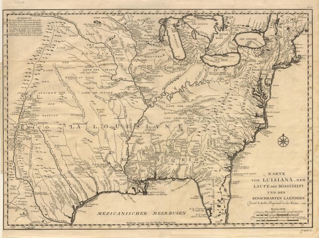
Auction 103, Lot 86
Subject: Colonial Louisiana
Bellin, Jacques Nicolas
Karte von Luisiana, dem Laufe des Mississipi und den Benachbarten Laendern…, 1744
Size: 22 x 15.5 inches (55.9 x 39.4 cm)
Estimate: $1,100 - $1,200
Sold for: $950
Closed on 6/11/2003
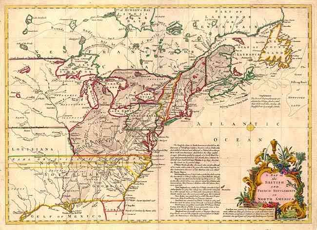
Auction 103, Lot 87
Subject: Colonial United States and Canada
Lodge, John
A Map of the British and French Settlements in North America, 1755
Size: 15 x 11 inches (38.1 x 27.9 cm)
Estimate: $550 - $600
Sold for: $900
Closed on 6/11/2003
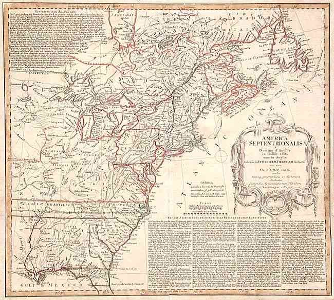
Auction 103, Lot 88
Subject: Colonial North America - Eastern Part
Homann Heirs
America Septentrionalis a Domino d'Anville in Galliis edita nunc in Anglia Coloniis in Interiorem Virginiam deductis nec non Fluvii Ohio cursu…, 1756
Size: 20 x 18 inches (50.8 x 45.7 cm)
Estimate: $500 - $600
Sold for: $425
Closed on 6/11/2003
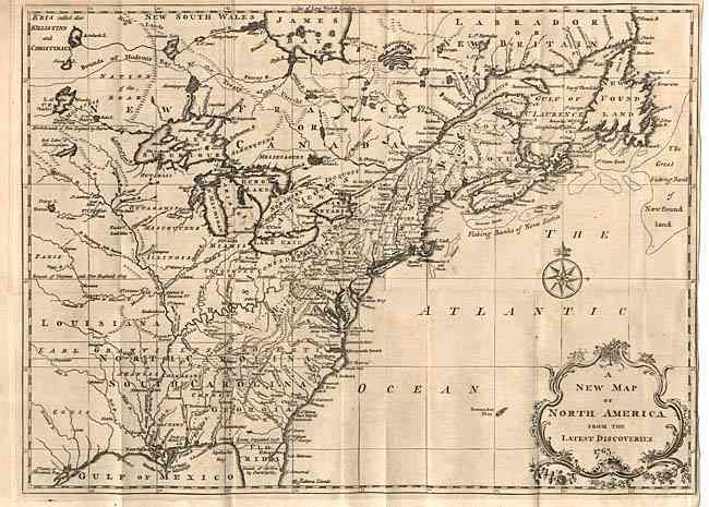
Auction 103, Lot 89
Subject: Colonial United States and Canada
Spilsbury, J.
A New Map of North America from the Latest Discoveries, 1763
Size: 14.9 x 10.9 inches (37.8 x 27.7 cm)
Estimate: $300 - $350
Sold for: $600
Closed on 6/11/2003
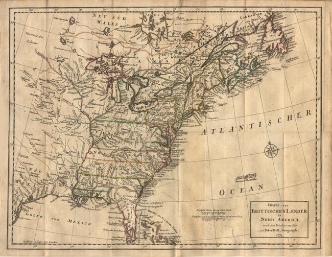
Auction 103, Lot 90
Subject: Colonial North America
Bell, Peter
Charte der Brittischen Laender in Nord America, nach den Frieden von 1763, 1772
Size: 15 x 11.7 inches (38.1 x 29.7 cm)
Estimate: $300 - $350
Sold for: $350
Closed on 6/11/2003
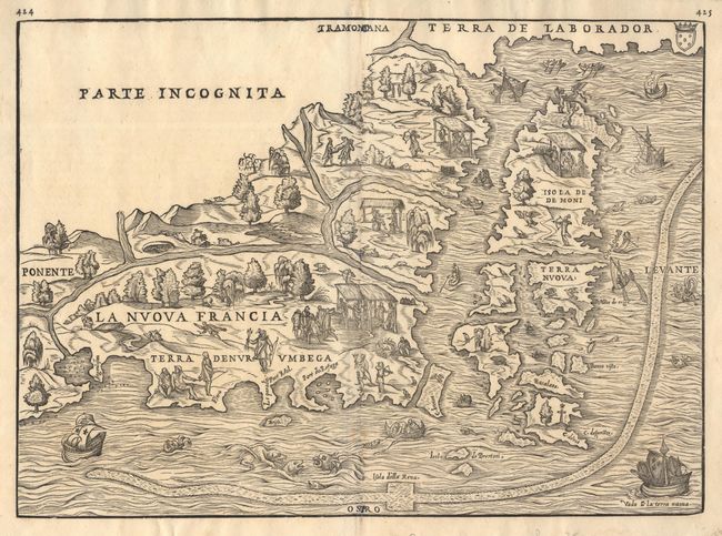
Auction 103, Lot 91
Subject: Colonial New England & Canada
Gastaldi/Ramusio
La Nuova Francia, 1565
Size: 14.5 x 10.5 inches (36.8 x 26.7 cm)
Estimate: $1,500 - $1,800
Sold for: $1,700
Closed on 6/11/2003
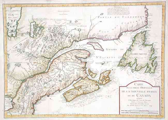
Auction 103, Lot 92
Subject: Colonial New England and Canada
Bellin, Jacques Nicolas
Carte de la partie Orientale de la Nouvelle France ou du Canada…, 1744
Size: 21.7 x 15.6 inches (55.1 x 39.6 cm)
Estimate: $600 - $650
Sold for: $600
Closed on 6/11/2003
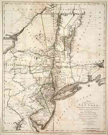
Auction 103, Lot 93
Subject: Colonial Mid Atlantic
Sauthier/Faden
A Map of the Province of New-York, Reduc'd from the large Drawing of that Province...by Order of His Excellency William Tryon Esqr. Captain General & Governor of the same...to which is added New-Jersey…, 1776
Size: 22.5 x 28.2 inches (57.2 x 71.6 cm)
Estimate: $2,500 - $3,000
Unsold
Closed on 6/11/2003
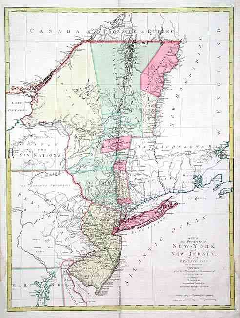
Auction 103, Lot 94
Subject: Colonial Northeast
Lotter, Mathias Albrecht
A Map of the Provinces of New-York and New-Jersey with a part of Pennsylvania and the Province of Quebec, 1777
Size: 22.5 x 30 inches (57.2 x 76.2 cm)
Estimate: $2,400 - $3,000
Unsold
Closed on 6/11/2003
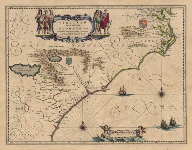
Auction 103, Lot 95
Subject: Colonial Southeast
Blaeu, Willem
Virginiae partis australis, et Floridae partis orientalis, interjacentiumq regionum Nova Descriptio, 1640
Size: 20 x 15 inches (50.8 x 38.1 cm)
Estimate: $1,900 - $2,200
Sold for: $1,500
Closed on 6/11/2003
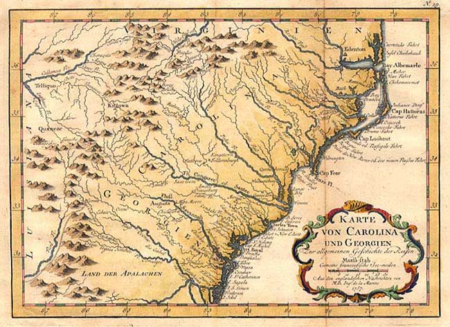
Auction 103, Lot 96
Subject: Colonial Southeast
Bellin, Jacques Nicolas
Karte von Carolina und Georgien, 1757
Size: 10 x 7.3 inches (25.4 x 18.5 cm)
Estimate: $350 - $400
Sold for: $325
Closed on 6/11/2003
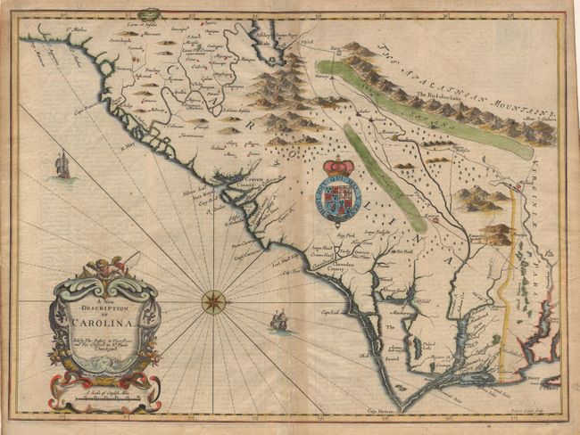
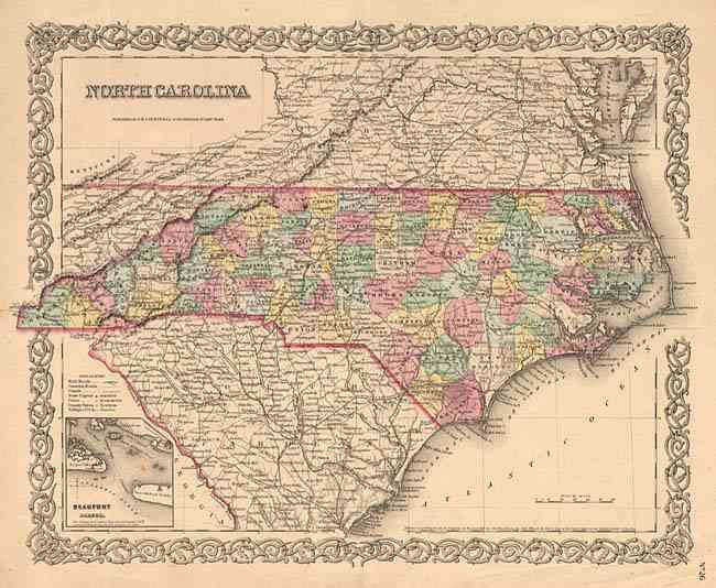
Auction 103, Lot 97
Subject: Colonial Carolinas
Speed/Lamb
A New Description of Carolina, 1676
Size: 20 x 14.7 inches (50.8 x 37.3 cm)
Estimate: $5,000 - $6,000
Unsold
Closed on 6/11/2003
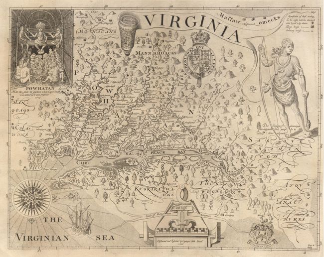
Auction 103, Lot 98
Subject: Colonial Virginia
Smith, John (Capt.)
Virginia, 1819
Size: 16 x 12.4 inches (40.6 x 31.5 cm)
Estimate: $400 - $500
Sold for: $425
Closed on 6/11/2003
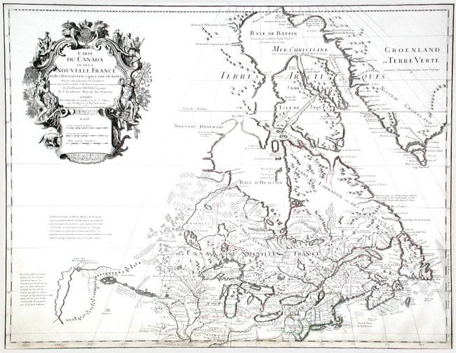
Auction 103, Lot 99
Subject: Colonial North America - Great Lakes
Delisle, Guillaume
Carte du Canada ou de la Nouvelle France et des Decouvertes qui y ont ete faites…, 1703
Size: 25.75 x 19.25 inches (65.4 x 48.9 cm)
Estimate: $3,250 - $4,000
Sold for: $3,750
Closed on 6/11/2003
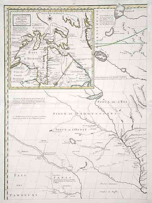
Auction 103, Lot 100
Subject: Colonial Midwest
Mitchell/Le Rouge
[Amerique Septentrionale, sheet 8], 1776
Size: 18.7 x 25.7 inches (47.5 x 65.3 cm)
Estimate: $500 - $600
Sold for: $450
Closed on 6/11/2003
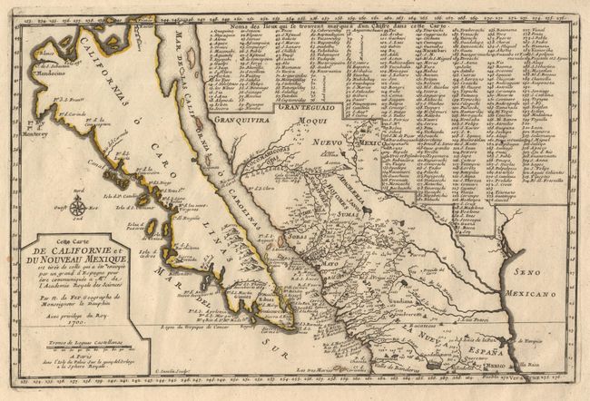
Auction 103, Lot 101
Subject: Colonial California and Mexico
Fer, Nicolas de
Cette Carte de Californie et du Nouveau Mexique…, 1700
Size: 13.4 x 8.7 inches (34 x 22.1 cm)
Estimate: $1,900 - $2,300
Sold for: $2,200
Closed on 6/11/2003
Auction 103, Lot 106
Subject: Canada & United States
Forster, Georg
Karte des Nordens von America…, 1791
Size: 25.5 x 19 inches (64.8 x 48.3 cm)
Estimate: $700 - $800
Sold for: $650
Closed on 6/11/2003
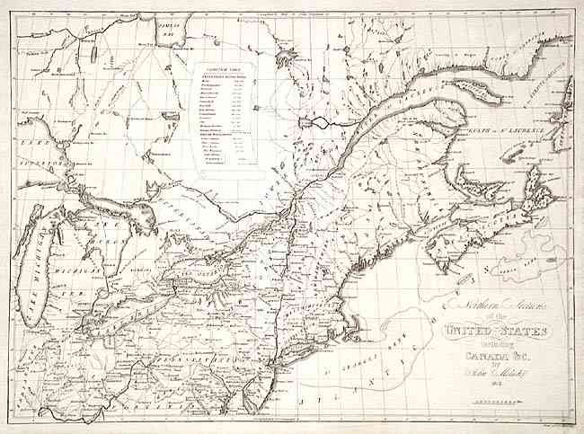
Auction 103, Lot 107
Subject: United States & Canada
Melish, John
Northern Section of the United States including Canada &c., 1816
Size: 20.6 x 15 inches (52.3 x 38.1 cm)
Estimate: $700 - $800
Sold for: $400
Closed on 6/11/2003
Auction 103, Lot 108
Subject: Canada & United States
Lapie, Alexander Emile & Pierre
Carte des Etats-Unis d'Amerique, du Canada, du Nouveau Brunswick et d'une partie de la Nouvelle Bretagne, 1832
Size: 21 x 15.3 inches (53.3 x 38.9 cm)
Estimate: $250 - $300
Sold for: $190
Closed on 6/11/2003
Auction 103, Lot 109
Subject: Canada and United States
SDUK Society for the Diffusion of Useful Knowledge
[Set of 15 maps], 1832-34
Size: 12 x 15 inches (30.5 x 38.1 cm)
Estimate: $1,200 - $1,400
Sold for: $2,500
Closed on 6/11/2003
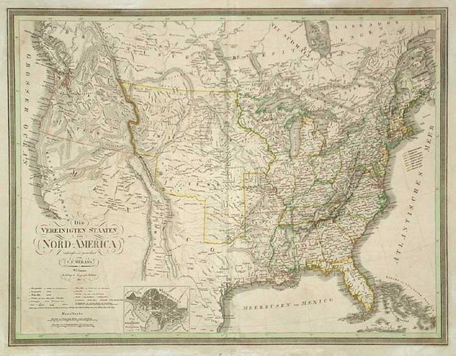
Auction 103, Lot 110
Subject: United States and Canada
Weiland, Carl Ferdinand
Die Vereinigten Staaten von Nord-America, 1837
Size: 24.5 x 19 inches (62.2 x 48.3 cm)
Estimate: $300 - $350
Sold for: $220
Closed on 6/11/2003
Auction 103, Lot 111
Subject: United States
Alabern, Pablo
Estados Unidos de la America Septentrional, 1834
Size: 16.2 x 11.5 inches (41.1 x 29.2 cm)
Estimate: $350 - $450
Sold for: $275
Closed on 6/11/2003
Auction 103, Lot 112
Subject: United States
Anon.
United States, 1839
Size: 17.5 x 10.2 inches (44.5 x 25.9 cm)
Estimate: $300 - $400
Sold for: $500
Closed on 6/11/2003
Auction 103, Lot 113
Subject: United States
Burr, David H.
Map of the United States Exhibiting the Several Collection Districts, 1856
Size: 49 x 31 inches (124.5 x 78.7 cm)
Estimate: $300 - $350
Sold for: $250
Closed on 6/11/2003
Auction 103, Lot 114
Subject: United States
Perthes, Justus
Verein-Staaten von Nord-America, Mexico, Yucatan U.A., 1868
Size: 15.5 x 12.5 inches (39.4 x 31.8 cm)
Estimate: $70 - $90
Sold for: $50
Closed on 6/11/2003
Auction 103, Lot 115
Subject: United States
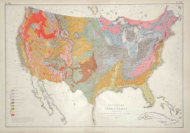
Hitchcock, Charles Henry
Geological Map of the United States compiled by C.H. Hitchcock and W. P. Blake…, 1874
Size: 28 x 19.7 inches (71.1 x 50 cm)
Estimate: $300 - $400
Unsold
Closed on 6/11/2003
Auction 103, Lot 116
Subject: United States
Rand McNally & Co.
New Official Railroad map of the United States and Canada, 1885
Size: 42.5 x 26.5 inches (108 x 67.3 cm)
Estimate: $250 - $300
Sold for: $275
Closed on 6/11/2003
Auction 103, Lot 118
Subject: U.S. States and Cities
Colton, George Woolworth
[Lot of 22 - U.S. States and Cities], 1855-56
Size: 14 x 11 inches (35.6 x 27.9 cm)
Estimate: $450 - $550
Sold for: $600
Closed on 6/11/2003
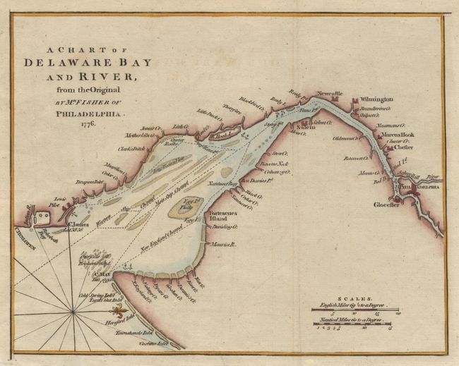
Auction 103, Lot 119
Subject: Delaware Bay
Anon.
A Chart of Delaware Bay and River, from the Original by Mr. Fisher of Philadelphia - 1776, 1779
Size: 9.2 x 7 inches (23.4 x 17.8 cm)
Estimate: $275 - $325
Sold for: $220
Closed on 6/11/2003
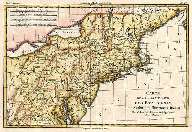
Auction 103, Lot 120
Subject: Eastern United States
Bonne, Rigobert
Carte de la Partie Nord, des Etats Unis, de l'Amerique Septentrionale, 1782
Size: 12.5 x 8.4 inches (31.8 x 21.3 cm)
Estimate: $180 - $220
Sold for: $170
Closed on 6/11/2003

Auction 103, Lot 121
Subject: Eastern United States
Brion de la Tour, Louis
Carte des Etats-Unis d'Amerique et du Cours du Mississipi…, 1785
Size: 10.5 x 8.7 inches (26.7 x 22.1 cm)
Estimate: $500 - $550
Sold for: $550
Closed on 6/11/2003
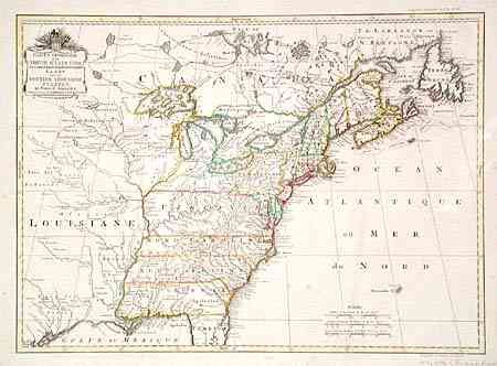
Auction 103, Lot 122
Subject: Eastern United States
Covens & Mortier
Carte Generale des Treize Etats Unis, de l'Amerique Septentrionale / Kaart van de Dertien Verenigde Staaten in Noord Amerika, 1785
Size: 22.5 x 16.2 inches (57.2 x 41.1 cm)
Estimate: $4,000 - $4,500
Unsold
Closed on 6/11/2003
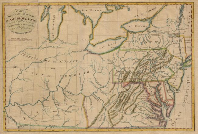
Auction 103, Lot 123
Subject: Eastern United States
Conder, Thomas
Carte des Etats Mitoyens de l Amerique Unie dressee d'apres les Autorites les plus nouvelles et les mieux choisies, 1794
Size: 17.7 x 12 inches (45 x 30.5 cm)
Estimate: $400 - $450
Sold for: $230
Closed on 6/11/2003
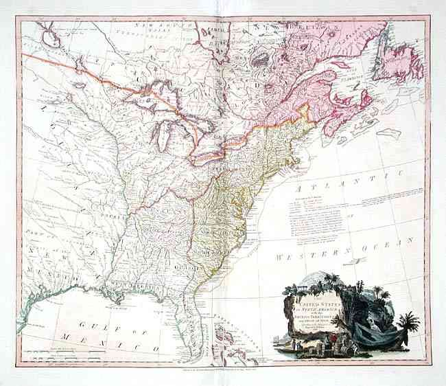
Auction 103, Lot 124
Subject: Eastern United States
Faden, William
The United States of North America: with the British Territories and Those of Spain, according to the Treaty of 1784, 1796
Size: 24.7 x 20.7 inches (62.7 x 52.6 cm)
Estimate: $1,800 - $2,200
Sold for: $1,700
Closed on 6/11/2003
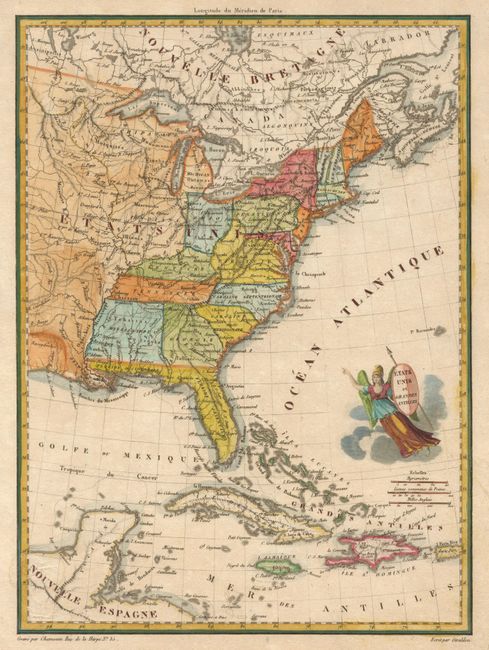
Auction 103, Lot 125
Subject: Eastern United States
Chamouin, Jean Baptiste Marie
Etats Unis et Grandes Antilles, 1825
Size: 8.7 x 11.7 inches (22.1 x 29.7 cm)
Estimate: $160 - $200
Sold for: $200
Closed on 6/11/2003
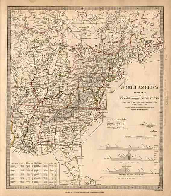
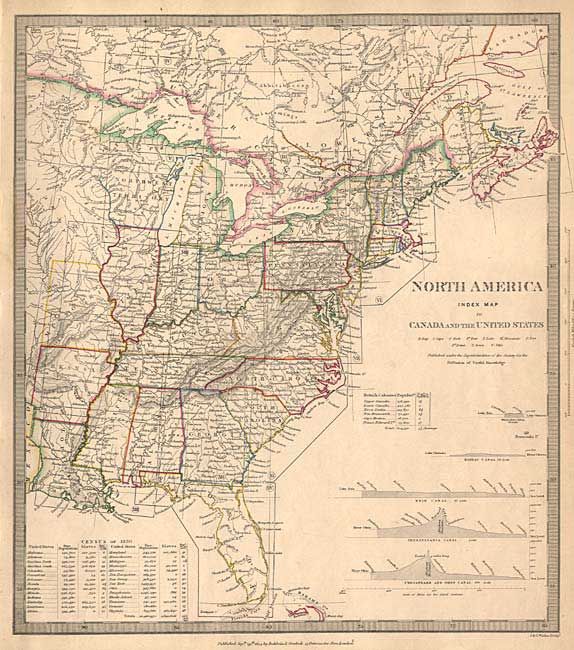
Auction 103, Lot 126
Subject: Eastern United States
SDUK Society for the Diffusion of Useful Knowledge
North America Index Map to Canada and the United States, 1834
Size: 12.4 x 14.5 inches (31.5 x 36.8 cm)
Estimate: $140 - $180
Sold for: $180
Closed on 6/11/2003
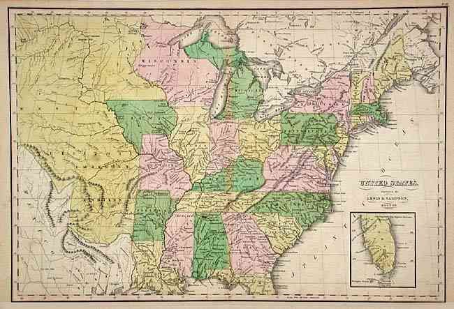
Auction 103, Lot 127
Subject: Eastern United States
Lewis & Sampson
United States, 1835-40
Size: 16.6 x 11.4 inches (42.2 x 29 cm)
Estimate: $300 - $400
Sold for: $250
Closed on 6/11/2003
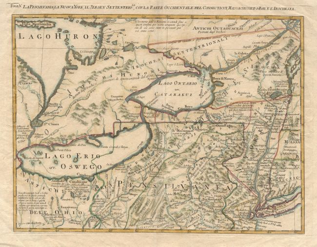
Auction 103, Lot 128
Subject: Northeastern United States
Zatta, Antonio
Fogl. V. La Pensilvania, la Nuova York, il Jersey Settentrio;le, con la Parte Occidentale del Connecticut, Massachusset-s-Baye l'Irochesia, 1785
Size: 16.6 x 12.5 inches (42.2 x 31.8 cm)
Estimate: $500 - $600
Sold for: $375
Closed on 6/11/2003
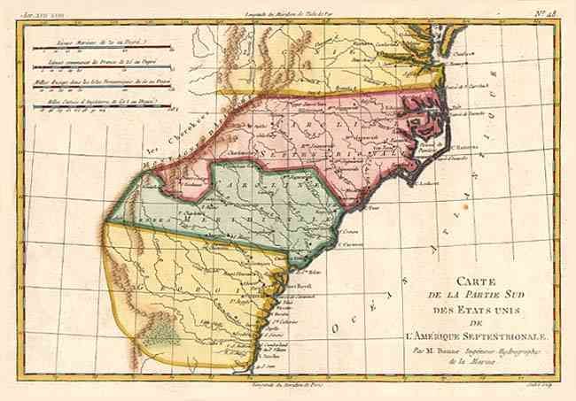
Auction 103, Lot 129
Subject: Southeastern United States
Bonne, Rigobert
Carte de la Partie Sud des Etats Unis de l'Amerique Septentrionale, 1783
Size: 12.5 x 8.5 inches (31.8 x 21.6 cm)
Estimate: $180 - $220
Sold for: $210
Closed on 6/11/2003
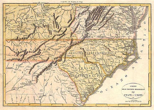
Auction 103, Lot 130
Subject: Southeastern United States
Anon.
Carta delle Provincie Meridionali degli Stati-Uniti, 1790
Size: 19 x 13.2 inches (48.3 x 33.5 cm)
Estimate: $350 - $400
Unsold
Closed on 6/11/2003
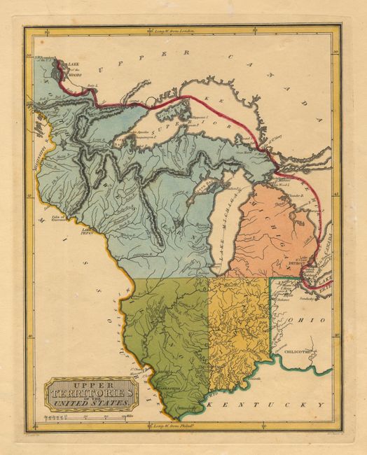
Auction 103, Lot 131
Subject: Central United States
Lewis, Samuel
Upper Territories of the United States, 1808
Size: 8.5 x 10.7 inches (21.6 x 27.2 cm)
Estimate: $400 - $500
Sold for: $650
Closed on 6/11/2003

Auction 103, Lot 132
Subject: Central United States
SDUK Society for the Diffusion of Useful Knowledge
North America Sheet X Parts of Missouri, Illinois, Kentucky, Tennessee, Alabama, Mississippi and Arkansas, 1833
Size: 15.7 x 12.5 inches (39.9 x 31.8 cm)
Estimate: $70 - $90
Sold for: $40
Closed on 6/11/2003
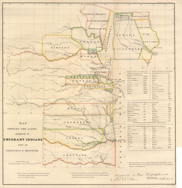
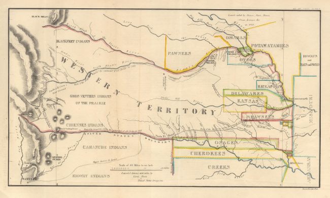
Auction 103, Lot 133
Subject: Central United States
U.S. War Dept.
Map Showing the Lands assigned to Emigrant Indians West of Arkansas & Missouri, 1860
Size: 17.7 x 18.7 inches (45 x 47.5 cm)
Estimate: $325 - $375
Sold for: $325
Closed on 6/11/2003
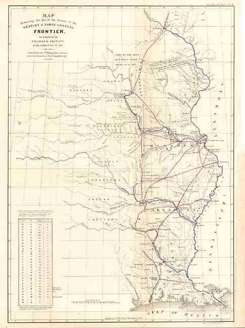
Auction 103, Lot 134
Subject: Central United States
Gratiot, Charles
Map Illustrating the Plan of the Defences of the Western & North-Western Frontier, as proposed by Charles Gratiot, in his report of Oct. 31, 1837, 1860
Size: 15.2 x 21.5 inches (38.6 x 54.6 cm)
Estimate: $350 - $400
Sold for: $325
Closed on 6/11/2003
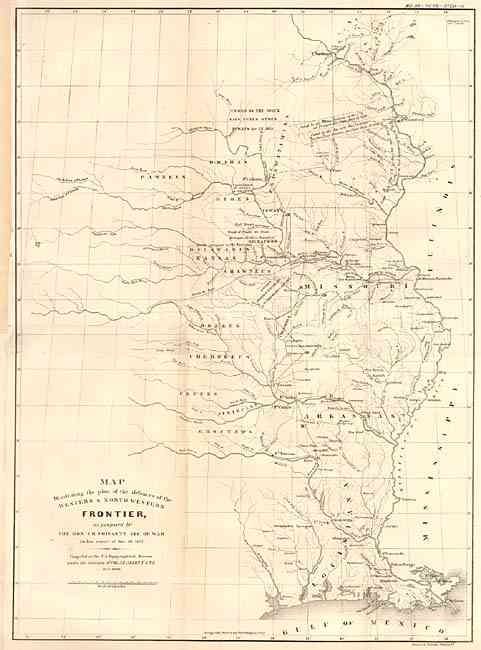
Auction 103, Lot 135
Subject: Central United States
Poinsett, J. R.
Map Illustrating the plan of the defences of the Western & North-Western Frontier, as proposed by the Hon: J.R. Poinsett, Sec. of War, in his report of Dec. 30, 1837, 1860
Size: 15.5 x 21.5 inches (39.4 x 54.6 cm)
Estimate: $350 - $400
Sold for: $325
Closed on 6/11/2003
Auction 103, Lot 136
Subject: Colorado, Kansas, Nebraska
U.S. Government
[Colorado, Kansas, Nebraska], 1860
Size: 17.5 x 10 inches (44.5 x 25.4 cm)
Estimate: $250 - $300
Sold for: $170
Closed on 6/11/2003
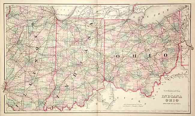
Auction 103, Lot 137
Subject: Central United States
Colton, G.W. & C.B.
New Railroad Map of Indiana Ohio and part of Illinois, 1875
Size: 27.4 x 16 inches (69.6 x 40.6 cm)
Estimate: $100 - $150
Sold for: $75
Closed on 6/11/2003
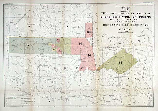
Auction 103, Lot 138
Subject: Central United States
Royce, C. C.
Map of the Former Territorial Limits of the Cherokee Nation of Indians… [together with] Map Showing the Territory Originally Assigned to the Cherokee Nation of Indians West of the Mississippi…, 1884
Size: See Description
Estimate: $300 - $400
Sold for: $150
Closed on 6/11/2003
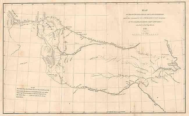
Auction 103, Lot 139
Subject: Western United States
Franklin, William Buell [Lt.]
Map of the Route Pursued by the Late Expedition under the Command of Col. S.W. Kearney, U.S. 1st Dragoons, 1845
Size: 12.8 x 8 inches (32.5 x 20.3 cm)
Estimate: $200 - $250
Sold for: $210
Closed on 6/11/2003
128 lots
Page 1 of 3