Subject: Colonial North America
Period: 1772 (dated)
Publication: Geschichte der englishen Kolonien in Nord-Amerika
Color: Hand Color
Size:
15 x 11.7 inches
38.1 x 29.7 cm
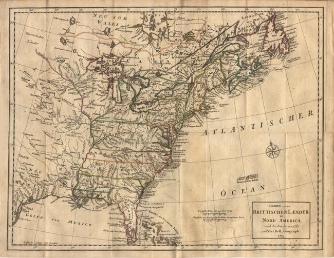
Attractive and detailed map of the British Colonies, focused on the eastern half of North America and describing the region according to the treaty of 1763. The area shown is from James Bay to Newfoundland in the north and from the Gulf of Mexico to the Florida Keys in the south. The colonies of Virginia, the Carolinas, Georgia and Florida all extend to the Mississippi River. Large amounts of coastal and interior detail with towns, Indian villages, rivers and fishing banks. This is a German edition of Bell's 1772 map, published in 1775.
References: McCorkle #772.1; Sellers & Van Ee #98 (British edition).
Condition: B
Original outline color. Folding as issued. Light offsetting and a few small, scattered spots, else very good.