Catalog Archive
Auction 103, Lot 124

"The United States of North America: with the British Territories and Those of Spain, according to the Treaty of 1784", Faden, William

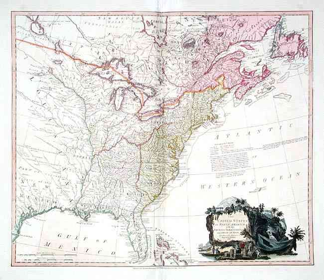
Subject: Eastern United States

Period: 1796 (dated)

Publication: General Atlas

Color: Hand Color

Size:
24.7 x 20.7 inches
62.7 x 52.6 cm
Download High Resolution Image
(or just click on image to launch the Zoom viewer)

This map is the sixth state of one of the first English maps to display the boundaries of the newly recognized United States. Extends westward to include Texas, here called Cenis. Shows the short lived state of Franklinia in eastern Tennessee, New Iberia west of the Mississippi, Army Lands, Tannassee Government, Indian tribes, forts, etc. Pictorial cartouche with figures and cargo. This state adds an interesting notation that all lands not settled by Europeans "should belong to the Aborigines." A nice example with a fully colored cartouche.

References: Tooley (America) p.100, #80f; Phillips (A) 6010-46.

Condition: B

Fine impression and very fine coloring. A little offsetting, short centerfold separation, and an old repair at bottom in margin, otherwise very good.

Estimate: $1,800 - $2,200

Sold for: $1,700

Closed on 6/11/2003

Archived