Subject: Colonial North America - Eastern Part
Period: 1756 (dated)
Publication:
Color: Hand Color
Size:
20 x 18 inches
50.8 x 45.7 cm
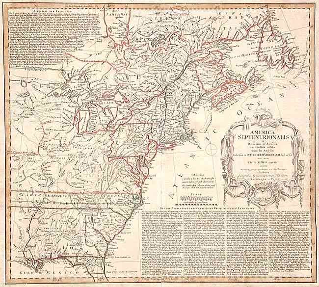
Informative and interesting map of colonial America from the French and Indian War period that shows the area from James Bay and Newfoundland in the north to northern Florida and the Gulf of Mexico in the south. The western extent of the map is to just west of the Mississippi River. Very unusual boundary of New York, extending across Lakes Ontario, Huron and Erie to include the lower peninsula of Michigan. Virginia, North Carolina and South Carolina extend west past the Mississippi to perhaps the Pacific Coast, along with Earl Granville's Property. This map shows a very early Georgia, chartered in 1754. The Six Nations is noted within the above colonies. Decorative, uncolored cartouche and descriptive text in German.
References: McCorkle #756.1; Sellers & van Ee #68.
Condition: B
Copper engraving with original outline color. A few scattered small wormholes, confined mostly to margins, slightly ragged bottom margin. Old repair to centerfold separation, approximately 4" long.