Catalog Archive
Auction 103, Lot 123

"Carte des Etats Mitoyens de l Amerique Unie dressee d'apres les Autorites les plus nouvelles et les mieux choisies", Conder, Thomas

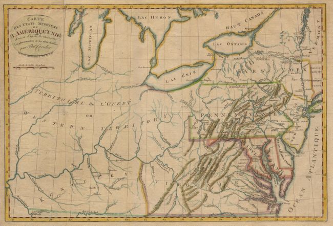
Subject: Eastern United States

Period: 1794 (dated)

Publication:

Color: Hand Color

Size:
17.7 x 12 inches
45 x 30.5 cm
Download High Resolution Image
(or just click on image to launch the Zoom viewer)

German edition after Conder's "A Map of the Middle States of America" published by Monthuchon in Altona. East central states from New York to Virginia and Kentucky, and extending west to the Wabash River. An unorganized Western Territory is a huge area west of Pennsylvania and north of Kentucky. Numerous place names, topographical information and watershed including good detail along the Ohio River.

References:

Condition: B

Folding, as issued, on fine hand laid paper with old color. A little age toning.

Estimate: $400 - $450

Sold for: $230

Closed on 6/11/2003

Archived