Subject: Eastern United States
Period: 1785 (circa)
Publication: Histoire Universelle
Color: Hand Color
Size:
10.5 x 8.7 inches
26.7 x 22.1 cm
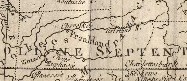
A fascinating map of the infant United States filled with details of early settlement, forts, and Indian villages as far west as present day Kansas. The states of Virginia, North Carolina, South Carolina and Georgia all have their western borders on the Mississippi River. The most notable feature is the notation of "Frankland" in present-day western North Carolina. The proposed 'state' of Franklin was formed in 1784 by "westerners" who felt cut-off from state government by the Appalachian Mountains. Due to some fascinating political intrigue, the state of Franklin was never recognized by Congress and eventually was re-annexed by North Carolina. A scarce issue as only a few printed maps make mention of the fledgling state.
References: Baynton-Williams (TMC-72) #3.
Condition: A
Folds as issued. Remargined along left binding side, right up to neatline with tiny loss.