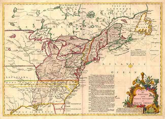
Subject: Colonial United States and Canada
Period: 1755 (published)
Publication: Gentleman's Magazine
Color: Hand Color
Size:
15 x 11 inches
38.1 x 27.9 cm
This is the first of several similar maps illustrating the French/British conflict in North America. It was issued just before the French and Indian War was officially declared and depicts, by hachures, the French encroachment into British claimed territory. Earl Granville's Property is shown in North Carolina and extending to the western-most edge of the map, which is about the 100th Meridian. Several treaty lines are shown, with British and French forts and numerous Indian tribes. Decorative title cartouche and lengthy description of the history of the colonies. Outline color with a fully colored cartouche.
References: Jolly GENT-91; McCorkle #755.24.
Condition: A
Attractive later color. Fold professionally reinforced with tissue on verso.