Subject: Newfoundland, Canada
Period: 1762 (published)
Publication: The Gentleman's and London Magazine
Color: Black & White
Size:
9.7 x 7 inches
24.6 x 17.8 cm
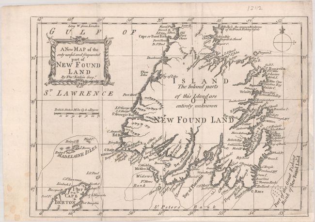
Most of the detail on this uncommon chart of Newfoundland is concentrated along the coast. The map depicts the southern 90% of the island up to Cape Rich. It locates Widows Bank, the Great Fishing Bank, Madelaine Isles (Magdalen Islands), and much more. Interior areas "are entirely unknown." A portrait-style title cartouche and simple compass rose adorn the map. This map originally appeared in the August 1762 issue of London Magazine; this example was published two months later in The Gentleman's and London Magazine.
References: Jolly #GAL-96.
Condition: B+
Issued folding, now flat, on watermarked paper with light soiling and a couple archivally repaired edge tears at right. Chips in the right and bottom right blank margin have been repaired with old paper, with short sections of the neatline replaced in facsimile.