Subject: St. Lawrence River
Period: 1757 (dated)
Publication: Histoire Generale des Voyages
Color: Hand Color
Size:
11.9 x 7.6 inches
30.2 x 19.3 cm
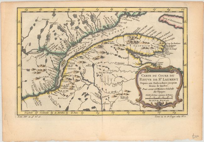
A. Carte du Cours du Fleuve de St. Laurent Depuis son Embouchure Jusqu'au Dessus de Quebec. Pour Servir a l'Histoire Generale des Voyages (12.0 x 7.6"). Nice example of the second state of this copper engraved map, published by La Harpe circa 1780-86. The map details the course of the St. Lawrence River from Anticosti Island and the mouth west to beyond Quebec. It details many rocks and shoals in the river with numerous villages and forts located along the shore. Decorated with a rococo-style cartouche that includes a distance scale.
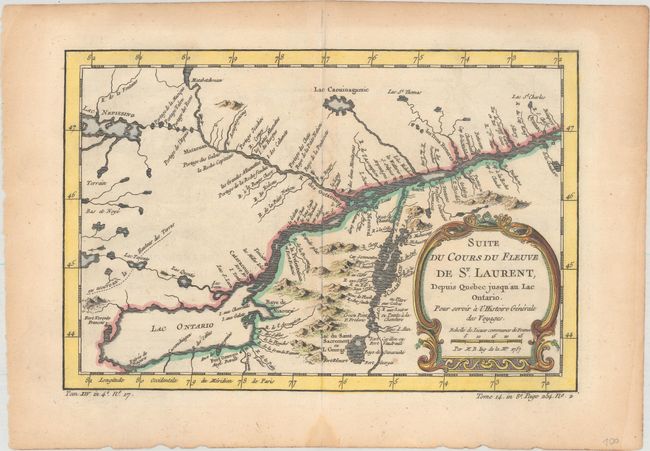
B. Suite de Cours du Fleuve de St. Laurent, Depuis Quebec Jusqua'au Lac Ontario. Pour Servir a l'Histoire Generale des Voyages (11.3 x 7.5"). A continuation of the map above extending from Quebec to Lake Ontario. The map extends to Lake Champlain and Lake George, as well as Lake Nepessing in Michigan, with numerous portages named on the interconnecting waterways. Locates Montreal. There are a number of forts named, including Ft. Toronto, Ft. Oswego, and Ft. Georges.
References: Kershaw #627 & 632.
Condition: B+
A dark impression on watermarked sheets with minor toning and offsetting, and a small damp stain confined to the bottom blank margin.