Showing Unsold Lots(remove filter)
Filtered by Category:United States(Show All Categories)
Current Auction
43 lots
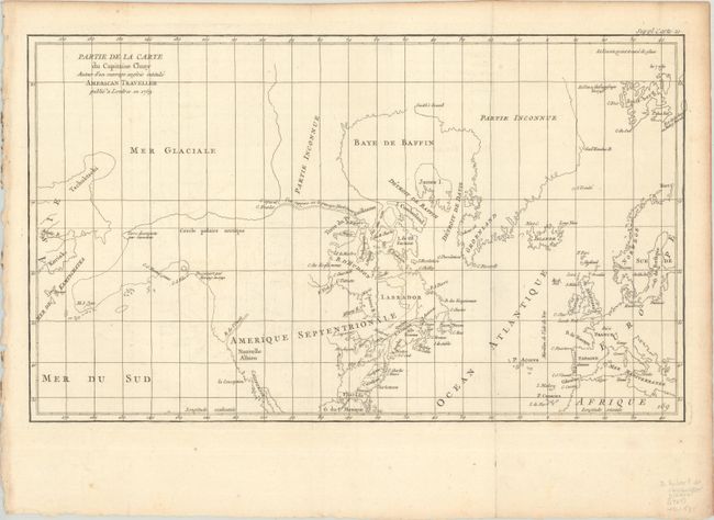
Lot 95
Subject: Colonial United States & Canada, Arctic
Robert de Vaugondy, Didier
Partie de la Carte du Capitaine Cluny Auteur d'un Ouvrage Anglois Intitule American Traveller Publie a Londres en 1769, 1773
Size: 19.6 x 11.6 inches (49.8 x 29.5 cm)
Estimate: $120 - $150
Price reduced by $30
Lot 102
Subject: Eastern United States & Canada
SDUK Society for the Diffusion of Useful Knowledge
[Lot of 14 - United States & Canada], 1835
Size: See Description
Estimate: $1,000 - $1,300
Price reduced by $150
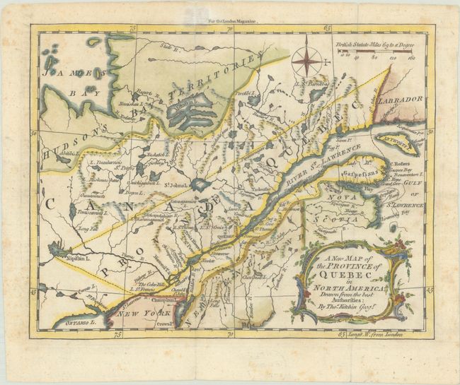
Lot 105
Subject: Colonial Northeastern United States & Canada
Kitchin, Thomas
A New Map of the Province of Quebec in North America; Drawn from the Best Authorities, 1764
Size: 8.7 x 6.8 inches (22.1 x 17.3 cm)
Estimate: $220 - $250
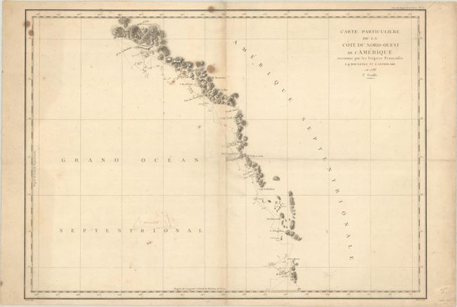
Lot 107
Subject: Western United States & Canada, Alaska
La Perouse, Comte Jean F. Galoup, de
[Lot of 2] Carte Particuliere de la Cote du Nord-Ouest de l'Amerique Reconnue par les Fregates Francaises la Boussole et l'Astrolabe en 1786. 1e Feuille [and] ... 2e Feuille, 1797
Size: 27.1 x 19.5 inches (68.8 x 49.5 cm)
Estimate: $300 - $375
Price reduced by $45
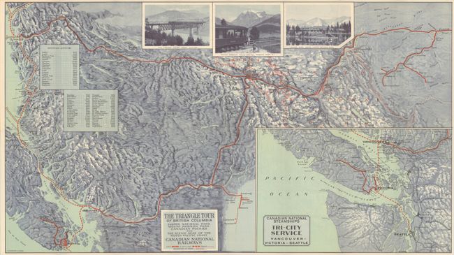
Lot 110
Subject: Northwestern United States & Canada
Railroad Companies, (Various)
The Triangle Tour of British Columbia - Jasper National Park Mount Robson Park Canadian Rockies and the Scenic Seas of the North Pacific Coast [on verso] Alaska and the Yukon, 1930
Size: 29.8 x 16.8 inches (75.7 x 42.7 cm)
Estimate: $150 - $180
Price reduced by $30
Lot 112
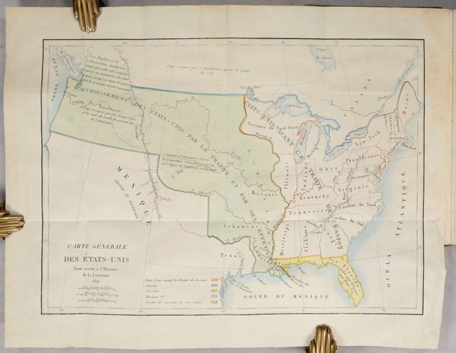
Subject: United States, Louisiana Purchase
Barbe-Marbois, Francois
[Map in Book] Carte Generale des Etats-Unis pour Servir a l'Histoire de la Louisiane [in] Histoire de la Louisiane et de la Cession de Cette Colonie par la France aux Etats-Unis de l'Amerique Septentrionale..., 1829
Size: 13.3 x 9.4 inches (33.8 x 23.9 cm)
Estimate: $800 - $1,000
Price reduced by $100! History of the Louisiana Purchase
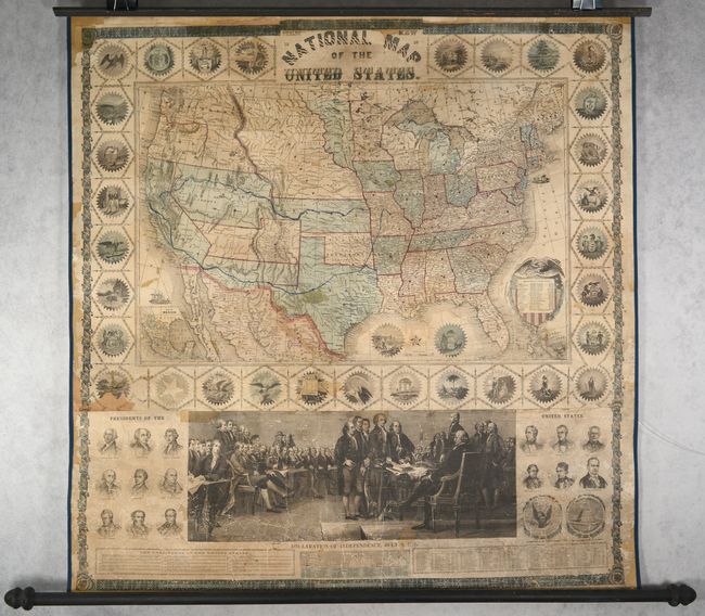
Lot 117
Subject: United States
Phelps & Watson
Phelps' New National Map of the United States, 1859
Size: 36.5 x 37.8 inches (92.7 x 96 cm)
Estimate: $2,200 - $2,500
Price reduced by $200! Attractive Wall Map Issued at the Onset of the Civil War
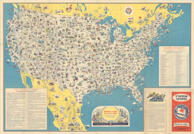
Lot 125
Subject: United States
Sights to See in Every State - And There Are Ever So Many More That Could Never Be Shown on a Map of This Size, 1936
Size: 30.8 x 21.3 inches (78.2 x 54.1 cm)
Estimate: $140 - $170
Price reduced by $50 - Early Version of a Popular Pictorial Map
Lot 126
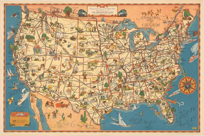
Subject: United States
A Good-Natured Map of the United States Setting Forth the Services of the Greyhound Lines and a Few Principal Connecting Bus Lines, 1939
Size: 29 x 19.1 inches (73.7 x 48.5 cm)
Estimate: $160 - $190
Price reduced by $45
Lot 131
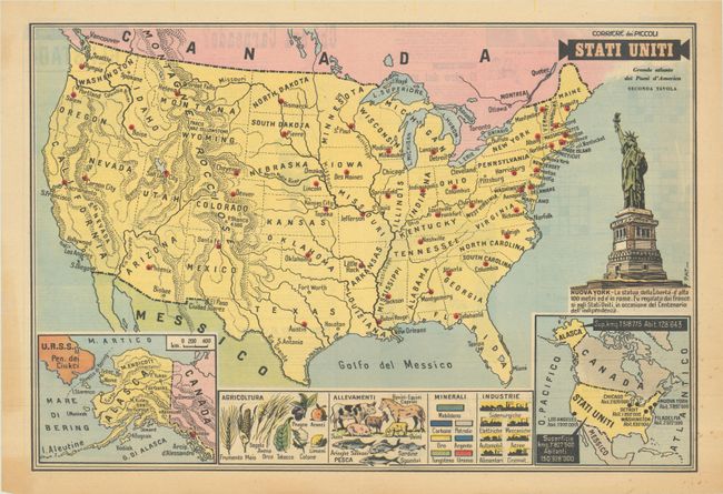
Subject: United States
Stati Uniti - Grande Atlante dei Paesi d'America Seconda Tavola, 1958
Size: 21 x 14.3 inches (53.3 x 36.3 cm)
Estimate: $120 - $150
Lot 132
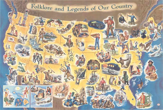
Subject: United States
Folklore and Legends of Our Country, 1960
Size: 35.5 x 24 inches (90.2 x 61 cm)
Estimate: $160 - $190
Price reduced by $30
Lot 135
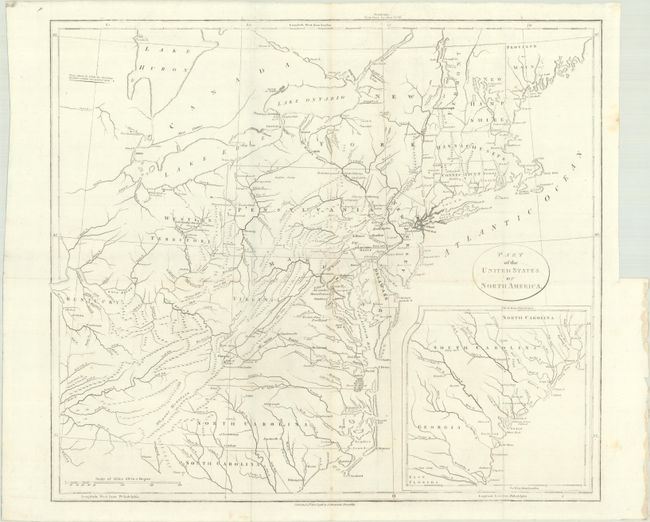
Subject: Eastern United States
Stockdale, John
Part of the United States of North America, 1798
Size: 18.5 x 16.2 inches (47 x 41.1 cm)
Estimate: $200 - $230
Price reduced by $10
Lot 136
Subject: Eastern United States, Revolutionary War
Marshall, John
[Atlas Volume] The Life of George Washington. Maps and Subscribers' Names, 1807
Size: 9.2 x 11.3 inches (23.4 x 28.7 cm)
Estimate: $1,000 - $1,300
Price reduced by $150!
Lot 141
Subject: Eastern United States
Black, Adam & Charles
United States, 1840
Size: 15.3 x 19.8 inches (38.9 x 50.3 cm)
Estimate: $110 - $140
Price reduced by $40
Lot 142
Subject: Eastern United States
Hall, Sidney
United States, 1849
Size: 10.4 x 8.1 inches (26.4 x 20.6 cm)
Estimate: $150 - $180
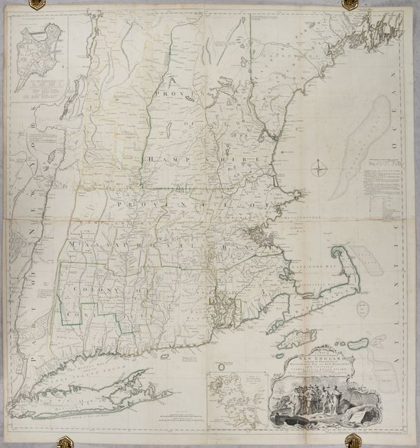
Lot 145
Subject: Colonial New England United States
Jefferys, Thomas
A Map of the Most Inhabited Part of New England, Containing the Provinces of Massachusets Bay and New Hampshire, with the Colonies of Conecticut and Rhode Island..., 1755
Size: 39.1 x 40.8 inches (99.3 x 103.6 cm)
Estimate: $4,750 - $6,000
Rare State of Jefferys' Influential Map of New England in Contemporary Color
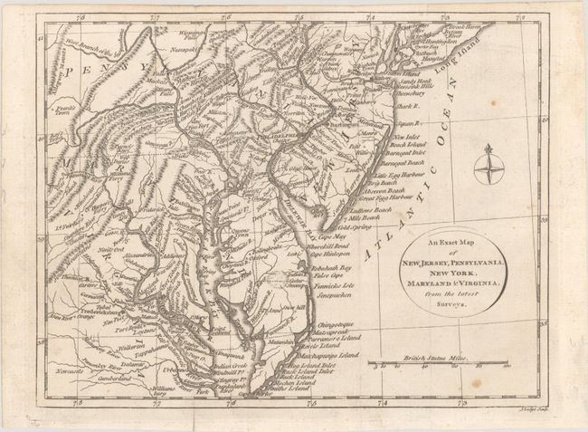
Lot 150
Subject: Colonial Mid-Atlantic United States
Lodge, John
An Exact Map of New Jersey, Pensylvania, New York, Maryland & Virginia, from the Latest Surveys, 1777
Size: 9.8 x 7.6 inches (24.9 x 19.3 cm)
Estimate: $400 - $475
Price reduced by $25
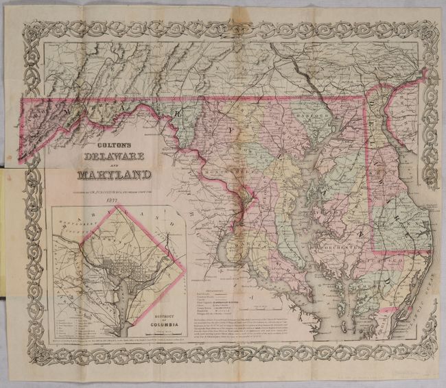
Lot 153
Subject: Delaware & Maryland
Colton, G.W. & C.B.
Colton's Delaware and Maryland, 1877
Size: 15.9 x 12.9 inches (40.4 x 32.8 cm)
Estimate: $100 - $130
Price reduced by $15
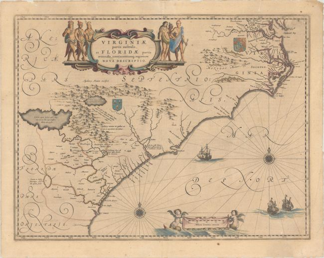
Lot 154
Subject: Colonial Southeastern United States
Blaeu, Willem
Virginiae Partis Australis, et Floridae Partis Orientalis, Interjacentiumq Regionum Nova Descriptio, 1647
Size: 20 x 15.3 inches (50.8 x 38.9 cm)
Estimate: $1,000 - $1,300
Blaeu's Decorative Map of the Southeast in Contemporary Color
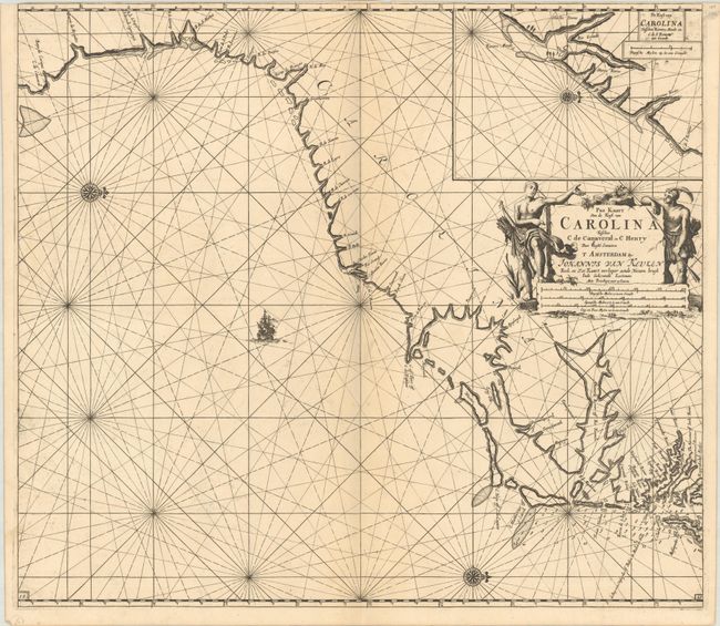
Lot 155
Subject: Colonial Southeastern United States
Keulen, Johannes van
Pas Kaart van de Kust van Carolina Tusschen C de Canaveral en C Henry, 1702
Size: 23 x 20.3 inches (58.4 x 51.6 cm)
Estimate: $2,400 - $3,000
Dutch Chart of the Carolinas
Lot 157
Subject: Southeastern United States
Bartram, William
Travels Through North & South Carolina, Georgia, East & West Florida, the Cherokee Country, the Extensive Territories of the Muscogulges, or Creek Confederacy, and the Country of the Chactaws..., 1791
Size: 5.9 x 9.8 inches (15 x 24.9 cm)
Estimate: $10,000 - $12,000
Price reduced by $750! Complete First Edition of Bartram's Work on the American Southeast
Lot 159
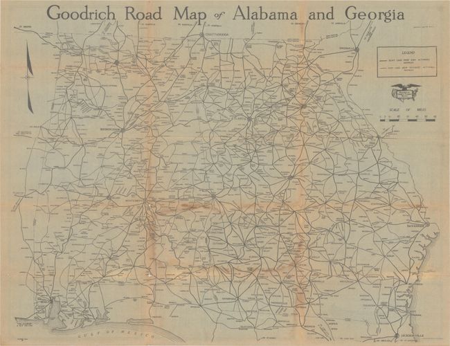
Subject: Georgia & Alabama
Goodrich Road Map of Alabama and Georgia, 1920
Size: 23.3 x 18.3 inches (59.2 x 46.5 cm)
Estimate: $140 - $170
Price reduced by $50
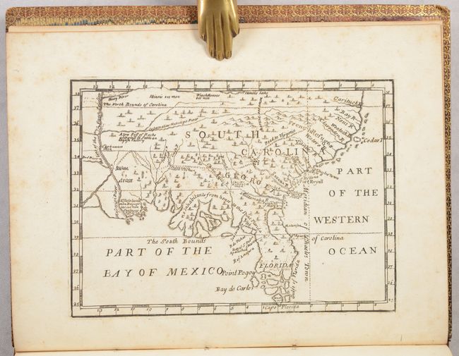
Lot 162
Subject: Colonial Southern United States
[Map in Book] [New Map of Georgia] [in] Reasons for Establishing the Colony of Georgia, with Regard to the Trade of Great Britain..., 1733
Size: 7.3 x 5.3 inches (18.5 x 13.5 cm)
Estimate: $5,500 - $6,500
First Printed Map to Name Georgia
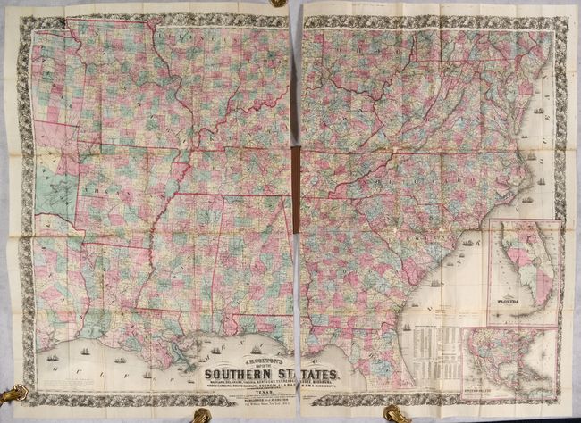
Lot 166
Subject: Southern United States, Civil War
Colton, Joseph Hutchins
J.H. Colton's Map of the Southern States. Maryland, Delaware, Virginia, Kentucky, Tennessee, Missouri, North Carolina, South Carolina, Georgia, Alabama, Mississippi, Arkansas, Louisiana and Texas..., 1864
Size: 52.7 x 38 inches (133.9 x 96.5 cm)
Estimate: $2,500 - $3,250
Price reduced by $100! Large-Scale Map of the South Issued During the Civil War
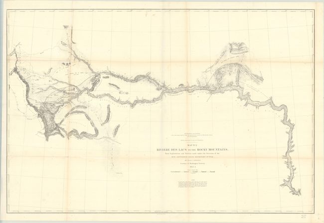
Lot 183
Subject: Western United States
Stevens, Isaac Ingalls
Map No. 2 Riviere des Lacs to the Rocky Mountains; from Explorations and Surveys Made Under the Direction of the Hon. Jefferson Davis Secretary of War, 1853-54
Size: 36.8 x 24.5 inches (93.5 x 62.2 cm)
Estimate: $180 - $210
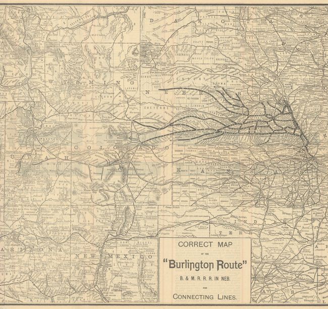
Lot 185
Subject: Western United States
Railroad Companies, (Various)
Correct Map of the "Burlington Route" B. & M. R. R. R. in Neb. and Connecting Lines, 1888
Size: 26.6 x 13.3 inches (67.6 x 33.8 cm)
Estimate: $160 - $190
Price reduced by $35
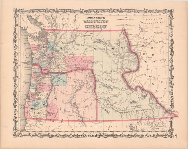
Lot 187
Subject: Washington & Oregon
Johnson and Ward
Johnson's Washington and Oregon, 1862
Size: 16 x 12.5 inches (40.6 x 31.8 cm)
Estimate: $120 - $150
Price reduced by $15
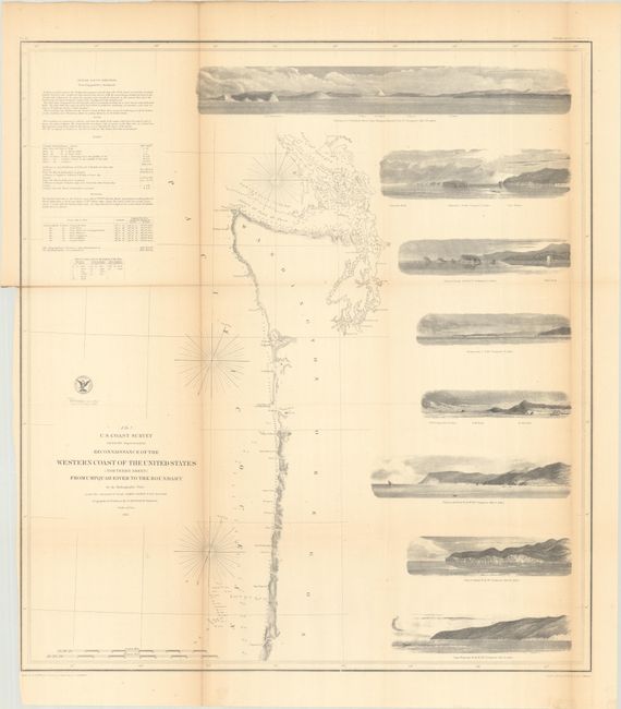
Lot 188
Subject: Western Washington & Oregon
U.S. Coast Survey
Reconnaissance of the Western Coast of the United States (Northern Sheet) from Umpquah River to the Boundary by the Hydrographic Party, 1855
Size: 22.4 x 24.7 inches (56.9 x 62.7 cm)
Estimate: $240 - $300
Price reduced by $60
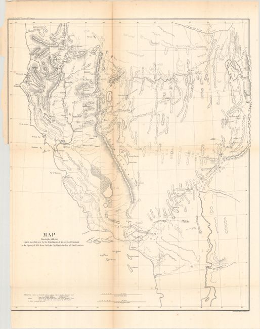
Lot 192
Subject: Southwestern United States
U.S. Army
Map Showing the Different Routes Travelled Over by the Detachments of the Overland Command in the Spring of 1855 from Salt Lake City, Utah to the Bay of San Francisco, 1856
Size: 18.8 x 22.3 inches (47.8 x 56.6 cm)
Estimate: $160 - $190
Price reduced by $35
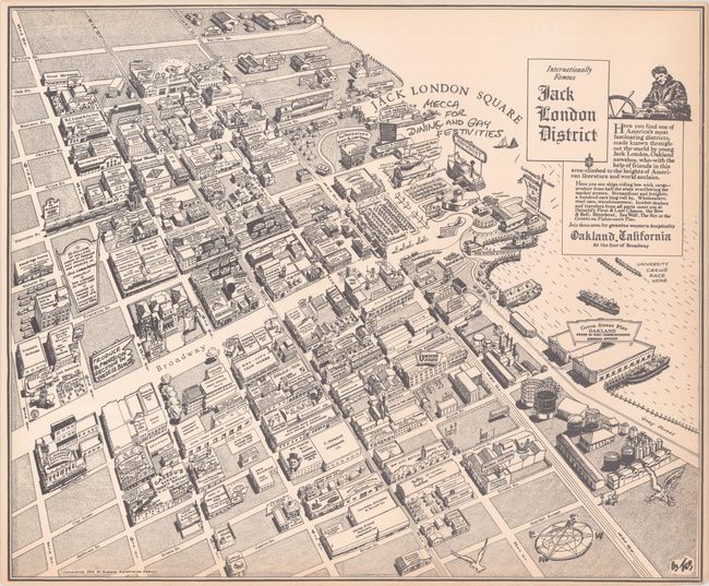
Lot 202
Subject: Oakland, California
Internationally Famous Jack London District, 1952
Size: 18.5 x 15.4 inches (47 x 39.1 cm)
Estimate: $160 - $190
Price reduced by $40
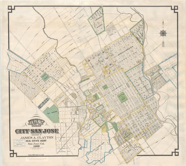
Lot 203
Subject: San Jose, California
Britton & Rey
Map of the City of San Jose, 1886
Size: 37.2 x 35 inches (94.5 x 88.9 cm)
Estimate: $2,000 - $2,500
An Early Large-Format Map of San Jose
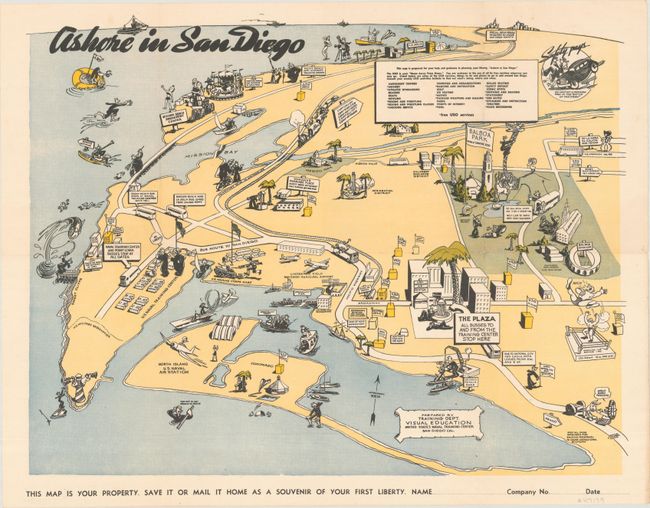
Lot 208
Subject: San Diego, California
Ashore in San Diego, 1943
Size: 20.9 x 16.1 inches (53.1 x 40.9 cm)
Estimate: $350 - $425
Lot 226
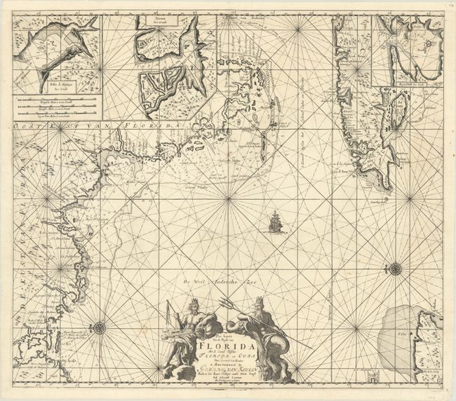
Subject: Western Florida & Cuba
Keulen, Gerard van
Pas Kaart van de Boght van Florida met de Canaal Tusschen Florida en Cuba , 1734
Size: 22.8 x 20.1 inches (57.9 x 51.1 cm)
Estimate: $2,400 - $3,000
Price reduced by $200! One of the First Charts of the Florida Gulf Coast
Lot 228
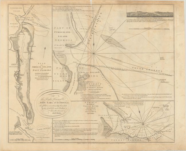
Subject: Amelia Island, Florida
Jefferys, Thomas
A Chart of the Entrance into St. Mary's River Taken by Captn. W. Fuller in November 1769 [on sheet with] Plan of Amelia Island in East Florida [and] A Chart of the Mouth of Nassau River... , 1770
Size: 24.1 x 20 inches (61.2 x 50.8 cm)
Estimate: $3,000 - $3,750
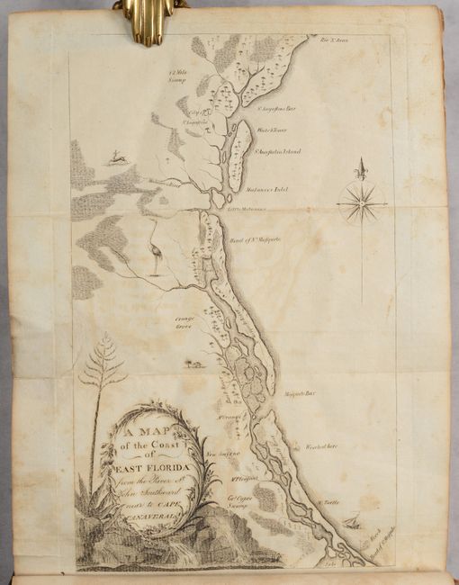
Important Charts Detailing Amelia Island and Surrounding Rivers
Lot 237
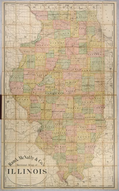
Subject: Illinois
Rand McNally & Co.
Rand, McNally & Co.'s Sectional Map of Illinois, 1892
Size: 32 x 52.5 inches (81.3 x 133.4 cm)
Estimate: $160 - $190
Price reduced by $25
Lot 238
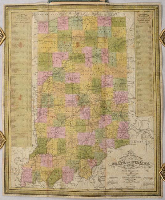
Subject: Indiana
Mitchell/Young
The Tourist's Pocket Map of the State of Indiana Exhibiting Its Internal Improvements Roads Distances &c., 1837
Size: 12.5 x 15.1 inches (31.8 x 38.4 cm)
Estimate: $300 - $375
Price reduced by $35
Lot 239
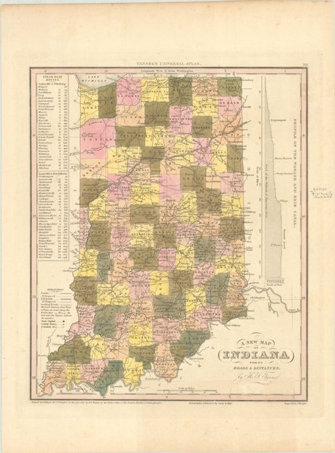
Subject: Indiana
Tanner, Henry Schenck
A New Map of Indiana with Its Roads & Distances, 1841
Size: 10.8 x 12.9 inches (27.4 x 32.8 cm)
Estimate: $110 - $140
Lot 246
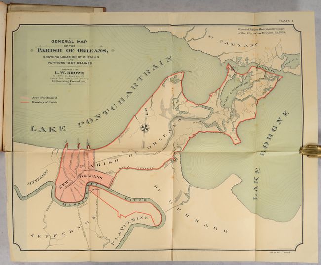
Subject: New Orleans, Louisiana
[4 Maps in Report] Report on the Drainage of the City of New Orleans..., 1895
Size: 7.2 x 10.3 inches (18.3 x 26.2 cm)
Estimate: $140 - $170
Price reduced by $40
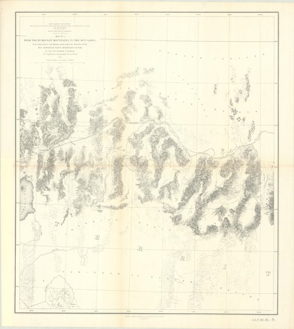
Lot 260
Subject: Nevada
Beckwith, E. G., Capt.
Map No. 3 From the Humboldt Mountains to the Mud Lakes, from Explorations and Surveys Made Under the Direction of the Hon. Jefferson Davis Secretary of War, 1855
Size: 18.1 x 20.8 inches (46 x 52.8 cm)
Estimate: $100 - $130
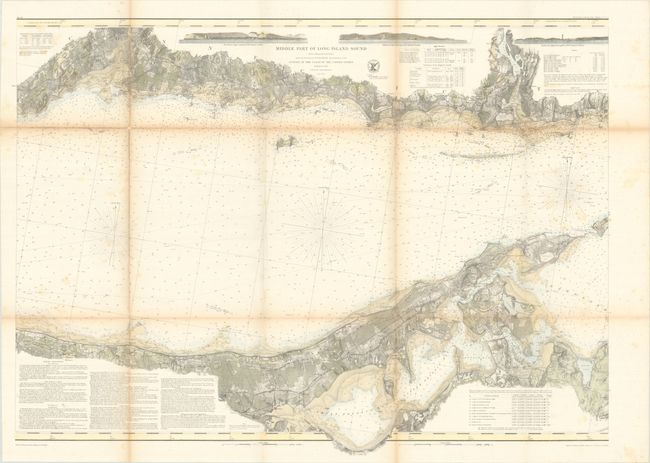
Lot 268
Subject: Long Island, New York
U.S. Coast Survey
[Lot of 2] Middle Part of Long Island Sound from a Trigonometrical Survey... [and] Eastern Part of Long Island Sound..., 1855
Size: 35.2 x 25.8 inches (89.4 x 65.5 cm)
Estimate: $275 - $350
Price reduced by $25
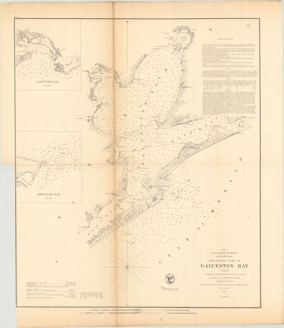
Lot 289
Subject: Galveston Bay, Texas
U.S. Coast Survey
Preliminary Chart of Galveston Bay Texas, 1855
Size: 16.9 x 19.8 inches (42.9 x 50.3 cm)
Estimate: $140 - $170
Price reduced by $30
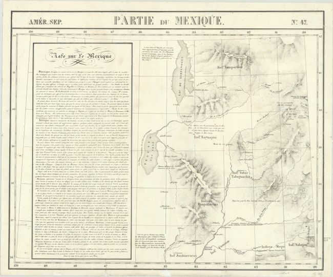
Lot 291
Subject: Utah
Vandermaelen, Philippe Marie Guillaume
Amer. Sep. Partie du Mexique. No. 47, 1825-27
Size: 22.6 x 18.6 inches (57.4 x 47.2 cm)
Estimate: $350 - $425
Price reduced by $50
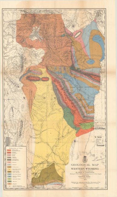
Lot 303
Subject: Yellowstone, Wyoming
U.S. Army
Geological Map of Western Wyoming Illustrating the Report of Mr. Theo. B. Comstock, Geologist of the Military Reconnoissance in that Region, 1874
Size: 17.9 x 31 inches (45.5 x 78.7 cm)
Estimate: $200 - $230
Price reduced by $25
43 lots