Subject: Illinois
Period: 1892 (dated)
Publication:
Color: Printed Color
Size:
32 x 52.5 inches
81.3 x 133.4 cm
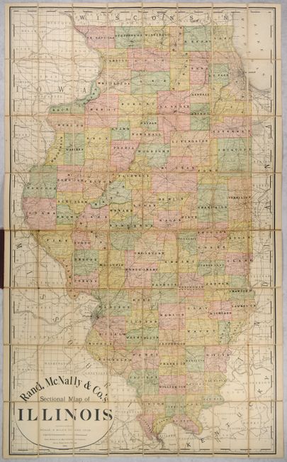
This very large pocket map of the state is delineated and colored by county and drawn on an impressive scale of 8 miles to the inch. It is noted as a "sectional" map due to the presentation of township and range lines of the Public Land Survey System, creating a grid pattern throughout the state. The railroad network is depicted and extends into neighboring states with individual lines named. Numerous towns and settlements are identified, with the block pattern shown for larger cities including Chicago, Springfield, St. Louis and more. Folds into brown cloth boards (4.0 x 7.0”).
References:
Condition: B+
On a lightly toned sheet that has been dissected and backed with contemporary linen. The linen has split along the fold lines in a few places with some archival reinforcement on verso. There are a few manuscript notations at bottom in red ink and pencil.
Covers have light shelf wear.