Subject: Western United States
Period: 1853-54 (dated)
Publication: Pacific Railroad Surveys
Color: Black & White
Size:
36.8 x 24.5 inches
93.5 x 62.2 cm
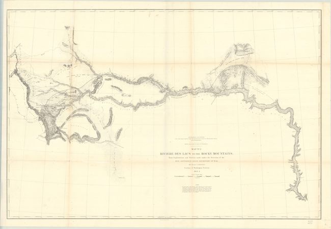
This is the second in a series of three maps detailing the Stevens survey for a route for the Pacific railway that would connect the Mississippi River with the Pacific Coast, thereby opening up the trade route to Asia. It covers the survey from the Missouri River at Fort Pierre and culminates at the Continental Divide of the Rockies. The route travels along the Plateau of the Missouri to Fort Benton (Missoula) and on to the Continental Divide at Lewis and Clark Pass. It locates Hell's Gate Passes to the south. Throughout there is excellent detail along the route, with place names, forts, and unexplored areas. Mountain terrain is indicated through fine hachuring.
After being named Governor of the newly created Washington Territory in March 1853, Stevens made his way across the northern plains while completing the survey. His work was published in Report of Explorations for a Route for the Pacific Railroad near the 47th and 49th Parallels of North Latitude, from St. Paul, Minnesota, to Puget Sound.
References: Wagner-Camp #262; Wheat (TMW) #865.
Condition: B+
Issued folding, now flat and backed with archival tissue to repair some fold separations. There is light toning along the folds and light foxing. The sheet has been remargined at right, with a tiny sliver of original border missing and a short archivally repaired binding tear. The map now folds into fours along new vertical and horizontal creases.