Subject: Utah
Period: 1825-27 (published)
Publication: Atlas Universel de Geographie...
Color: Black & White
Size:
22.6 x 18.6 inches
57.4 x 47.2 cm
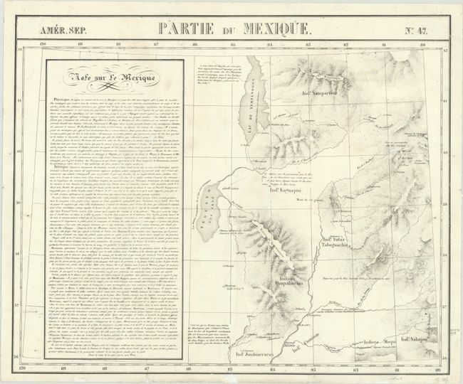
Vandermaelen was the son of a wealthy industrialist who abandoned his father's business to follow a career in cartography. His goal was to produce the first atlas ever published in which every map was drawn on the same projection and to the same scale (1: 1,641,836), with each map covering an area of approximately 20 degrees of longitude (from Paris) and 6 degrees of latitude. Because of the consistent scale and projection, the maps could be joined together to form a huge globe that would measure over 25 feet in diameter. Vandermaelen had the only known globe constructed from his maps, requiring a special room for its display. It was also the first lithographic atlas ever published. There was one edition of the atlas, published in 1825-27, and the subscription list shows that only 810 copies were sold. Koeman called his Atlas Universel, "One of the most remarkable world atlases ever made. Far ahead of its time."
A detailed map of mostly today's Utah featuring Lake Timpanogos and Teguayo, whose western boundary is unknown. It names a number of Indian tribes and locates, somewhat erroneously, rivers and mountains in the region. Flanked by descriptive text at left.
References:
Condition: B
The sheet has been brightened and backed with tissue to reinforce some small areas of loss mostly in unengraved areas. There are a few edge chips and repaired tears at bottom.