Subject: Southern United States, Civil War
Period: 1864 (dated)
Publication:
Color: Hand Color
Size:
52.7 x 38 inches
133.9 x 96.5 cm
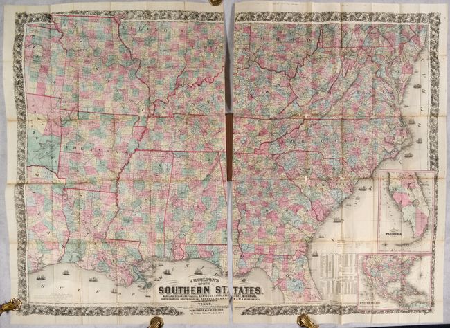
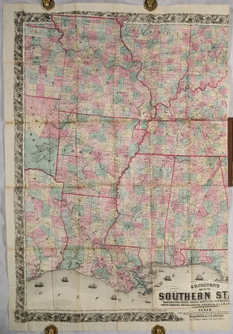
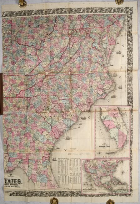
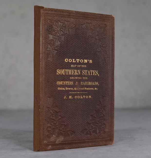
The title continues "Showing also Part of the Adjoining States & Territories Locating the Forts & Military Stations of the U. States & Showing all the Railroads, R.R. Stations & Other Internal Improvements." This is a large and highly detailed map of the southern states (Colton makes no mention of the Confederacy) that extends from the Atlantic coast to east Texas, south into Florida to below Sumter County, and north to above Bloomington, Illinois. It is filled with information locating towns, villages, post offices, railroads, stage roads, canals, trails, watershed and much more. The Atlantic Ocean and Gulf of Mexico are filled with ships, which depict the Union blockade of southern harbors. A large inset at right is the "Southern Part of Florida" which takes off from the main map on a slightly smaller scale. Another inset at lower right shows the United States with “Proposed Railroad Routes to the Pacific Ocean.” This inset depicts large Dakota and Idaho territories and the southern tip of Nevada is part of Arizona. To the left of the inset maps is a population table based on the 1860 census with the categories Free States and Slave States. The cartography is taken from GLO maps and from the southern part of Calvin Smith’s important large scale map (1843) of the U.S. and Canada. Embellished with a broad decorative border and fancy titling. This map has a copyright imprint of 1863 and is dated 1864. Other editions were printed in 1861 and 1862. Printed on two separate sheets and fold into brown cloth boards (5.2 x 8.2") with gilt title on the front cover. A scarce map issued near the end of the American Civil War.
References: Phillips (Maps) p. 909; Stephenson (CW) #37.6; Rumsey #4085.002.
Condition: B
A colorful example on a clean bright sheet with archival repairs to a number of small fold separations on verso. The two folding panels that were glued to the front and rear boards have archival repairs along the folds on recto. Small areas of loss at 4 fold junctions on the eastern sheet have been backed with archival material. Covers have light wear and slightly sunned along the spine.