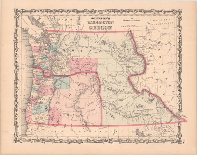
Subject: Washington & Oregon
Period: 1862 (circa)
Publication:
Color: Hand Color
Size:
16 x 12.5 inches
40.6 x 31.8 cm
A handsome and colorful map of the Pacific Northwest with Washington Territory wrapping around Oregon and extending south to Utah and east to Nebraska Territory. County development is mostly limited to the coastal areas. At the time of publication, Oregon was a state, but the county configuration here is only current up to 1856, when it was still a territory. Josephine County has formed out of Jackson, but their positions are reversed. Very little information is displayed in the area of today's Idaho except for Fort Hall, the nearby Cantonment Loring, and an early reference to Soda Springs as "Beer or Soda Springs." The map locates numerous forts including Boise, Benton, Owen, Colville, and Hall. The important landmarks of Three Buttes and the Three Tetons are noted in the lower portion of Washington Territory. Published in editions of Johnson's atlas in 1862-63.
References:
Condition: A
Full contemporary color on a faintly toned sheet with a few minor spots in map image.