Filtered by Category:United States(Show All Categories)
Showing results for:Auction 170
Catalog Archive
214 lots
Page 1 of 5
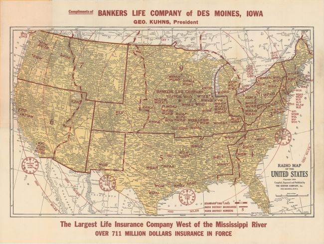
Auction 170, Lot 125
Subject: United States & Canada
Cram, George F. & Company
[Lot of 3] Radio Map of the United States [and] Cram's Detailed Radio Map of the United States & Canada [and] Cram's Detailed Radio Map of the United States & Canada, 1924
Size: See Description
Estimate: $220 - $250
Sold for: $150
Closed on 11/14/2018
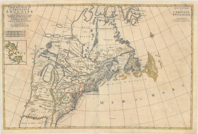
Auction 170, Lot 126
Subject: Colonial Eastern United States & Canada
Mortier, Pierre
Carte Nouvelle de l'Amerique Angloise Contenant la Virginie, Mary-Land, Caroline, Pensylvania Nouvelle Iorck. N: Iarsey N: France, et les Terres Nouvellement Decouerte..., 1700
Size: 35.4 x 23.4 inches (89.9 x 59.4 cm)
Estimate: $1,900 - $2,200
A Map Showing Fascinating Geographic Misconceptions
Unsold
Closed on 11/14/2018
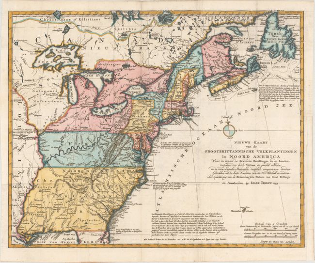
Auction 170, Lot 127
Subject: Colonial Eastern United States & Canada
Tirion, Isaac
Nieuwe Kaart van de Grootbrittannische Volkplantingen in Noord America..., 1755
Size: 17.9 x 14.4 inches (45.5 x 36.6 cm)
Estimate: $600 - $750
Sold for: $550
Closed on 11/14/2018
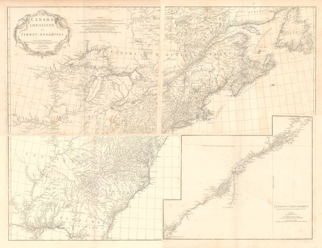
Auction 170, Lot 128
Subject: Colonial Eastern United States & Canada
Anville, Jean Baptiste Bourguignon d'
[On 4 Sheets] Canada Louisiane et Terres Angloises, 1755
Size: 22 x 18.8 inches (55.9 x 47.8 cm)
Estimate: $1,400 - $1,700
D'Anville's Spectacular Map of Eastern Seaboard
Unsold
Closed on 11/14/2018
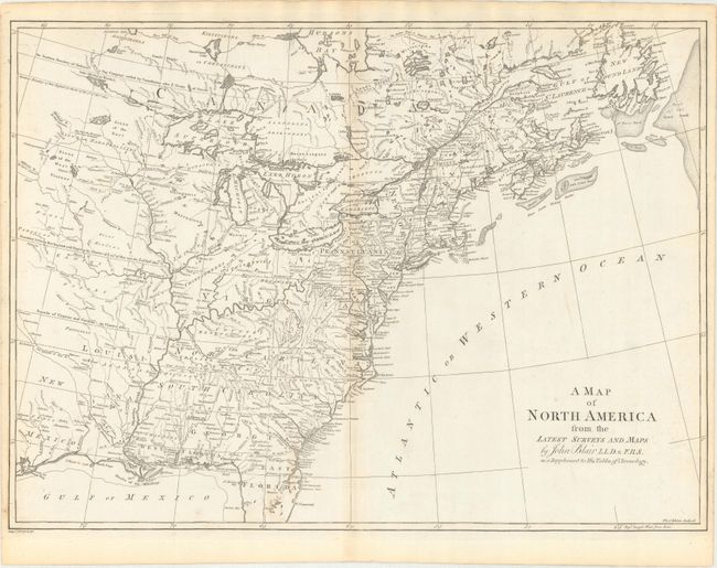
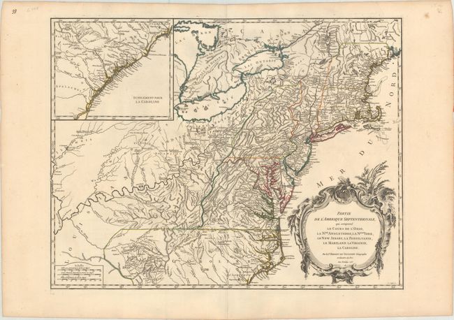
Auction 170, Lot 129
Subject: Colonial Eastern United States & Canada
Blair, Rev. John
A Map of North America from the Latest Surveys and Maps, 1768
Size: 22.8 x 16.6 inches (57.9 x 42.2 cm)
Estimate: $550 - $700
Sold for: $400
Closed on 11/14/2018
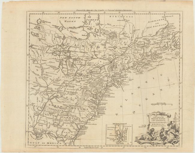
Auction 170, Lot 130
Subject: Colonial Eastern United States & Canada
Kitchin, Thomas
A New Map of the British Empire in Nth. America, Drawn from the Latest Authorities, 1782
Size: 15 x 13.3 inches (38.1 x 33.8 cm)
Estimate: $400 - $475
Sold for: $250
Closed on 11/14/2018
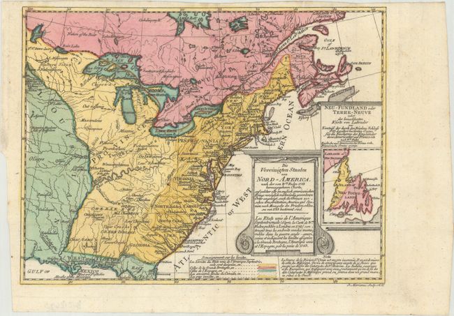
Auction 170, Lot 131
Subject: Colonial Eastern United States & Canada
Sotzmann, Daniel Friedrich
Die Vereinigten Staaten von Nord-America. Nach der von Wm. Faden 1783 herausgegebenen Charte / Les Etats Unis de l'Amerique Septentrionale d'Apres la Carte de Wm. Faden Publiee a Londres en 1783..., 1785
Size: 10 x 7.6 inches (25.4 x 19.3 cm)
Estimate: $600 - $800
Rare, Multi-Lingual Reduced Version of Faden's Map of 1783
Sold for: $550
Closed on 11/14/2018
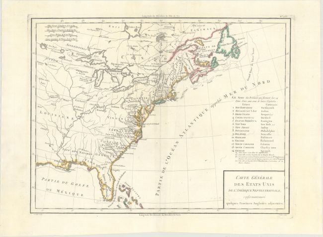
Auction 170, Lot 132
Subject: Eastern United States & Canada
Tardieu, Pierre Francois
Carte Generale des Etats Unis de l'Amerique Septentrionale, Renfermantaussi Quelques Provinces Angloises Adjacentes, 1797
Size: 16.8 x 12.7 inches (42.7 x 32.3 cm)
Estimate: $240 - $300
Sold for: $180
Closed on 11/14/2018
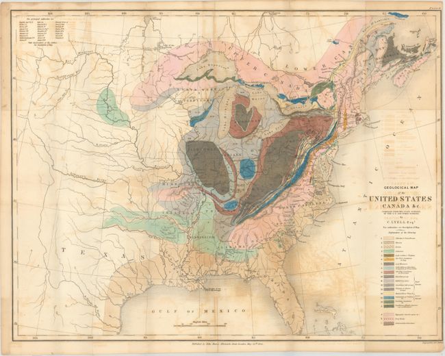
Auction 170, Lot 133
Subject: Eastern United States & Canada, Geology
Lyell, Charles
Geological Map of the United States Canada &c. [with] [2 Volumes] Travels in North America, in the Years 1841-2; with Geological Observations on the United States, Canada, and Nova Scotia, 1845
Size: 19.8 x 15.3 inches (50.3 x 38.9 cm)
Estimate: $600 - $750
First American Edition of Lyell's Important Account & Geological Map
Sold for: $450
Closed on 11/14/2018
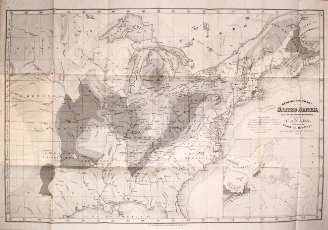
Auction 170, Lot 134
Subject: Eastern United States & Canada, Geology
Geological Chart of the United States, East of the Rocky Mountains. And of Canada, 1876
Size: 23.7 x 15.6 inches (60.2 x 39.6 cm)
Estimate: $250 - $325
Sold for: $180
Closed on 11/14/2018
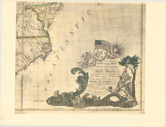
Auction 170, Lot 135
Subject: Eastern United States & Canada
[Facsimile - On 4 Sheets] A New and Correct Map of the United States of North America Layd Down from the Latest Observations and Best Authorities Agreeable to the Peace of 1783..., 1963
Size: 25.4 x 21.7 inches (64.5 x 55.1 cm)
Estimate: $550 - $700
Facsimile of the First Large-Scale Map Printed in North America
Sold for: $275
Closed on 11/14/2018
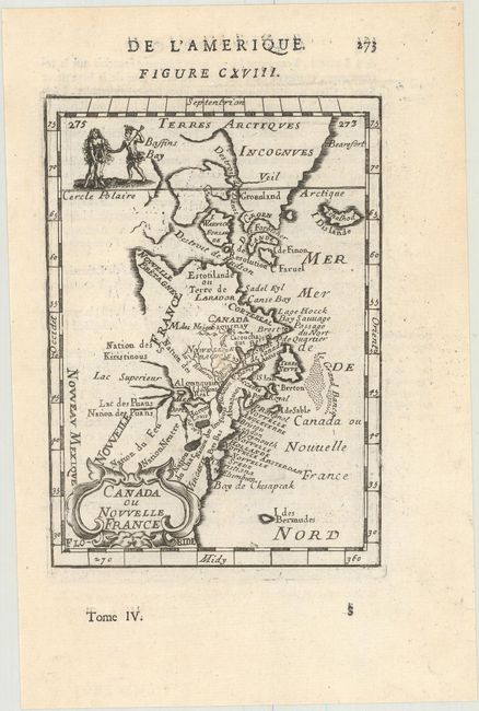
Auction 170, Lot 136
Subject: Colonial Northeastern United States & Canada
Mallet, Alain Manesson
Canada ou Nouvelle France, 1683
Size: 3.9 x 5.6 inches (9.9 x 14.2 cm)
Estimate: $220 - $250
Sold for: $100
Closed on 11/14/2018
Auction 170, Lot 137
Subject: Colonial Northeastern United States & Canada, Great Lakes
Robert de Vaugondy, Didier
Partie de l'Amerique Septent? qui Comprend la Nouvelle France ou le Canada, 1755
Size: 23.9 x 19 inches (60.7 x 48.3 cm)
Estimate: $550 - $700
Unsold
Closed on 11/14/2018
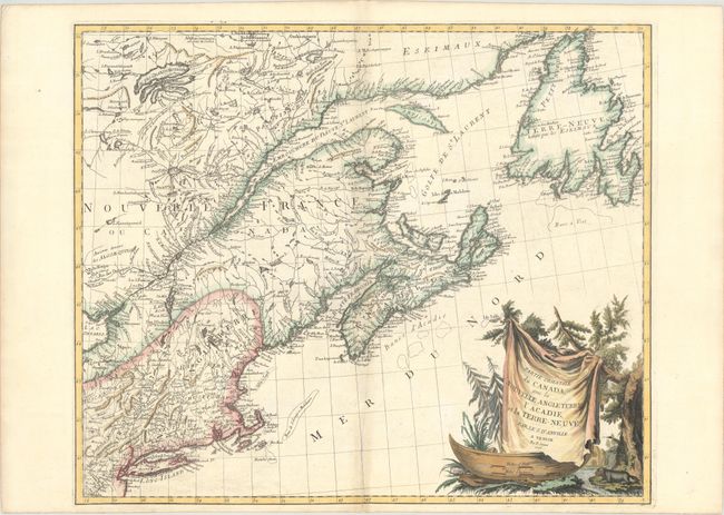
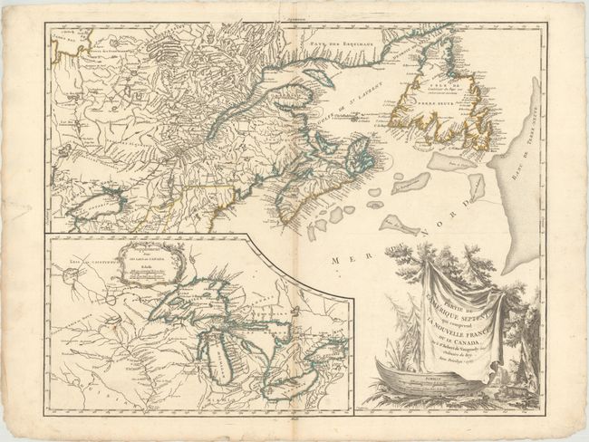
Auction 170, Lot 138
Subject: Colonial Northeastern United States & Canada
D'Anville/Santini
Partie Orientale du Canada, avec la Nouvelle Angleterre, l'Acadie, et la Terre-Neuve, 1776
Size: 22.9 x 19.1 inches (58.2 x 48.5 cm)
Estimate: $600 - $750
Unsold
Closed on 11/14/2018
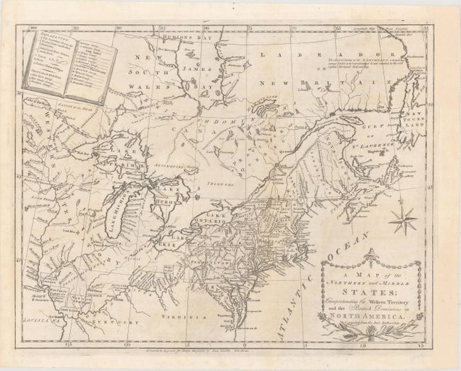
Auction 170, Lot 139
Subject: Northeastern United States & Canada
Doolittle, Amos
A Map of the Northern and Middle States; Comprehending the Western Territory and the British Dominions in North America. Compiled from the Best Authorities, 1789
Size: 16.1 x 12.5 inches (40.9 x 31.8 cm)
Estimate: $450 - $550
Sold for: $325
Closed on 11/14/2018
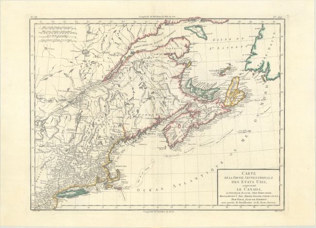
Auction 170, Lot 140
Subject: Northeastern United States & Canada
Tardieu, Pierre Francois
Carte de la Partie Septentrionale des Etats Unis, Comprenant le Canada, la Nouvelle Ecosse, New Hampshire, Massachuset's Bay, Rhode-Island, Connecticut, New-Yorck, Etat de Vermont..., 1797
Size: 16.6 x 12.7 inches (42.2 x 32.3 cm)
Estimate: $240 - $300
Unsold
Closed on 11/14/2018
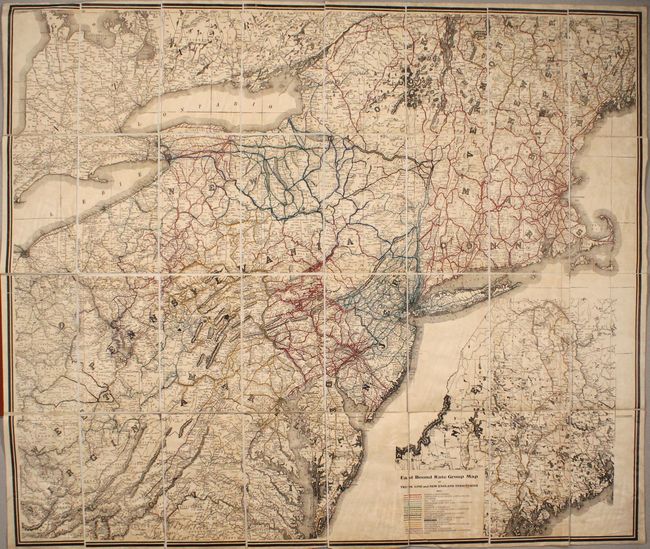
Auction 170, Lot 141
Subject: Northeastern United States & Canada
East Bound Rate Group Map of Trunk Line and New England Territories, 1912
Size: 40.9 x 34.9 inches (103.9 x 88.6 cm)
Estimate: $160 - $200
Sold for: $220
Closed on 11/14/2018
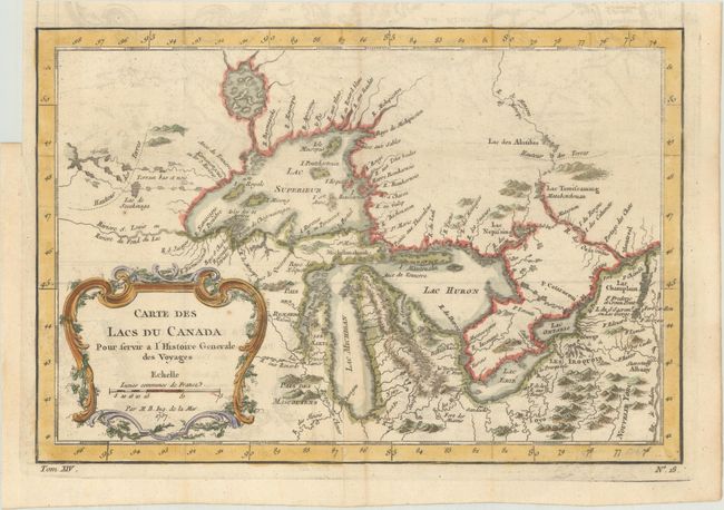
Auction 170, Lot 142
Subject: Colonial Central United States & Canada, Great Lakes
Bellin, Jacques Nicolas
Carte des Lacs du Canada pour Servir a l'Histoire Generale des Voyages, 1757
Size: 11.6 x 7.8 inches (29.5 x 19.8 cm)
Estimate: $400 - $475
Sold for: $325
Closed on 11/14/2018
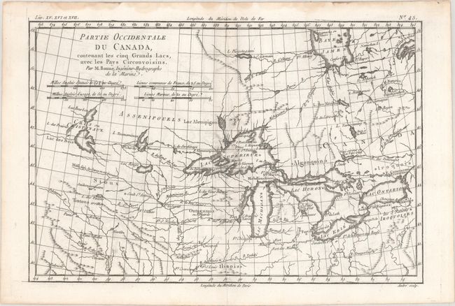
Auction 170, Lot 143
Subject: Colonial Great Lakes
Bonne, Rigobert
Partie Occidentale du Canada, Contenant les Cinq Grands Lacs, avec les Pays Circonvoisins, 1775
Size: 12.6 x 8.4 inches (32 x 21.3 cm)
Estimate: $200 - $230
Sold for: $100
Closed on 11/14/2018
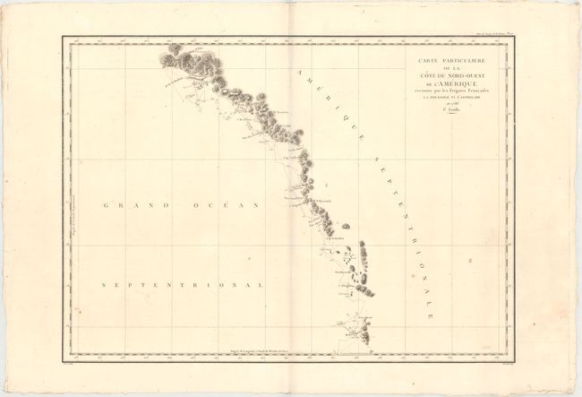
Auction 170, Lot 144
Subject: Western United States & Canada, Alaska
La Perouse, Comte Jean F. Galoup, de
[Lot of 3] Carte Particuliere de la Cote du Nord-Ouest de l'Amerique Reconnue par les Fregates Francaises la Boussole et l'Astrolabe en 1786. 1e. Feuille [and] 2e Feuille [and] 3e Feuille, 1797
Size: 26.8 x 19.4 inches (68.1 x 49.3 cm)
Estimate: $400 - $475
Sold for: $230
Closed on 11/14/2018
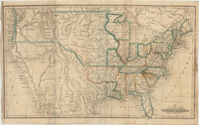
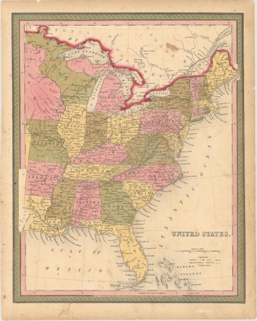
Auction 170, Lot 145
Subject: United States
Morse, Sidney Edwards
United States, 1822
Size: 17 x 10.2 inches (43.2 x 25.9 cm)
Estimate: $350 - $425
Sold for: $200
Closed on 11/14/2018
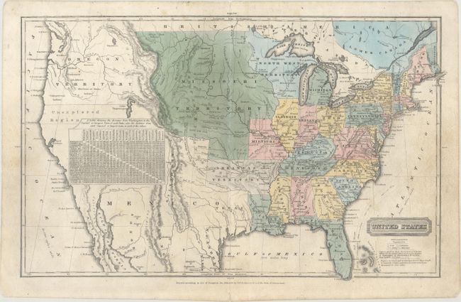
Auction 170, Lot 146
Subject: United States
Robinson, D.F. & Co.
United States, 1828
Size: 16.8 x 10.3 inches (42.7 x 26.2 cm)
Estimate: $240 - $300
Sold for: $140
Closed on 11/14/2018
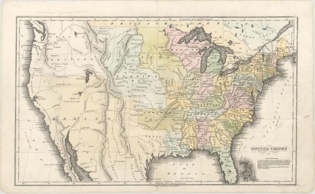
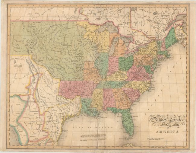
Auction 170, Lot 147
Subject: United States
Hammond, J.T.
United States, 1833
Size: 16.9 x 10.2 inches (42.9 x 25.9 cm)
Estimate: $240 - $300
Sold for: $150
Closed on 11/14/2018
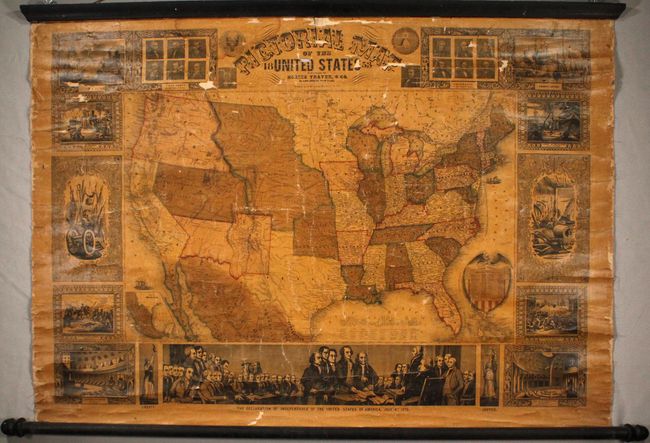
Auction 170, Lot 148
Subject: United States
Thayer & Co.
Pictorial Map of the United States, 1853
Size: 40 x 28.9 inches (101.6 x 73.4 cm)
Estimate: $600 - $750
Sold for: $500
Closed on 11/14/2018
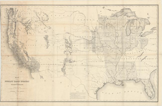
Auction 170, Lot 149
Subject: United States
General Land Office
Map of the Public Land States and Territories Constructed from the Public Surveys and Other Official Sources in the General Land Office, 1864
Size: 44.9 x 27.7 inches (114 x 70.4 cm)
Estimate: $180 - $220
Sold for: $95
Closed on 11/14/2018
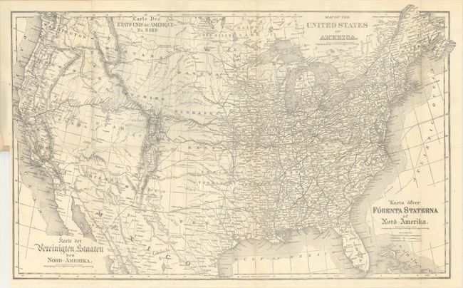
Auction 170, Lot 150
Subject: United States, Immigration
General Land Office
Map of the United States of America [bound in] Brief Description of the Public Lands of the United States of America, 1873
Size: 26.6 x 16.3 inches (67.6 x 41.4 cm)
Estimate: $150 - $180
A Map for the European Immigrant
Unsold
Closed on 11/14/2018
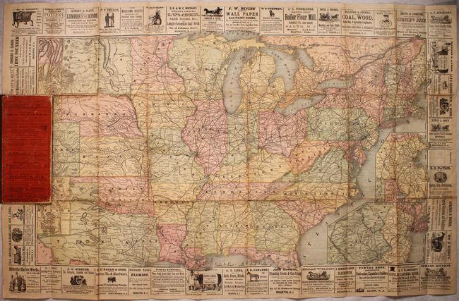
Auction 170, Lot 151
Subject: United States, Railroads
Rand McNally & Co.
[Title on Verso] 1888 - Railroad Map and Business Directory in Book Form - 1889, 1888
Size: 35.3 x 20.8 inches (89.7 x 52.8 cm)
Estimate: $100 - $130
Sold for: $130
Closed on 11/14/2018
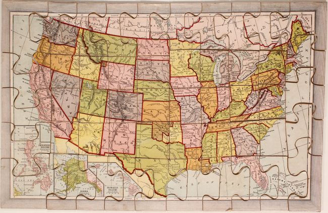
Auction 170, Lot 152
Subject: United States
McLoughlin Bros.
Dissected Map of the United States, 1890
Size: 17.5 x 11.3 inches (44.5 x 28.7 cm)
Estimate: $200 - $230
Sold for: $130
Closed on 11/14/2018
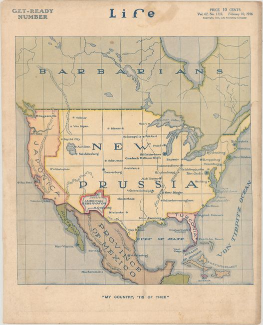
Auction 170, Lot 153
Subject: United States
My Country, 'Tis of Thee, 1916
Size: 8.1 x 8.5 inches (20.6 x 21.6 cm)
Estimate: $190 - $220
Sold for: $475
Closed on 11/14/2018
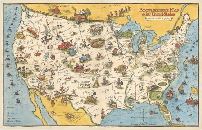
Auction 170, Lot 154
Subject: United States
Bootlegger's Map of the United States, 1931
Size: 33.9 x 21.4 inches (86.1 x 54.4 cm)
Estimate: $1,200 - $1,500
McCandlish's Humorous Prohibition Map in Hand Color
Sold for: $750
Closed on 11/14/2018

Auction 170, Lot 155
Subject: United States
Paul Bunyan's Pictorial Map of the United States Depicting Some of His Deeds and Exploits, 1935
Size: 28.7 x 18.8 inches (72.9 x 47.8 cm)
Estimate: $400 - $500
Sold for: $300
Closed on 11/14/2018
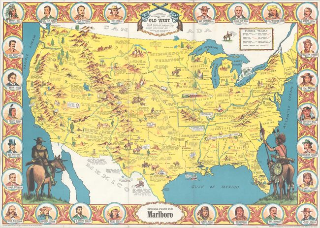
Auction 170, Lot 156
Subject: United States
Sheriff Danny Arnold's Pictorial Map of the Old West Showing Pioneer Trails and Battles, Indian Territories, Stagecoach Lines, Military Forts, Historical Data of the Frontier Period Around 1840, 1950
Size: 34.3 x 24.3 inches (87.1 x 61.7 cm)
Estimate: $200 - $250
Sold for: $160
Closed on 11/14/2018
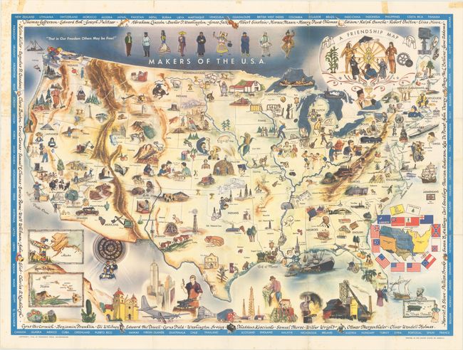
Auction 170, Lot 157
Subject: United States
A Friendship Map, 1956
Size: 37.9 x 27.8 inches (96.3 x 70.6 cm)
Estimate: $120 - $150
A Map Promoting Peace and Tolerance
Sold for: $275
Closed on 11/14/2018
Auction 170, Lot 158
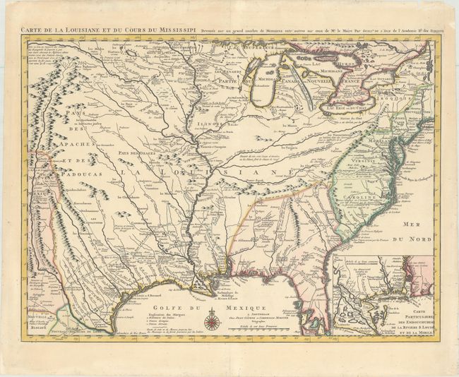
Subject: Colonial Eastern United States, Louisiana Territory
Delisle/Covens & Mortier
Carte de la Louisiane et du Cours du Mississipi Dressee sur un Grand Nombre de Memoires Entr'autres sur ceux de Mr. le Maire, 1730
Size: 23.4 x 17.3 inches (59.4 x 43.9 cm)
Estimate: $2,000 - $2,300
Delisle's Influential Map of the Louisiana Territory
Unsold
Closed on 11/14/2018
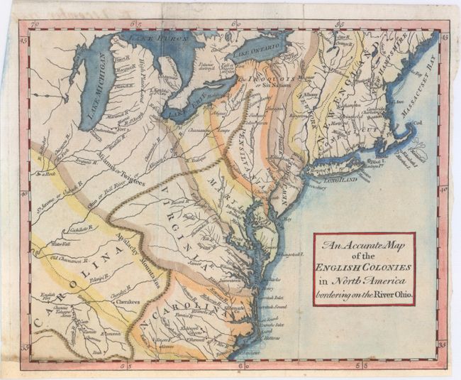
Auction 170, Lot 159
Subject: Colonial Eastern United States
Anon.
An Accurate Map of the English Colonies in North America Bordering on the River Ohio, 1754
Size: 9.6 x 7.9 inches (24.4 x 20.1 cm)
Estimate: $550 - $700
Unsold
Closed on 11/14/2018
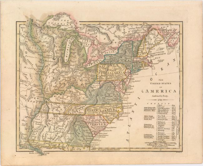
Auction 170, Lot 160
Subject: Eastern United States, Franklin
Wilkinson, Robert
The United States of America Confirmed by Treaty. 1783, 1812
Size: 11.3 x 9.8 inches (28.7 x 24.9 cm)
Estimate: $900 - $1,100
Early Map of the United States Featuring Franklinia and the Indiana Land Company
Sold for: $600
Closed on 11/14/2018
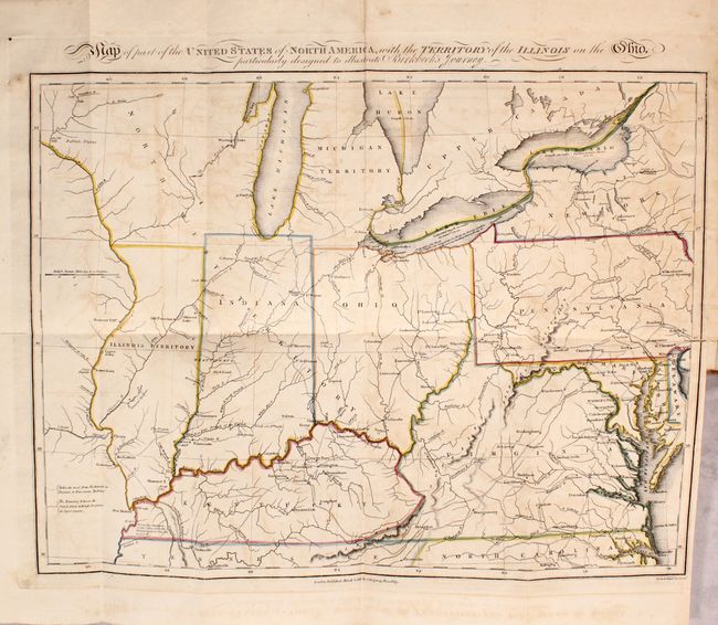
Auction 170, Lot 161
Subject: Eastern United States
Map of Part of the United States of North America, with the Territory of the Illinois on the Ohio... [bound in] Notes on a Journey in America, from the Coast of Virginia to the Territory of Illinois, 1818
Size: 16.1 x 12.1 inches (40.9 x 30.7 cm)
Estimate: $550 - $700
Sold for: $400
Closed on 11/14/2018
Auction 170, Lot 162
Subject: Eastern United States
Melish, John
United States of America, 1827
Size: 21.1 x 16.9 inches (53.6 x 42.9 cm)
Estimate: $600 - $750
Sold for: $450
Closed on 11/14/2018
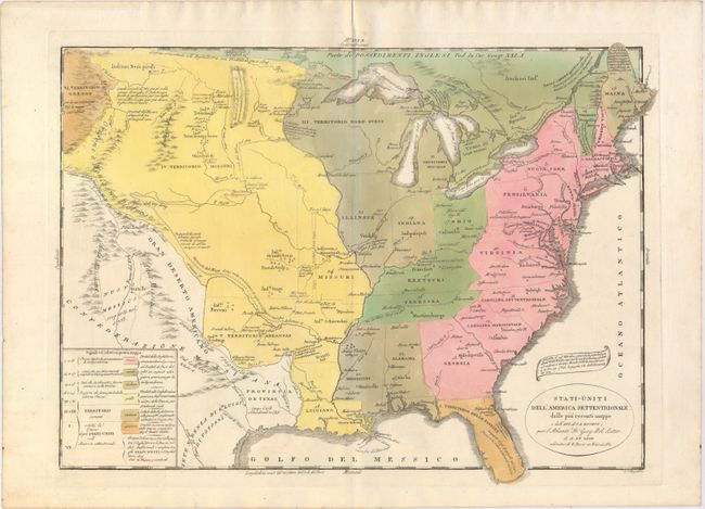
Auction 170, Lot 163
Subject: Eastern United States
Tasso, G.
Stati-Uniti dell' America Settentrionale dalle Piu Recenti Mappe…, 1832
Size: 18.6 x 13.6 inches (47.2 x 34.5 cm)
Estimate: $250 - $325
Sold for: $200
Closed on 11/14/2018
Auction 170, Lot 164
Subject: Eastern United States
Burr/Illman
United States, 1833
Size: 12.6 x 10.6 inches (32 x 26.9 cm)
Estimate: $120 - $150
NO RESERVE
Sold for: $55
Closed on 11/14/2018
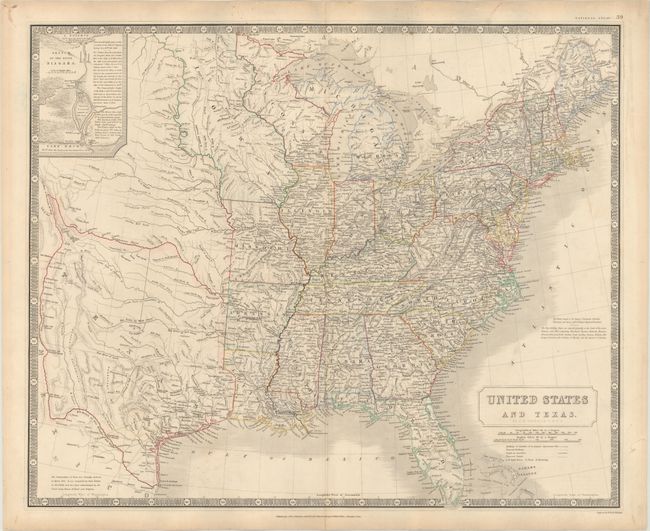
Auction 170, Lot 165
Subject: Eastern United States, Texas
Johnston, W. & A.K.
United States and Texas, 1844
Size: 23.9 x 19.6 inches (60.7 x 49.8 cm)
Estimate: $1,000 - $1,300
Highly Detailed British Map Featuring the Independent Republic of Texas
Sold for: $950
Closed on 11/14/2018
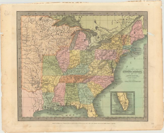
Auction 170, Lot 166
Subject: Eastern United States
Mitchell, Samuel Augustus
United States, 1846
Size: 12.6 x 15.8 inches (32 x 40.1 cm)
Estimate: $100 - $130
Sold for: $75
Closed on 11/14/2018
Auction 170, Lot 167
Subject: Colonial New England & Mid-Atlantic United States
Robert de Vaugondy, Didier
Partie de l'Amerique Septentrionale, qui Comprend le Cours de l'Ohio, la Nlle. Angleterre, la Nlle York, le New Jersey, la Pensylvanie, le Maryland la Virginie, la Caroline, 1755
Size: 24.5 x 18.8 inches (62.2 x 47.8 cm)
Estimate: $650 - $800
First State
Unsold
Closed on 11/14/2018
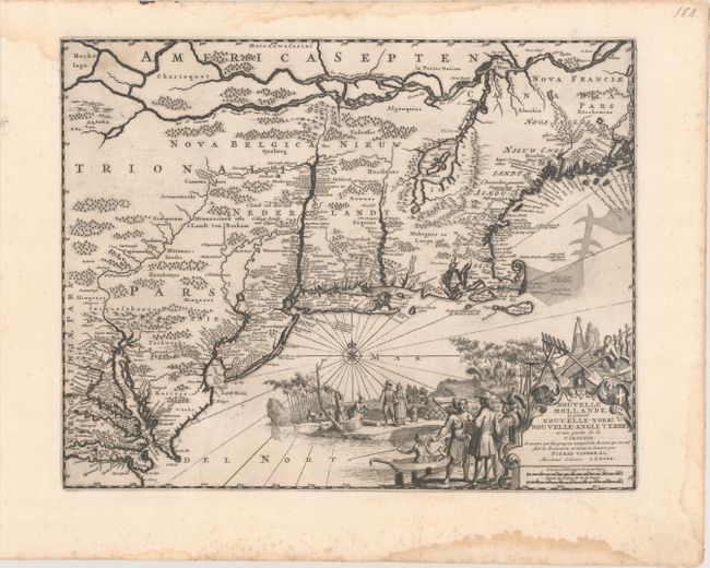
Auction 170, Lot 168
Subject: Colonial New England United States
Aa, Pieter van der
Nouvelle Hollande, (a present Nouvelle-York) Nouvelle-Angleterre, et Une Partie de la Virginie..., 1729
Size: 14.4 x 11.4 inches (36.6 x 29 cm)
Estimate: $900 - $1,100
Unsold
Closed on 11/14/2018
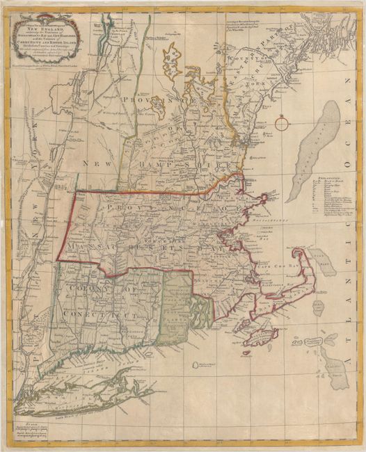
Auction 170, Lot 169
Subject: Colonial New England United States
Bowles, Carrington
A Map of the Most Inhabited Part of New England, Containing the Provinces of Massachusets Bay and New Hampshire, with the Colonies of Conecticut and Rhode Island..., 1771
Size: 20.4 x 25.1 inches (51.8 x 63.8 cm)
Estimate: $3,000 - $4,000
Reduced-Size Edition of Jefferys' Influential Map of New England
Sold for: $1,500
Closed on 11/14/2018
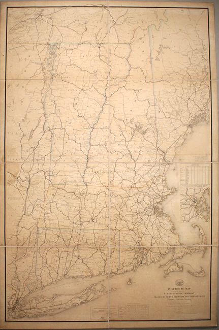
Auction 170, Lot 170
Subject: New England - United States
Nicholson, W. L.
Post Route Map of the States of New Hampshire, Vermont Massachusetts, Rhode Island, Connecticut and Parts of New York and Maine, 1878
Size: 37.7 x 58.7 inches (95.8 x 149.1 cm)
Estimate: $700 - $850
Sold for: $350
Closed on 11/14/2018
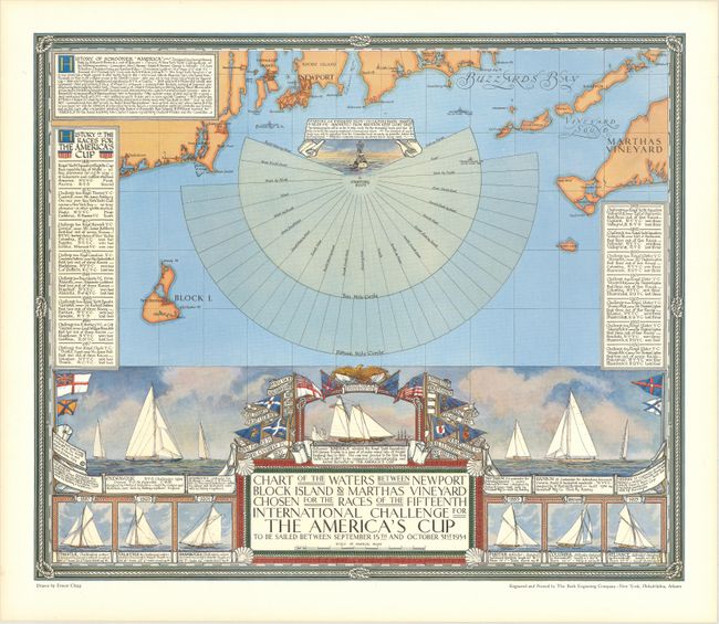
Auction 170, Lot 171
Subject: New England - United States
Chart of the Waters Between Newport Block Island & Marthas Vineyard Chosen for the Races of the Fifteenth International Challenge for the America's Cup..., 1934
Size: 20 x 17 inches (50.8 x 43.2 cm)
Estimate: $550 - $700
Map Promoting the 1934 America's Cup Race
Sold for: $400
Closed on 11/14/2018
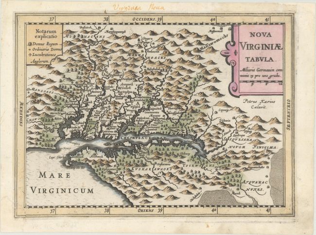
Auction 170, Lot 172
Subject: Colonial Mid-Atlantic United States
Mercator/Cloppenburgh
Nova Virginiae Tabula, 1673
Size: 9.9 x 7.3 inches (25.1 x 18.5 cm)
Estimate: $750 - $900
Sold for: $550
Closed on 11/14/2018
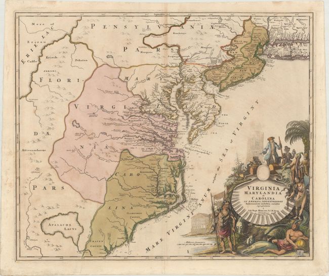
Auction 170, Lot 173
Subject: Colonial Mid-Atlantic United States
Homann, Johann Baptist
Virginia Marylandia et Carolina in America Septentrionali Britannorum Industria Excultae Repraesentatae, 1730
Size: 22.9 x 19.2 inches (58.2 x 48.8 cm)
Estimate: $1,600 - $2,000
Map Created to Promote German Immigration to the New World
Sold for: $1,200
Closed on 11/14/2018
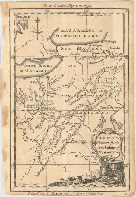
Auction 170, Lot 174
Subject: Colonial Mid-Atlantic United States
Gibson, John
A Map of the Western Parts of the Colony of Virginia, 1754
Size: 4.8 x 7.4 inches (12.2 x 18.8 cm)
Estimate: $350 - $425
Sold for: $190
Closed on 11/14/2018
214 lots
Page 1 of 5