Filtered by Category:Books, Atlases, Travel Guides, Geography & Reference Books(Show All Categories)
Showing results for:Auction 170
Catalog Archive
48 lots
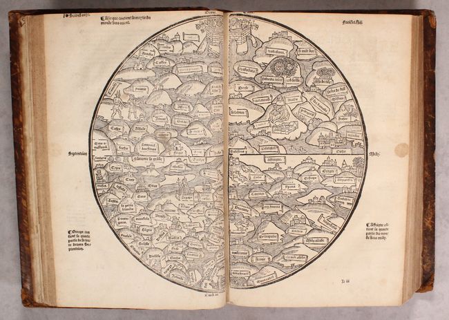
Auction 170, Lot 45
Subject: Ancient World & Holy Land
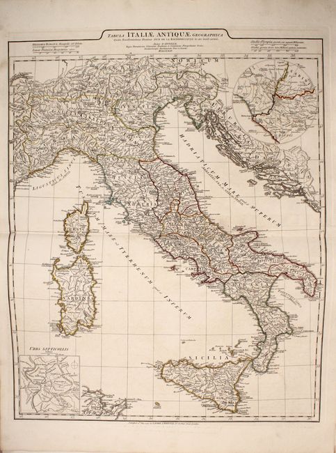
[Ancient World & Palestine Maps in book] La Mer des Histoires..., 1543
Size: 13.5 x 9.3 inches (34.3 x 23.6 cm)
Estimate: $28,000 - $35,000
Rare Medieval Maps of the World and Palestine
Unsold
Closed on 11/14/2018
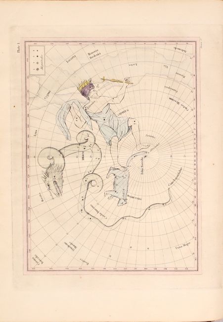
Auction 170, Lot 58
Subject: Celestial Atlas
Finley, Anthony
Astronomical Recreations: or Sketches of the Relative Position and Mythological History of the Constellations, 1824
Size: 8.8 x 11 inches (22.4 x 27.9 cm)
Estimate: $1,600 - $2,000
An Early American Celestial Atlas
Sold for: $1,100
Closed on 11/14/2018
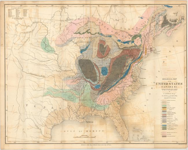
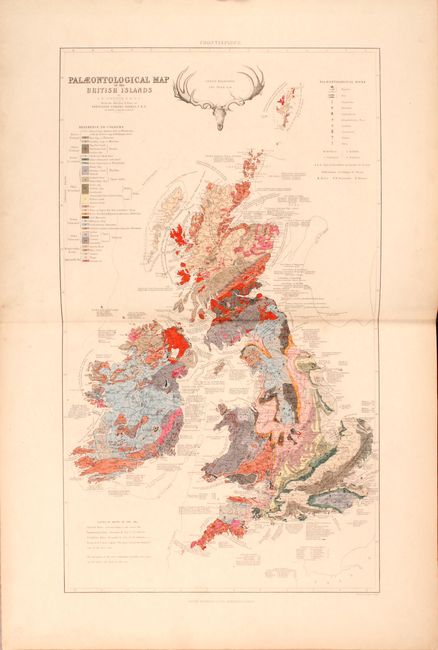
Auction 170, Lot 133
Subject: Eastern United States & Canada, Geology
Lyell, Charles
Geological Map of the United States Canada &c. [with] [2 Volumes] Travels in North America, in the Years 1841-2; with Geological Observations on the United States, Canada, and Nova Scotia, 1845
Size: 19.8 x 15.3 inches (50.3 x 38.9 cm)
Estimate: $600 - $750
First American Edition of Lyell's Important Account & Geological Map
Sold for: $450
Closed on 11/14/2018
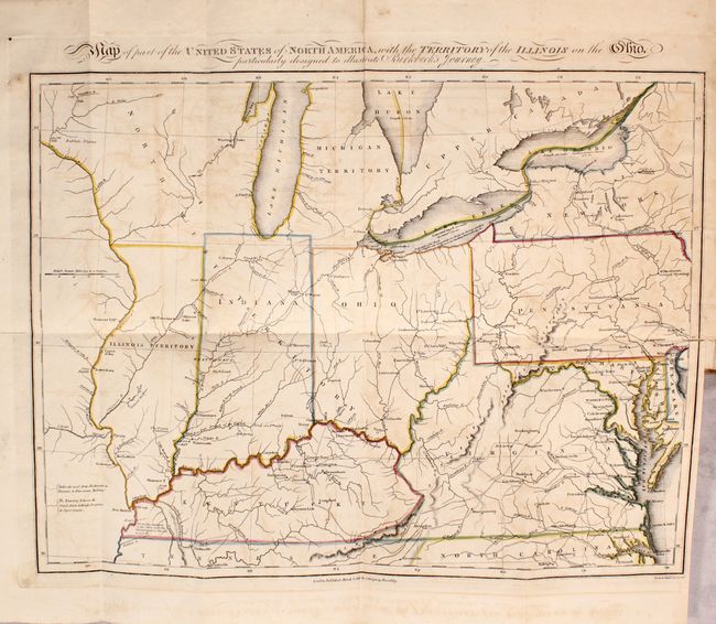
Auction 170, Lot 161
Subject: Eastern United States
Map of Part of the United States of North America, with the Territory of the Illinois on the Ohio... [bound in] Notes on a Journey in America, from the Coast of Virginia to the Territory of Illinois, 1818
Size: 16.1 x 12.1 inches (40.9 x 30.7 cm)
Estimate: $550 - $700
Sold for: $400
Closed on 11/14/2018
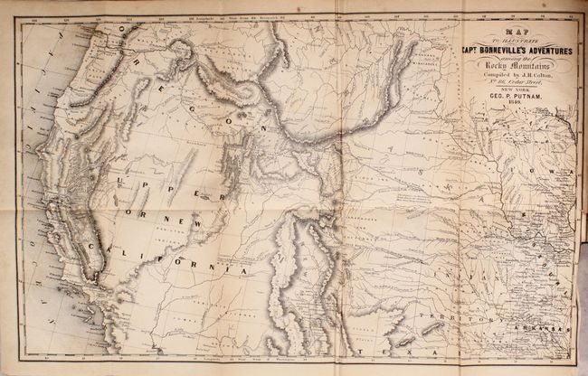
Auction 170, Lot 203
Subject: Western United States
Irving, Washington
Map to Illustrate Capt. Bonneville's Adventures Among the Rocky Mountains [bound in] The Adventures of Captain Bonneville, U.S.A., in the Rocky Mountains and the Far West..., 1850
Size: 18.2 x 11.1 inches (46.2 x 28.2 cm)
Estimate: $200 - $230
Sold for: $120
Closed on 11/14/2018
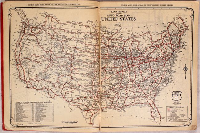
Auction 170, Lot 209
Subject: Western United States
Rand McNally & Co.
Rand McNally Junior Auto Road Atlas of the Western United States Including a Brief Description of the National Parks and Monuments, 1927
Size: 9.3 x 12.3 inches (23.6 x 31.2 cm)
Estimate: $160 - $200
Sold for: $50
Closed on 11/14/2018
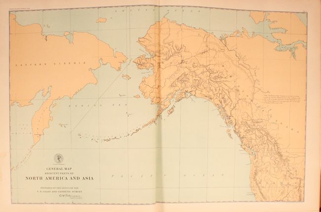
Auction 170, Lot 219
Subject: Alaska
U.S. Gov't Printing Office
[3 Volumes] Senate Documents Vol. 21, Pts. 1, 2, and 3 - No. 162 Alaskan Boundary Tribunal..., 1904
Size: 15.5 x 19 inches (39.4 x 48.3 cm)
Estimate: $700 - $850
Sold for: $350
Closed on 11/14/2018
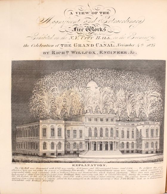
Auction 170, Lot 285
Subject: New York, Erie Canal
Colden, Cadwallader
Memoir, Prepared at the Request of a Committee of the Common Council of the City of New York..., 1825
Size: 8.3 x 10.1 inches (21.1 x 25.7 cm)
Estimate: $800 - $1,000
Celebrating the Completion of the Erie Canal
Sold for: $650
Closed on 11/14/2018
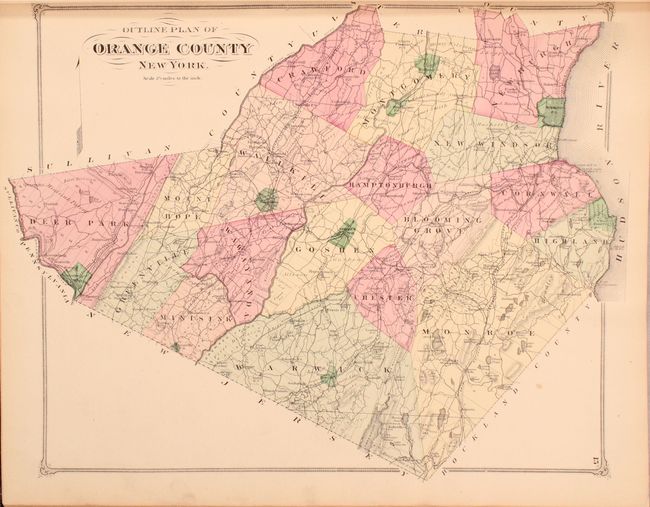
Auction 170, Lot 297
Subject: Orange County, New York
Beers, F. W.
County Atlas of Orange New York..., 1875
Size: 15.1 x 18 inches (38.4 x 45.7 cm)
Estimate: $800 - $950
Unsold
Closed on 11/14/2018
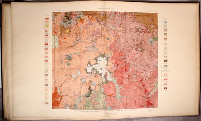
Auction 170, Lot 326
Subject: Yellowstone, Wyoming, Geology
U.S. Geological Survey (USGS)
Atlas to Accompany Monograph XXXII on the Geology of the Yellowstone National Park, 1904
Size: 18.8 x 21.9 inches (47.8 x 55.6 cm)
Estimate: $500 - $650
Sold for: $375
Closed on 11/14/2018
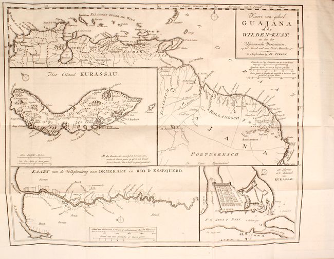
Auction 170, Lot 403
Subject: South America, Exploration & Surveys
Tirion, Isaac
[Volume 2 - South America] Hedendaagsche Historie of Tegenwoordige Staat van Amerika..., 1767
Size: 4.9 x 7.6 inches (12.4 x 19.3 cm)
Estimate: $400 - $500
Sold for: $300
Closed on 11/14/2018
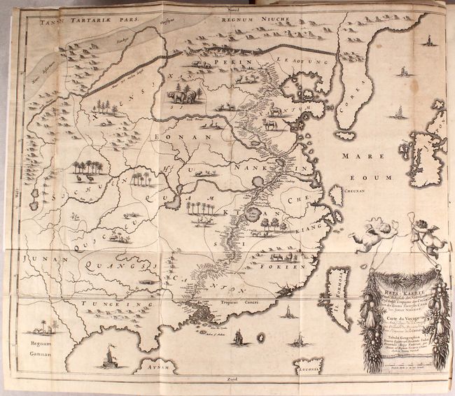
Auction 170, Lot 632
Subject: China
Nieuhoff, Johann
L'Ambassade de la Compagnie Orientale des Provinces Unies vers l'Empereur de la Chine, ou Grand Cam de Tartarie..., 1665
Size: 13.4 x 8.8 inches (34 x 22.4 cm)
Estimate: $3,250 - $4,000
Nieuhoff's Important Description of the Chinese Empire
Unsold
Closed on 11/14/2018
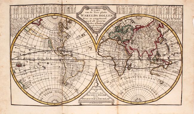
Auction 170, Lot 710
Subject: Atlases
Keizer/De Lat
[Atlas der Waereld Vol. II...], 1747
Size: 5.3 x 8.8 inches (13.5 x 22.4 cm)
Estimate: $1,600 - $2,000
Unsold
Closed on 11/14/2018
Auction 170, Lot 711
Subject: Atlases
Laurie & Whittle
A Complete Body of Ancient Geography, 1801
Size: 15.5 x 21.6 inches (39.4 x 54.9 cm)
Estimate: $400 - $500
Sold for: $425
Closed on 11/14/2018
Auction 170, Lot 712
Subject: Atlases
Lavoisne/Aspin
A Complete Genealogical, Historical, Chronological, and Geographical Atlas; Being a General Guide to Ancient and Modern History..., 1821
Size: 12.3 x 17.9 inches (31.2 x 45.5 cm)
Estimate: $300 - $400
NO RESERVE
Sold for: $240
Closed on 11/14/2018
Auction 170, Lot 713
Subject: Atlases
Johnston, Alexander K.
The Physical Atlas of Natural Phenomena, 1850
Size: 11.4 x 14.8 inches (29 x 37.6 cm)
Estimate: $550 - $700
Sold for: $400
Closed on 11/14/2018
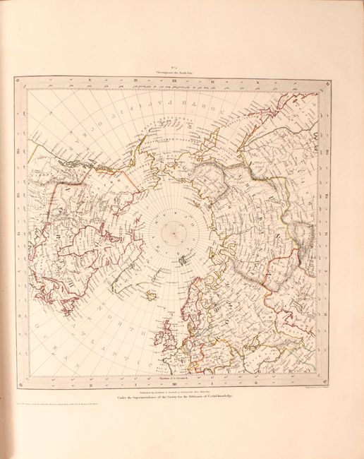
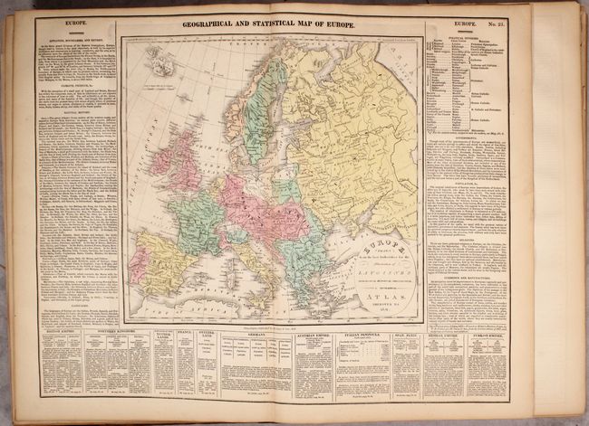
Auction 170, Lot 714
Subject: Atlases
SDUK Society for the Diffusion of Useful Knowledge
General Atlas Published Under the Superintendence of the Society for the Diffusion of Useful Knowledge ... Vol. I, 1852
Size: 13.6 x 16.3 inches (34.5 x 41.4 cm)
Estimate: $750 - $900
NO RESERVE
Unsold
Closed on 11/14/2018
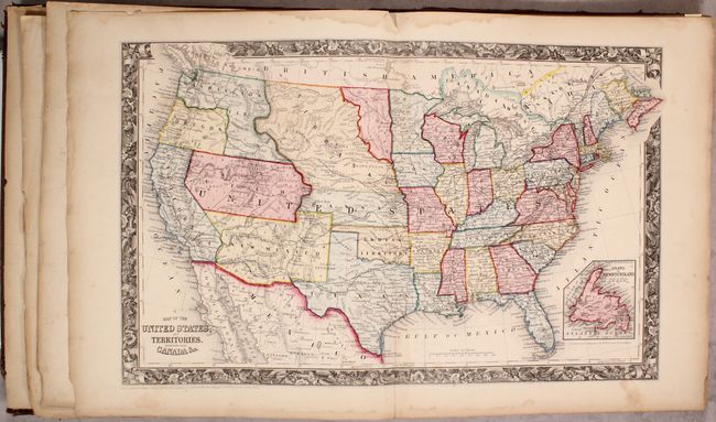
Auction 170, Lot 715
Subject: Atlases
Mitchell, Samuel Augustus
Mitchell's New General Atlas, Containing Maps of the Various Countries of the World, Plans of Cities, Etc. Embraced in Forty-Seven Quarto Maps..., 1860
Size: 13.1 x 15.9 inches (33.3 x 40.4 cm)
Estimate: $700 - $850
First Edition, First State
Sold for: $550
Closed on 11/14/2018
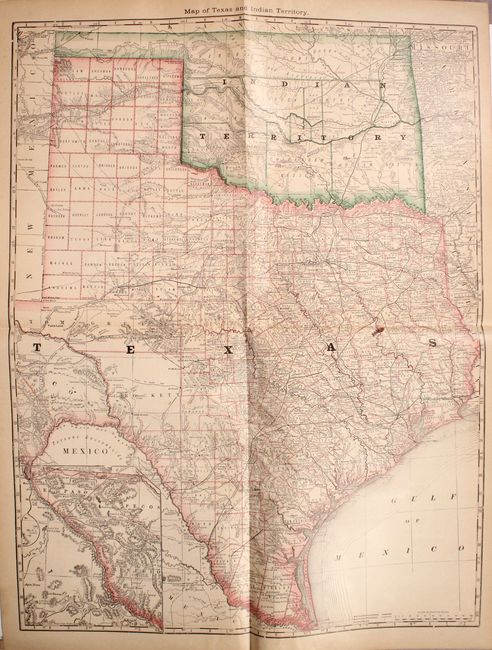
Auction 170, Lot 716
Subject: Atlases
Hardesty, Hiram H.
Historical Hand-Atlas Illustrated Containing Large Scale Copper Plate Maps of Each State annd Territory of the United States..., 1882
Size: 11.1 x 14.9 inches (28.2 x 37.8 cm)
Estimate: $180 - $220
Sold for: $275
Closed on 11/14/2018
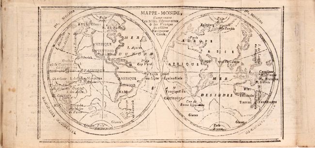
Auction 170, Lot 717
Subject: Geography Books
Buffier, Claude
Geographie Universelle, Exposee dans les Differentes Methodes qui Peuvent Abreger l'Etude & Faciliter l'Usage de Cette Science..., 1767
Size: 4.1 x 6.9 inches (10.4 x 17.5 cm)
Estimate: $550 - $650
Sold for: $400
Closed on 11/14/2018
Auction 170, Lot 718
Subject: Geography Books
Langlois, H.
Etrennes Interessantes des Quatre Parties du Monde, et des Troupes de France, 1791
Size: 2.4 x 4 inches (6.1 x 10.2 cm)
Estimate: $350 - $425
Sold for: $250
Closed on 11/14/2018
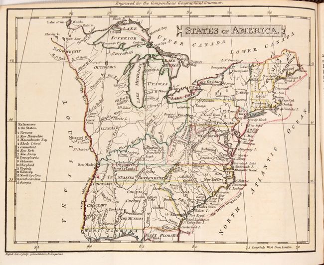
Auction 170, Lot 719
Subject: Geography Books
Peacock, W.
[Lot of 2] A Compendious Geographical and Historical Grammar: Exhibiting a Brief Survey of the Terraqueous Globe... [and] A Compendious Geographical Dictionary, Containing, a Concise Description of the Most Remarkable Places ... The Second Edition, 1795
Size: 3.4 x 5.3 inches (8.6 x 13.5 cm)
Estimate: $450 - $550
Sold for: $475
Closed on 11/14/2018
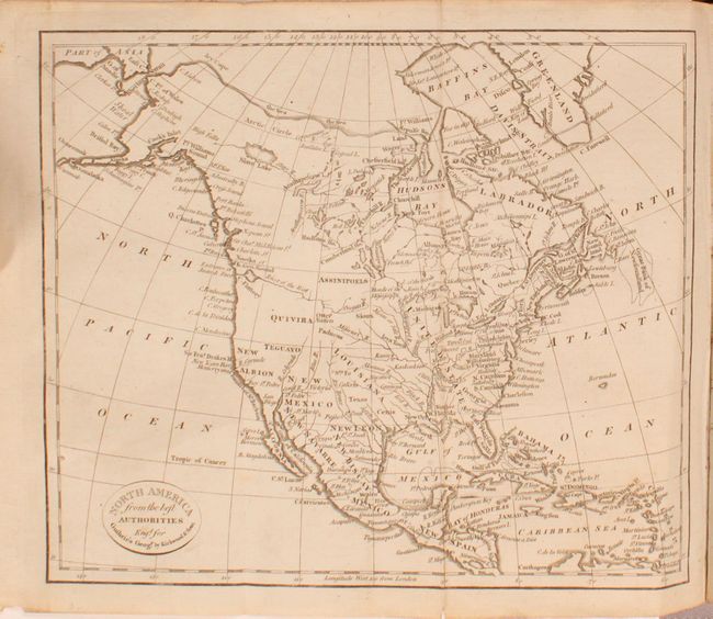
Auction 170, Lot 720
Subject: Geography Books
Guthrie, William
A New Geographical, Historical, and Commercial Grammar; and Present State of the Several Kingdoms of the World, 1800
Size: 5.6 x 8.7 inches (14.2 x 22.1 cm)
Estimate: $300 - $400
Sold for: $190
Closed on 11/14/2018
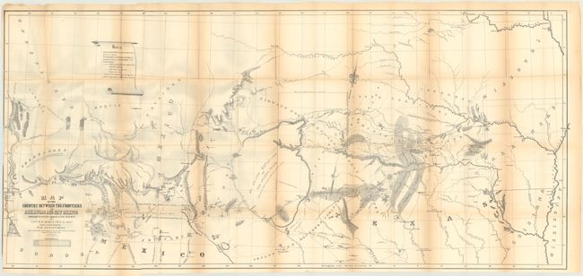
Auction 170, Lot 721
Subject: Exploration & Surveys, Central United States
Marcy, Capt. R.B.
Exploration of the Red River of Louisiana, in the Year 1852, 1854
Size: 6 x 9.2 inches (15.2 x 23.4 cm)
Estimate: $450 - $550
Sold for: $325
Closed on 11/14/2018
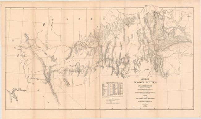
Auction 170, Lot 722
Subject: Exploration & Surveys, Utah
Simpson, James H. (Lt. Col.)
Map of Wagon Routes in Utah Territory... [with] Captain Simpson's Report and Map of Wagon Routes in Utah Territory, 1876
Size: 48 x 26 inches (121.9 x 66 cm)
Estimate: $450 - $550
Sold for: $240
Closed on 11/14/2018
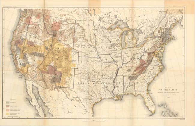
Auction 170, Lot 723
Subject: Exploration & Surveys, Geology
Powell, John Wesley
[Fifth Annual Report of the United States Geological Survey], 1884
Size: 8 x 11.6 inches (20.3 x 29.5 cm)
Estimate: $350 - $425
Sold for: $180
Closed on 11/14/2018

Auction 170, Lot 724
Subject: References
Phillips, P. Lee
The Lowery Collection - A Descriptive List of Maps of the Spanish Possessions Within the Present Limits of the United States, 1502-1820, 1912
Size: 7.3 x 10.3 inches (18.5 x 26.2 cm)
Estimate: $95 - $130
NO RESERVE
Sold for: $36
Closed on 11/14/2018
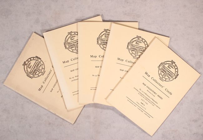
Auction 170, Lot 725
Subject: References
[Complete Set of 111] Map Collectors' Circle, 1963-2000
Size: 7.3 x 9.7 inches (18.5 x 24.6 cm)
Estimate: $600 - $800
Sold for: $400
Closed on 11/14/2018
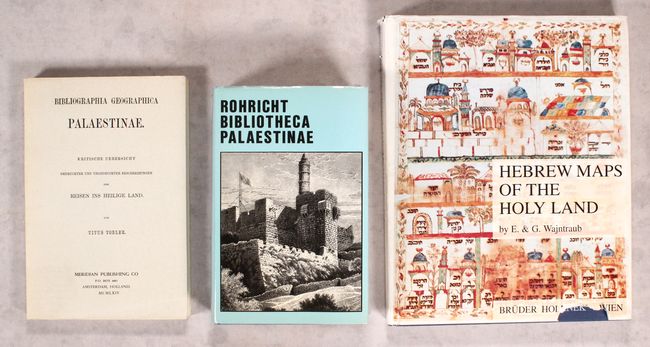
Auction 170, Lot 726
Subject: References
[Lot of 3] Bibliographia Geographica Palaestinae... [and] Bibliographia Geographica Palaestinae - Chronologisches Verzeichnis der von 333 Bis 1878... [and] Hebrew Maps of the Holy Land, 1964-92
Size: See Description
Estimate: $90 - $120
NO RESERVE
Sold for: $60
Closed on 11/14/2018
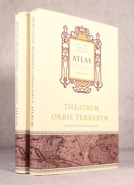
Auction 170, Lot 727
Subject: References
Mercator/Hondius
[Facsimile] Mercator-Hondius-Janssonius Atlas or a Geographicke Description of the World, 1968
Size: 12.2 x 18.4 inches (31 x 46.7 cm)
Estimate: $400 - $500
Sold for: $300
Closed on 11/14/2018
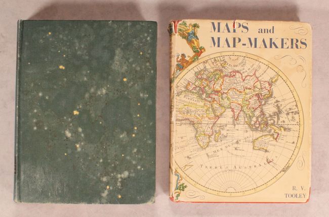
Auction 170, Lot 728
Subject: References
Tooley, R. V.
[Lot of 2] The Mapping of America [and] Maps and Map-Makers, 1970-80
Size: See Description
Estimate: $100 - $130
NO RESERVE
Sold for: $34
Closed on 11/14/2018
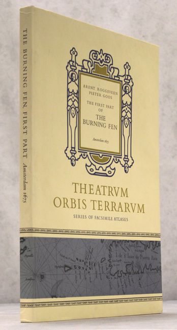
Auction 170, Lot 729
Subject: References
Roggeveen, Arent
[Facsimile] The Burning Fen - First Part, 1971
Size: 12.3 x 18.4 inches (31.2 x 46.7 cm)
Estimate: $140 - $170
NO RESERVE
Sold for: $40
Closed on 11/14/2018
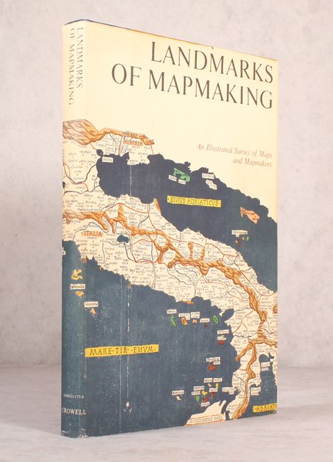
Auction 170, Lot 730
Subject: References
Tooley & Bricker
Landmarks of Mapmaking - An Illustrated Survey of Maps and Mapmakers, 1976
Size: 11 x 15.9 inches (27.9 x 40.4 cm)
Estimate: $60 - $80
NO RESERVE
Sold for: $41
Closed on 11/14/2018
Auction 170, Lot 731
Subject: References
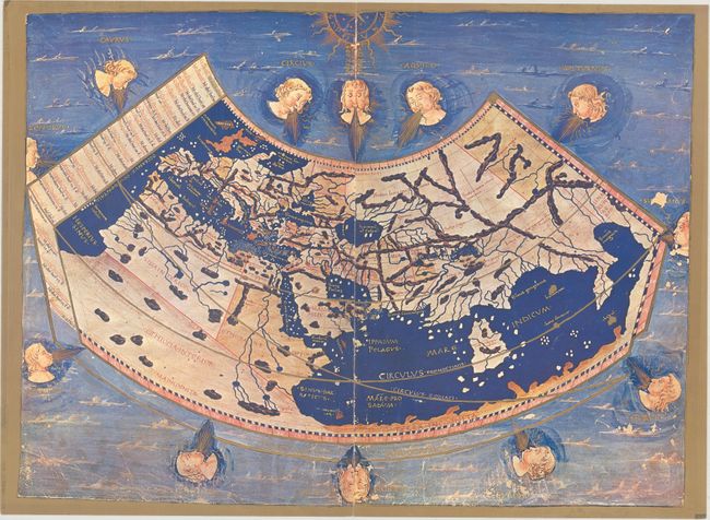
Ptolemy
[Lot of 2] Claudii Ptolemaei Cosmographia [and] Claudius Ptolemy - The Geography, 1976-91
Size: 12.6 x 18.3 inches (32 x 46.5 cm)
Estimate: $200 - $230
Sold for: $100
Closed on 11/14/2018
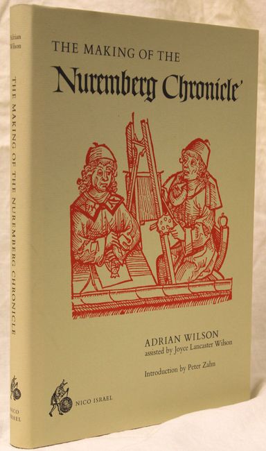
Auction 170, Lot 732
Subject: References
Wilson, Adrian
The Making of the Nuremberg Chronicle, 1978
Size: 9.8 x 14 inches (24.9 x 35.6 cm)
Estimate: $140 - $170
Sold for: $120
Closed on 11/14/2018
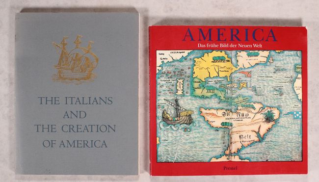
Auction 170, Lot 733
Subject: References
[Lot of 2] The Italians and the Creation of America... [and] America - Das Fruhe Bild der Neuen Welt, 1980-92
Size: See Description
Estimate: $60 - $80
NO RESERVE
Sold for: $21
Closed on 11/14/2018
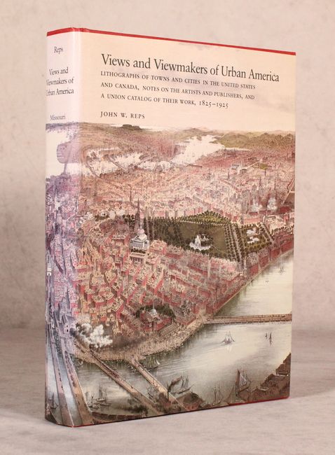
Auction 170, Lot 734
Subject: References
Reps, John W.
Views and Viewmakers of Urban America..., 1985
Size: 9.3 x 12.3 inches (23.6 x 31.2 cm)
Estimate: $95 - $130
Sold for: $70
Closed on 11/14/2018

Auction 170, Lot 735
Subject: References
Shirley, Rodney W.
The Mapping of the World - Early Printed World Maps 1472-1700, 1987
Size: 10 x 13.8 inches (25.4 x 35.1 cm)
Estimate: $475 - $600
Sold for: $400
Closed on 11/14/2018
Auction 170, Lot 736
Subject: References
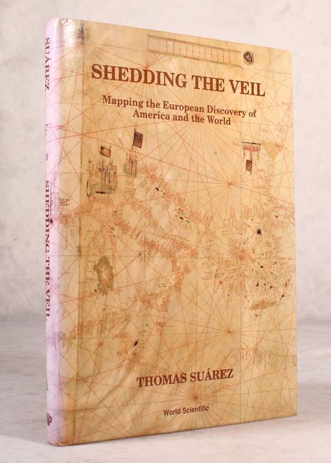
Suarez, Thomas
Shedding the Veil - Mapping the European Discovery of America and the World, 1992
Size: 8.7 x 11.8 inches (22.1 x 30 cm)
Estimate: $90 - $120
NO RESERVE
Sold for: $26
Closed on 11/14/2018
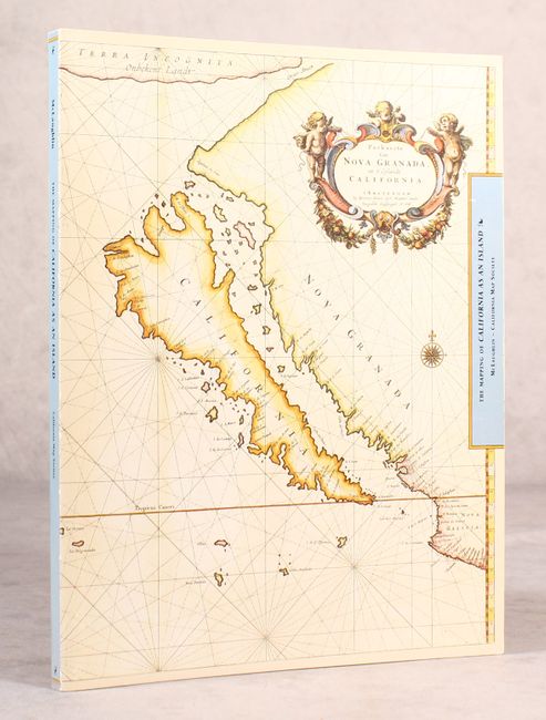
Auction 170, Lot 737
Subject: References
McLaughlin, Glen
The Mapping of California as an Island - An Illustrated Checklist, 1995
Size: 8.5 x 11 inches (21.6 x 27.9 cm)
Estimate: $90 - $120
NO RESERVE
Sold for: $100
Closed on 11/14/2018
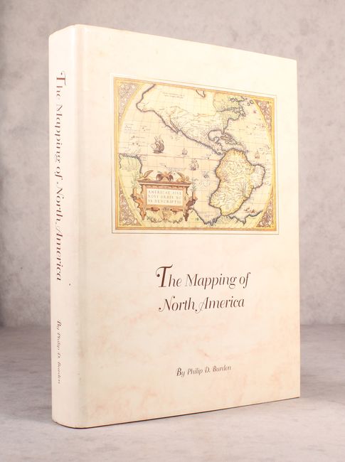
Auction 170, Lot 738
Subject: References
Burden, Philip D.
The Mapping of North America - A List of Printed Maps 1511-1670, 1996
Size: 10.5 x 14.3 inches (26.7 x 36.3 cm)
Estimate: $200 - $230
Sold for: $190
Closed on 11/14/2018
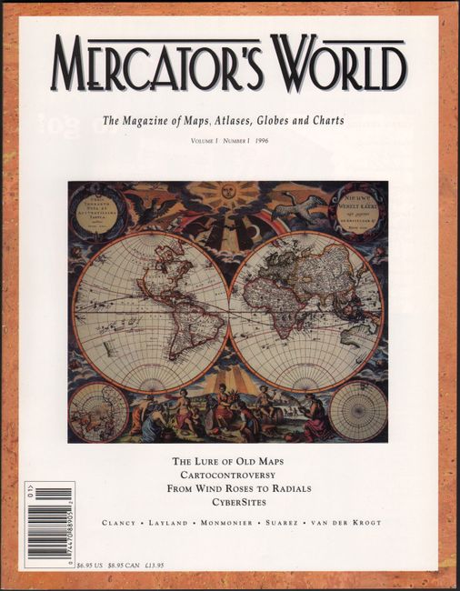
Auction 170, Lot 739
Subject: References
Mercator's World - The Magazine of Maps, Atlases, Globes and Charts Volume I Number I, 1996
Size: 8.4 x 10.9 inches (21.3 x 27.7 cm)
Estimate: $20 - $40
NO RESERVE
Sold for: $26
Closed on 11/14/2018
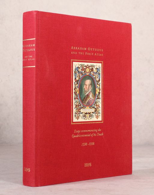
Auction 170, Lot 740
Subject: References
Krogt, Peter van der
Abraham Ortelius and the First Atlas - Essays Commemorating the Quadricentennial of His Death 1598-1998, 1998
Size: 9.6 x 12.1 inches (24.4 x 30.7 cm)
Estimate: $180 - $210
NO RESERVE
Sold for: $80
Closed on 11/14/2018
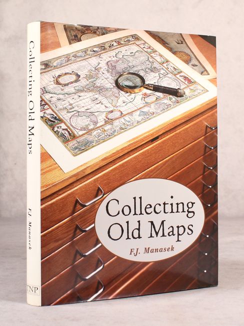
Auction 170, Lot 741
Subject: References
Manasek, F.J.
Collecting Old Maps, 1998
Size: 8.8 x 11.3 inches (22.4 x 28.7 cm)
Estimate: $100 - $130
NO RESERVE
Sold for: $36
Closed on 11/14/2018

Auction 170, Lot 742
Subject: References
[6 Volumes] The Iconography of Manhattan Island 1498-1909 Compiled from Original Sources and Illustrated by Photo-Intaglio..., 1998
Size: 8.8 x 11.3 inches (22.4 x 28.7 cm)
Estimate: $300 - $400
Sold for: $200
Closed on 11/14/2018
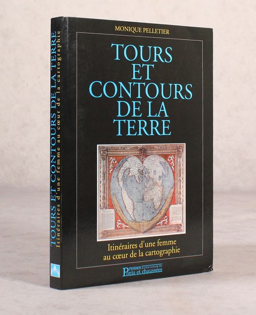
Auction 170, Lot 743
Subject: References
Tours et Contours de la Terre - Itineraires d'une Femme au Coeur de la Cartographie, 1999
Size: 6.8 x 9.4 inches (17.3 x 23.9 cm)
Estimate: $70 - $90
NO RESERVE
Sold for: $43
Closed on 11/14/2018
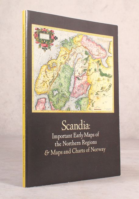
Auction 170, Lot 744
Subject: References
Scandia: Important Early Maps of the Northern Regions & Maps and Charts of Norway, 2002
Size: 9 x 12 inches (22.9 x 30.5 cm)
Estimate: $25 - $40
NO RESERVE
Sold for: $100
Closed on 11/14/2018
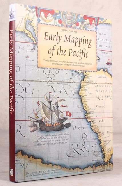
Auction 170, Lot 745
Subject: References
Suarez, Thomas
Early Mapping of the Pacific - The Epic Story of Seafarers, Adventurers, and Cartographers Who Mapped the Earth's Greatest Ocean, 2004
Size: 9.4 x 12.3 inches (23.9 x 31.2 cm)
Estimate: $80 - $100
NO RESERVE
Sold for: $85
Closed on 11/14/2018
48 lots