Subject: Colonial Northeastern United States & Canada
Period: 1683 (circa)
Publication: Description de l'Univers
Color: Black & White
Size:
3.9 x 5.6 inches
9.9 x 14.2 cm
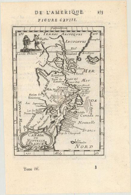
This charming small map depicts the eastern seaboard from Chesapeake Bay to Greenland. The Great Lakes are shown open-ended in the west allowing the possibility of a Northwest Passage. The map extends to include Bermuda. Names Lake Superior, the Cercle Polaire and shows Nouveu Mexique at extreme lower left. The map is decorated with a strapwork title cartouche at lower left and a vignette at upper left shows two Indians and an infant. Page number 273 at upper right and French text on verso.
References: Kershaw #267; McCorkle #683.3; Pastoureau, MANESSON-MALLET I A [626].
Condition: A
A nice impression on a watermarked sheet with one tiny abrasion near the center of the map.