Subject: United States
Period: 1822 (circa)
Publication:
Color: Hand Color
Size:
17 x 10.2 inches
43.2 x 25.9 cm
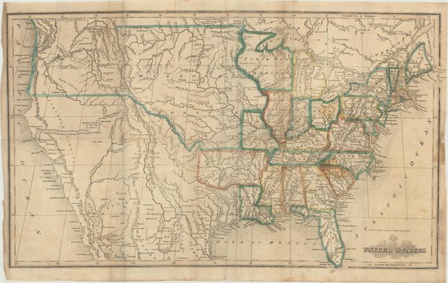
This uncommon map of the United States shows early territorial configurations in the middle of the country. Arkansas is in its large configuration extending to Mexico, while Texas is named and is part of Mexico. The large Northwest Territory is bounded on the west by the Mississippi River and stretches to Lake Superior and Lake Michigan. The central plains and Northwest are labeled Missouri Territory with a portion extending into Canada labeled New Caledonia. In Utah a lake is shown whose "Western Limits...are unknown" and just to the east is the Valle Salado. An unknown, spurious river bisects the unnamed Great Basin with a hopeful notation predicting it "will probably be the communication between the Atlantic and Pacific."
References:
Condition: B
Issued folding with some light staining primarily in the Carolinas, and a 3.5" edge tear at bottom that has been closed on verso with archival tape. There is a short, closed binding tear along the right sheet edge and an edge chip that has been replaced with old paper.