Subject: Colonial Mid-Atlantic United States
Period: 1673 (circa)
Publication:
Color: Hand Color
Size:
9.9 x 7.3 inches
25.1 x 18.5 cm
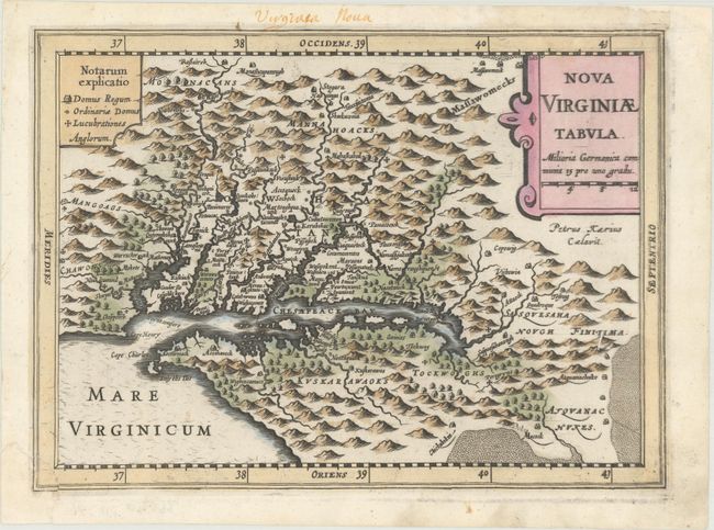
This delicately engraved map is a reduced version of John Smith's map of the Chesapeake Bay region (fourth derivative). Despite its small size, it is filled with towns with both English and Native names, including Jamestown (Iamestowne), and a key to the types of buildings on the left and pictorial topography. Engraved by Pieter van den Keere with his Latinized name appearing below the title cartouche. In this Cloppenburg edition, Keere increased the map size from 5 x 7" to 7 x 10" inches.
References: Burden #226; Tooley (America) plt. 72; Van der Krogt (Vol. III) #9410:353.
Condition: B+
A dark impression that is slightly uneven at far right. The bottom left corner of the map (only affecting the border) was torn off and professionally reattached, and a small chip at top right (confined to the blank margin) has also been professionally repaired. There is an old manuscript title in the top margin.