Filtered by Category:United States(Show All Categories)
Showing results for:Auction 156
Catalog Archive
222 lots
Page 1 of 5
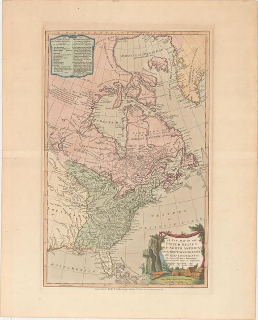
Auction 156, Lot 119
Subject: United States & Canada
Dunn, Samuel
A New Map of the United States of North America with the British Dominions on that Continent &c., 1786
Size: 12 x 18.5 inches (30.5 x 47 cm)
Estimate: $800 - $1,000
Unsold
Closed on 2/17/2016
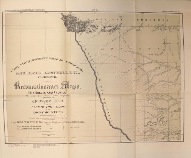
Auction 156, Lot 120
Subject: Canada & United States, Boundary Surveys
Twining, William J. (Capt.)
Reports upon the Survey of the Boundary Between the Territory of the United States and the Possessions of Great Britain from the Lake of the Woods to the Summit of the Rocky Mountains..., 1878
Size: 9.8 x 12.1 inches (24.9 x 30.7 cm)
Estimate: $400 - $500
Sold for: $200
Closed on 2/17/2016
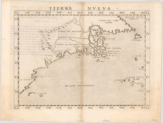
Auction 156, Lot 121
Subject: Eastern United States & Canada
Ruscelli, Girolamo
Tierra Nueva, 1562
Size: 9.6 x 7.1 inches (24.4 x 18 cm)
Estimate: $1,200 - $1,500
First State of Ruscelli's Map of the East Coast
Unsold
Closed on 2/17/2016
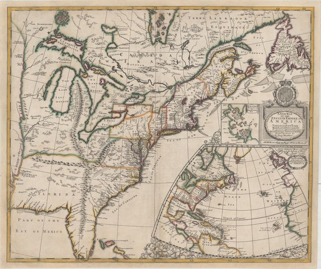
Auction 156, Lot 122
Subject: Colonial Eastern United States & Canada
Morden, Robert
A New Map of the English Empire in America viz Virginia Maryland Carolina Pennsylvania New York New Iarsey New England Newfoundland New France &c., 1695
Size: 23.4 x 19.8 inches (59.4 x 50.3 cm)
Estimate: $14,000 - $16,000
First State of Morden's Rare Map of the American Colonies
Unsold
Closed on 2/17/2016
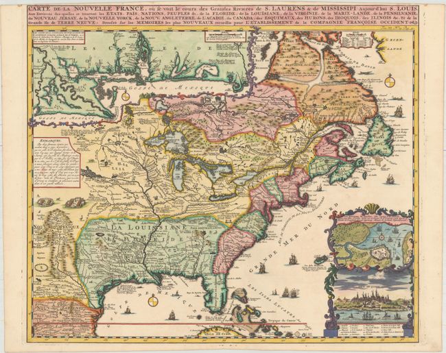
Auction 156, Lot 123
Subject: Colonial Eastern United States & Canada
Chatelain, Henry Abraham
Carte de la Nouvelle France, ou se voit le Cours des Grandes Rivieres de S. Laurens & de Mississipi Aujour d'hui S. Louis, aux Environs des-quelles se Trouvent les Etats, Pais, Nations, Peuples &c..., 1719
Size: 19.1 x 16.6 inches (48.5 x 42.2 cm)
Estimate: $2,200 - $2,500
One of the Most Informative 18th Century Maps of the French Possessions in North America
Sold for: $2,500
Closed on 2/17/2016
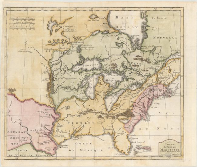
Auction 156, Lot 124
Subject: Colonial Eastern United States & Canada, Great Lakes
Bernard, Jean Frederic
Le Cours du Fleuve Missisipi Selon les Relations les Plus Modernes, 1737
Size: 17.3 x 14.7 inches (43.9 x 37.3 cm)
Estimate: $1,600 - $1,900
Scarce and Desirable Early Hennepin Variant
Sold for: $1,400
Closed on 2/17/2016
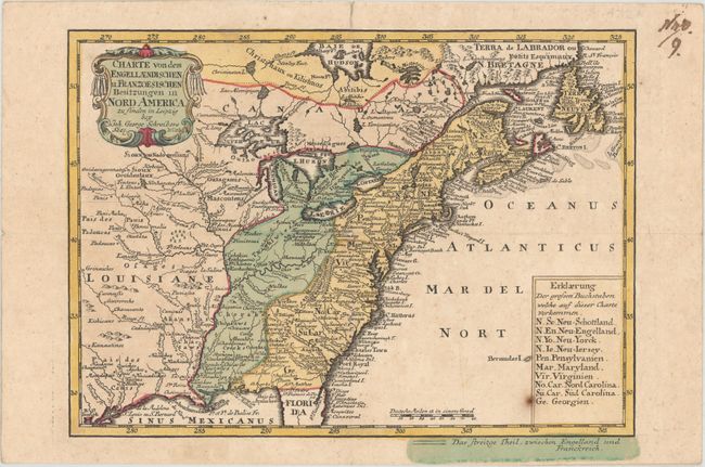
Auction 156, Lot 125
Subject: Colonial Eastern United States & Canada
Schreiber, Johann Georg
Charte von dem Engellaendischen u. Franzoesischen Besitzungen in Nord America, 1753
Size: 9.6 x 6.9 inches (24.4 x 17.5 cm)
Estimate: $400 - $500
Sold for: $200
Closed on 2/17/2016
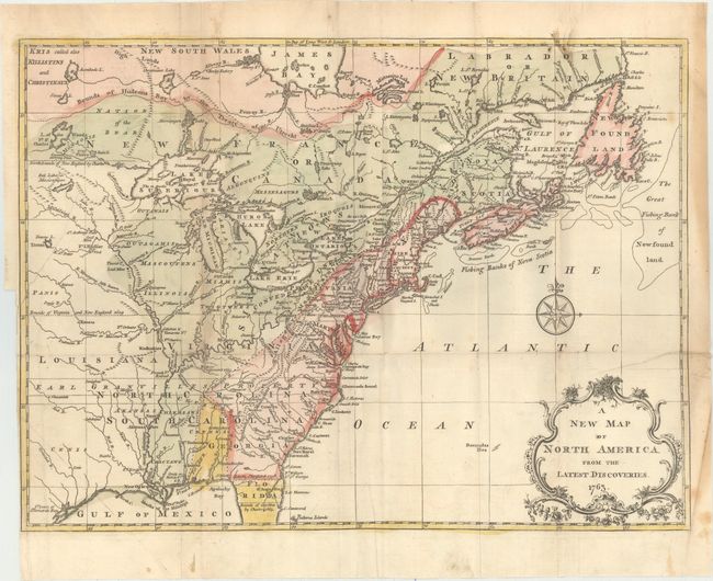
Auction 156, Lot 126
Subject: Colonial Eastern United States & Canada
Spilsbury, J.
A New Map of North America from the Latest Discoveries, 1763
Size: 14.9 x 10.9 inches (37.8 x 27.7 cm)
Estimate: $200 - $250
Sold for: $190
Closed on 2/17/2016
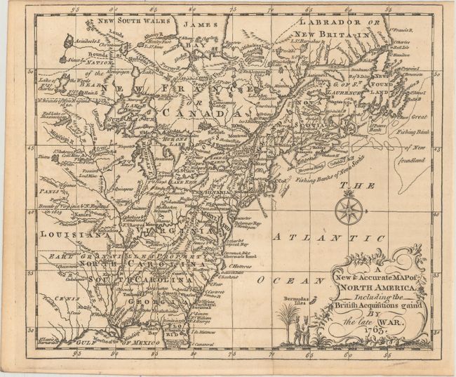
Auction 156, Lot 127
Subject: Colonial Eastern United States & Canada
Entick, John
A New & Accurate Map of North America, Including the British Acquisitions Gain'd by the Late War, 1763
Size: 9 x 7.6 inches (22.9 x 19.3 cm)
Estimate: $350 - $425
Sold for: $150
Closed on 2/17/2016
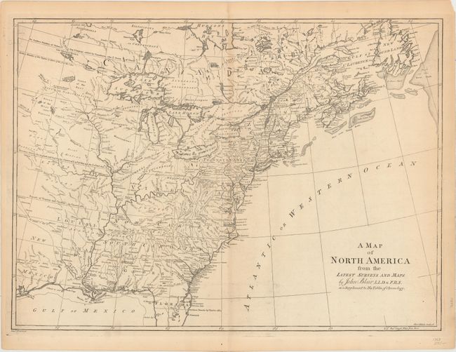
Auction 156, Lot 128
Subject: Colonial Eastern United States & Canada
Blair, Rev. John
A Map of North America from the Latest Surveys and Maps, 1768
Size: 22.8 x 16.7 inches (57.9 x 42.4 cm)
Estimate: $700 - $850
Sold for: $350
Closed on 2/17/2016
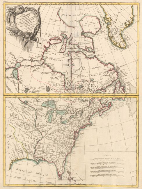
Auction 156, Lot 129
Subject: Colonial Eastern United States & Canada
Bonne/Lattre
[On 2 Sheets] Partie de l'Amerique Septentrionale, qui Comprend le Canada, la Louisiane, le Labrador, le Groenland, la Nouvelle Angleterre, la Floride &c. Projettee et Assujettie aux Observations, 1773
Size: 17.1 x 11.8 inches (43.4 x 30 cm)
Estimate: $550 - $700
Sold for: $400
Closed on 2/17/2016
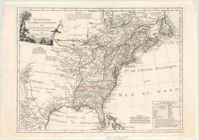
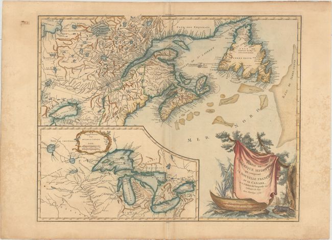
Auction 156, Lot 130
Subject: Eastern United States & Canada
Delamarche, Charles Francois
Etats-Unis de l'Amerique Septentrionale avec les Isles Royale, de Terre Neuve, de St. Jean, l'Acadie &c., 1785
Size: 24.6 x 18.7 inches (62.5 x 47.5 cm)
Estimate: $1,100 - $1,300
First Reference to Michigan as a Land Division of the United States
Sold for: $800
Closed on 2/17/2016
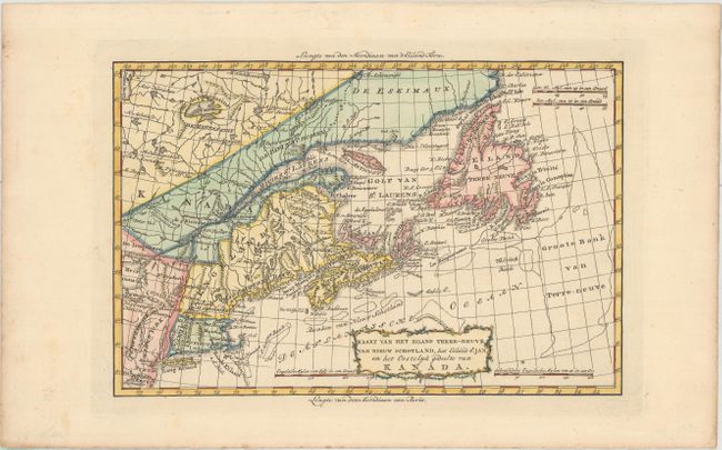
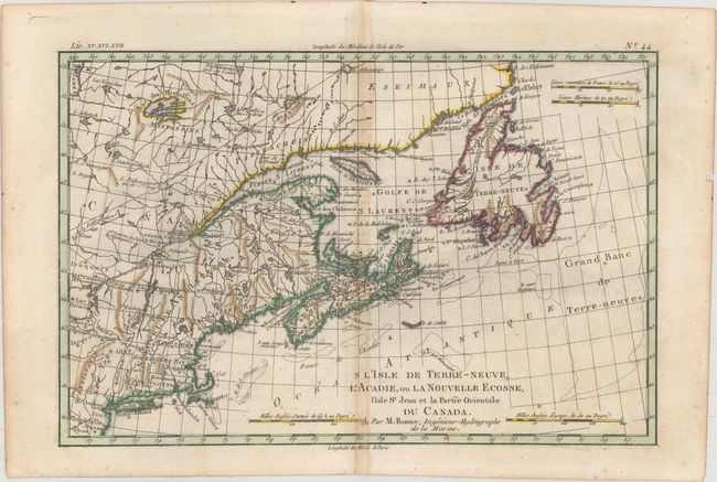
Auction 156, Lot 131
Subject: Eastern United States & Canada
Bachiene, Willem Albert
Kaart van het Eiland Terre-Neuve, van Nieuw Schotland, het Eiland St. Jan en het Oostelyk Gedeelte van Kanada, 1785
Size: 12.5 x 8.3 inches (31.8 x 21.1 cm)
Estimate: $300 - $375
Unsold
Closed on 2/17/2016
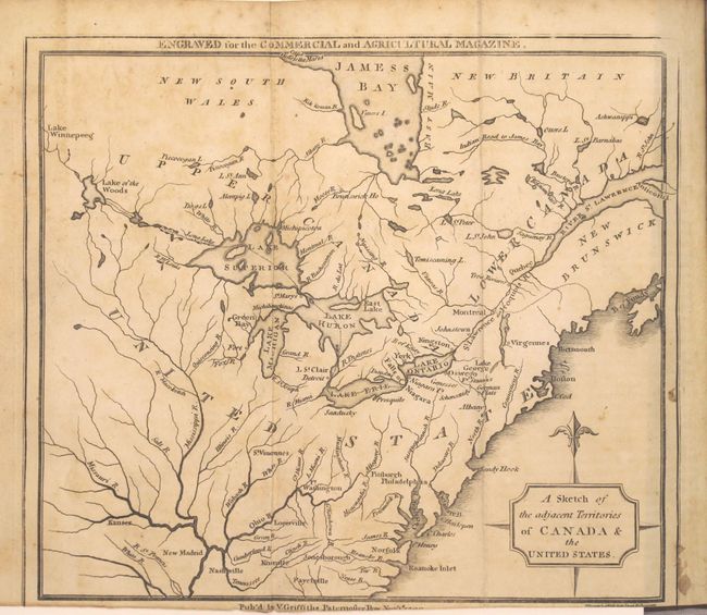
Auction 156, Lot 132
Subject: Eastern United States & Canada, Great Lakes
A Sketch of the Adjacent Territories of Canada & the United States [in] The Commercial and Agricultural Magazine..., 1799
Size: 5.1 x 8.4 inches (13 x 21.3 cm)
Estimate: $200 - $250
Sold for: $150
Closed on 2/17/2016
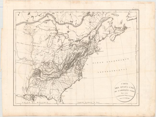
Auction 156, Lot 133
Subject: Eastern United States & Canada
Volney, C. F.
Carte des Etats-Unis de l'Amerique-Nord pour Servir au Tableau du Climat et du Sol , 1803
Size: 21.4 x 16.5 inches (54.4 x 41.9 cm)
Estimate: $240 - $300
Sold for: $140
Closed on 2/17/2016
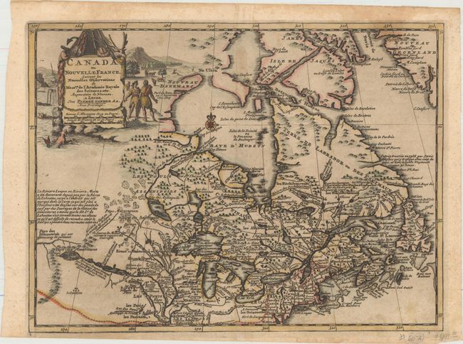
Auction 156, Lot 134
Subject: Colonial Northeastern United States & Canada
Aa, Pieter van der
Canada ou Nouvelle France, Suivant les Nouvelles Observations de Messrs. de l'Academie Royale des Sciences, etc. Augmentees de Nouveau, 1714
Size: 11.8 x 8.8 inches (30 x 22.4 cm)
Estimate: $400 - $475
Sold for: $350
Closed on 2/17/2016
Auction 156, Lot 135
Subject: Colonial Northeastern United States & Canada, Great Lakes
Robert de Vaugondy, Didier
Partie de l'Amerique Septent? qui Comprend la Nouvelle France ou le Canada, 1755
Size: 23.9 x 18.8 inches (60.7 x 47.8 cm)
Estimate: $600 - $750
Unsold
Closed on 2/17/2016
Auction 156, Lot 136
Subject: Colonial Northeastern United States & Canada
[Lot of 2] L'Isle de Terre-Neuve, l'Acadie, ou la Nouvelle Ecosse, l'Isle St Jean et la Partie Orientale du Canada [and] British North America Sheet 1, East. Newfoundland, New Brunswick, Nova Scotia, Prince Edward Island &c., 1775-1872
Size: See Description
Estimate: $200 - $230
NO RESERVE
Unsold
Closed on 2/17/2016
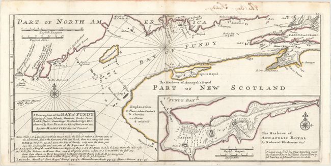
Auction 156, Lot 137
Subject: Bay of Fundy
Moll, Herman
A Description of the Bay of Fundy Shewing ye Coast, Islands, Harbours, Creeks, Coves, Rocks, Sholes, Soundings & Anchorings &c. Observed by Nat. Blackmore in ye Years 1711 and 1712, 1745
Size: 17.1 x 8.2 inches (43.4 x 20.8 cm)
Estimate: $250 - $325
Sold for: $220
Closed on 2/17/2016
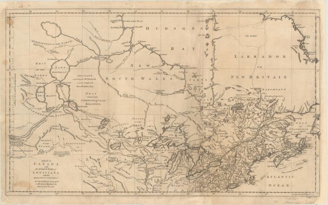
Auction 156, Lot 138
Subject: Colonial Northern United States & Canada, Great Lakes
Jefferys, Thomas
A Map of Canada and the North Part of Louisiana with the Adjacent Countrys, 1761
Size: 21.1 x 12.4 inches (53.6 x 31.5 cm)
Estimate: $1,000 - $1,300
Unsold
Closed on 2/17/2016
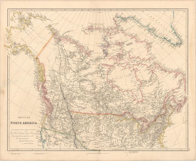
Auction 156, Lot 139
Subject: Canada, Northern United States & Alaska
Arrowsmith, John
British North America, 1834
Size: 24.5 x 19.6 inches (62.2 x 49.8 cm)
Estimate: $200 - $230
Sold for: $160
Closed on 2/17/2016
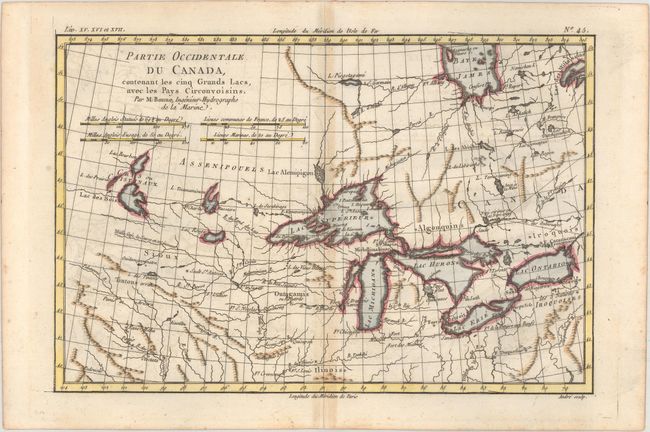
Auction 156, Lot 140
Subject: Great Lakes
Bonne, Rigobert
Partie Occidentale du Canada, Contenant les Cinq Grands Lacs, avec les Pays Circonvoisins, 1775
Size: 12.6 x 8.4 inches (32 x 21.3 cm)
Estimate: $240 - $300
Sold for: $180
Closed on 2/17/2016
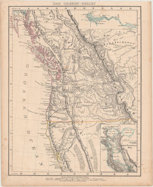
Auction 156, Lot 141
Subject: Western United States & Canada
Flemming, Carl
Das Oregon-Gebiet, 1848
Size: 12.6 x 16.4 inches (32 x 41.7 cm)
Estimate: $200 - $250
Sold for: $150
Closed on 2/17/2016
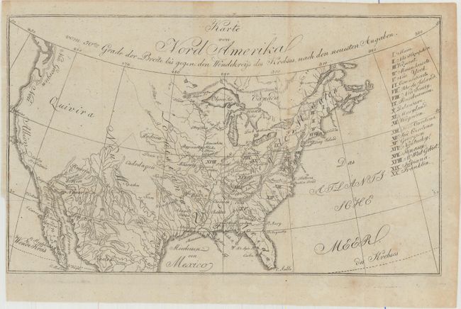
Auction 156, Lot 142
Subject: United States
Zimmerman, Eberhard A.W.
Karte von Nord Amerika von 50sten Grade der Breite bis Gegen den Wendekreiss des Krebses, den Neuesten Angaben, 1805
Size: 10.6 x 6.3 inches (26.9 x 16 cm)
Estimate: $200 - $250
State of Franklin
Sold for: $140
Closed on 2/17/2016
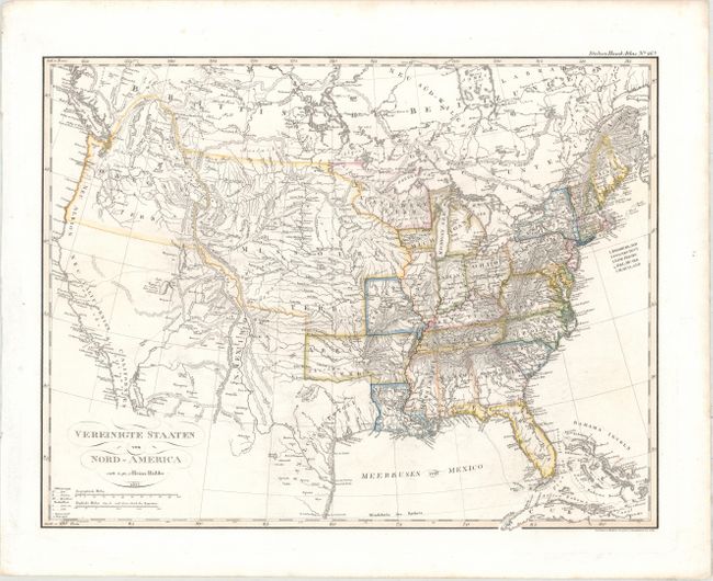
Auction 156, Lot 143
Subject: United States
Huebbe, Heinrich
Vereinigte Staaten von Nord-America, 1825
Size: 15.3 x 11.8 inches (38.9 x 30 cm)
Estimate: $180 - $220
Sold for: $130
Closed on 2/17/2016
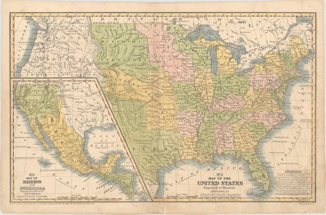
Auction 156, Lot 144
Subject: United States, Texas, Mexico
Mitchell, Samuel Augustus
No. 5 Map of the United States Engraved to Illustrate Mitchell's School and Family Geography, 1839
Size: 16.6 x 10.4 inches (42.2 x 26.4 cm)
Estimate: $160 - $200
Sold for: $140
Closed on 2/17/2016
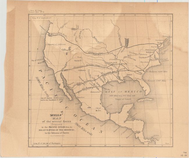
Auction 156, Lot 145
Subject: United States
U.S. Government
Mills' Map of the Several Routes Proposed to the Pacific Ocean from the Head Waters of the Missouri, to the Isthmus of Darien, 1848
Size: 9 x 8.3 inches (22.9 x 21.1 cm)
Estimate: $100 - $130
Sold for: $30
Closed on 2/17/2016
Auction 156, Lot 146
Subject: United States
[Lot of 2] United States North America [and] Stati Uniti dell' America Settentrionale, 1852-58
Size: See Description
Estimate: $230 - $275
Sold for: $130
Closed on 2/17/2016
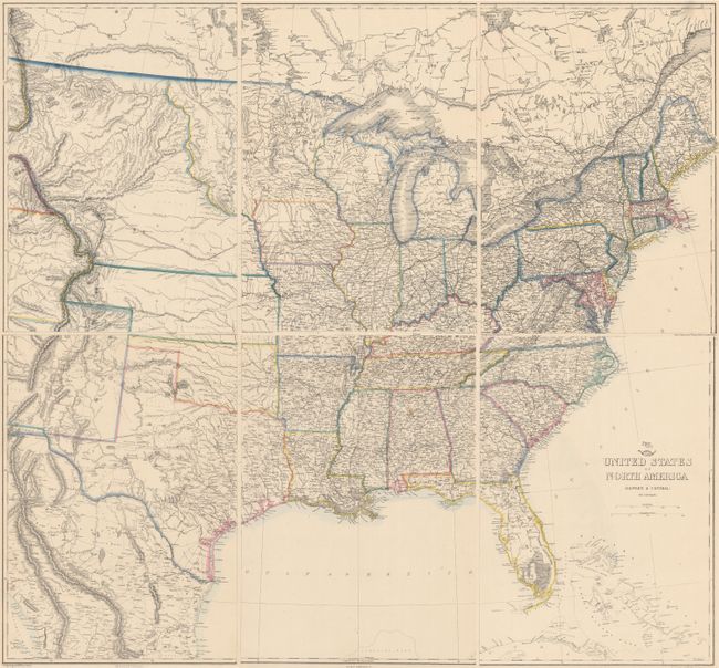
Auction 156, Lot 147
Subject: United States
Ettling, Theodor
[On 6 Sheets] United States of North America (Eastern & Central), 1860
Size: 12 x 16.8 inches (30.5 x 42.7 cm)
Estimate: $350 - $425
Sold for: $150
Closed on 2/17/2016
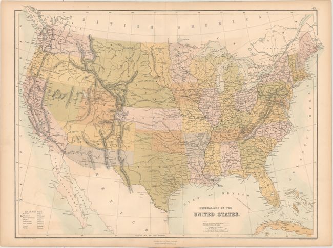
Auction 156, Lot 148
Subject: United States
Black, Adam & Charles
General Map of the United States, 1861
Size: 22.1 x 16.6 inches (56.1 x 42.2 cm)
Estimate: $120 - $150
Sold for: $90
Closed on 2/17/2016
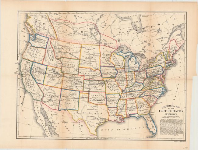
Auction 156, Lot 149
Subject: United States
U.S. Government
Statistical Map of the United States of America, 1864
Size: 19.9 x 14.8 inches (50.5 x 37.6 cm)
Estimate: $80 - $120
Sold for: $60
Closed on 2/17/2016
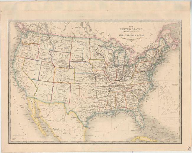
Auction 156, Lot 150
Subject: United States
Wyld, James
The United States & the Relative Position of the Oregon & Texas, 1864
Size: 21.1 x 15 inches (53.6 x 38.1 cm)
Estimate: $400 - $500
Sold for: $200
Closed on 2/17/2016
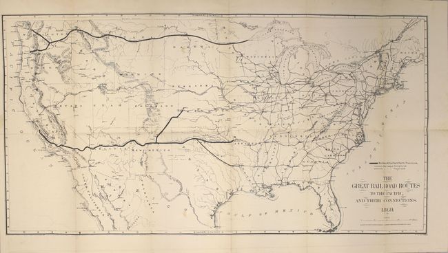
Auction 156, Lot 151
Subject: United States
Gorlinski, Joseph
The Great Railroad Routes to the Pacific, and Their Connections [bound in report], 1869
Size: 27.5 x 14 inches (69.9 x 35.6 cm)
Estimate: $275 - $350
Sold for: $200
Closed on 2/17/2016
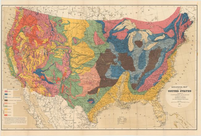
Auction 156, Lot 152
Subject: United States
Hitchcock, Charles Henry
Geological Map of the United States Compiled by C.H. Hitchcock and W. P. Blake…, 1873
Size: 33.5 x 21.5 inches (85.1 x 54.6 cm)
Estimate: $400 - $500
Sold for: $600
Closed on 2/17/2016
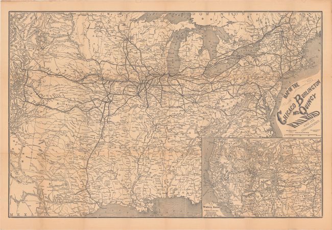
Auction 156, Lot 153
Subject: United States, Railroads
Rand McNally & Co.
Map of the Chicago Burlington and Quincy Railroad and Its Connections, 1878
Size: 30 x 20 inches (76.2 x 50.8 cm)
Estimate: $170 - $200
Sold for: $90
Closed on 2/17/2016
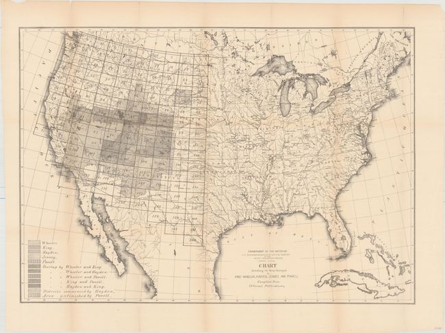
Auction 156, Lot 154
Subject: United States
U.S. Department of Interior
Chart Exhibiting the Areas Surveyed by King, Wheeler, Hayden, Jenney, and Powell Compiled from Official Publications, 1878
Size: 28.3 x 19.8 inches (71.9 x 50.3 cm)
Estimate: $160 - $200
Sold for: $80
Closed on 2/17/2016
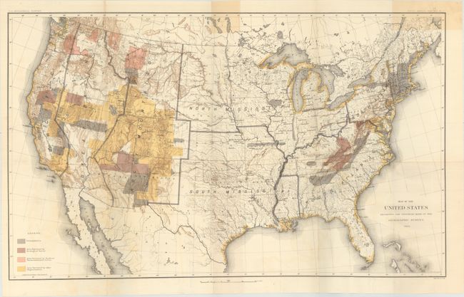
Auction 156, Lot 155
Subject: United States
U.S. Geological Survey (USGS)
[Lot of 4] Map of the United States Exhibiting the Progress Made in the Geographic Survey [and] ... Progress of Geologic Mapping [and] ... Condition and Progress of Topographic Surveys... [and] ... Condition and Progress of Astronomic Location..., 1884-97
Size: 28.3 x 17.3 inches (71.9 x 43.9 cm)
Estimate: $160 - $200
Sold for: $80
Closed on 2/17/2016
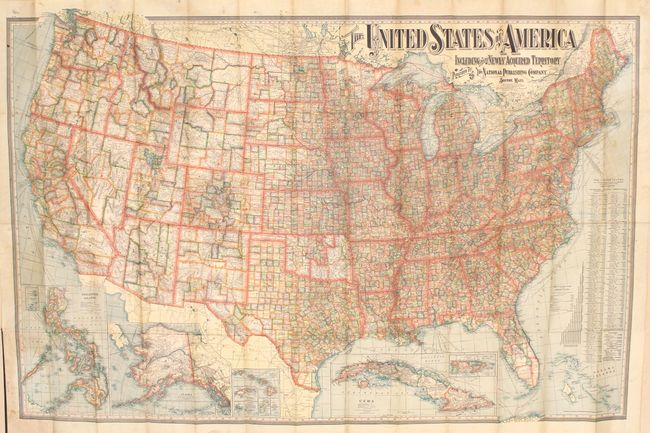
Auction 156, Lot 156
Subject: United States
National Publishing Co.
The United States of America Including All Its Newly Acquired Territory, 1902
Size: 56.3 x 37.3 inches (143 x 94.7 cm)
Estimate: $150 - $200
Sold for: $100
Closed on 2/17/2016
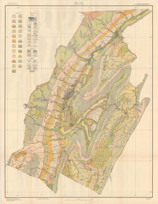
Auction 156, Lot 157
Subject: United States
U.S. Government
[Lot of 63] House Documents Vol. 90 - No. 1362 Field Operations of the Bureau of Soils 17th Report, 1915 Maps - 64th Congress 1st Session , 1915-16
Size: 7.1 x 9.6 inches (18 x 24.4 cm)
Estimate: $500 - $750
Includes Several Maps of Southern California
Sold for: $350
Closed on 2/17/2016
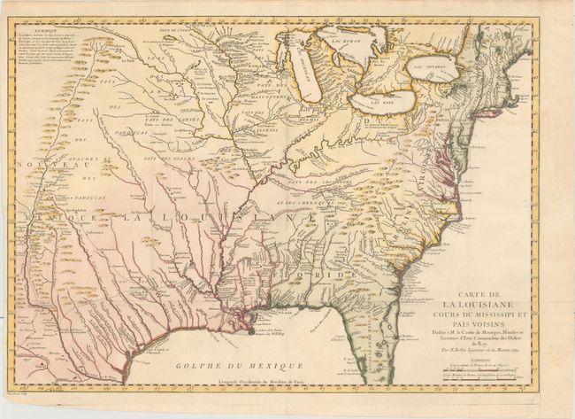
Auction 156, Lot 158
Subject: Colonial Eastern United States
Bellin, Jacques Nicolas
Carte de la Louisiane Cours du Mississipi et Pais Voisins..., 1744
Size: 21.9 x 15.6 inches (55.6 x 39.6 cm)
Estimate: $1,000 - $1,300
Sold for: $750
Closed on 2/17/2016
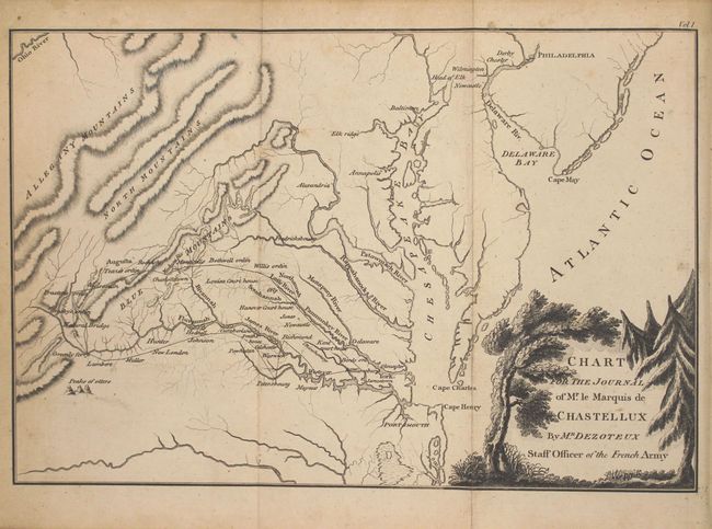
Auction 156, Lot 159
Subject: Colonial Eastern United States, Revolutionary War
Chastellux, Francois Jean, Marquis de
[2 Volumes] Travels in North-America, in the Years 1780, 1781, and 1782..., 1777
Size: 5.3 x 8.5 inches (13.5 x 21.6 cm)
Estimate: $700 - $850
Sold for: $500
Closed on 2/17/2016
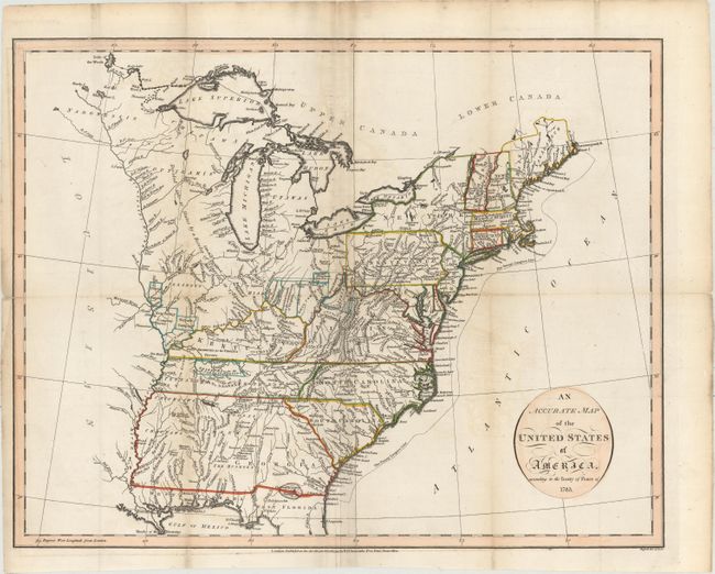
Auction 156, Lot 160
Subject: Eastern United States
Russell, John C.
An Accurate Map of the United States of America, According to the Treaty of Peace of 1783, 1794
Size: 18.4 x 14.5 inches (46.7 x 36.8 cm)
Estimate: $600 - $700
Sold for: $450
Closed on 2/17/2016
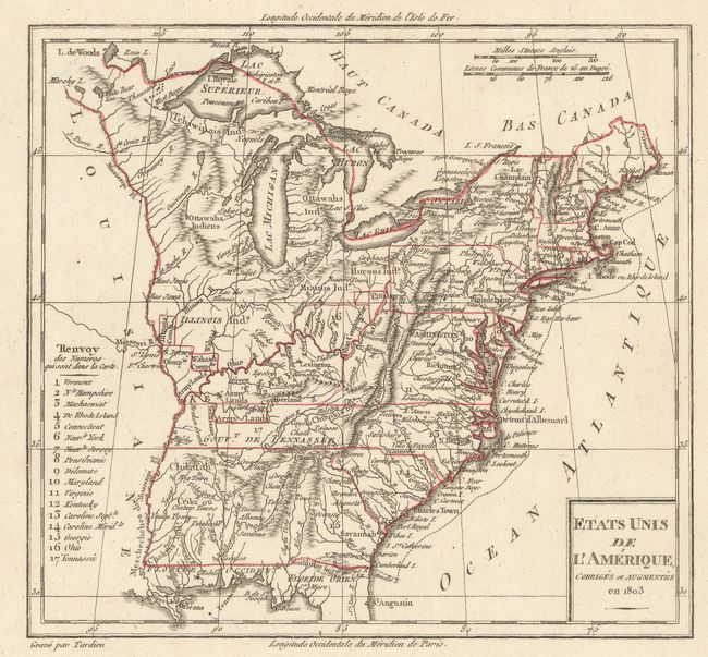
Auction 156, Lot 161
Subject: Eastern United States
[Lot of 3] Etats Unis de l'Amerique, Corriges et Augmentes en 1803 [and] Etats Unis [and] Stati Uniti di Arrowsmith, 1803-15
Size: See Description
Estimate: $300 - $375
Sold for: $200
Closed on 2/17/2016
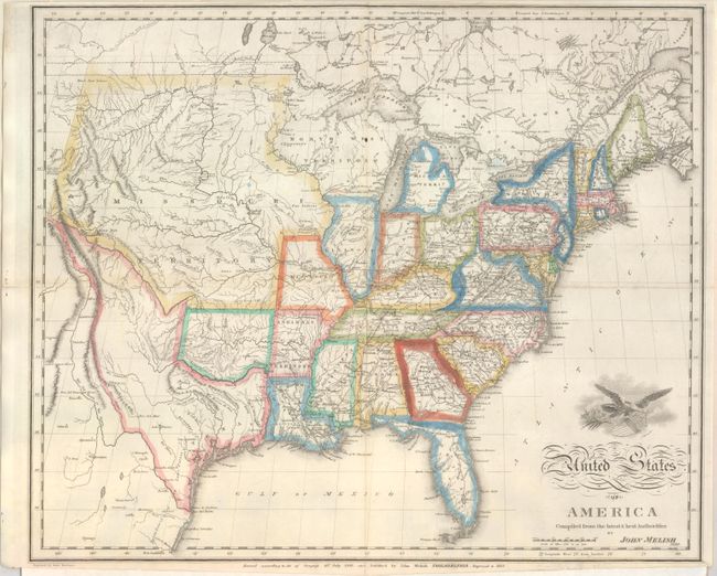
Auction 156, Lot 162
Subject: Eastern United States
Melish, John
United States of America Compiled from the Latest & Best Authorities, 1822
Size: 19.3 x 15.9 inches (49 x 40.4 cm)
Estimate: $650 - $800
Sold for: $425
Closed on 2/17/2016
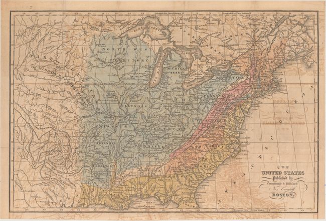
Auction 156, Lot 163
Subject: Eastern United States
Cummings & Hilliard
The United States, 1822
Size: 16.5 x 11 inches (41.9 x 27.9 cm)
Estimate: $400 - $500
Sold for: $250
Closed on 2/17/2016
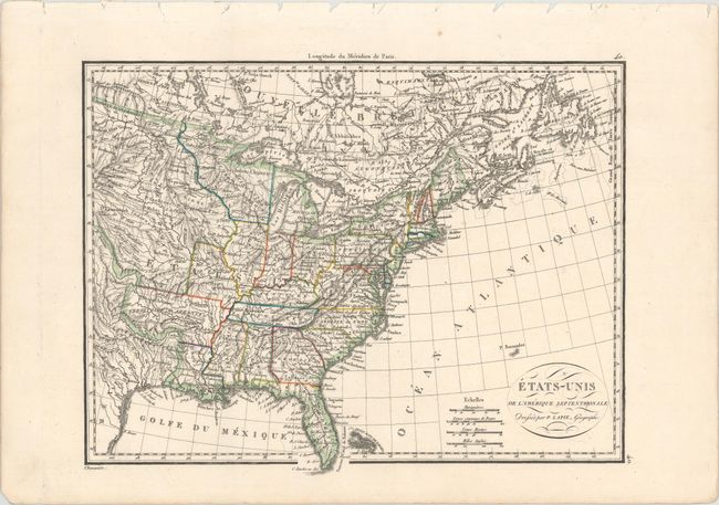
Auction 156, Lot 164
Subject: Eastern United States
Tanner, Henry Schenck
A Map of the United States, of America, 1828
Size: 12.8 x 15.1 inches (32.5 x 38.4 cm)
Estimate: $300 - $375
Sold for: $180
Closed on 2/17/2016
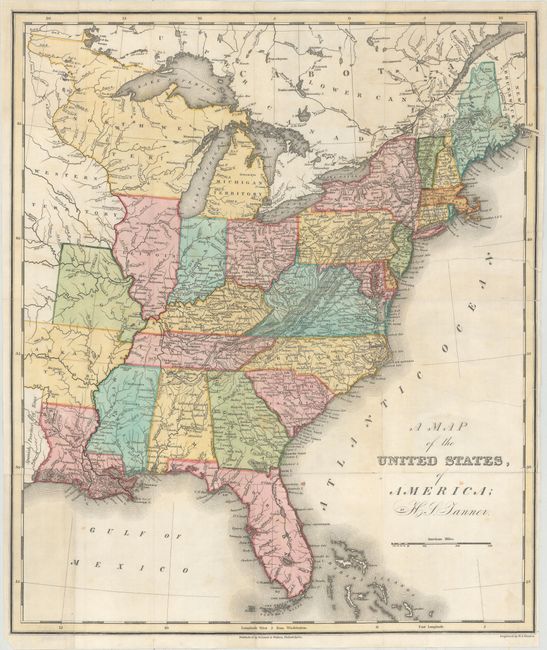
Auction 156, Lot 165
Subject: Eastern United States
Lapie, Alexander Emile & Pierre
Etats-Unis de l'Amerique Septentrionale, 1830
Size: 11.8 x 9.2 inches (30 x 23.4 cm)
Estimate: $130 - $160
Sold for: $70
Closed on 2/17/2016
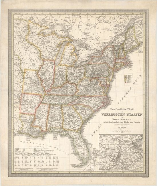
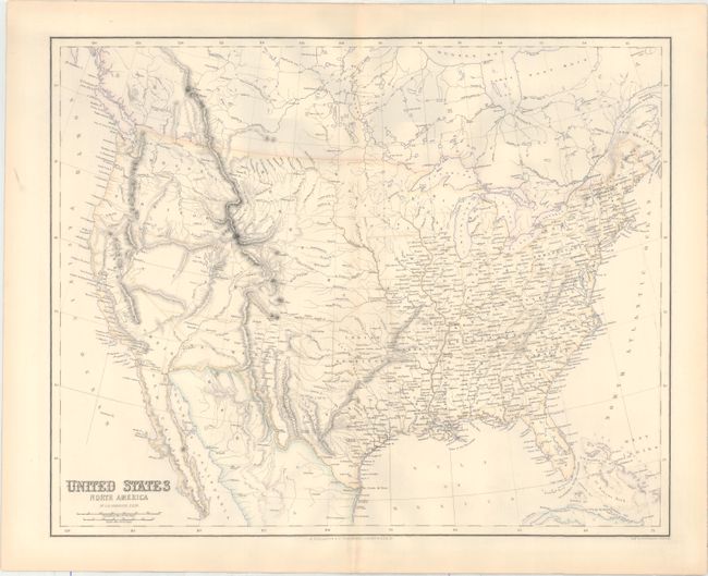
Auction 156, Lot 166
Subject: Eastern United States
Weiland, Carl Ferdinand
Der Oestliche Theil der Vereinigten Staaten von Nord America Nebst dem Bewohntesten Theile von Canada, 1835
Size: 20.5 x 24.4 inches (52.1 x 62 cm)
Estimate: $350 - $450
Unsold
Closed on 2/17/2016
Auction 156, Lot 167
Subject: Eastern United States
General Land Office
[9 Maps in Report - Public Surveys], 1841
Size: See Description
Estimate: $140 - $170
Unsold
Closed on 2/17/2016
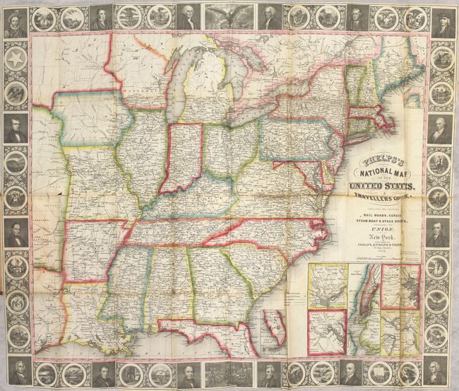
Auction 156, Lot 168
Subject: Eastern United States
Phelps, Ensigns & Thayer
Phelps's National Map of the United States, a Travellers Guide. Embracing the Principal Rail Roads, Canals, Steam Boat & Stage Routes, Throughout the Union, 1847
Size: 25.5 x 21.3 inches (64.8 x 54.1 cm)
Estimate: $700 - $900
Sold for: $500
Closed on 2/17/2016
222 lots
Page 1 of 5