Subject: Canada, Northern United States & Alaska
Period: 1834 (dated)
Publication:
Color: Hand Color
Size:
24.5 x 19.6 inches
62.2 x 49.8 cm
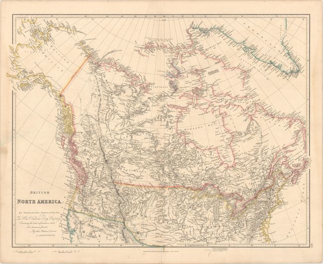
The United States and Great Britain established in 1818 joint claim over the Oregon Territory - the region north of Spanish controlled Upper California up to the southern boundary of Russia's Alaska Territory at North latitude 54°40'. By the late 1830's this arrangement was beginning to fall apart.
In the 1840's the expansionist Democrats, including their 1844 presidential candidate, James Polk, claimed the entire region for the United States. Their expansionist desires were expressed by Polk's famous campaign slogan, "Fifty-four Forty or Fight!" The slogan also became a rally cry for Americans desiring to settle the territory. Following Polk's election, the dispute was resolved by the 1846 Treaty of Oregon, which struck a compromise that fixed the U.S./Canadian boundary at 49º North.
This detailed map depicts Canada, Alaska, and the United States as far south as Arkansas River and the Outer Banks in North Carolina. California and the Southwest are still under Spanish control, an the western boundary between Canada and the United States is still under contention. Alaska is labeled Russian America. The map is filled with the river systems, mountain ranges and cities scattered throughout.
References:
Condition: B+
Original outline color with minor offsetting and a centerfold separation that enters less than 1" into map at bottom.