Subject: United States
Period: 1915-16 (published)
Publication:
Color: Printed Color
Size:
7.1 x 9.6 inches
18 x 24.4 cm
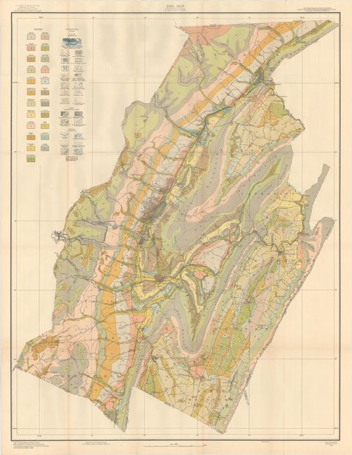
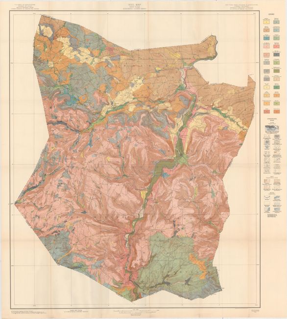
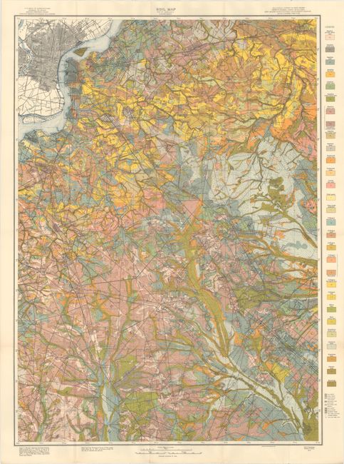
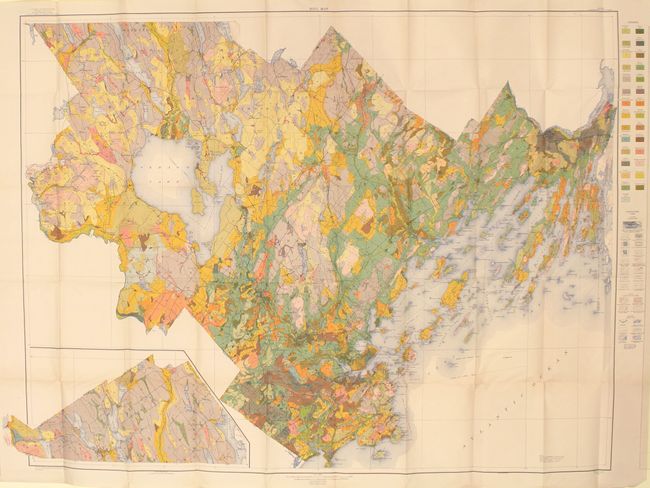
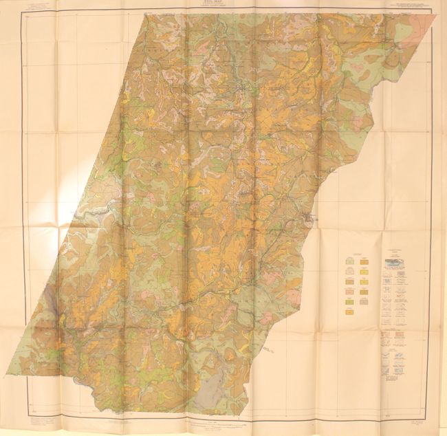
Housed in an attractive brown cloth case, this set contains soil maps from the seventeenth annual report of the Field Operations of the Bureau of Soils, under the direction of Milton Whitney. Each of the maps has a legend identifying the various soil profiles which are overlayed on base maps provided by the Geological Survey. In addition to the soil types, the maps depict roads, railroads, cities and towns, county boundaries and topography via contour lines. The maps highlight the soil survey work being done across the entire country including:
Cumberland County sheet, Maine
Schoharle County sheet, New York
Camden sheet, New Jersey
Blair County sheet, Pennsylvania
Cambria County sheet, Pennsylvania
New Castle County sheet, Delaware
Alleghany County sheet, North Carolina
Anson County sheet, North Carolina
Columbus County sheet, North Carolina
Davidson County sheet, North Carolina
Wayne County sheet, North Carolina
Dorchester County sheet, South Carolina
Hampton County sheet, South Carolina
Laurens County sheet, Georgia
Turner County sheet, Georgia
Washington County sheet, Georgia
Wilkes County sheet, Georgia
Fort Lauderdale sheet, Florida
Franklin County sheet, Florida
Clay Count sheet, Alabama
Walker County sheet, Alabama
Washington County sheet, Alabama
Chickasaw County sheet, Mississippi
Coahoma County sheet, Mississippi
Grenada County seat (typo?), Mississippi
Jefferson Davis County sheet, Mississippi
Lafayette Parish sheet, Louisiana
Smith County sheet, Texas
Taylor County sheet, Texas
Jefferson County sheet, Arkansas
Yell County sheet, Arkansas
Lewis and Gilmer Counties sheet, West Virginia
Jessamine County sheet, Kentucky
Geauga County sheet, Ohio
Hamilton County sheet, Ohio
Grant County sheet, Indiana
Starke County sheet, Indiana
Wells County sheet, Indiana
White County sheet, Indiana
Portage County sheet, Wisconsin
Wood County sheet, Wisconsin
South Part of North-Central Wisconsin Sheet
Clinton County sheet, Iowa
Scott County sheet, Iowa
Sioux County sheet, Iowa
Van Buren County sheet, Iowa
Buchanan County sheet, Missouri
Newton County sheet, Missouri
Ripley County sheet, Missouri
Cowley County sheet, Kansas
Dawes County sheet, Nebraska
Polk County sheet, Nebraska
Richardson County sheet, Nebraska
Washington County sheet, Nebraska
Kay County sheet, Nebraska
Bottineau County sheet, North Dakota
Latah County sheet, Idaho
Healdsburg sheet, California
Honey Lake sheet, California
Pasadena sheet, California
Riverside sheet, California
San Fernando Valley sheet, California
Reconnaissance Survey, Lower San Joaquin Valley sheet, California
References:
Condition: A
While not all maps were individually inspected, they appear to be in very good to fine condition. Case has light soiling. The first map is marked "Surplus - Library of Congress Duplicate."