Catalog Archive
Auction 156, Lot 129

"[On 2 Sheets] Partie de l'Amerique Septentrionale, qui Comprend le Canada, la Louisiane, le Labrador, le Groenland, la Nouvelle Angleterre, la Floride &c. Projettee et Assujettie aux Observations", Bonne/Lattre

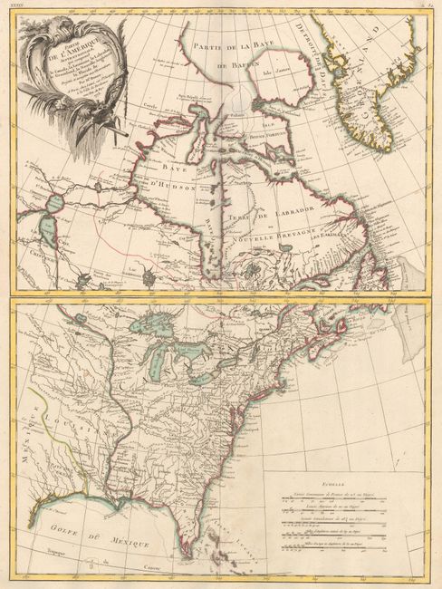
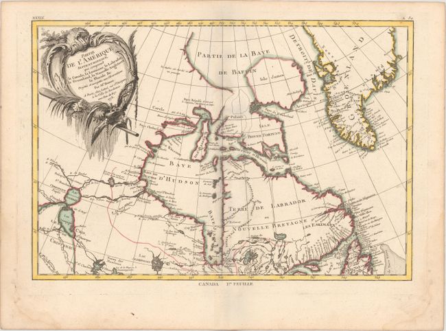
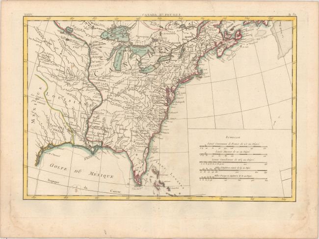
Subject: Colonial Eastern United States & Canada

Period: 1773 (dated)

Publication: Atlas Moderne

Color: Hand Color

Size:
17.1 x 11.8 inches
43.4 x 30 cm
Download High Resolution Image
(or just click on image to launch the Zoom viewer)

Finely engraved pair of Revolutionary War maps covering the Eastern parts of North America. This map was first issued in 1771; here it is bears the date of 1773, the second state according to McCorkle. The first sheet contains the decorative title cartouche, and it covers eastern Canada and Greenland from the bottom of Hudson Bay, northward beyond the Arctic Circle to about 70 deg. N. Latitude. It includes an interesting depiction of a passage between Lake Winnipeg and Hudson Bay alluding to a possible passage to the Pacific. The second map covers French Louisiane and the British Colonies with their western boundary on the Mississippi River. Nice detail, particularly of the French forts and Indian villages.

References: cf. Kershaw #473; McCorkle #771.2.

Condition: A

A nice impression on watermarked paper with minor soiling and faint damp stains in bottom corners of sheets, away from image.

Estimate: $550 - $700

Sold for: $400

Closed on 2/17/2016

Archived