Subject: Colonial Northeastern United States & Canada
Period: 1775-1872 (circa)
Publication:
Color:
An interesting look at a century of cartography of the region.
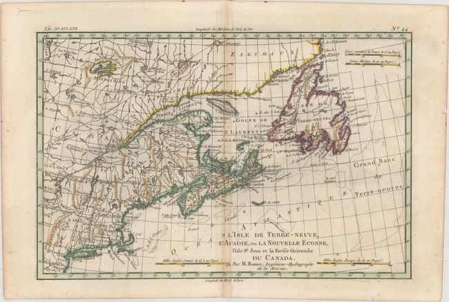
A. L'Isle de Terre-Neuve, l'Acadie, ou la Nouvelle Ecosse, l'Isle St Jean et la Partie Orientale du Canada, by Rigobert Bonne, from Atlas de Toutes les Parties Connues du Globe Terrestre, circa 1775, hand color (12.6 x 8.4"). This small map covers the Maritimes and extends as far west as Lake Ontario, as well as to New England and the Atlantic coast to Philadelphia. The map is detailed to show the provinces, towns, forts, harbors, Indian tribes, and the fishing banks in the North Atlantic. This is the first state. References: Kershaw #720; McCorkle #782.3; Sellers and van Ee #172. Condition: A dark impression with light offsetting and toning along the centerfold.
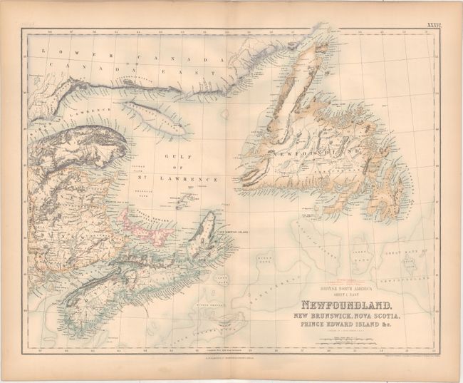
B. British North America Sheet 1, East. Newfoundland, New Brunswick, Nova Scotia, Prince Edward Island &c., by Archibald Fullerton & Co., from The Royal Illustrated Atlas, Of Modern Geography, circa 1872, printed color (20.7 x 16.4). This map of Newfoundland, New Brunswick and Nova Scotia shows topography by hachure and gives great detail of place names and political boundaries. The fishing banks off the coasts are also well delineated. The railways extending through New Brunswick and Nova Scotia are identified with a numbered key above the title. Compiled by J. Hugh Johnson. Condition: Light toning along the edges of the sheet, which is somewhat cockled.
References:
Condition: B+
See description above.