Subject: United States
Period: 1864 (circa)
Publication:
Color: Hand Color
Size:
21.1 x 15 inches
53.6 x 38.1 cm
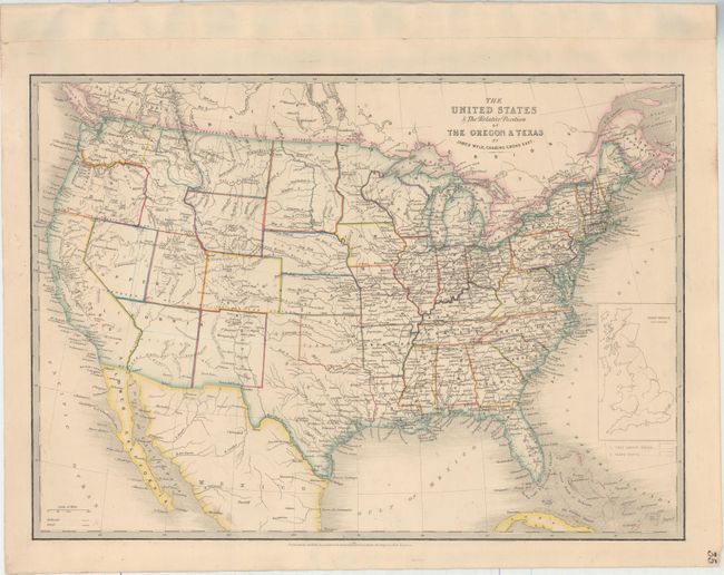
This is an updated version of this interesting map, first published in 1845 when the Oregon District was in dispute between the U.S. and Britain, and Texas had just been annexed. The map shows several previous and proposed western boundaries; Line Proposed by the Convention of the 20th October 1818 (the present boundary between the U.S. and Canada), Line of the Treaty of Florida 1819, Line Proposed to Mexico by the United Sates in 1835, and Boundary of 1848 (pre-Gadsden boundary between U.S. and Mexico). Many of the boundaries in the west have been settled, and the new territories of Idaho (1863) and Montana (1864) have been established. While Wyoming appears to be delineated, it is not named (became a territory in 1868). The Oregon Route is shown crossing the plains and the only other transcontinental road shown is unnamed and apparently follows the route of the Stevens exploration for the Pacific Railroad. An inset of Great Britain on the same scale is in the Atlantic.
References:
Condition: B+
A nice impression with a few faint spots of foxing.