Showing Featured Lots(remove filter)
Showing results for:Auction 186
Catalog Archive
72 lots
Page 1 of 2
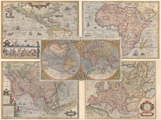
Auction 186, Lot 1
Subject: World & Continents
Mercator/Hondius
[Lot of 5] Orbis Terrae Compendiosa Descriptio... [and] America [and] Nova Africae Tabula [and] Asiae Nova Descriptio [and] Europa..., 1619
Size: See Description
Estimate: $10,000 - $13,000
Matching Set of World and Continents
Sold for: $7,500
Closed on 2/9/2022
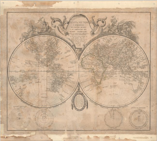
Auction 186, Lot 3
Subject: World, Americas & Africa
Lopez, D. Tomas
[Lot of 3] Mapa Mundi o Descripcion de Todo el Mundo y en Particular del Globo Terrestre... [and] Mapa de America Sujeto a las Observaciones Astronomicas [and] Mapa de Africa..., 1772-92
Size: See Description
Estimate: $4,000 - $6,000
Rare Spanish Maps Including the Second Printed Map to Locate San Francisco Bay
Sold for: $16,500
Closed on 2/9/2022
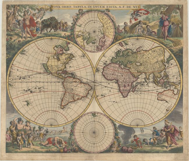
Auction 186, Lot 13
Subject: World
Wit, Frederick de
Nova Orbis Tabula, in Lucem Edita, 1665
Size: 21.8 x 18.3 inches (55.4 x 46.5 cm)
Estimate: $4,500 - $5,500
First State of De Wit's Stunning Double-Hemisphere Map
Sold for: $3,250
Closed on 2/9/2022
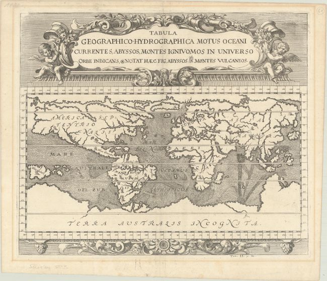
Auction 186, Lot 14
Subject: World
Zahn, Johannes
Tabula Geographico-Hydrographica Motus Oceani Currentes, Abyssos, Montes Igniuomos in Universo Orbe Indicans, Notat haec Fig. Abyssos Montes Vulcanios, 1696
Size: 16.6 x 13.9 inches (42.2 x 35.3 cm)
Estimate: $1,700 - $2,000
Early Example of Thematic Cartography
Sold for: $1,200
Closed on 2/9/2022
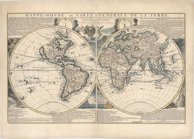
Auction 186, Lot 16
Subject: World
Fer, Nicolas de
Mappe-Monde, ou Carte Generale de la Terre, Divisee en Deux Hemispheres..., 1700
Size: 27.7 x 17.3 inches (70.4 x 43.9 cm)
Estimate: $2,400 - $3,000
Rare First State of De Fer Two-Sheet Map of the World
Sold for: $1,500
Closed on 2/9/2022
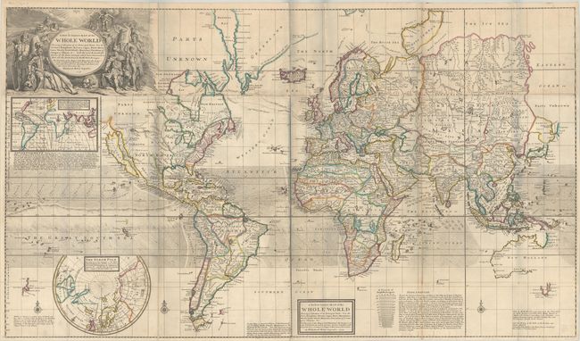
Auction 186, Lot 17
Subject: World
Moll, Herman
A New & Correct Map of the Whole World Shewing ye Situation of Its Principal Parts. Viz the Oceans, Kingdoms, Rivers, Capes, Ports, Mountains, Woods, Trade-Winds, Monsoons, Variation of ye Compass..., 1719
Size: 47.9 x 27.8 inches (121.7 x 70.6 cm)
Estimate: $5,500 - $7,000
Moll's Large-Scale Map of the World
Sold for: $4,000
Closed on 2/9/2022
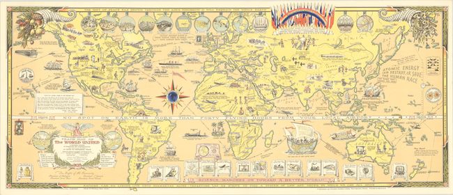
Auction 186, Lot 43
Subject: World
Peace Map of the World United - A Pictorial History of Transport and Communications from Jonah to the Jet Plane as Paths to Permanent Peace, 1945
Size: 35.2 x 14.9 inches (89.4 x 37.8 cm)
Estimate: $1,000 - $1,400
Rare Pictorial Map Promoting Unity after World War II
Sold for: $750
Closed on 2/9/2022
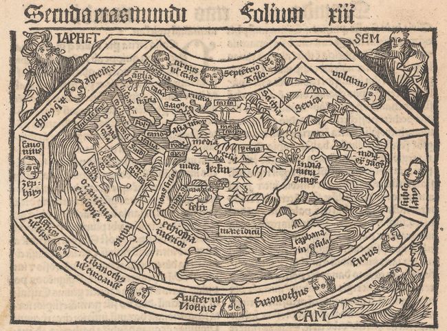
Auction 186, Lot 44
Subject: Ancient World
Schonsperger, Johann
Secunda Etas Mundi, 1496
Size: 5.8 x 4 inches (14.7 x 10.2 cm)
Estimate: $3,750 - $4,500
A Miniature Version of Schedel's Ancient World Map
Sold for: $2,750
Closed on 2/9/2022
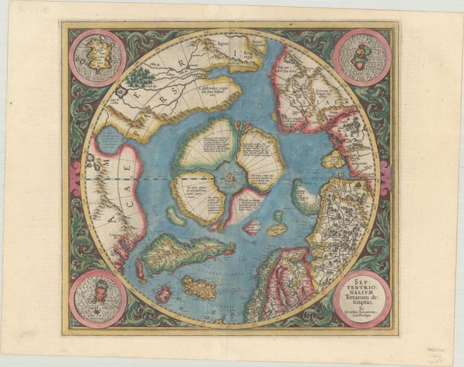
Auction 186, Lot 46
Subject: North Pole
Mercator/Hondius
Septentrionalium Terrarum Descriptio, 1606
Size: 15.5 x 14.8 inches (39.4 x 37.6 cm)
Estimate: $2,200 - $2,500
The First Printed Map Devoted to the Arctic
Sold for: $2,750
Closed on 2/9/2022
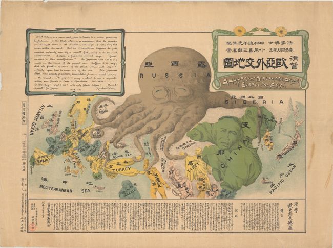
Auction 186, Lot 67
Subject: Persuasive Maps, Russo-Japanese War
A Humorous Diplomatic Atlas of Europe and Asia, 1904
Size: 22.5 x 16.5 inches (57.2 x 41.9 cm)
Estimate: $2,750 - $3,500
Japanese Propaganda Map Depicting the Russian Octopus
Sold for: $1,850
Closed on 2/9/2022
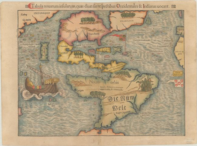
Auction 186, Lot 75
Subject: Western Hemisphere - America
Munster, Sebastian
Tabula Novarum Insularum, qua Diversis Respectibus Occidentales & Indianas Vocant, 1550
Size: 13.4 x 10.1 inches (34 x 25.7 cm)
Estimate: $5,500 - $7,000
One of the Most Important 16th Century Maps of the New World
Sold for: $4,000
Closed on 2/9/2022
Auction 186, Lot 79
Subject: Western Hemisphere - America
Wit, Frederick de
Nova Totius Americae Descriptio, 1660
Size: 21.6 x 17.3 inches (54.9 x 43.9 cm)
Estimate: $2,400 - $3,000
De Wit's Uncommon Carte-a-Figures Map of the Americas
Sold for: $1,800
Closed on 2/9/2022
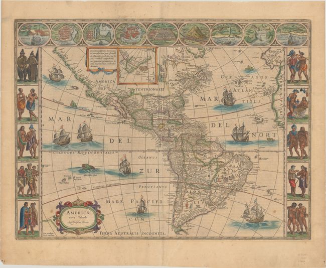
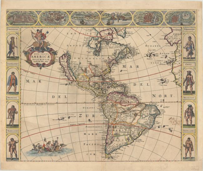
Auction 186, Lot 80
Subject: Western Hemisphere - America
Blaeu, Willem
Americae Nova Tabula, 1662
Size: 21.7 x 16.3 inches (55.1 x 41.4 cm)
Estimate: $4,750 - $6,000
Blaeu's Stunning Carte-a-Figures Map of the Americas
Sold for: $3,250
Closed on 2/9/2022
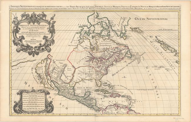
Auction 186, Lot 95
Subject: Colonial North America
Sanson/Mortier
Amerique Septentrionale Divisee en ses Principales Parties, ou sont Distingues les uns des Autres les Estats..., 1696
Size: 34.4 x 21.4 inches (87.4 x 54.4 cm)
Estimate: $2,400 - $3,000
Two-Sheet Map Showing the Island of California
Sold for: $1,800
Closed on 2/9/2022
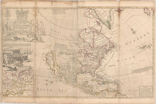
Auction 186, Lot 99
Subject: Colonial North America
Moll, Herman
To the Right Honourable John Lord Sommers Baron of Evesham ... This Map of North America According to ye Newest and Most Exact Observations..., 1764
Size: 37.9 x 23 inches (96.3 x 58.4 cm)
Estimate: $4,000 - $4,750
Moll's Famous "Codfish Map" Reflecting New Boundaries at End of French & Indian War
Sold for: $3,000
Closed on 2/9/2022
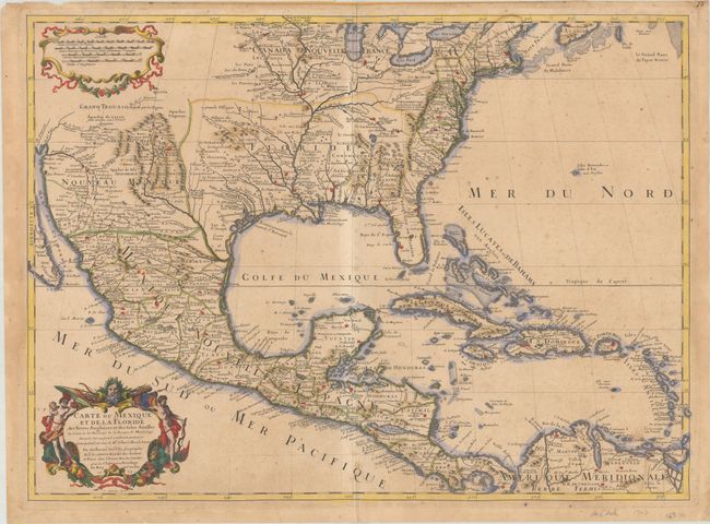
Auction 186, Lot 116
Subject: Colonial Eastern North America & West Indies
Delisle, Guillaume
Carte du Mexique et de la Floride des Terres Angloises et des Isles Antilles du Cours et des Environs de la Riviere de Mississipi..., 1703
Size: 25.6 x 18.7 inches (65 x 47.5 cm)
Estimate: $2,750 - $3,500
Rare First Issue of Landmark in American Cartography - First Printed Map to Accurately Depict the Mouth of the Mississippi River
Sold for: $2,000
Closed on 2/9/2022
Auction 186, Lot 118
Subject: Colonial Eastern North America & West Indies
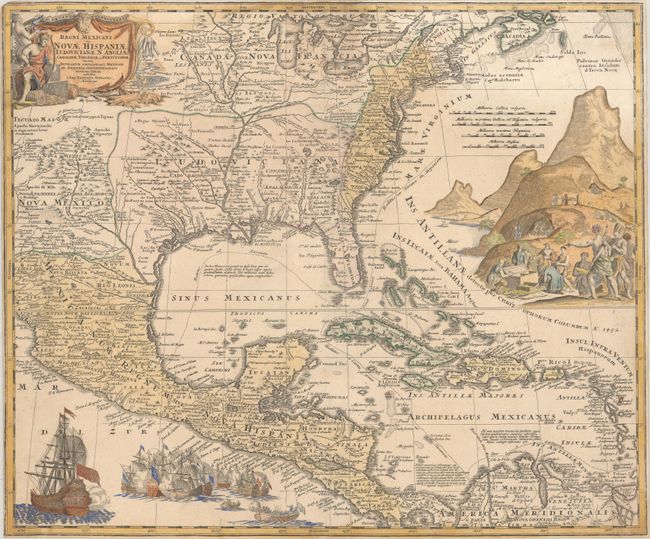
Homann, Johann Baptist
Regni Mexicani seu Novae Hispaniae Ludoviciane, N. Angliae, Carolinae, Virginiae et Pensylvaniae nec non Insularum Archipelagi Mexicani in America Septentrionali Accurata Tabula, 1720
Size: 22.4 x 18.8 inches (56.9 x 47.8 cm)
Estimate: $1,400 - $1,700
Homann's Decorative Map of Colonial America in the Era of the War of the Spanish Succession
Sold for: $700
Closed on 2/9/2022
Auction 186, Lot 126
Subject: Montreal, Canada
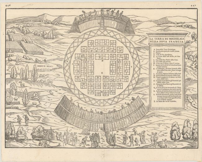
Gastaldi/Ramusio
La Terra de Hochelaga Nella Nova Francia, 1556
Size: 14.5 x 10.6 inches (36.8 x 26.9 cm)
Estimate: $2,400 - $3,000
The First Published Plan of a Settlement in North America
Sold for: $3,000
Closed on 2/9/2022
Auction 186, Lot 130
Subject: Colonial Eastern United States & Canada
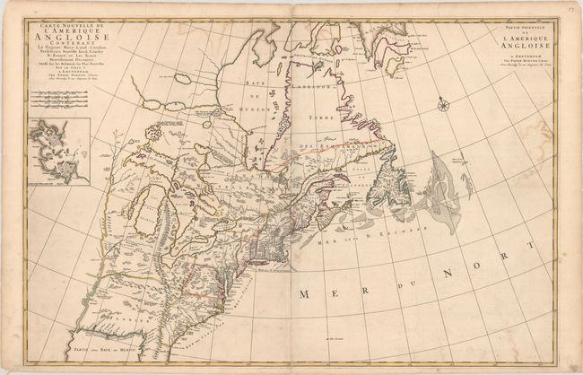
Mortier, Pierre
Carte Nouvelle de l'Amerique Angloise Contenant la Virginie, Mary-Land, Caroline, Pensylvania Nouvelle Iorck, N: Iarsey N: France, et les Terres Nouvellement Decouerte..., 1700
Size: 35.8 x 23.4 inches (90.9 x 59.4 cm)
Estimate: $2,000 - $2,300
A Map Showing Fascinating Geographic Misconceptions
Sold for: $1,500
Closed on 2/9/2022
Auction 186, Lot 131
Subject: Colonial Eastern United States & Canada
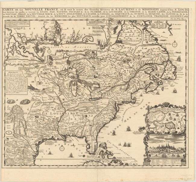
Chatelain, Henry Abraham
Carte de la Nouvelle France, ou se voit le Cours des Grandes Rivieres de S. Laurens & de Mississipi Aujour d'hui S. Louis, aux Environs des-quelles se Trouvent les Etats, Pais, Nations, Peuples &c..., 1720
Size: 19.3 x 16.6 inches (49 x 42.2 cm)
Estimate: $2,400 - $3,000
One of the Most Informative 18th Century Maps of the French Possessions in North America
Sold for: $2,100
Closed on 2/9/2022
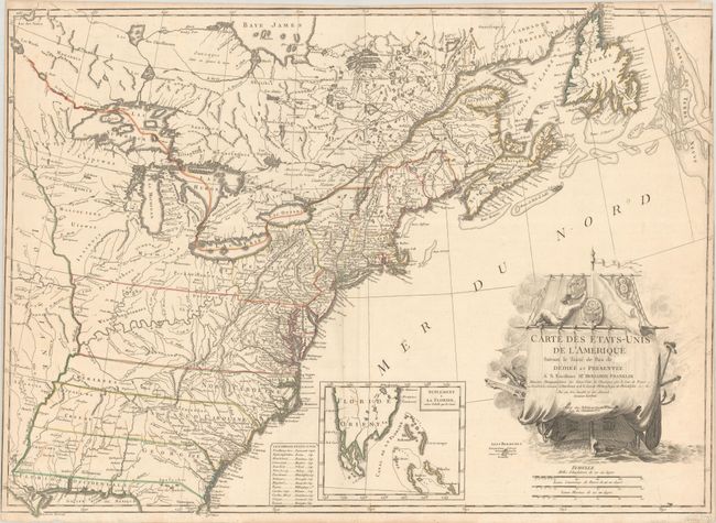
Auction 186, Lot 137
Subject: Eastern United States & Canada
Lattre, Jean
Carte des Etats-Unis de l'Amerique Suivant le Traite de Paix de ... Dediee et Presentee a S. Excellence Mr. Benjamin Franklin..., 1791
Size: 30 x 21.9 inches (76.2 x 55.6 cm)
Estimate: $5,500 - $7,000
First French Map of the New United States
Sold for: $7,000
Closed on 2/9/2022
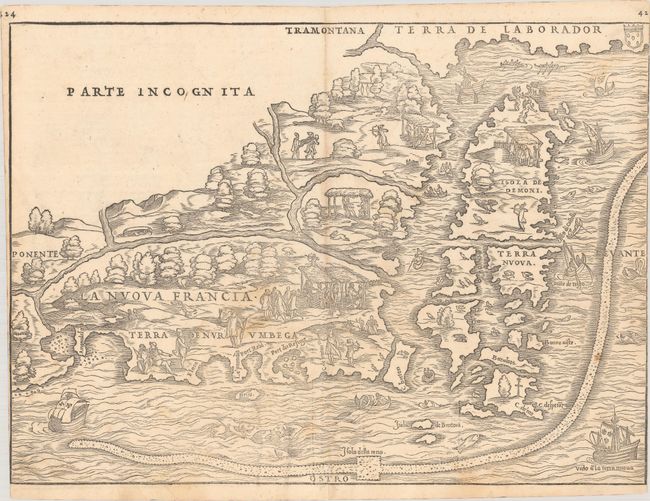
Auction 186, Lot 143
Subject: Colonial Northeastern United States & Canada
Gastaldi/Ramusio
La Nuova Francia, 1556
Size: 14.8 x 10.8 inches (37.6 x 27.4 cm)
Estimate: $5,000 - $6,500
Rare First State of the First Printed Map to Focus on New England and New France
Sold for: $3,500
Closed on 2/9/2022
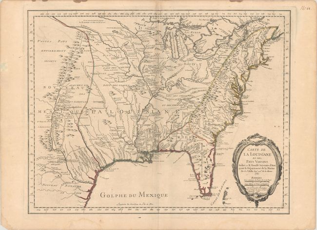
Auction 186, Lot 171
Subject: Colonial Eastern United States
Bellin, Jacques Nicolas
Carte de la Louisiane et des Pays Voisins Dediee a M. Rouille Secretaire d'Etat, Ayant le Departement de la Marine, 1755
Size: 24.1 x 18.8 inches (61.2 x 47.8 cm)
Estimate: $1,200 - $1,500
Bellin's Scarce French and Indian War-Era Map of the Colonial United States
Sold for: $1,200
Closed on 2/9/2022
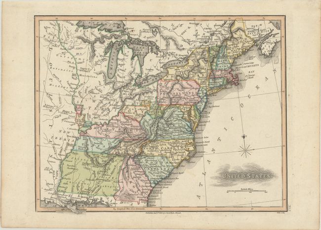
Auction 186, Lot 180
Subject: Eastern United States, Franklin
Neele, Samuel John
United States, 1813
Size: 11.3 x 8.9 inches (28.7 x 22.6 cm)
Estimate: $1,100 - $1,400
Map Depicting Proposed State of "Franklinia" and Other Short-Lived Territories
Unsold
Closed on 2/9/2022
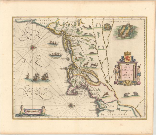
Auction 186, Lot 189
Subject: Colonial New England & Mid-Atlantic United States
Blaeu, Willem
Nova Belgica et Anglia Nova, 1635
Size: 19.9 x 15.3 inches (50.5 x 38.9 cm)
Estimate: $2,000 - $2,300
Important Map of Colonial New England and the Mid-Atlantic
Sold for: $2,750
Closed on 2/9/2022
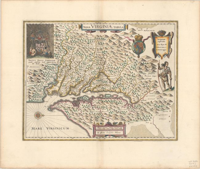
Auction 186, Lot 196
Subject: Colonial Mid-Atlantic United States
Hondius/Blaeu
Nova Virginiae Tabula, 1647
Size: 18.8 x 14.8 inches (47.8 x 37.6 cm)
Estimate: $2,000 - $2,300
One of the Most Important 17th Century Maps of the Chesapeake Bay
Sold for: $1,500
Closed on 2/9/2022
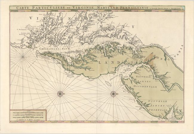
Auction 186, Lot 197
Subject: Colonial Mid-Atlantic United States
Jaillot/Mortier
Carte Particuliere de Virginie, Maryland, Pennsilvanie, la Nouvelle Iarsey. Orient et Occidentale, 1700
Size: 31.5 x 21.2 inches (80 x 53.8 cm)
Estimate: $4,000 - $5,000
One of the Most Beautiful Charts of Maryland and the Chesapeake Bay
Sold for: $3,000
Closed on 2/9/2022
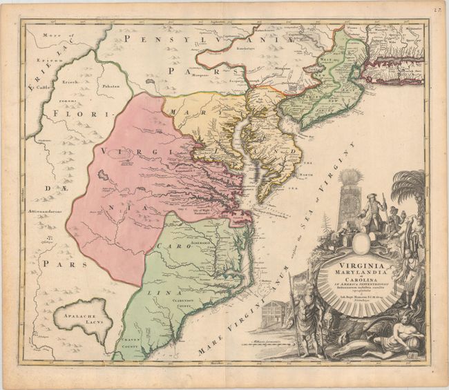
Auction 186, Lot 198
Subject: Colonial Mid-Atlantic United States
Homann, Johann Baptist
Virginia Marylandia et Carolina in America Septentrionali Britannorum Industria Excultae Repraesentatae, 1730
Size: 22.8 x 19.1 inches (57.9 x 48.5 cm)
Estimate: $1,500 - $1,800
Map Created to Promote German Immigration to the New World
Sold for: $1,100
Closed on 2/9/2022
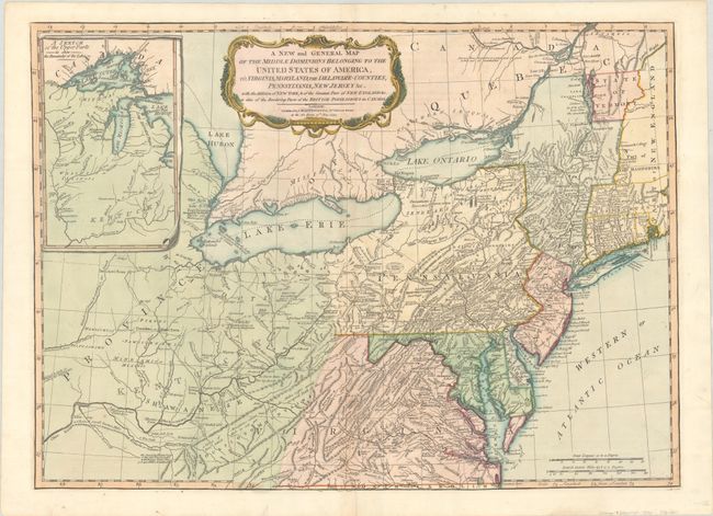
Auction 186, Lot 203
Subject: Mid-Atlantic United States & Great Lakes
Laurie & Whittle
A New and General Map of the Middle Dominions Belonging to the United States of America, viz. Virginia, Maryland, the Delaware-Counties, Pennsylvania, New Jersey &c. with the Addition of New York, & of the Greatest Part of New England…, 1794
Size: 26 x 18.8 inches (66 x 47.8 cm)
Estimate: $1,200 - $1,500
Laurie & Whittle's Popular Map Depicting the "New" United States
Sold for: $750
Closed on 2/9/2022
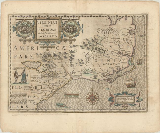
Auction 186, Lot 206
Subject: Colonial Southeast United States
Hondius, Jodocus
Virginiae Item et Floridae Americae Provinciarum, Nova Descriptio, 1634
Size: 19.1 x 13.6 inches (48.5 x 34.5 cm)
Estimate: $1,800 - $2,100
A Seminal Map of the Southeast and Early American Cartography - Full Contemporary Color
Sold for: $1,200
Closed on 2/9/2022
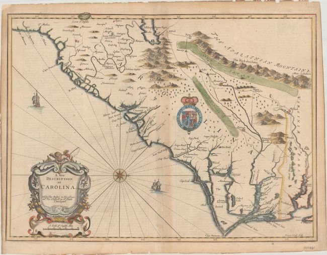
Auction 186, Lot 208
Subject: Colonial Southeast United States
Speed/Lamb
A New Description of Carolina, 1676
Size: 20.1 x 14.9 inches (51.1 x 37.8 cm)
Estimate: $2,400 - $3,000
Speed's Map of the Carolinas Based Upon the Lords Proprietor's Map
Sold for: $1,800
Closed on 2/9/2022
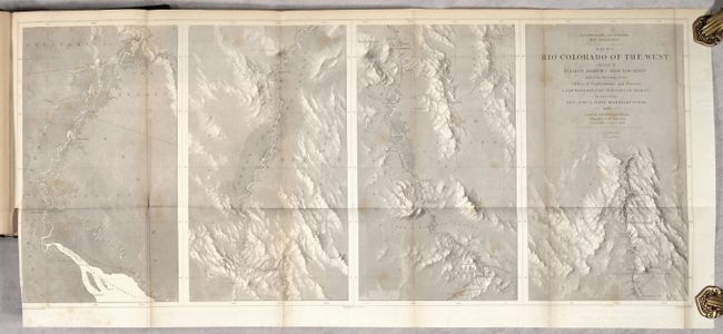
Auction 186, Lot 226
Subject: Southwestern United States
Ives, Joseph C. (Lt.)
[4 Maps with Report] ] Map No. 1 [and] Map No. 2 Rio Colorado of the West... [and] Geological Map No. 1 [and] Geological Map No. 2 Rio Colorado of the West [bound in] Report upon the Colorado River of the West, Explored 1857 and 1858…, 1861
Size: 34.5 x 14.6 inches (87.6 x 37.1 cm)
Estimate: $700 - $850
Complete Ives Report with Scarce Geological Maps
Sold for: $350
Closed on 2/9/2022
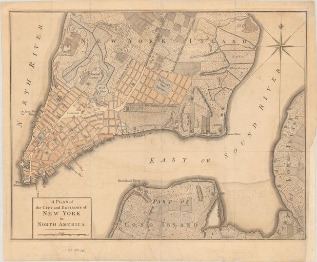
Auction 186, Lot 295
Subject: New York City, New York, Revolutionary War
Anon.
A Plan of the City and Environs of New York in North America, 1776
Size: 14.4 x 11.2 inches (36.6 x 28.4 cm)
Estimate: $2,000 - $2,300
Revolutionary War-Era Plan of New York City
Sold for: $1,500
Closed on 2/9/2022
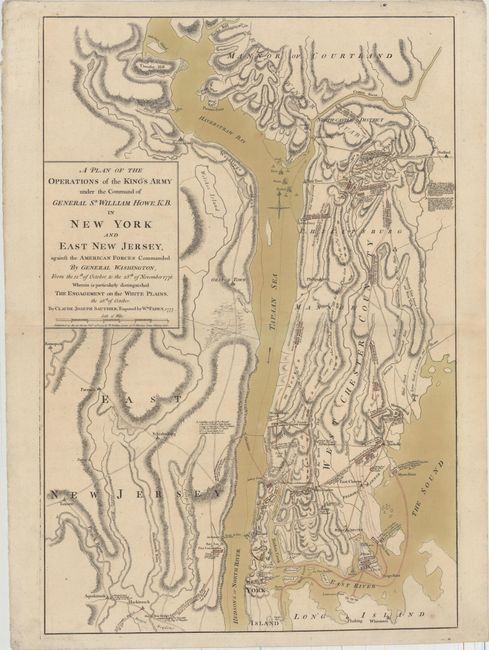
Auction 186, Lot 296
Subject: Colonial New York, Revolutionary War
Sauthier/Faden
A Plan of the Operations of the King's Army Under the Command of General Sr. William Howe, K.B. in New York and East New Jersey, Against the American Forces Commanded by General Washington..., 1777
Size: 19.3 x 28.7 inches (49 x 72.9 cm)
Estimate: $7,000 - $8,500
Important Revolutionary War Map of the Battle of White Plains
Sold for: $5,000
Closed on 2/9/2022
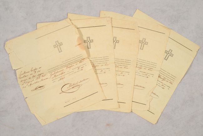
Auction 186, Lot 326
Subject: Austin's Colony, Texas, Documents
[5 Certificates of Baptism Signed by Michael Muldoon in Austin's Colony], 1831
Size: 8 x 9.7 inches (20.3 x 24.6 cm)
Estimate: $2,000 - $2,500
Important Documents Enabling Land Ownership in Austin's Colony
Sold for: $17,000
Closed on 2/9/2022
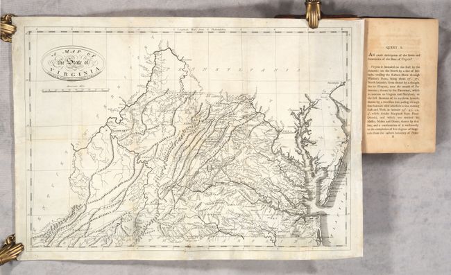
Auction 186, Lot 329
Subject: Virginia
Jefferson, Thomas
[Map in Book] A Map of the State of Virginia... [in] Notes on the State of Virginia, 1801
Size: 19.6 x 13.4 inches (49.8 x 34 cm)
Estimate: $2,400 - $3,000
"First Hot-Pressed Edition" of Jefferson's Famous Work
Sold for: $1,500
Closed on 2/9/2022
Auction 186, Lot 330
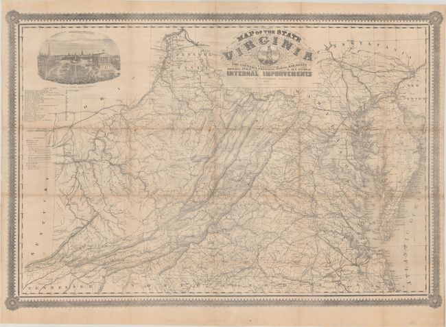
Subject: Virginia, Civil War
West & Johnston
Map of the State of Virginia Containing the Counties, Principal Towns, Railroads Rivers, Canals & All Other Internal Improvements, 1862
Size: 37.4 x 25.6 inches (95 x 65 cm)
Estimate: $8,000 - $9,500
Rare Civil War Map Based on Bucholtz Map of Virginia
Unsold
Closed on 2/9/2022
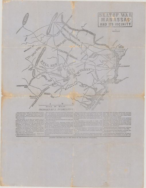
Auction 186, Lot 331
Subject: Northern Virginia, Civil War
Seat of War Manassas and Its Vicinity, 1861
Size: 9.8 x 10.4 inches (24.9 x 26.4 cm)
Estimate: $2,400 - $3,000
Confederate Broadside of the First Major Battle of the Civil War
Unsold
Closed on 2/9/2022
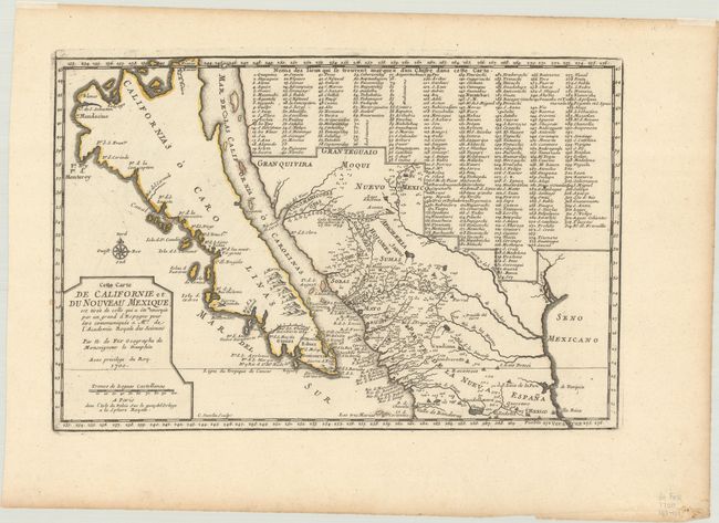
Auction 186, Lot 341
Subject: Southwestern United States & Mexico, California
Fer, Nicolas de
Cette Carte de Californie et du Nouveau Mexique, 1700
Size: 13.4 x 8.9 inches (34 x 22.6 cm)
Estimate: $1,200 - $1,500
De Fer's Important Map of the Island of California
Sold for: $1,100
Closed on 2/9/2022
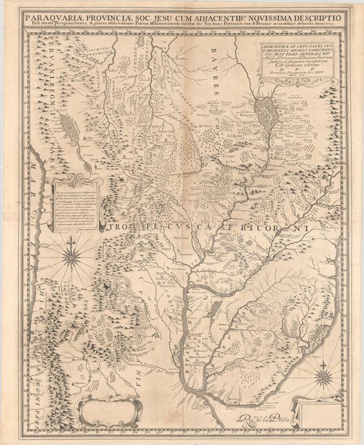
Auction 186, Lot 385
Subject: Central South America, Paraguay
Paraquariae Provinciae Soc. Jesu cum Adjacentib. Novissima Descriptio..., 1722
Size: 21.9 x 28.4 inches (55.6 x 72.1 cm)
Estimate: $4,000 - $4,750
Pre-Publication Proof of Extremely Rare Jesuit Map of Paraguay
Unsold
Closed on 2/9/2022
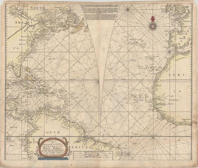
Auction 186, Lot 397
Subject: North Atlantic
Thornton, John
A General Chart from England to Guinea with All the Tradeing Part of the West Indies, 1704
Size: 22.2 x 18.6 inches (56.4 x 47.2 cm)
Estimate: $1,400 - $1,800
Rare Chart with Unique Feature to Correct Mercator's Projection
Sold for: $4,750
Closed on 2/9/2022
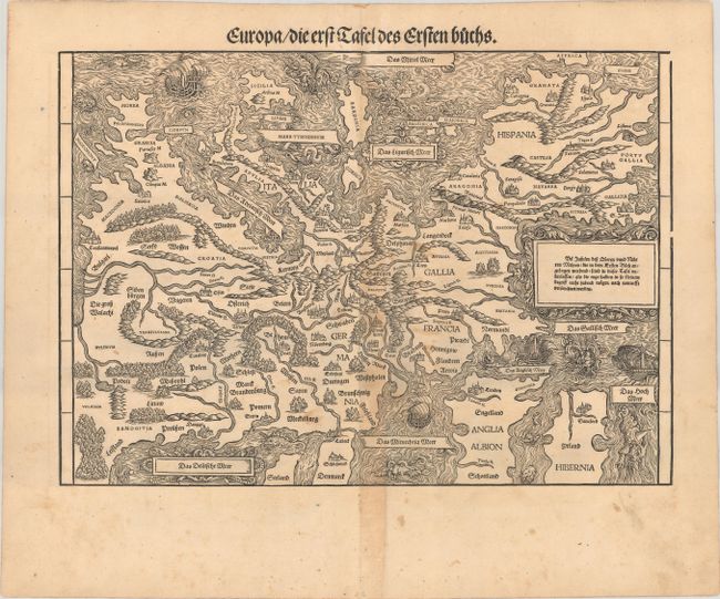
Auction 186, Lot 401
Subject: Europe
Stumpf, Johann
Europa / die erst Tafel des Ersten Buchs, 1548
Size: 15.4 x 10.9 inches (39.1 x 27.7 cm)
Estimate: $2,400 - $3,000
Rare Decorative Map of Europe with South Oriented to the Top
Sold for: $1,800
Closed on 2/9/2022
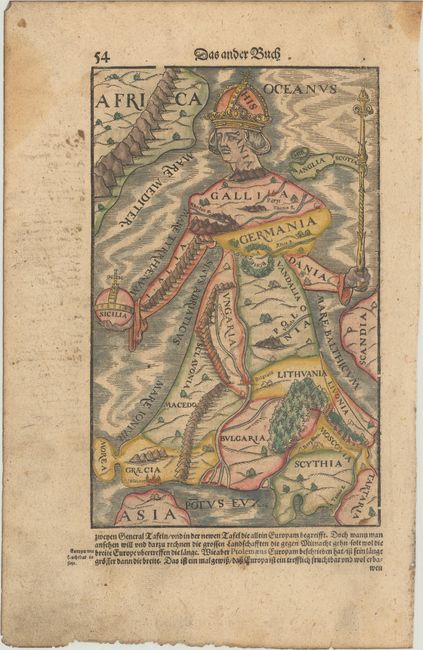
Auction 186, Lot 403
Subject: Europe
Munster, Sebastian
[Europa Regina], 1628
Size: 6.4 x 10.2 inches (16.3 x 25.9 cm)
Estimate: $900 - $1,100
Famous Cartographic Oddity of Europe in the Shape of a Woman
Sold for: $1,100
Closed on 2/9/2022
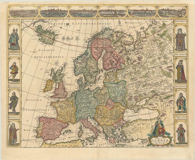
Auction 186, Lot 404
Subject: Europe
Wit, Frederick de
Nova Europae Descriptio, 1660
Size: 21.9 x 17.2 inches (55.6 x 43.7 cm)
Estimate: $1,800 - $2,100
Rare Carte-a-Figures Map of Europe
Sold for: $1,200
Closed on 2/9/2022
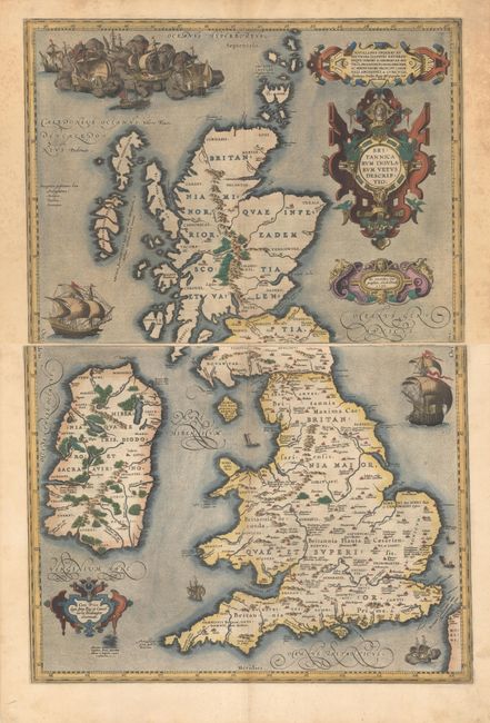
Auction 186, Lot 412
Subject: Britain
Ortelius, Abraham
[On 2 Sheets] Britannicarum Insularum Vetus Descriptio, 1590
Size: 19.1 x 14.1 inches (48.5 x 35.8 cm)
Estimate: $3,500 - $4,250
Scarce Two-Sheet Map of British Isles in Full Contemporary Color
Sold for: $4,000
Closed on 2/9/2022
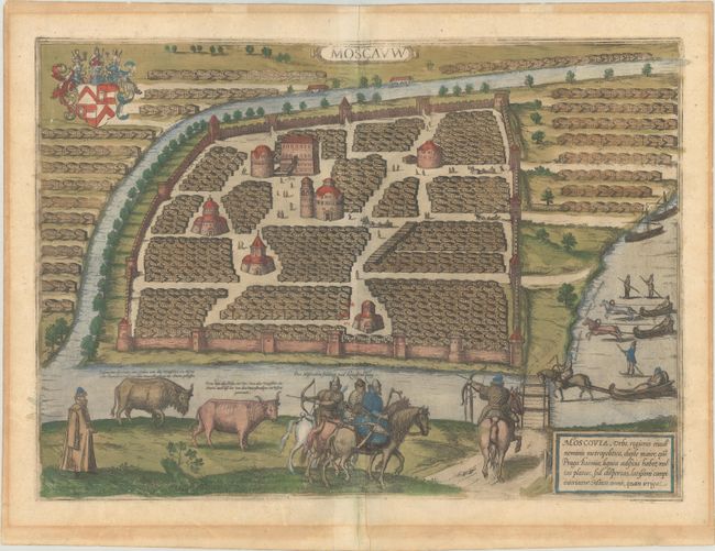
Auction 186, Lot 551
Subject: Moscow, Russia
Braun & Hogenberg
Moscauw, 1597
Size: 19.1 x 13.7 inches (48.5 x 34.8 cm)
Estimate: $2,750 - $3,500
Braun & Hogenberg's First Plan of Moscow in Full Contemporary Color
Unsold
Closed on 2/9/2022
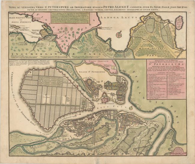
Auction 186, Lot 553
Subject: St. Petersburg, Russia
Ottens, Reiner and Joshua
Nova ac Verissima Urbis St. Petersburg ab Imperatore Russico Petro Alexii F. Conditae, Item Fl. Nevae, Fossae Jussu Imp. Russ..., 1765
Size: 23.2 x 18.8 inches (58.9 x 47.8 cm)
Estimate: $1,400 - $1,700
Map Illustrating Peter the Great's Plans for St. Petersburg
Unsold
Closed on 2/9/2022
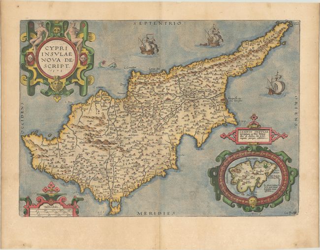
Auction 186, Lot 607
Subject: Cyprus
Ortelius, Abraham
Cypri Insulae Nova Descript., 1573
Size: 19.5 x 13.8 inches (49.5 x 35.1 cm)
Estimate: $1,200 - $1,500
Superb, Decorative Map of Cyprus
Sold for: $900
Closed on 2/9/2022
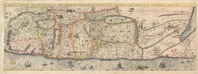
Auction 186, Lot 638
Subject: Holy Land
Adrichom, Christian van
Situs Terrae Promissionis SS Bibliorum Intelligentiam Exacte Aperiens, 1590
Size: 39.9 x 14 inches (101.3 x 35.6 cm)
Estimate: $1,400 - $1,700
Adrichom's Influential Map of the Holy Land
Sold for: $1,000
Closed on 2/9/2022
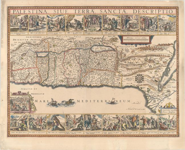
Auction 186, Lot 644
Subject: Holy Land
Jansson, Jan
Palestina, sive Terrae Sanctae Descriptio, 1677
Size: 22.5 x 17 inches (57.2 x 43.2 cm)
Estimate: $1,500 - $1,800
Decorative Map Featuring 18 Biblical Scenes
Sold for: $1,100
Closed on 2/9/2022
72 lots
Page 1 of 2