Subject: Southwestern United States
Period: 1861 (published)
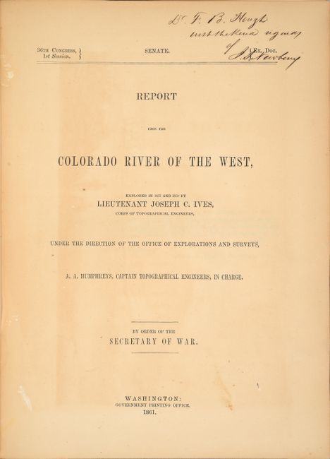
Publication: 36th Congress, 1st Session
Color: Hand Color
Size:
34.5 x 14.6 inches
87.6 x 37.1 cm
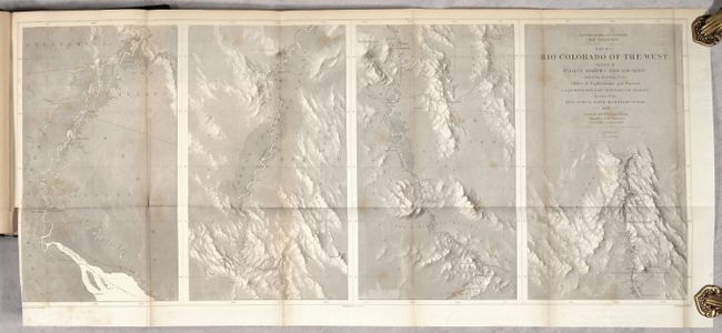
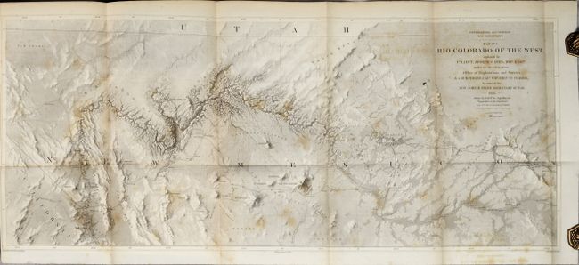
This is the unnumbered Senate version of this report that contains 2 topographical maps and 2 corresponding geological maps based upon Ives explorations. The maps represent one of the most important exploring efforts of the American Southwest. In his book Mapping of the Trans-Mississippi West, Carl Wheat devotes several pages to the two topographical maps saying they are two of the best created by the remarkable F.W. von Egloffstein. They were engraved using his system that imparts the appearance of depth to the topography and nearly mimics a satellite image. A remarkable accomplishment for the time.
The first map shows the topography and geology of the lower Colorado River in four panels (each about 8.5" x 14"), beginning at the Gulf and ending in Black Canyon at Fortification Rock. Locates and names Pt. Invincible, Ogden's Landing, Fort Yuma, Lighthouse Rock, The Needles, the location of Beale's Crossing, Bullshead (today's Bullhead City), Painted Canyon, Fortification Rock, and much more. Numerous rapids are noted including Roaring Rapid 3 large rocks & one sunken rock below, and Violent Rapid with rocks on both sides.
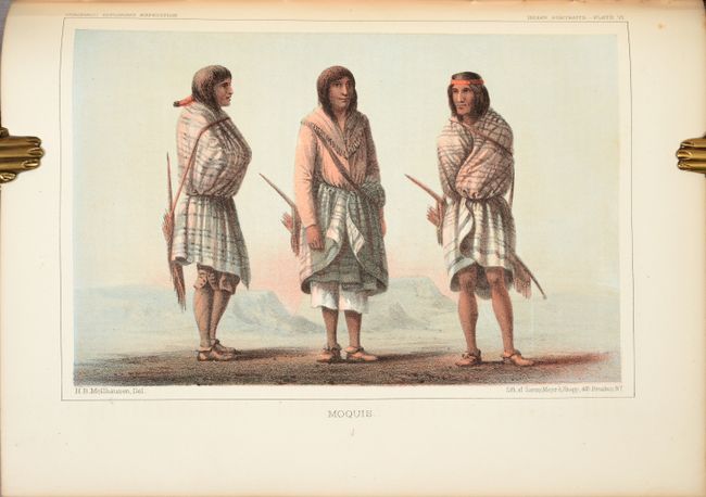
The second map details the region around the Grand Canyon and Little Colorado River. It shows the river from about Needles (Whipple's Crossing and Mojave Canyon) north through Black Canyon, to the Little Colorado and then north to beyond the survey's limit as the riverbed fades to nothing. The map locates Fort Defiance, Campbell's Pass, Zuni, Moquis (Hopi) Pueblos, San Francisco Springs (Flagstaff), Las Vegas, the Mormon Road, numerous Indian tribes, and much more. Several important exploration routes and trails are shown including The Old Spanish Trail, Whipple's trail 1854-4 and Beale's trail.
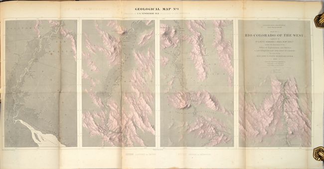
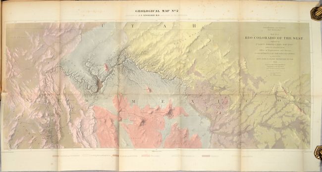
The two geological maps at the rear of the volume use the same base map as the two topographical maps, but also include geological data by J.S. Newberry, Geologist for the Expedition. The second geological map is particularly detailed, showing 7 different geological types including tertiary, silurian and volcanic among others. This scarce pair of maps represents the earliest geological maps of the Grand Canyon region.
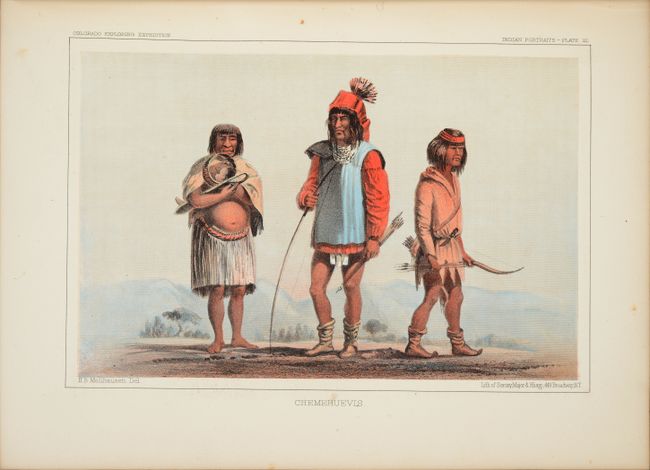
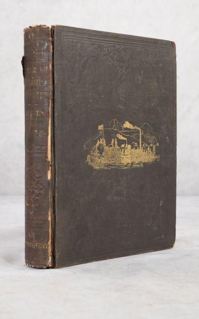
The maps are still bound in the original report. The report consists of 5 parts including a general report, hydrographic report, Newberry's geological report, and sections on botany and zoology. In addition to the 353 pages of text, there are numerous plates of the Grand Canyon and other panoramic views along with the fascinating hand-colored Indian portraits. According to Goetzmann, "the comprehensive observations of Ives and the scientists accompanying his expedition were a distinct contribution to the knowledge of a little-known and superficially explored region." Quarto, original brown cloth with gilt illustration on the front cover.
This presentation example was inscribed by J.S. Newberry on the title page.
References: Howes #I-92; Wagner-Camp #375; Wheat (TMW) #947 & #948; Goetzmann (Army Exploration) pp. 379-94; Marcou & Marcou #784.
Condition: B
The folding maps have light scattered foxing, and the two geological maps also have short binding tears at left that have been closed on verso with masking tape. Plates are mostly clean and bright, and the text is lightly toned. The hinges are starting, covers are worn, and the corners are bumped.