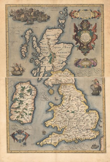
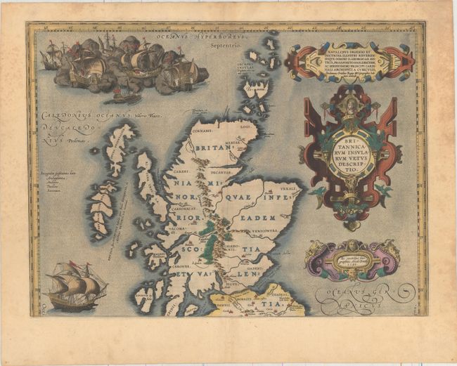
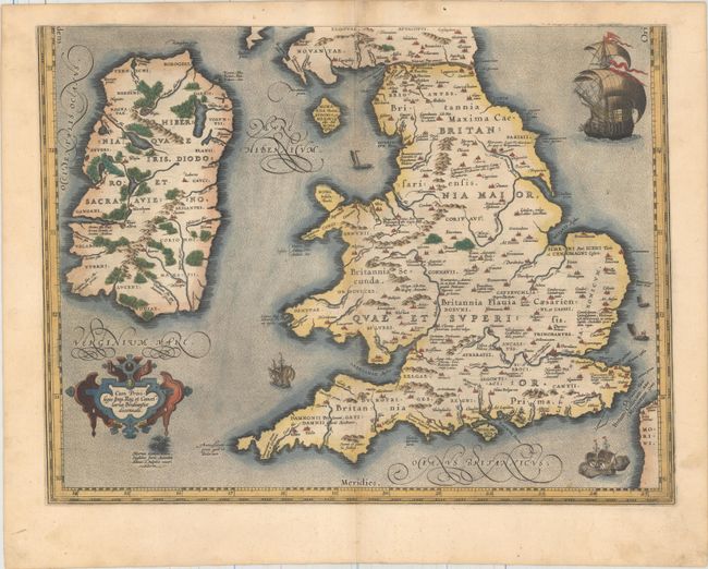
Subject: Britain
Period: 1590 (dated)
Publication: Theatrum Orbis Terrarum
Color: Hand Color
Size:
19.1 x 14.1 inches
48.5 x 35.8 cm
Fabulous two-sheet map of ancient Britain that combines geographical information from Mercator and Saxton with ancient knowledge from Diodorus, Siculus, Plinius, Appianus, Tacitus, Caesar and Strabo. The map is filled with ancient place names, Hadrian's Wall, and Wall of Pius (mislabeled Severi Murus). Probably engraved by Jan Wierix and richly embellished with fabulous large ships, a raging sea battle, and four elaborate strapwork cartouches. This two-part map only appeared in the early editions; being replaced by a single plate in 1595. Only 710 are estimated by Van den Broecke to have been printed. Latin text on verso, published in 1592.
References: Shirley (BI to 1650) #160; Van den Broecke #190-191.
Condition: A
Nice impressions with full contemporary color on sturdy paper with the crossed arrows watermark commonly found on Ortelius maps. There is light foxing primarily confined to the blank margins in the top sheet, and a 1" tear in the right blank margin of the bottom sheet, which has been closed on verso with archival material. The first image is a composite image - the map is in two separate sheets.