Subject: New York City, New York, Revolutionary War
Period: 1776 (published)
Publication: Universal Magazine
Color: Hand Color
Size:
14.4 x 11.2 inches
36.6 x 28.4 cm
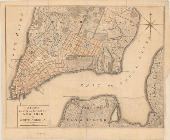
This uncommon, Revolutionary War-era map was published in November 1776 to inform the British public of the growing conflict. The cartography is a compilation of the Montresor (1766) and Ratzen (1767) maps, but with some new additions and details, including the addition of the name Delaney's New Square to an area near the Collect Pond (labeled here Fresh Water) that is surrounded by blocks of New Buildings not Finished. The square is shown on the Ratzen map as the Great Square, and by the 1780s it is filled with buildings. The map names many streets and roads, including Broadway and the Road to King's Bridge where the Rebels mean to make a Stand, which runs parallel to Road to Kepps Bay where the Kings Troops Landed. It also includes details of wharves, ferries, public buildings, some industries, orchards, gardens, fields, houses (including some resident's names), Fort George, and the battery.
References: Jolly #UNIV-177; Nebenzahl (Biblio) #114; Sellers & Van Ee #1110.
Condition: B+
Issued folding on watermarked paper with light offsetting. There is a binding trim at lower right that has been replaced with old paper and a related 0.75" binding tear that has been archivally repaired on verso.