Showing Featured Lots(remove filter)
Showing results for:Auction 102
Catalog Archive
144 lots
Page 1 of 3
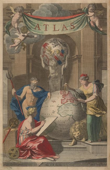
Auction 102, Lot 4
Subject: Title Pages
Elwe, Jan Barend
Atlas, 1792
Size: 11.5 x 18.2 inches (29.2 x 46.2 cm)
Estimate: $275 - $325
Sold for: $250
Closed on 3/5/2003
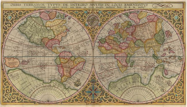
Auction 102, Lot 5
Subject: World
Plancius, Petrus
Orbis Terrarum Typus De Integro Multis In Locis Emendatus, 1630
Size: 20 x 11.1 inches (50.8 x 28.2 cm)
Estimate: $4,750 - $5,500
Sold for: $4,000
Closed on 3/5/2003
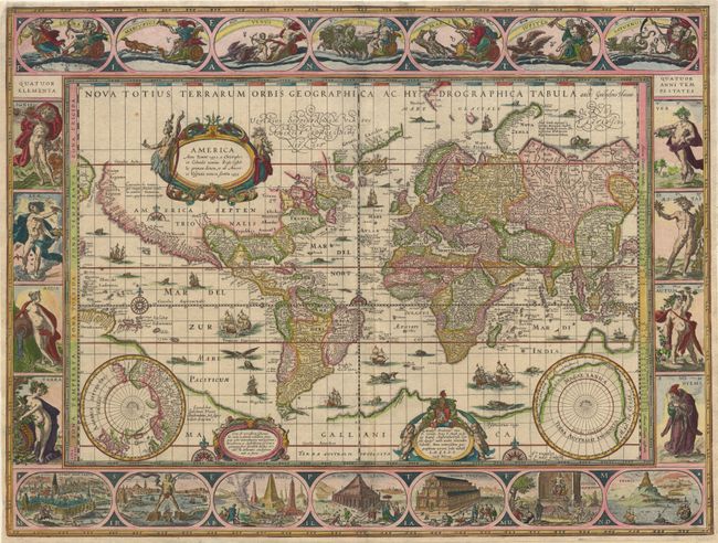
Auction 102, Lot 7
Subject: World
Blaeu, Willem
Nova Totius Terrarum Orbis Geographica ac Hydrographica Tabula, 1640
Size: 21.5 x 16.1 inches (54.6 x 40.9 cm)
Estimate: $15,000 - $17,000
Sold for: $11,000
Closed on 3/5/2003
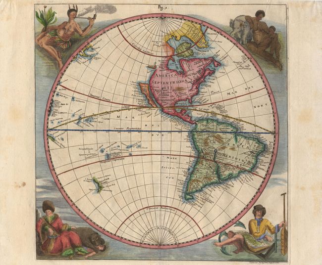
Auction 102, Lot 10
Subject: World
Happel, Everard Werner
[Lot of 2 - Eastern Hemisphere & Western Hemisphere], 1687
Size: 11.5 x 11.5 inches (29.2 x 29.2 cm)
Estimate: $3,000 - $3,500
Sold for: $2,200
Closed on 3/5/2003
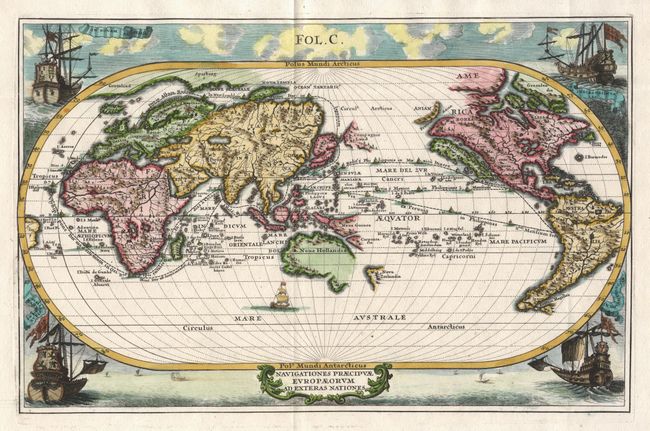
Auction 102, Lot 13
Subject: World
Scherer, Heinrich
Navigationes Praecipuae Europaeorum ad Exteras Nationes, 1700
Size: 13.4 x 8.6 inches (34 x 21.8 cm)
Estimate: $1,700 - $2,000
Sold for: $1,300
Closed on 3/5/2003
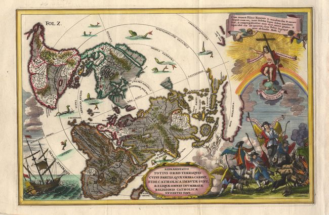
Auction 102, Lot 14
Subject: World
Scherer, Heinrich
Repraesentatio Totius Orbis Terraquei Cuius Partes, Quae Umbra Carent, Fide Catholica Imbutae sunt, Reliquae Omnes Inumbratae Religionis Catholicae Expertes sunt, 1702
Size: 13.8 x 9 inches (35.1 x 22.9 cm)
Estimate: $1,400 - $1,500
Unsold
Closed on 3/5/2003
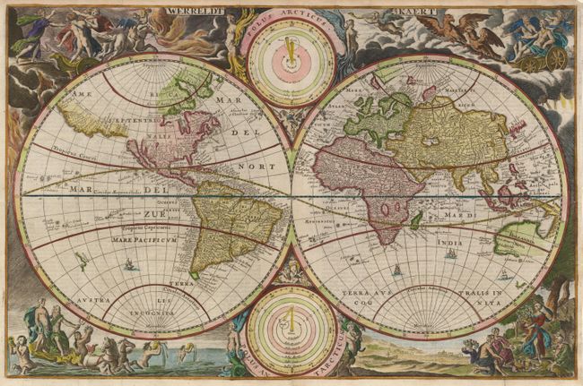
Auction 102, Lot 15
Subject: World
Van de Putte
Werreldt Kaert, 1718
Size: 18.9 x 12.2 inches (48 x 31 cm)
Estimate: $2,000 - $2,300
Sold for: $1,500
Closed on 3/5/2003
Auction 102, Lot 20
Subject: World
Anon.
Planisphaerium Terrestre cum…, 1750
Size: 8.5 x 7.4 inches (21.6 x 18.8 cm)
Estimate: $950 - $1,100
Sold for: $700
Closed on 3/5/2003
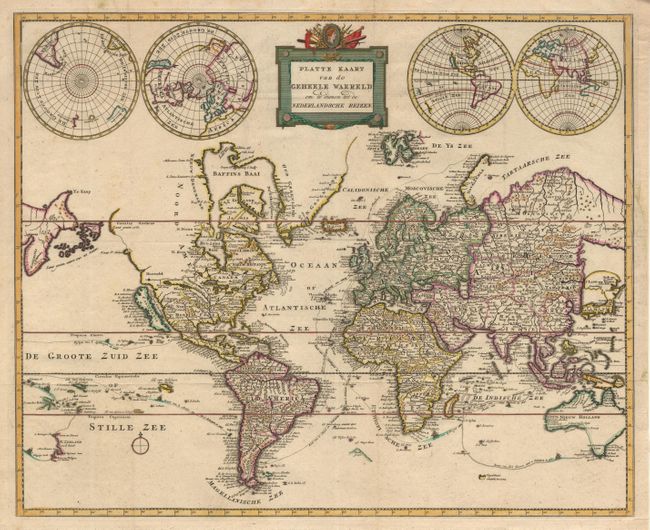
Auction 102, Lot 24
Subject: World
Anon.
Platte Kaart van de Geheele Waereld om te dienen tot de Nederlandsche Reizen., 1784
Size: 18.1 x 14.6 inches (46 x 37.1 cm)
Estimate: $1,200 - $1,500
Sold for: $1,100
Closed on 3/5/2003
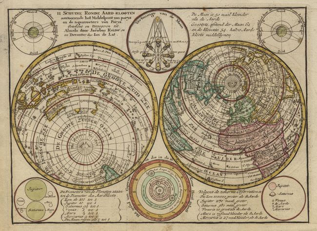
Auction 102, Lot 25
Subject: World
Keizer/De Lat
Il Schuine Ronde Aard-Klooten aantoonende het Middelpunt van parys en de tegenvoeters van Parys…, 1787
Size: 9.5 x 6.7 inches (24.1 x 17 cm)
Estimate: $200 - $250
Sold for: $210
Closed on 3/5/2003
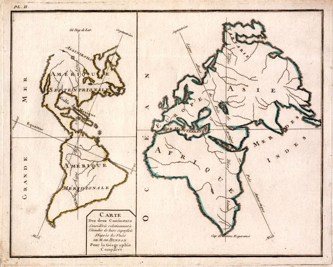
Auction 102, Lot 26
Subject: World
Robert de Vaugondy
Carte des Deux Continents, 1789
Size: 11.5 x 9.3 inches (29.2 x 23.6 cm)
Estimate: $120 - $150
Sold for: $90
Closed on 3/5/2003
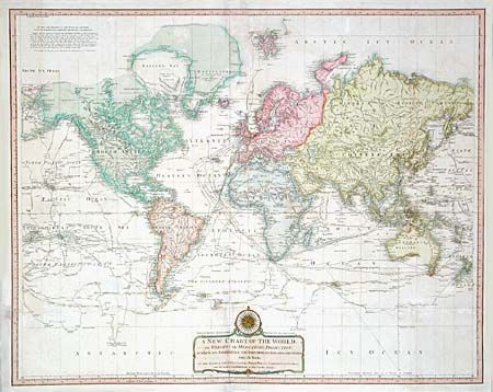
Auction 102, Lot 28
Subject: World
Laurie & Whittle
A New Chart of the World on Wright's or Mercator's Projection in which are Exhibited All The Parts Hitherto Explored or Discovered with the Tracks of the British Circumnavigators Byron, Wallis Carteret and Cook, &c. and the Track of La Perouse…, 1808
Size: 35.7 x 28.5 inches (90.7 x 72.4 cm)
Estimate: $1,300 - $1,500
Sold for: $850
Closed on 3/5/2003
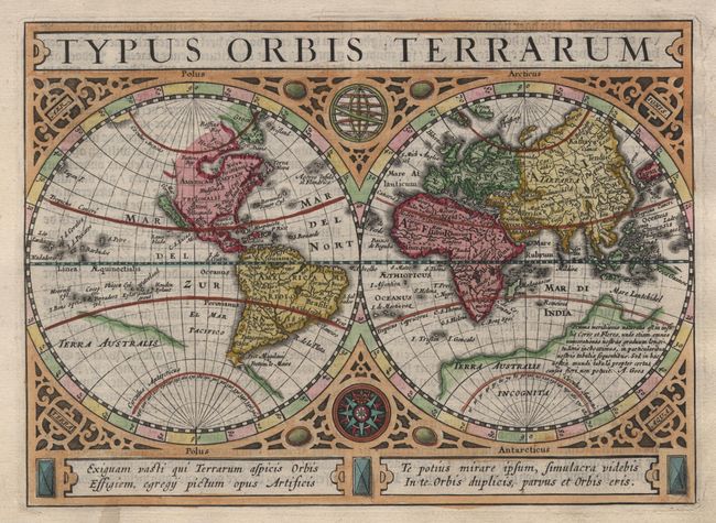
Auction 102, Lot 36
Subject: World and Continents
Hondius/Jansson
[Set of 5] Typus Orbis Terrarum [and] Europae Nova Tabula [and] Americae Descriptio [and] Asia [and] Africae Descriptio, 1628
Size: 7.9 x 5.6 inches (20.1 x 14.2 cm)
Estimate: $3,500 - $4,000
Sold for: $2,500
Closed on 3/5/2003
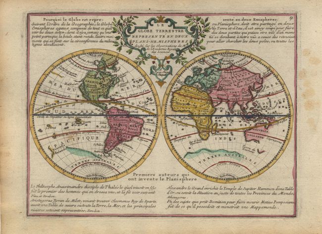
Auction 102, Lot 37
Subject: World and Continents
Chiquet, Jacques
[Set of 6] Le Globe Terrestre [and] L'Europe [and] L'Asie [and] L'Afrique [and] L'Amerique Septentrionale [and] L'Amerique Meridionale, 1719
Size: 8.5 x 6.5 inches (21.6 x 16.5 cm)
Estimate: $2,200 - $2,400
Unsold
Closed on 3/5/2003
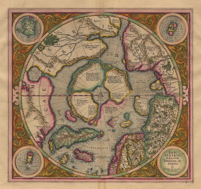
Auction 102, Lot 48
Subject: North Pole
Mercator, Gerard
Septentrionalium Terrarum descriptio, 1619
Size: 15.5 x 14.5 inches (39.4 x 36.8 cm)
Estimate: $3,000 - $4,000
Sold for: $2,200
Closed on 3/5/2003
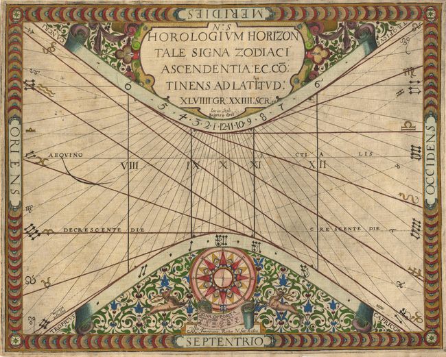
Auction 102, Lot 54
Subject: Cartographic Miscellany
Ritter, Franz
No. S Horologium Horizontale Signa Zodiaci Ascendentia ec, Cotinens ad Latitud. XLVIII Gr XXIIII Scr., 1610
Size: 14.5 x 11.5 inches (36.8 x 29.2 cm)
Estimate: $800 - $1,000
Sold for: $750
Closed on 3/5/2003
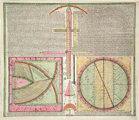
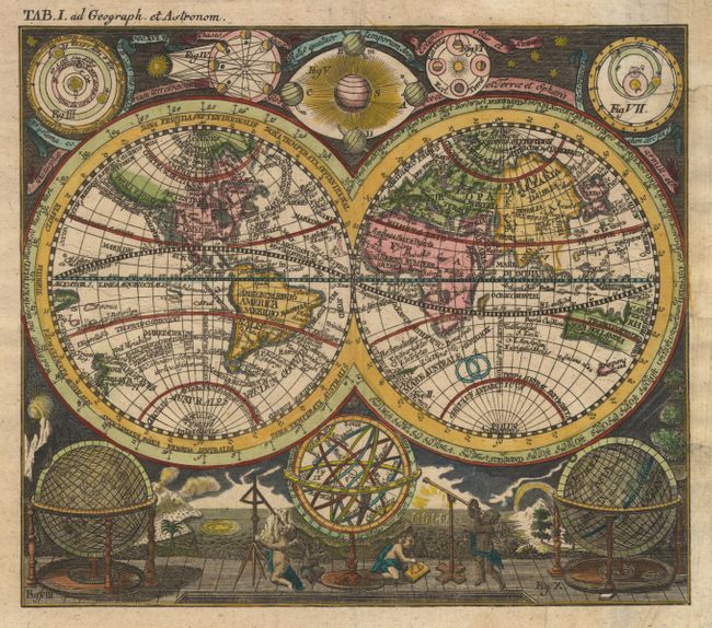
Auction 102, Lot 57
Subject: Cartographic Miscellany
Seutter/Lotter
Nouissimum Astronomiae, Geographiae, AC Gnomonicae, Compendium, 1749
Size: 23 x 19.9 inches (58.4 x 50.5 cm)
Estimate: $550 - $650
Sold for: $400
Closed on 3/5/2003
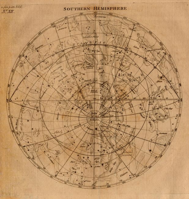
Auction 102, Lot 61
Subject: Celestial
Anon.
[Lot of 2] Northern Hemisphere [together with] Southern Hemisphere, 1768
Size: 7 x 7 inches (17.8 x 17.8 cm)
Estimate: $140 - $180
Sold for: $100
Closed on 3/5/2003

Auction 102, Lot 72
Subject: Globe
Joslin, Gilman
16-inch Terrestrial Floor Globe, 1890
Size: See Description
Estimate: $4,000 - $6,000
Sold for: $6,500
Closed on 3/5/2003
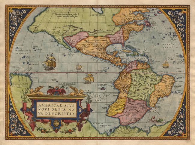
Auction 102, Lot 74
Subject: Western Hemisphere
Ortelius, Abraham
Americae Sive Novi Orbis, Nova Descriptio, 1573
Size: 19.7 x 14.3 inches (50 x 36.3 cm)
Estimate: $7,500 - $9,500
Sold for: $7,000
Closed on 3/5/2003
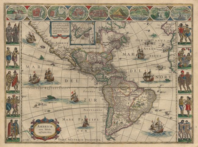
Auction 102, Lot 78
Subject: Western Hemisphere
Blaeu, Willem
Americae nova Tabula, 1640
Size: 21.7 x 16 inches (55.1 x 40.6 cm)
Estimate: $8,000 - $9,000
Sold for: $6,000
Closed on 3/5/2003
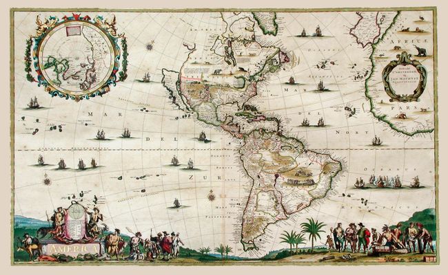
Auction 102, Lot 79
Subject: Western Hemisphere
Mathisz, Jan
America, 1655
Size: 37.2 x 22.6 inches (94.5 x 57.4 cm)
Estimate: $110,000 - $130,000
Unsold
Closed on 3/5/2003
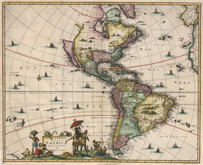
Auction 102, Lot 81
Subject: Western Hemisphere
Schagen, Gerrit Lucaszoon van
Novissima et Accuratissima Totius Americae Descriptio, 1671
Size: 21.4 x 17.2 inches (54.4 x 43.7 cm)
Estimate: $2,000 - $2,500
Sold for: $1,500
Closed on 3/5/2003
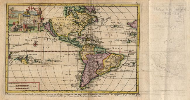
Auction 102, Lot 82
Subject: Western Hemisphere
Aa, Pieter van der
Amerika, of de Nieuwe Weerld Aller eerst door C. Kolumbus ontdekt en bevaren, int Jaar 1492, 1705-30
Size: 9 x 6 inches (22.9 x 15.2 cm)
Estimate: $750 - $850
Unsold
Closed on 3/5/2003
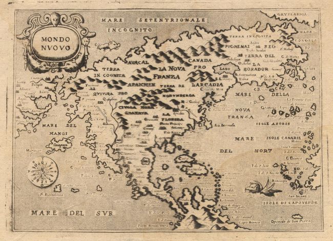
Auction 102, Lot 90
Subject: North America
Porcacchi, Tomaso
Mondo Nuovo, 1686
Size: 5.6 x 4 inches (14.2 x 10.2 cm)
Estimate: $700 - $800
Sold for: $500
Closed on 3/5/2003
Auction 102, Lot 91
Subject: North America
La Feuille, Daniel de
L'Amerique Septentrionale, 1702
Size: 7.3 x 5.5 inches (18.5 x 14 cm)
Estimate: $550 - $650
Sold for: $500
Closed on 3/5/2003
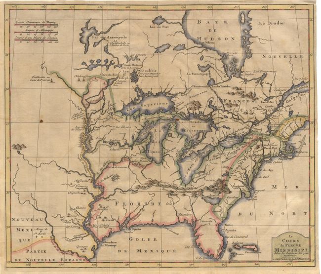
Auction 102, Lot 105
Subject: Colonial United States and Canada - Great Lakes
Bernard, Jean Frederic
Le Cours du Fleuve Missisipi Selon les Relations les plus modernes, 1737
Size: 17.2 x 14.6 inches (43.7 x 37.1 cm)
Estimate: $2,300 - $2,500
Unsold
Closed on 3/5/2003
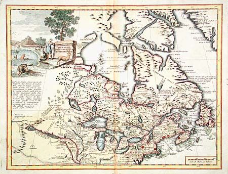
Auction 102, Lot 107
Subject: Colonial New England and Canada
Albrizzi, Girolamo
Carta Geografica del Canada Nell'America Settentrionale, 1742
Size: 16.8 x 12.9 inches (42.7 x 32.8 cm)
Estimate: $600 - $800
Sold for: $650
Closed on 3/5/2003

Auction 102, Lot 111
Subject: Colonial North America
Montanus, Arnoldus
Novi Belgii, quod nunc Novi Jorck Vocatur, Novae qz. Angliae & Partis Virginiae Accuratissima et Novissima Delineatio, 1671
Size: 14.3 x 11.5 inches (36.3 x 29.2 cm)
Estimate: $1,800 - $2,000
Sold for: $1,500
Closed on 3/5/2003
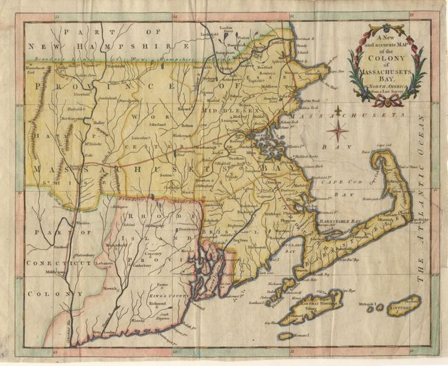
Auction 102, Lot 112
Subject: Colonial Northeast
Anon.
A New and accurate Map of the Colony of Massachusets Bay, in North America from a Late Survey, 1780
Size: 12.8 x 10.2 inches (32.5 x 25.9 cm)
Estimate: $325 - $375
Sold for: $220
Closed on 3/5/2003

Auction 102, Lot 113
Subject: Colonial Maryland
Ogilby, John
Nova Terrae-Mariae Tabula, 1671
Size: 15 x 11.5 inches (38.1 x 29.2 cm)
Estimate: $7,000 - $8,000
Sold for: $6,500
Closed on 3/5/2003
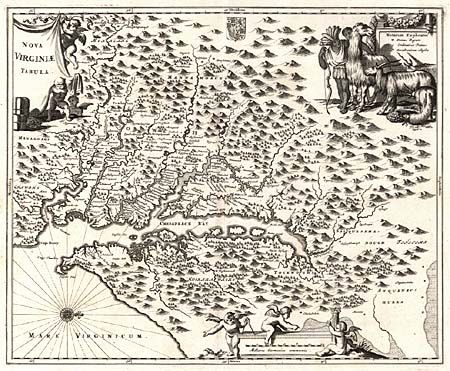
Auction 102, Lot 115
Subject: Colonial Virginia
Jansson, Jan
Virginia, 1648
Size: 7.5 x 5.6 inches (19.1 x 14.2 cm)
Estimate: $700 - $800
Sold for: $500
Closed on 3/5/2003
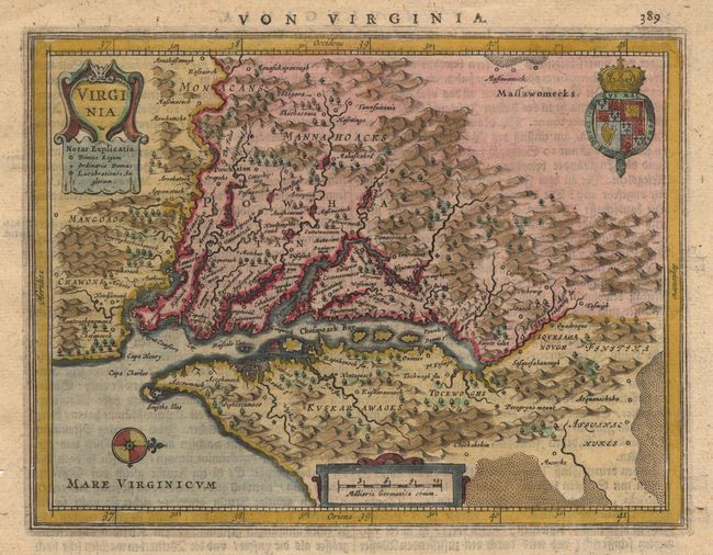
Auction 102, Lot 117
Subject: Colonial Virginia
Montanus/Ogilby
Nova Virginiae Tabula, 1671
Size: 13.7 x 11.5 inches (34.8 x 29.2 cm)
Estimate: $1,400 - $1,600
Sold for: $1,000
Closed on 3/5/2003
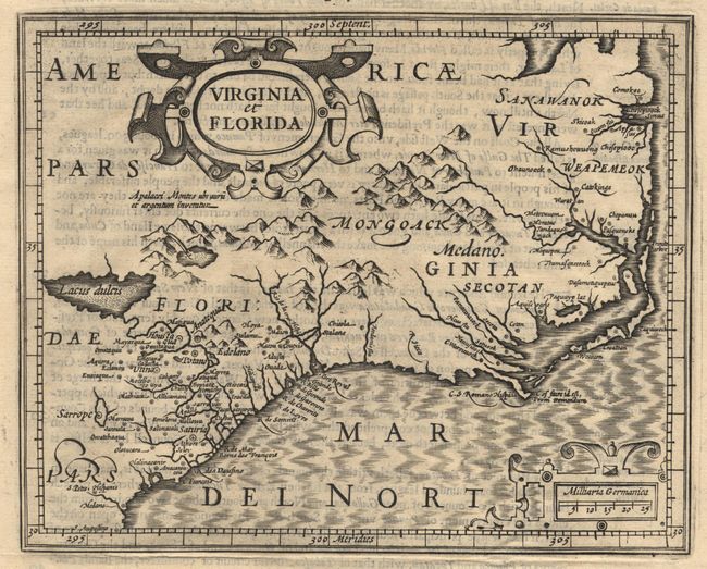
Auction 102, Lot 118
Subject: Colonial Southeast
Hondius/Purchas
Virginia et Florida, 1625
Size: 7.2 x 5.7 inches (18.3 x 14.5 cm)
Estimate: $550 - $600
Sold for: $550
Closed on 3/5/2003
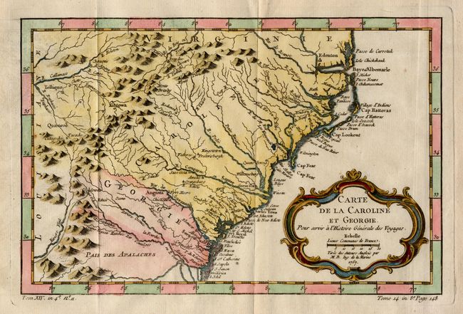
Auction 102, Lot 119
Subject: Colonial Southeast
Bellin, Jacques Nicolas
Carte de la Caroline et Georgie, 1757
Size: 11.3 x 7.5 inches (28.7 x 19.1 cm)
Estimate: $350 - $400
Sold for: $350
Closed on 3/5/2003
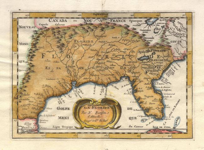
Auction 102, Lot 120
Subject: Colonial South
Sanson, Nicolas
La Floride, 1682
Size: 9.9 x 6.9 inches (25.1 x 17.5 cm)
Estimate: $400 - $450
Sold for: $450
Closed on 3/5/2003
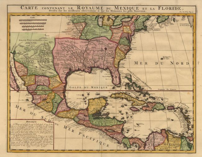
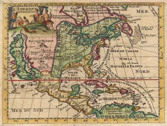
Auction 102, Lot 122
Subject: Colonial North America and Caribbean
Chatelain, Henry Abraham
Carte Contenant le Royaume du Mexique et la Floride, Dressez sur les Meilleures Observations & sur les Memoires les Plus Nouveaux, 1719
Size: 20.5 x 16 inches (52.1 x 40.6 cm)
Estimate: $1,400 - $1,500
Unsold
Closed on 3/5/2003
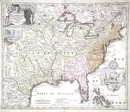
Auction 102, Lot 123
Subject: Colonial Louisiana
Homann, Johann Baptist
Amplissimae Regionis Mississipi Seu Provinciae Ludovicianae…, 1730
Size: 23 x 19.5 inches (58.4 x 49.5 cm)
Estimate: $2,000 - $2,200
Unsold
Closed on 3/5/2003
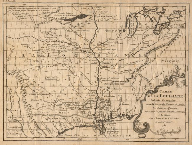
Auction 102, Lot 124
Subject: Colonial Louisiana
Le Page du Pratz
Carte de la Louisiane Colonie Francaise avec le Cours du Fleuve St. Louis, les Rivieres Adjacentes, les Nations des Naturels, les Stablissems. Franciase et les Mines, 1757
Size: 13.2 x 10 inches (33.5 x 25.4 cm)
Estimate: $400 - $500
Sold for: $400
Closed on 3/5/2003
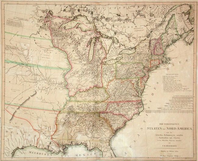
Auction 102, Lot 134
Subject: Eastern United States and Canada
Reichard, Christian Gottlieb Theoph
Die Vereinigten Staaten Von Nord-America, nach den sichersten Bestimmung en, neuesten Nachrichten und Charten, in der Alber'schen Projection entworsen Von C.G. Reichard., 1809
Size: 28 x 23 inches (71.1 x 58.4 cm)
Estimate: $1,800 - $2,200
Sold for: $1,200
Closed on 3/5/2003
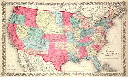
Auction 102, Lot 138
Subject: United States
Colton, Joseph Hutchins
United States of America, 1859
Size: 26.2 x 15.6 inches (66.5 x 39.6 cm)
Estimate: $750 - $850
Sold for: $800
Closed on 3/5/2003
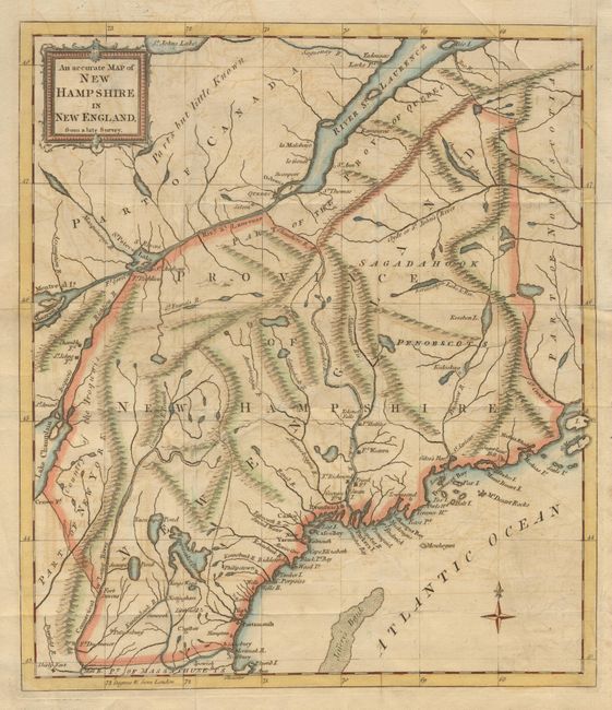
Auction 102, Lot 143
Subject: New England
Anon.
An accurate Map of New Hampshire in New England, from a late Survey, 1781
Size: 11.2 x 12.7 inches (28.4 x 32.3 cm)
Estimate: $350 - $400
Sold for: $250
Closed on 3/5/2003
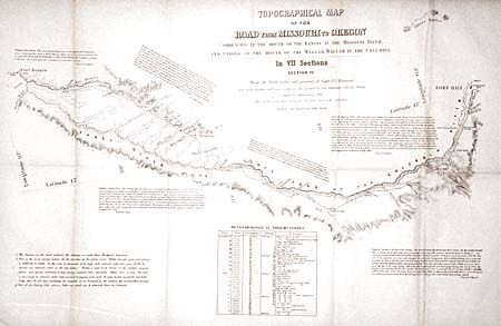
Auction 102, Lot 156
Subject: United States - Western
Fremont/Preuss
Topographical Map of the Road from Missouri to Oregon in Seven Sections, 1846
Size: See Description
Estimate: $2,000 - $3,000
Sold for: $2,000
Closed on 3/5/2003
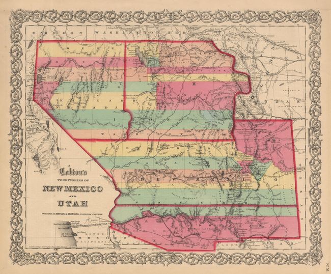
Auction 102, Lot 167
Subject: Southwestern United States
Colton, Joseph Hutchins
Territories of New Mexico and Utah, 1859
Size: 16 x 12.6 inches (40.6 x 32 cm)
Estimate: $600 - $700
Sold for: $950
Closed on 3/5/2003
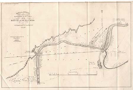
Auction 102, Lot 173
Subject: Southwestern United States - Arizona and Mexico
Whipple, Amiel Weekes
Map of a Survey and Reconnaissance of the Vicinity of the Mouth of the Rio Gila, 1849
Size: 16.5 x 11 inches (41.9 x 27.9 cm)
Estimate: $120 - $150
Sold for: $90
Closed on 3/5/2003
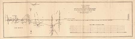
Auction 102, Lot 176
Subject: Southwestern United States and Mexico
U.S. Government
[Lot of 7 Maps - Mexican Boundary Survey], 1851
Size: See Description
Estimate: $400 - $500
Sold for: $325
Closed on 3/5/2003
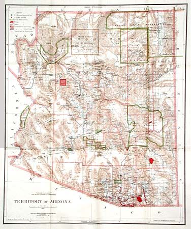
Auction 102, Lot 181
Subject: Arizona
General Land Office
Territory of Arizona, 1896
Size: 16.9 x 20.2 inches (42.9 x 51.3 cm)
Estimate: $150 - $200
Sold for: $140
Closed on 3/5/2003
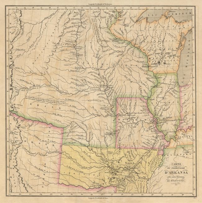
Auction 102, Lot 182
Subject: Southcentral United States, Arkansas
Buchon, Jean Alexandre
Carte Geographique, Statistique et Historique du Territoire d'Arkansas, 1825
Size: 14.2 x 14.1 inches (36.1 x 35.8 cm)
Estimate: $600 - $800
Sold for: $650
Closed on 3/5/2003
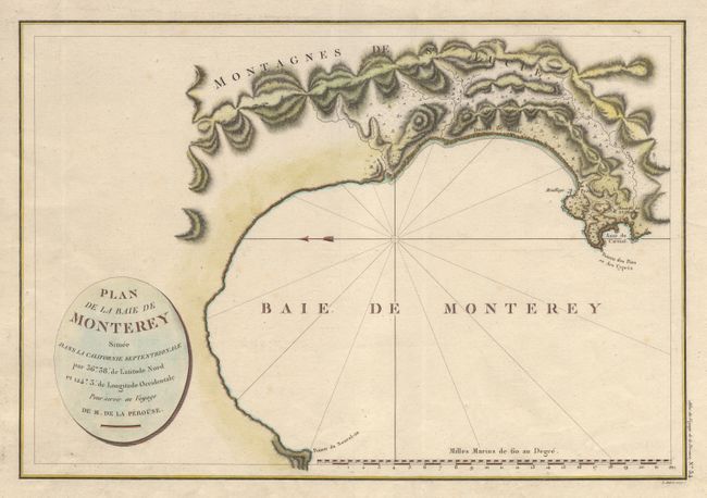
Auction 102, Lot 183
Subject: California
La Perouse, Comte Jean F. Galoup, de
Plan de la Baie de Monterey Situee dans la Calfornie Septentrionale…, 1797
Size: 19.5 x 13.2 inches (49.5 x 33.5 cm)
Estimate: $350 - $400
Sold for: $475
Closed on 3/5/2003
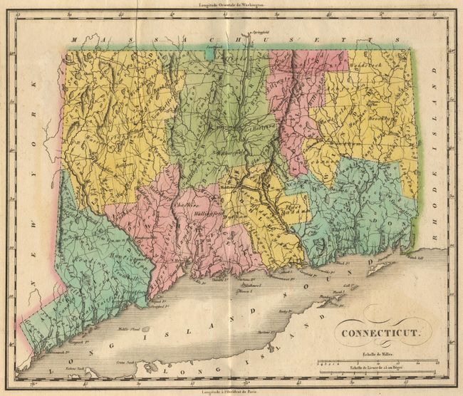
Auction 102, Lot 189
Subject: Connecticut
Buchon, Jean Alexandre
Carte Geographique, Statistique et Historique du Connecticut, 1825
Size: 11.3 x 9.5 inches (28.7 x 24.1 cm)
Estimate: $200 - $250
Unsold
Closed on 3/5/2003
144 lots
Page 1 of 3