Catalog Archive
Auction 102, Lot 28

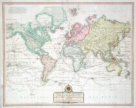
"A New Chart of the World on Wright's or Mercator's Projection in which are Exhibited All The Parts Hitherto Explored or Discovered with the Tracks of the British Circumnavigators Byron, Wallis Carteret and Cook, &c. and the Track of La Perouse…", Laurie & Whittle

Subject: World

Period: 1808 (published)

Publication: A New and Elegant Imperial Sheet Atlas…

Color: Hand Color

Size:
35.7 x 28.5 inches
90.7 x 72.4 cm
Download High Resolution Image
(or just click on image to launch the Zoom viewer)

Impressive world map showing a myriad of exploration routes with the details of their voyages and discoveries. Alaska is approximately the correct shape, New Zealand is completely mapped, and just a bit of Australia's southern coastline is incomplete. The map does not show interior political divisions but provides nice detail of the topography, major cities and regions. Title cartouche incorporates a compass rose.

References:

Condition: B

Old repairs on folds. Light offsetting, toned with pastel. Overall a visually attractive map that is rarely seen on the market.

Estimate: $1,300 - $1,500

Sold for: $850

Closed on 3/5/2003

Archived