Subject: World
Period: 1784 (published)
Publication: Petrus Conradi's Nederlandse reizen…
Color: Hand Color
Size:
18.1 x 14.6 inches
46 x 37.1 cm
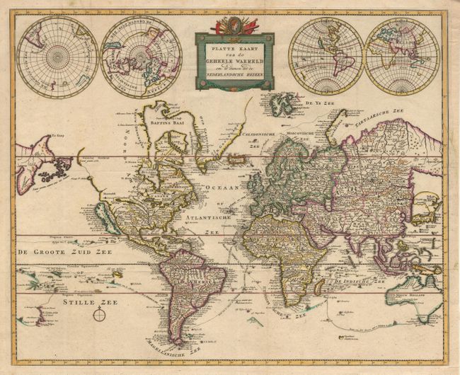
Very scarce and unusual map of the world derived from Pierre Mortier's Carte General du Monde of 1700. The map is on Mercator's projection and depicts California as an Island. The Northwest coast of North America has been updated to reflect the Russian discoveries in the region of Alaska, which is shown as a group of islands, the biggest of which is named Unamak Eil. just off the exaggerated Asian coast of Kamchatka. Japan is depicted connected to T Land van Yedso. Australia and New Zealand are only partially mapped. Numerous exploration routes are shown, with their respective discoveries, depicted with tiny ships sailing the routes. Above the map are two additional double hemispheres, including one polar projection that flank a block-style title cartouche.
References:
Condition: A+
Margin professionally extended at binding side to accommodate framing.