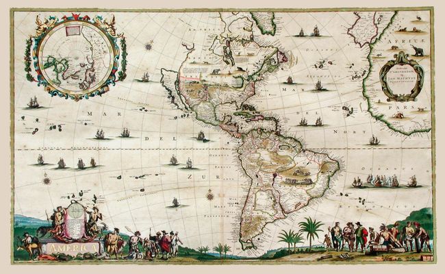
Subject: Western Hemisphere
Period: 1655 (circa)
Publication:
Color: Hand Color
Size:
37.2 x 22.6 inches
94.5 x 57.4 cm
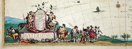
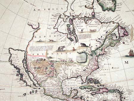
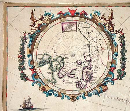
This is the first state of an Extremely Rare two-sheet map of the Americas. The splendid map appears to be based largely on Blaeu's wall map of 1648 with the distinctive single large Great Lake, an insular Staten Island off Tierra del Fuego, and a large inset of the North Pole. However, the Island of California more closely follows Nicolaas Visscher's Totius Americae Descriptio with a flat northern coastline and the mainland coastline continuing north-northeast towards the Straet Anian, which separates it from Anian. It is possible that Visscher published the map, although it is difficult to determine due to the lack of surviving examples. A fabulous scene incorporating the title cartouche and filling the bottom on the map depicts Europeans trading with Native Americans. The inset Polar map is surrounded in a strapwork and garland-draped cartouche with Mathisz' imprint contained in another cartouche. The map is further embellished with scores of animals, sailing ships, sea battles, Indian battles, a cannibalistic scene, and compass roses. According to Burden only three other copies are known to exist: Stokes Collection, NYPL; British Library; and Nederlands Scheepvaart Museum. This example is nearly identical to the example in the NYPL and appears to have been colored by the same hand.
References: Burden #313; McLaughlin #47; Pritchard & Taliaferro, plt #65.
Condition: A
Magnificent original color with extensive highlights in gold leaf. Pleasant toning with a few very insignificant spots. Expert repairs of folds in blank margins.