Catalog Archive
Auction 102, Lot 183

"Plan de la Baie de Monterey Situee dans la Calfornie Septentrionale…", La Perouse, Comte Jean F. Galoup, de
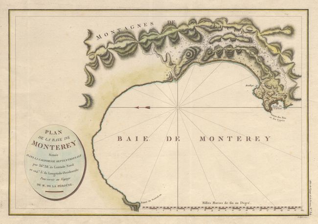
Subject: California

Period: 1797 (published)

Publication: Voyage de la Perouse autour du monde…

Color: Hand Color

Size:
19.5 x 13.2 inches
49.5 x 33.5 cm
Download High Resolution Image
(or just click on image to launch the Zoom viewer)

First French edition of this wonderful and early plan of Monterey Bay. The well engraved chart shows the town and the Mission de St. Charles, and the Presidio. Locates Mouillage, Pointe du Nouvel-an and the Montagnes de St. Lucie. Rhumb lines in the bay with north oriented to the left. A scarce map of the area.

References: Phillips (A) #688-15.

Condition: A+

On a full sheet with wide margins. Some marginal spotting, two old tissue repairs in blank left margin. Still very fine.

Estimate: $350 - $400

Sold for: $475

Closed on 3/5/2003

Archived