Catalog Archive
Auction 102, Lot 124

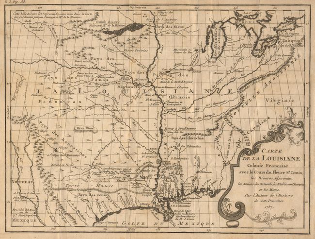
"Carte de la Louisiane Colonie Francaise avec le Cours du Fleuve St. Louis, les Rivieres Adjacentes, les Nations des Naturels, les Stablissems. Franciase et les Mines", Le Page du Pratz

Subject: Colonial Louisiana

Period: 1757 (dated)

Publication: Histoire de la Louisiane

Color: Black & White

Size:
13.2 x 10 inches
33.5 x 25.4 cm
Download High Resolution Image
(or just click on image to launch the Zoom viewer)

Uncommon map of the heart of French Louisiana covering the Mississippi River valley and extending from Santa Fe in the west to the Appalachian Mountains in the east. The Great Lakes, with Fort Detroit, are shown with numerous portages linking them to rivers flowing into the Mississippi River. West of the Mississippi is Lahontan's Grande Riviere nearly connecting with the Belle Riviere purportedly forming the long sought Northwest Passage. Numerous forts, trading posts, Indian villages and mines are located along the rivers. Title in decorative cartouche.

References:

Condition: B

Crisp impression with a bit of very faint foxing, else very good. Folds as issued with a couple of tiny separations in blank margins.

Estimate: $400 - $500

Sold for: $400

Closed on 3/5/2003

Archived