Subject: Colonial Louisiana
Period: 1730 (circa)
Publication:
Color: Hand Color
Size:
23 x 19.5 inches
58.4 x 49.5 cm
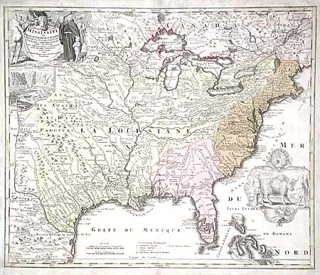
Based on Delisle's landmark map of 1718, but covering a slightly larger area. This great map focuses on the American interior and Great Lakes. Its most outstanding features are the vignettes of a buffalo and Native Americans in a cartouche filling the Atlantic and a beaver colony at Niagara Falls under the title cartouche. Also depicted (in the cartouche) is Father Louis Hennepin who explored the Great Lakes region and claimed to have reached the mouth of the Mississippi. His purported route and those of other explorers are traced on the map.
References: Cumming (SE) #170; Goss (NA) #49.
Condition: B
Light impression in cartouches. Old repairs along centerfold and margins.