Filtered by Category:United States(Show All Categories)
Showing results for:Auction 92
Catalog Archive
108 lots
Page 1 of 3
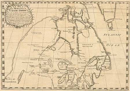
Auction 92, Lot 101
Subject: Colonial United States and Canada
La France, Joseph
A new Map of Part of North America From the Latitude of 40 to 68 Degrees. Including the late discoveries made on Board the Furnace Bomb Ketch in 1742…, 1744
Size: 19 x 13 inches (48.3 x 33 cm)
Estimate: $4,500 - $5,000
Sold for: $4,000
Closed on 9/13/2000
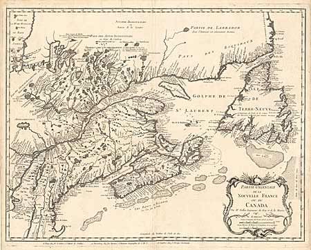
Auction 92, Lot 102
Subject: Canada
Bellin, Jacques Nicolas
Partie Orientale de la Nouvelle France ou du Canada, 1745
Size: 18.5 x 23.8 inches (47 x 60.5 cm)
Estimate: $2,200 - $2,500
Sold for: $2,750
Closed on 9/13/2000
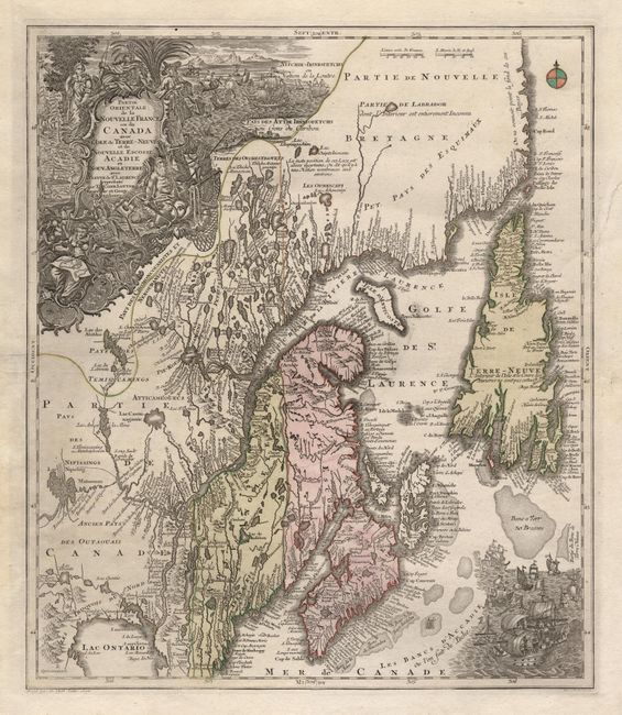
Auction 92, Lot 103
Subject: Canada
Lotter, Tobias Conrad
Partie Orientale de la Nouvelle France ou du Canada avec l'Isle de Terre-Neuve et de Nouvelle Ecosse, Acadie et Nouv. Angleterre…, 1756
Size: 19.5 x 22.7 inches (49.5 x 57.7 cm)
Estimate: $2,000 - $2,300
Sold for: $1,500
Closed on 9/13/2000
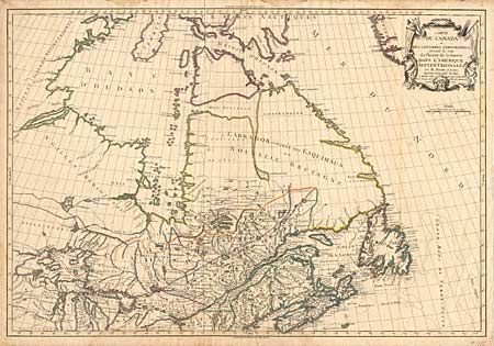
Auction 92, Lot 107
Subject: Canada and United States
Brion de la Tour, Louis
Carte du Canada et des Contrees Limitrophes, formant la suite du Theatre de al Guerre dans L'Amerique Septentrionale, 1784
Size: 29.7 x 20.2 inches (75.4 x 51.3 cm)
Estimate: $4,500 - $5,000
Sold for: $3,750
Closed on 9/13/2000
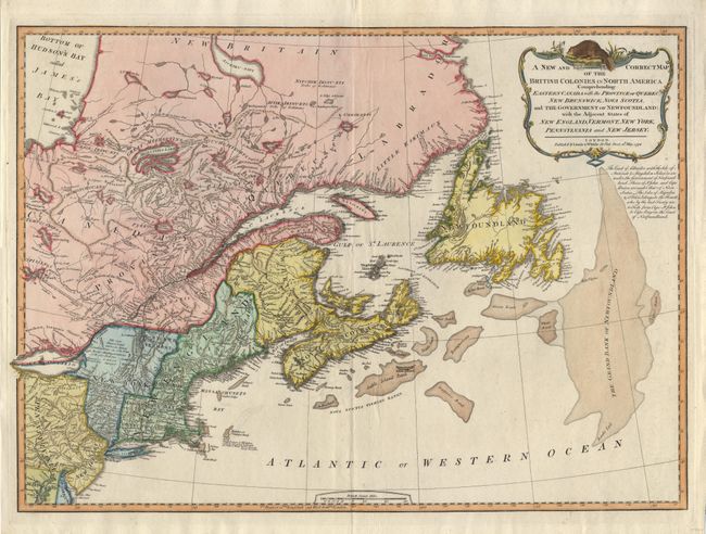
Auction 92, Lot 108
Subject: Canada and United States
Laurie & Whittle
A New and Correct Map of the British Colonies in North America Comprehending Eastern Canada with the Province of Quebec, New Brunswick, Nova Scotia, and the Government of Newfoundland: with the Adjacent States of New England, Vermont, New York…, 1794
Size: 26 x 18.8 inches (66 x 47.8 cm)
Estimate: $1,000 - $1,100
Sold for: $600
Closed on 9/13/2000
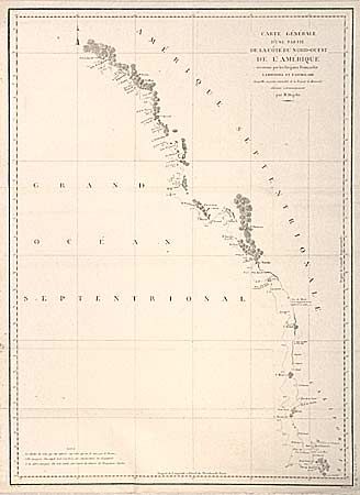
Auction 92, Lot 109
Subject: Canada and United States, Northwest
La Perouse, Comte Jean F. Galoup, de
Carte Generale d'une Partie de la Cote du Nord-Ouest de l'Amerique reconnue par les Fregates Francaises la Boussole et l'Astrolabe, 1797
Size: 19.5 x 26.7 inches (49.5 x 67.8 cm)
Estimate: $300 - $375
Sold for: $350
Closed on 9/13/2000
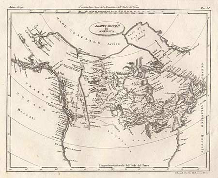
Auction 92, Lot 110
Subject: Canada and United States
Barbiellini, Carlo Antonio
Dominj Inglesi in America, 1807
Size: 9.7 x 7.8 inches (24.6 x 19.8 cm)
Estimate: $140 - $160
Sold for: $170
Closed on 9/13/2000
Auction 92, Lot 111
Subject: Canada and United States
Thomson, John
The Course of the River St Laurence, from Lake Ontario to Manicougan Point. [on sheet with] United States of America, 1817
Size: 24 x 18 inches (61 x 45.7 cm)
Estimate: $250 - $300
Sold for: $275
Closed on 9/13/2000
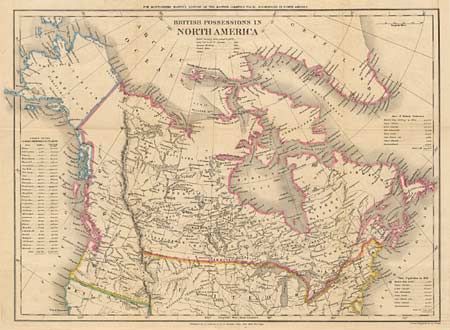
Auction 92, Lot 112
Subject: Canada and United States
Walker, J & C
British Possessions in North America, 1834
Size: 17.8 x 12.4 inches (45.2 x 31.5 cm)
Estimate: $120 - $150
Sold for: $150
Closed on 9/13/2000
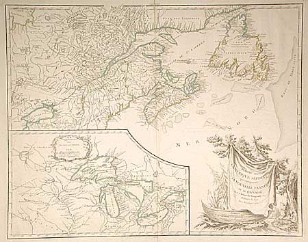
Auction 92, Lot 113
Subject: Colonial United States and Canada
Alexander, William (Sir)
[New Englande], 1625
Size: 13.4 x 9.7 inches (34 x 24.6 cm)
Estimate: $7,000 - $7,500
Sold for: $8,500
Closed on 9/13/2000
Auction 92, Lot 114
Subject: Colonial United States and Canada
Sanson, Nicolas
Le Canada, ou Nouvelle France, &c., 1656
Size: 21.5 x 15.7 inches (54.6 x 39.9 cm)
Estimate: $4,000 - $4,500
Sold for: $3,250
Closed on 9/13/2000
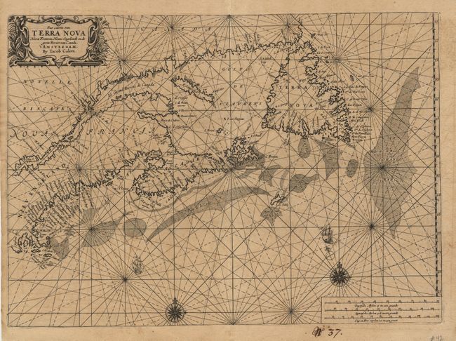
Auction 92, Lot 115
Subject: Colonial United States and Canada
Colby, Charles G.
Pascaerte von Terra Nova Nova Francia Niew Englelandt en de groote Rivier van Canada, 1663-69
Size: 20.7 x 14.8 inches (52.6 x 37.6 cm)
Estimate: $6,000 - $6,500
Sold for: $4,750
Closed on 9/13/2000
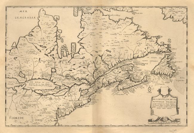
Auction 92, Lot 116
Subject: Colonial United States and Canada
Boisseau, Jean
Description de la Nouvelle France ou sont remarquees les diverse habitations des Francois, depuis la premiere descouvert jusques a present, recueillie et dressee sur diverses relations modernes, 1664
Size: 20.5 x 13.5 inches (52.1 x 34.3 cm)
Estimate: $12,000 - $14,000
Sold for: $9,250
Closed on 9/13/2000
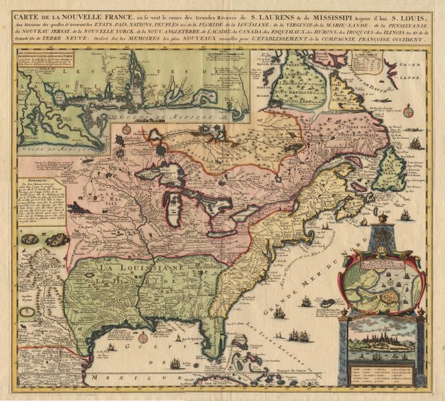
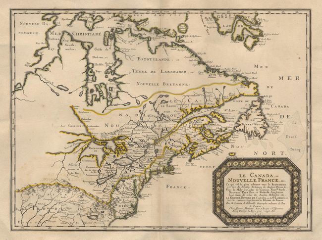
Auction 92, Lot 117
Subject: Colonial United States and Canada
Ottens/De Fer
Carte de la Nouvelle France, ou se voit le cours des Grandes Rivieres de S. Laurens & de Mississipi, Aujour d'hui S. Louis…, 1719
Size: 21.5 x 19.2 inches (54.6 x 48.8 cm)
Estimate: $2,750 - $3,250
Sold for: $2,000
Closed on 9/13/2000
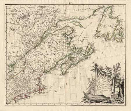
Auction 92, Lot 118
Subject: Colonial United States and Canada
D'Anville/Santini
Partie Orientale du Canada, avec la Nouvelle Angleterre, l'Acadie, et la Terre-Neuve, 1776
Size: 22.7 x 19 inches (57.7 x 48.3 cm)
Estimate: $650 - $750
Sold for: $650
Closed on 9/13/2000
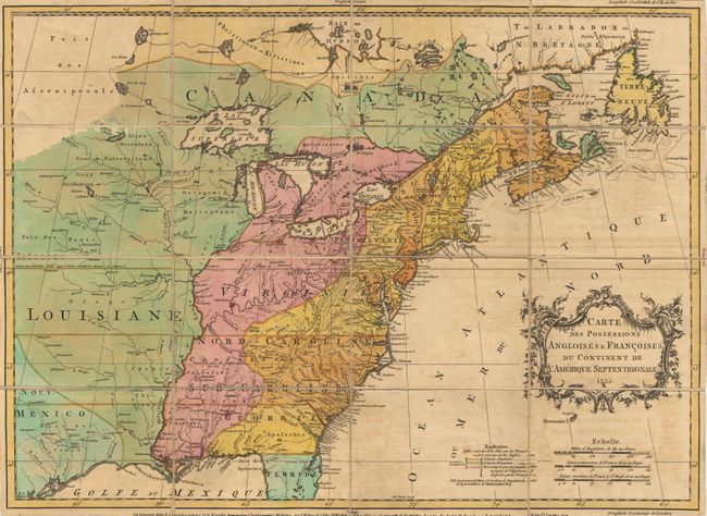
Auction 92, Lot 119
Subject: Colonial United States and Canada
Palairet, Jean
Carte des Possessions Angloises & Francoises du Continent de l'Amerique Septentrionale, 1755
Size: 23 x 16.5 inches (58.4 x 41.9 cm)
Estimate: $7,000 - $7,500
Sold for: $6,000
Closed on 9/13/2000
Auction 92, Lot 120
Subject: Colonial United States and Canada
Robert de Vaugondy, Didier
Partie de l'Amerique Septent? qui comprend la Nouvelle France ou le Canada, 1778
Size: 23.7 x 18.8 inches (60.2 x 47.8 cm)
Estimate: $750 - $850
Sold for: $550
Closed on 9/13/2000
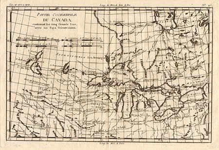
Auction 92, Lot 121
Subject: Colonial United States and Canada
Bonne, Rigobert
Partie Occidentale du Canada, contenant les cinq Grands Lacs, avec les Pays Circonvoisins, 1790
Size: 12.5 x 8.7 inches (31.8 x 22.1 cm)
Estimate: $220 - $250
Sold for: $300
Closed on 9/13/2000
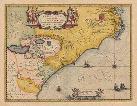
Auction 92, Lot 122
Subject: Colonial United States
Blaeu, Willem
Virginiae partis australis, et Floridae partis orientalis, interjacentiumq regionum Nova Descriptio, 1640
Size: 19.8 x 15.1 inches (50.3 x 38.4 cm)
Estimate: $1,700 - $1,800
Sold for: $2,000
Closed on 9/13/2000
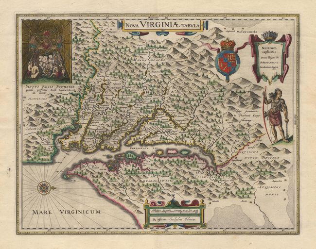
Auction 92, Lot 123
Subject: Colonial United States
Hondius/Blaeu
Nova Virginiae Tabula, 1640-55
Size: 18.7 x 14.7 inches (47.5 x 37.3 cm)
Estimate: $2,500 - $2,800
Sold for: $1,900
Closed on 9/13/2000
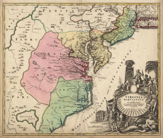
Auction 92, Lot 124
Subject: Colonial United States
Homann, Johann Baptist
Virginia Marylandia et Carolina in America Septentrionali Britannorum industria excultae, 1730
Size: 23 x 19.3 inches (58.4 x 49 cm)
Estimate: $1,800 - $1,900
Sold for: $1,900
Closed on 9/13/2000
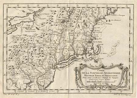
Auction 92, Lot 125
Subject: Colonial New England and Mid-Atlantic
Bellin, Jacques Nicolas
Carte de la Nouvelle Angleterre, Nouvelle Yorck et Pensilvanie, 1757
Size: 11.7 x 8 inches (29.7 x 20.3 cm)
Estimate: $400 - $500
Sold for: $650
Closed on 9/13/2000
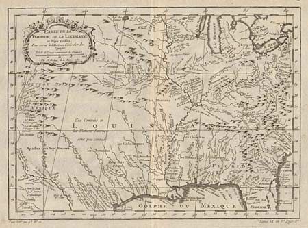
Auction 92, Lot 126
Subject: Colonial South Central United States
Bellin, Jacques Nicolas
Carte de la Floride, de la Louisiane et Pays Voisins, 1757
Size: 12 x 8.6 inches (30.5 x 21.8 cm)
Estimate: $400 - $450
Sold for: $600
Closed on 9/13/2000
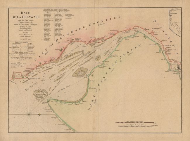
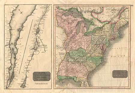
Auction 92, Lot 127
Subject: Colonial United States
Le Rouge, George Louis
Bay de la Delaware Avec les Ports, Sondes, Dangers, Bancs. &c. depuis les Caps, Jusqu'q Philadelphie de'Apres la Carte de Joshua Fisher publiee a Philadelphie, 1777
Size: 25 x 18.2 inches (63.5 x 46.2 cm)
Estimate: $4,000 - $4,200
Unsold
Closed on 9/13/2000
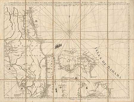
Auction 92, Lot 128
Subject: Colonial United States
Le Rouge, George Louis
Carte de la Floride Occidentale et Louisiana [together with] La Peninsule et Golfe de la Floride ou Canal de Bahama avec les Isles de Bahama, Traduit de Gefferys, 1777
Size: 26.2 x 20 inches (66.5 x 50.8 cm)
Estimate: $2,500 - $3,500
Sold for: $1,300
Closed on 9/13/2000
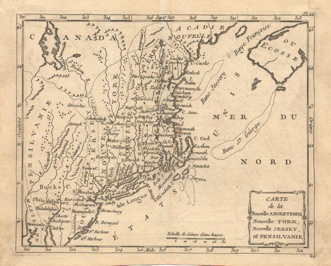
Auction 92, Lot 129
Subject: Colonial New England
Laporte, Joseph de
Carte de la Nouvelle Angleterre, Nouvelle York, Nouvelle Jersey et Pensilvanie, 1780
Size: 8.7 x 7 inches (22.1 x 17.8 cm)
Estimate: $275 - $325
Sold for: $240
Closed on 9/13/2000
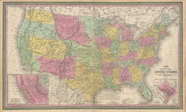
Auction 92, Lot 130
Subject: United States
Thomas, Cowperthwait & Co.
A New Map of the United States of America by J.H. Young, 1850
Size: 26.5 x 15.7 inches (67.3 x 39.9 cm)
Estimate: $475 - $550
Sold for: $600
Closed on 9/13/2000
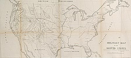
Auction 92, Lot 131
Subject: United States
U.S. Government
Military Map of the United States, 1857
Size: 29.3 x 13.5 inches (74.4 x 34.3 cm)
Estimate: $220 - $250
Sold for: $160
Closed on 9/13/2000
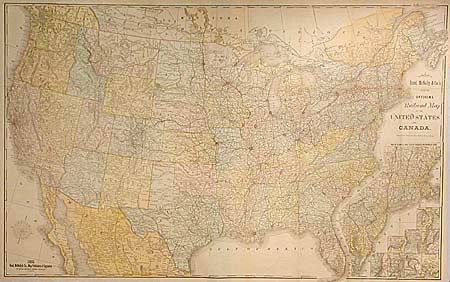
Auction 92, Lot 132
Subject: United States
Rand McNally & Co.
New Official Railroad Map of the United States and Canada, 1885
Size: 42.5 x 26.5 inches (108 x 67.3 cm)
Estimate: $250 - $350
Sold for: $425
Closed on 9/13/2000
Auction 92, Lot 133
Subject: United States
Cram, George F. & Company
[Lot of 3 maps], 1891
Size: 24 x 10.5 inches (61 x 26.7 cm)
Estimate: $90 - $120
Sold for: $70
Closed on 9/13/2000
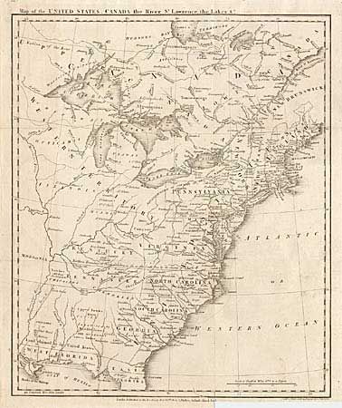
Auction 92, Lot 134
Subject: Eastern United States
Anon.
Map of the United States, Canada the River St. Lawrence, the Lakes &c., 1801
Size: 13.2 x 16 inches (33.5 x 40.6 cm)
Estimate: $600 - $700
Sold for: $1,200
Closed on 9/13/2000
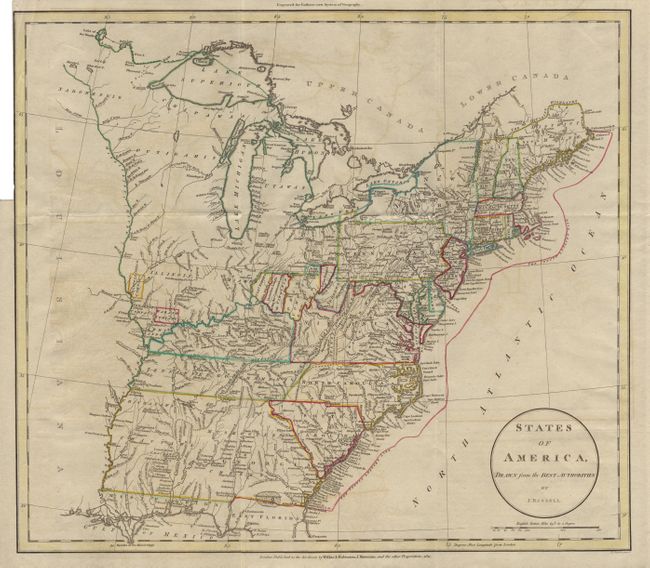
Auction 92, Lot 135
Subject: Eastern United States
Russell, John C.
States of America, Drawn from the Best Authorities, 1811
Size: 17.7 x 15.5 inches (45 x 39.4 cm)
Estimate: $550 - $600
Sold for: $700
Closed on 9/13/2000
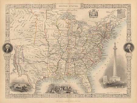
Auction 92, Lot 136
Subject: Eastern United States
Tallis, John
United States, 1851
Size: 13.5 x 10 inches (34.3 x 25.4 cm)
Estimate: $300 - $350
Sold for: $500
Closed on 9/13/2000
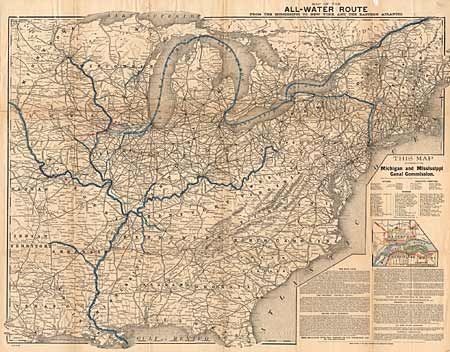
Auction 92, Lot 137
Subject: Eastern United States
Rand McNally & Co.
Map of All-Water Route from the Mississippi to New York and the Eastern Atlantic, 1885
Size: 27 x 20 inches (68.6 x 50.8 cm)
Estimate: $120 - $150
Sold for: $160
Closed on 9/13/2000
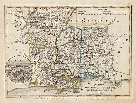
Auction 92, Lot 138
Subject: Southern United States
Meyer, Joseph
Die Staaten von Arkansas, Mississippi, Louisiana & Alabama, 1853
Size: 10.5 x 7.8 inches (26.7 x 19.8 cm)
Estimate: $50 - $60
Sold for: $75
Closed on 9/13/2000
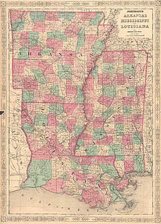
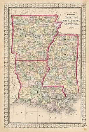
Auction 92, Lot 139
Subject: Southern United States
County Map of the States of Arkansas, Mississippi & Louisiana [together with] Arkansas, Mississippi and Louisiana, 1864-72
Size: 13.7 x 20.7 inches (34.8 x 52.6 cm)
Estimate: $60 - $80
Sold for: $160
Closed on 9/13/2000
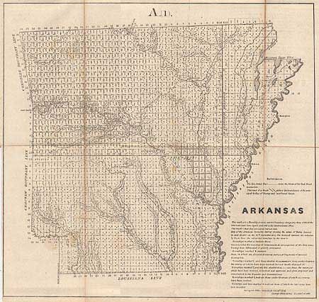
Auction 92, Lot 140
Subject: Southern United States
Mitchell, S. A.
County Map of the States of Arkansas, Mississippi and Louisiana, 1874
Size: 14 x 21 inches (35.6 x 53.3 cm)
Estimate: $70 - $90
Sold for: $95
Closed on 9/13/2000
Auction 92, Lot 141
Subject: Central United States
Lot of 3 maps; Micigan, Iowa & Arkansas, 1854
Size: See Description
Estimate: $40 - $50
Sold for: $65
Closed on 9/13/2000
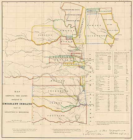
Auction 92, Lot 142
Subject: Central United States
U.S. War Dept.
Map Showing the Lands assigned to Emigrant Indians West of Arkansas & Missouri, 1860
Size: 17.7 x 18.7 inches (45 x 47.5 cm)
Estimate: $375 - $425
Sold for: $200
Closed on 9/13/2000
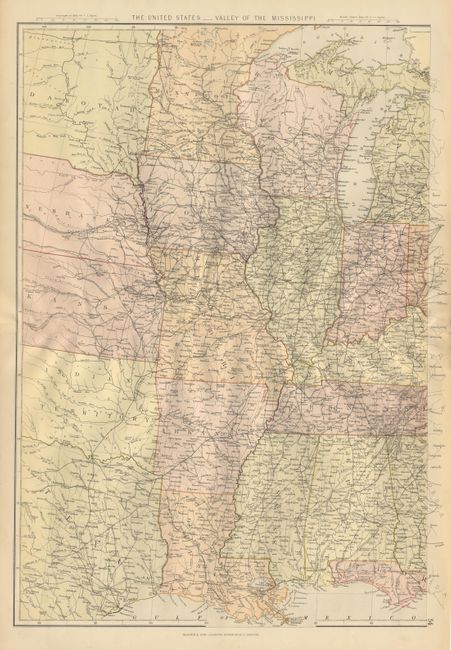
Auction 92, Lot 143
Subject: Central United States
Blackie, W. G. & Son
The United States - Valley of the Mississippi, 1880
Size: 13.5 x 19.5 inches (34.3 x 49.5 cm)
Estimate: $50 - $70
Sold for: $90
Closed on 9/13/2000
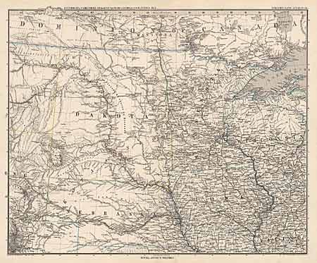
Auction 92, Lot 144
Subject: North-central United States
Petermann, Augustus Herman
[Dakota Territory], 1880
Size: 16 x 13 inches (40.6 x 33 cm)
Estimate: $60 - $80
Sold for: $0
Closed on 9/13/2000
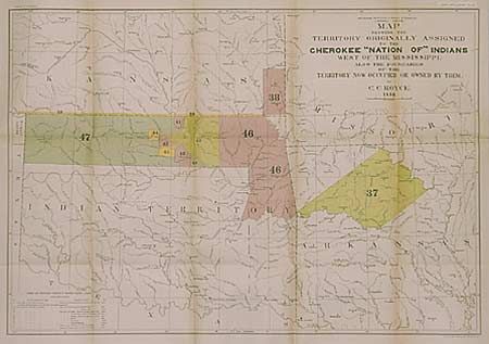
Auction 92, Lot 145
Subject: Southern United States
Royce, C. C.
Map of the Former Territorial Limits of the Cherokee Nation of Indians… [together with] Map showing the Territory Originally Assigned to the Cherokee Nation of Indians West of the Mississippi…, 1884
Size: See Description
Estimate: $300 - $350
Sold for: $300
Closed on 9/13/2000
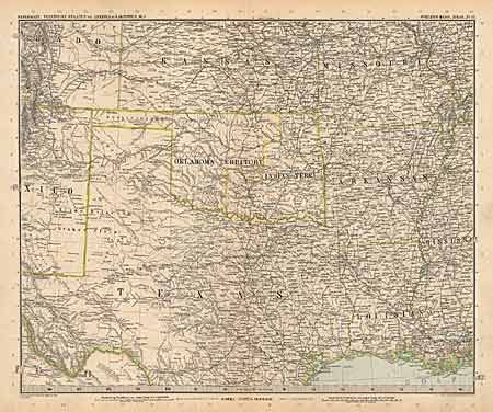
Auction 92, Lot 146
Subject: South-central United States
Petermann, Augustus Herman
[South-central United States], 1887
Size: 16 x 13 inches (40.6 x 33 cm)
Estimate: $70 - $90
Sold for: $55
Closed on 9/13/2000
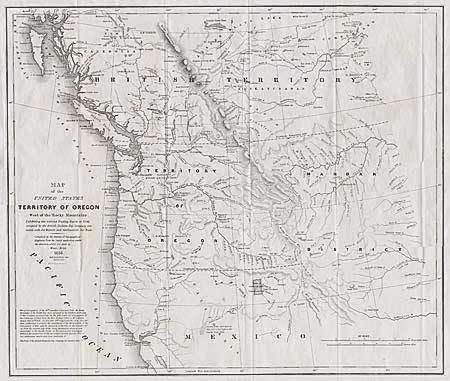
Auction 92, Lot 147
Subject: Pacific Northwest
Abert/Hood
Map of the United States Territory of Oregon West of the Rocky Mountains Exhibiting the various Trading Depots or Forts occupied by the British Hudson Bay Company connected with the Western and Northwestern Fur Trade., 1838
Size: 20.4 x 17.5 inches (51.8 x 44.5 cm)
Estimate: $400 - $475
Sold for: $400
Closed on 9/13/2000
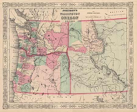
Auction 92, Lot 148
Subject: Pacific Northwest
Johnson & Ward
Johnson's Washington, Oregon and Idaho, 1863
Size: 15.5 x 12.5 inches (39.4 x 31.8 cm)
Estimate: $70 - $100
Sold for: $160
Closed on 9/13/2000
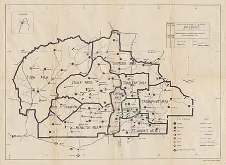
Auction 92, Lot 149
Subject: Southwestern United States
U.S. Bureau of Indian Affairs
Navajo Reservation - Educational Facilities - Arizona - New Mexico - Utah, 1954
Size: 25.5 x 18.2 inches (64.8 x 46.2 cm)
Estimate: $40 - $60
Sold for: $20
Closed on 9/13/2000
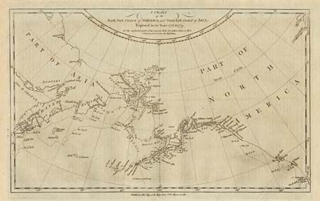
Auction 92, Lot 150
Subject: Alaska
Hogg, Alexander
A Chart of the North West Coast of America and North East Coast of Asia…, 1786
Size: 14 x 8.5 inches (35.6 x 21.6 cm)
Estimate: $150 - $180
Sold for: $170
Closed on 9/13/2000
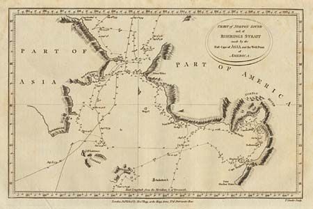
Auction 92, Lot 151
Subject: Alaska
Hogg, Alexander
Chart of Norton Sound and of Bherings Strait…, 1786
Size: 8.2 x 12.7 inches (20.8 x 32.3 cm)
Estimate: $80 - $100
Sold for: $120
Closed on 9/13/2000
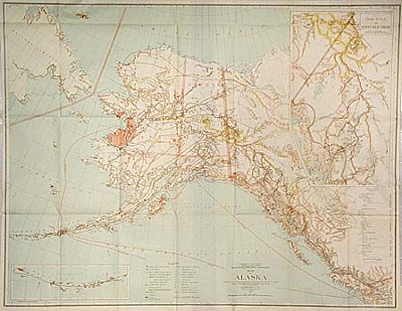
Auction 92, Lot 152
Subject: Alaska
General Land Office
Map of Alaska, 1898
Size: 32 x 24.7 inches (81.3 x 62.7 cm)
Estimate: $100 - $130
Sold for: $160
Closed on 9/13/2000
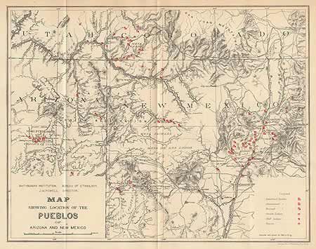
Auction 92, Lot 153
Subject: Hopi Reservation, Arizona
U.S. Bureau of Ethnology
Map of the Province of Tusayan, Arizona Surveyed by A.L. Webster, 1881 [together with] Map Showing the Location of the Pueblos of Arizona and New Mexico, 1881
Size: 11 x 8 inches (27.9 x 20.3 cm)
Estimate: $60 - $80
Sold for: $325
Closed on 9/13/2000
108 lots
Page 1 of 3