Subject: Eastern United States
Period: 1811 (dated)
Publication: Guthrie's New System of Geography
Color: Hand Color
Size:
17.7 x 15.5 inches
45 x 39.4 cm
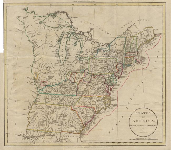
A handsome and fascinating map detailing states and Indian lands east of the Mississippi River from northern Florida to Canada. Tracts of land in southern Ohio are labeled "Seven Ranges, Army Lands, Ohio Company, and Donation Lands from the Commonwealth of Virginia". Other interesting designations west of there bear the labels "Illinois Company, Wabash Company, New Jersy Company and Col. Simmes". South of the Ohio River, in present-day West Virginia, is land of the "Indiana Land Company". "The Twenty Leagues Line" is drawn in the coastal Atlantic. The newly formed Tennessee Government is outlined, and Georgia's western boundary is the Mississippi River. Various tribes are indicated throughout.
References:
Condition: A
Trimmed nearly neatline at binding side, as issued. Very faint offsetting, but a fine crisp impression with original color.