Subject: Colonial United States and Canada
Period: 1719 (circa)
Publication:
Color: Hand Color
Size:
21.5 x 19.2 inches
54.6 x 48.8 cm
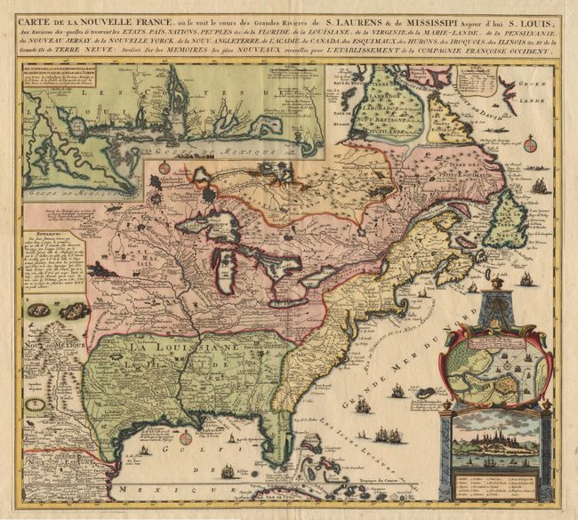
This is the Ottens version of the De Fer map. It is a very handsome map and represents the most informative map of French possessions in North America in the early 18th century. Inset with very decorative cartouche style plan and view of Quebec (in full color). Louisiana and the Mississippi valley are based on De l'Isle's manuscript map of 1701. The geography of New England and Eastern Canada originates with Franquelin. Inset at top left is a large scale map of the Mississippi delta and Mobile Bay, based on the voyage of Pierre Le Moyne d'Iberville. The map is filled with wildlife, scenes of Indians hunting, Indian villages and notations, and the oceans are embellished with numerous ships, canoes and sea monsters.
References:
Condition: A+
Filled worm tracks in margins, well away from image, otherwise fine condition and impression.