Catalog Archive
Auction 92, Lot 137

"Map of All-Water Route from the Mississippi to New York and the Eastern Atlantic", Rand McNally & Co.

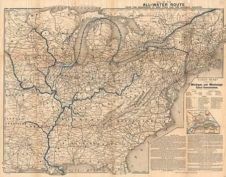
Subject: Eastern United States

Period: 1885 (circa)

Publication:

Color: Hand Color

Size:
27 x 20 inches
68.6 x 50.8 cm
Download High Resolution Image
(or just click on image to launch the Zoom viewer)

Published for the Michigan and Mississippi Canal Commission, the map highlights the importance of the construction of the Hennepin Canal. The canal would provide a 75 mile water connection from Hennepin, Illinois to Rock Island on the Mississippi River and would allow a straight cargo route without having to break up the shipment for overland transport. It was conceived in 1834, and after numerous delays, the canal system was built between 1890 and 1907. In addition to the canal information, this map has a wealth of information concerning roads and railways.

References:

Condition: A

Issued folding, and now pressed and backed with Japanese tissue.

Estimate: $120 - $150

Sold for: $160

Closed on 9/13/2000

Archived