Filtered by Category:United States(Show All Categories)
Showing results for:Auction 183
Catalog Archive
175 lots
Page 1 of 4
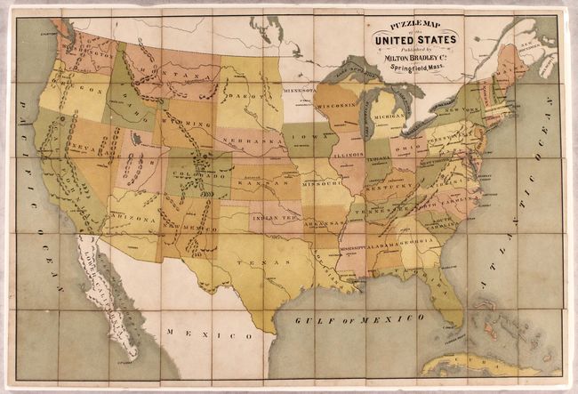
Auction 183, Lot 38
Subject: Cartographic Miscellany, United States Puzzle
Milton Bradley Co.
Puzzle Map of the United States, 1880
Size: 20.1 x 13.4 inches (51.1 x 34 cm)
Estimate: $200 - $230
Unsold
Closed on 6/9/2021
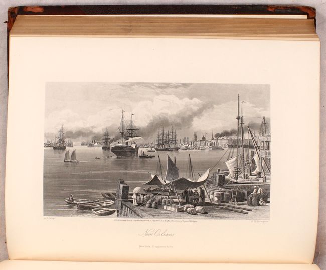
Auction 183, Lot 83
Subject: United States & Canada
Bryant, William C.
[2 Volumes] Picturesque America; or, the Land We Live In..., 1872-74
Size: 10.3 x 13 inches (26.2 x 33 cm)
Estimate: $400 - $475
Sold for: $500
Closed on 6/9/2021
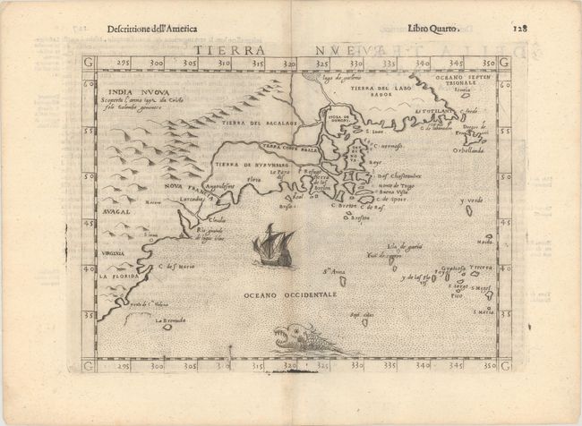
Auction 183, Lot 84
Subject: Eastern United States & Canada
Ruscelli, Girolamo
Tierra Nueva, 1598
Size: 9.6 x 7 inches (24.4 x 17.8 cm)
Estimate: $1,100 - $1,400
Ruscelli's Map of the East Coast
Sold for: $850
Closed on 6/9/2021
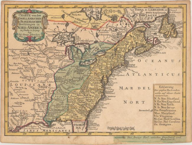
Auction 183, Lot 85
Subject: Colonial Eastern United States & Canada
Schreiber, Johann Georg
Charte von dem Engellaendischen u. Franzoesischen Besitzungen in Nord America..., 1753
Size: 9.4 x 6.9 inches (23.9 x 17.5 cm)
Estimate: $350 - $425
Sold for: $500
Closed on 6/9/2021
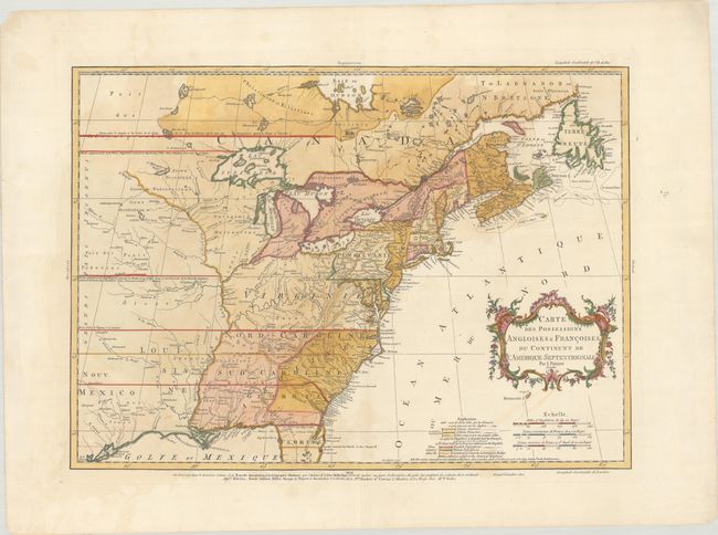
Auction 183, Lot 86
Subject: Colonial Eastern United States & Canada
Palairet, Jean
Carte des Possessions Angloises & Francoises du Continent de l'Amerique Septentrionale, 1756
Size: 22.8 x 16.3 inches (57.9 x 41.4 cm)
Estimate: $2,200 - $2,500
Important Map of French and English Territorial Claims at the Outset of the French & Indian War
Sold for: $2,000
Closed on 6/9/2021
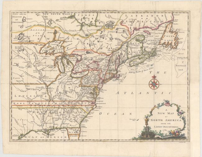
Auction 183, Lot 87
Subject: Colonial Eastern United States & Canada
Spilsbury, J.
A New Map of North America from the Latest Discoveries, 1761
Size: 14.9 x 10.8 inches (37.8 x 27.4 cm)
Estimate: $600 - $750
Sold for: $650
Closed on 6/9/2021
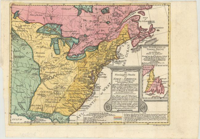
Auction 183, Lot 88
Subject: Eastern United States & Canada
Sotzmann, Daniel Friedrich
Die Vereinigten Staaten von Nord-America. Nach der von Wm. Faden 1783 herausgegebenen Charte / Les Etats Unis de l'Amerique Septentrionale d'Apres la Carte de Wm. Faden Publiee a Londres en 1783..., 1785
Size: 10 x 7.6 inches (25.4 x 19.3 cm)
Estimate: $650 - $800
Rare, Multi-Lingual Reduced Version of Faden's Map of 1783
Sold for: $475
Closed on 6/9/2021
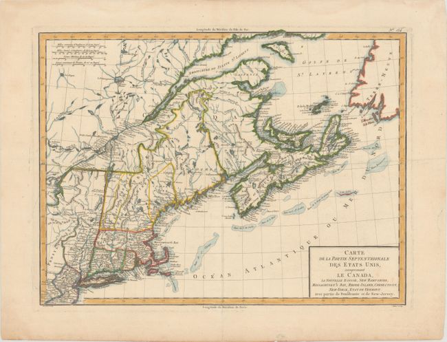
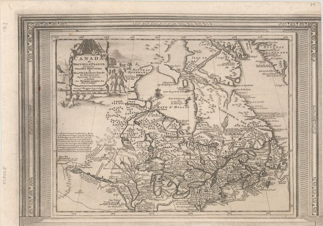
Auction 183, Lot 89
Subject: Northeastern United States & Canada
Tardieu, Pierre Francois
Carte de la Partie Septentrionale des Etats Unis, Comprenant le Canada, la Nouvelle Ecosse, New Hampshire, Massachuset's Bay, Rhode-Island, Connecticut, New-Yorck, Etat de Vermont avec Partie de Pensilvanie et de New-Jersey, 1797
Size: 16.8 x 12.6 inches (42.7 x 32 cm)
Estimate: $180 - $220
Sold for: $325
Closed on 6/9/2021
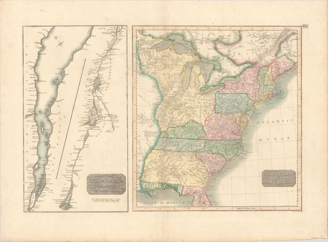
Auction 183, Lot 90
Subject: Eastern United States & Canada, St. Lawrence River
Thomson, John
United States of America [on sheet with] The Course of the River St. Laurence, from Lake Ontario, to Manicouagan Point, 1815
Size: 24 x 15.9 inches (61 x 40.4 cm)
Estimate: $200 - $230
Sold for: $150
Closed on 6/9/2021
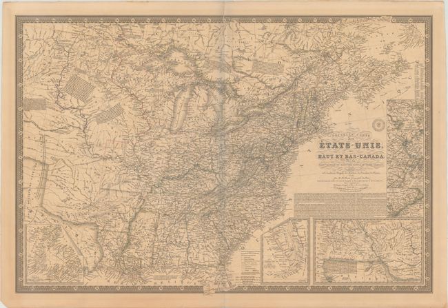
Auction 183, Lot 91
Subject: Eastern United States & Canada
Brue, Adrien Hubert
Nouvelle Carte des Etats-Unis, des Haut et Bas-Canada, de la Nouvle.-Ecosse, du Nouvau Brunswick, de Terre-Neuve &a..., 1836
Size: 36.5 x 24.8 inches (92.7 x 63 cm)
Estimate: $450 - $550
Sold for: $550
Closed on 6/9/2021
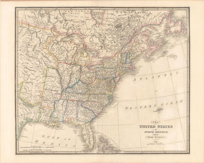
Auction 183, Lot 92
Subject: Eastern United States & Canada
Wyld, James
The United States of North America, with the British Territories, 1838
Size: 25 x 21.1 inches (63.5 x 53.6 cm)
Estimate: $450 - $550
Sold for: $400
Closed on 6/9/2021
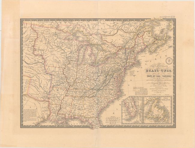
Auction 183, Lot 93
Subject: Eastern United States & Canada
Brue, Adrien Hubert
Carte Generale des Etats-Unis, des Haut et Bas-Canada, de la Nouvle. Ecosse, du Nouvau. Brunswick, de Terre-Neuve, &a. Seconde Edition, 1840
Size: 20.3 x 14.8 inches (51.6 x 37.6 cm)
Estimate: $180 - $220
Sold for: $130
Closed on 6/9/2021
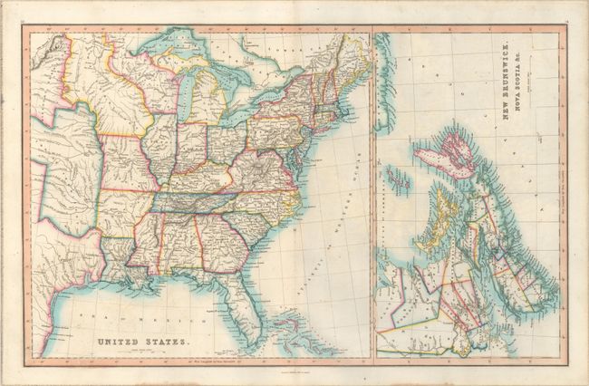
Auction 183, Lot 94
Subject: Eastern United States & Canada
Smith & Son
United States [on sheet with] New Brunswick, Nova Scotia &c., 1846
Size: 22.5 x 14.1 inches (57.2 x 35.8 cm)
Estimate: $160 - $190
Sold for: $170
Closed on 6/9/2021
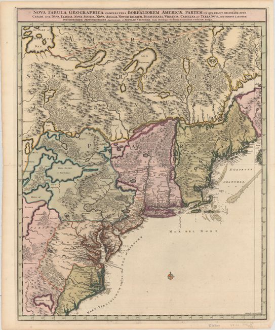
Auction 183, Lot 95
Subject: Colonial Northeastern United States & Canada
Visscher, Nicolas
Nova Tabula Geographica Complectens Borealiorem Americae Partem; in qua Exacte Delineatae sunt Canada sive Nova Francia, Nova Scotia, Nova Anglia, Novum Belgium, Pensylvania, Virginia..., 1696
Size: 18.5 x 23.3 inches (47 x 59.2 cm)
Estimate: $1,600 - $1,900
Sold for: $1,075
Closed on 6/9/2021
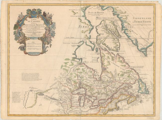
Auction 183, Lot 96
Subject: Colonial Northeastern United States & Canada, Great Lakes
Delisle, Guillaume
Carte du Canada ou de la Nouvelle France et des Decouvertes qui y ont ete Faites Dressee sur Plusieurs Observations et sur un Grand Nombre de Relations Imprimees ou Manuscrites..., 1703
Size: 25.6 x 19.6 inches (65 x 49.8 cm)
Estimate: $1,600 - $1,900
Delisle's Seminal Map of Canada and the Great Lakes
Sold for: $1,400
Closed on 6/9/2021
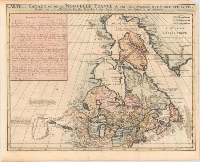
Auction 183, Lot 97
Subject: Colonial Northeastern United States & Canada
Chatelain, Henry Abraham
Carte du Canada ou de la Nouvelle France, & des Decouvertes qui y ont ete Faites, Dressee sur les Observations les Plus Nouvelles, & sur Divers Memoires tant Manuscrits qu' Imprimez, 1719
Size: 20.5 x 16.1 inches (52.1 x 40.9 cm)
Estimate: $550 - $700
Sold for: $400
Closed on 6/9/2021
Auction 183, Lot 98
Subject: Colonial Northeastern United States & Canada
Aa, Pieter van der
Canada ou Nouvelle France, Suivant les Nouvelles Observations de Messrs. de l'Academie Royale des Sciences, Etc., 1730
Size: 14.9 x 10.4 inches (37.8 x 26.4 cm)
Estimate: $450 - $550
Unusual Picture-Frame Style Border
Sold for: $300
Closed on 6/9/2021
Auction 183, Lot 99
Subject: Colonial Great Lakes
Bellin/Homann Heirs
Partie Occidentale de la Nouvelle France ou du Canada, 1755
Size: 21.4 x 16.8 inches (54.4 x 42.7 cm)
Estimate: $1,400 - $1,700
Influential Map of the Great Lakes
Sold for: $1,200
Closed on 6/9/2021
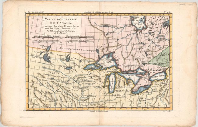
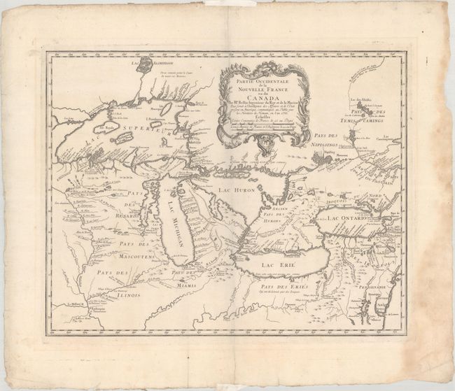
Auction 183, Lot 100
Subject: Colonial Great Lakes
Bonne, Rigobert
Partie Occidentale du Canada, Contenant les Cinq Grands Lacs, avec les Pays Circonvoisins, 1775
Size: 12.6 x 8.3 inches (32 x 21.1 cm)
Estimate: $200 - $230
Sold for: $150
Closed on 6/9/2021
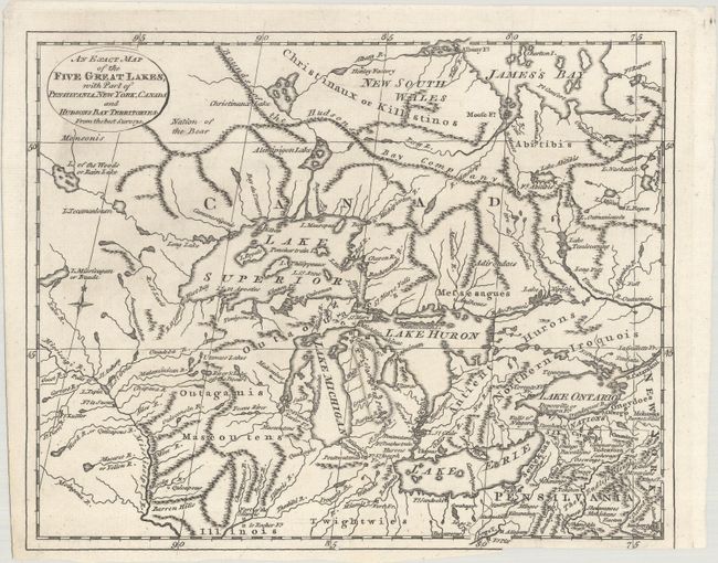
Auction 183, Lot 101
Subject: Colonial Great Lakes, Canada
Lodge, John
An Exact Map of the Five Great Lakes, with Part of Pensilvania, New York, Canada and Hudsons Bay Territories. From the Best Surveys, 1778
Size: 10.1 x 8.1 inches (25.7 x 20.6 cm)
Estimate: $300 - $375
Sold for: $220
Closed on 6/9/2021
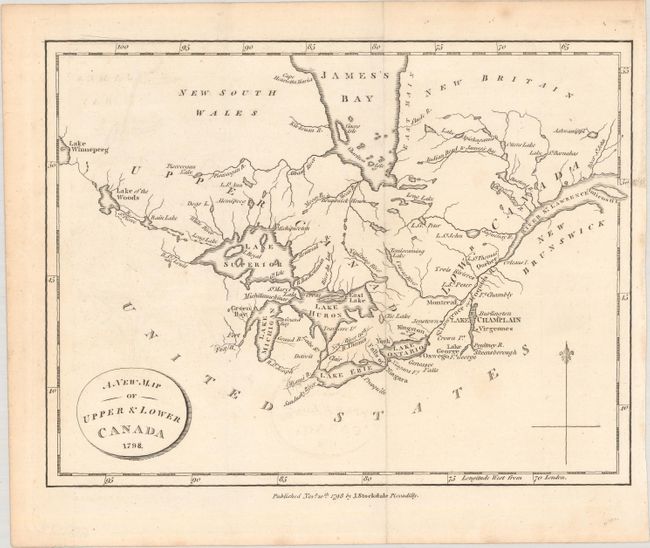
Auction 183, Lot 102
Subject: Great Lakes, Canada
Weld, Isaac
A New Map of Upper & Lower Canada, 1798
Size: 8.9 x 6.8 inches (22.6 x 17.3 cm)
Estimate: $120 - $150
Sold for: $60
Closed on 6/9/2021
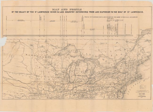
Auction 183, Lot 103
Subject: Great Lakes, St. Lawrence River
Disturnell, John
[Map with Book] Map and Profile of the Valley of the St. Lawrence River & Lake Country Extending from Lake Superior to the Gulf of St. Lawrence [with] A Trip Through the Lakes of North America..., 1857
Size: 30.4 x 19.1 inches (77.2 x 48.5 cm)
Estimate: $160 - $190
Sold for: $120
Closed on 6/9/2021
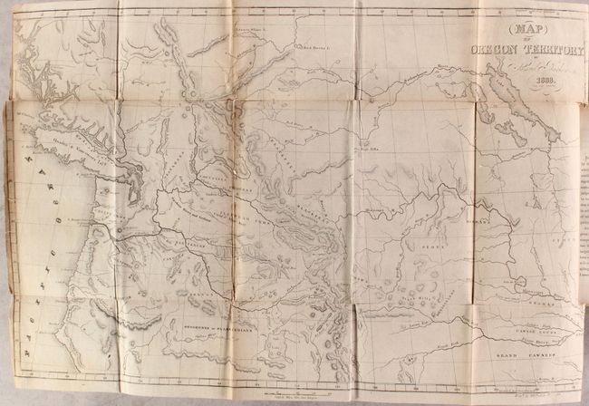
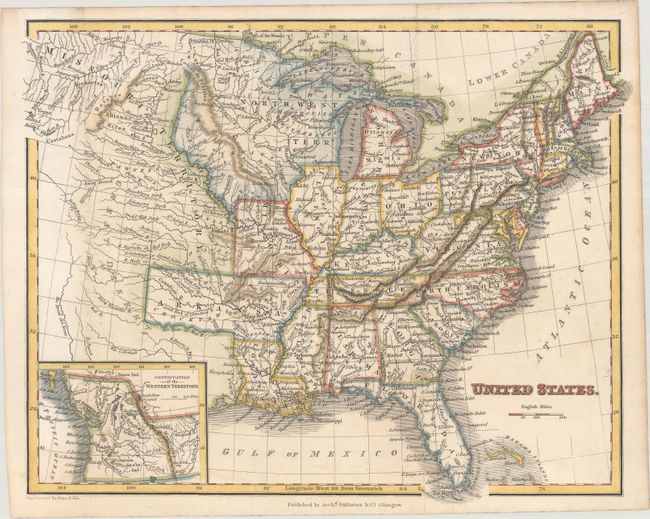
Auction 183, Lot 104
Subject: Western United States & Canada
Parker, Samuel (Rev.)
[Map in Book] Map of Oregon Territory [in] Journal of an Exploring Tour Beyond the Rocky Mountains... , 1842
Size: 22 x 14 inches (55.9 x 35.6 cm)
Estimate: $550 - $700
Sold for: $400
Closed on 6/9/2021
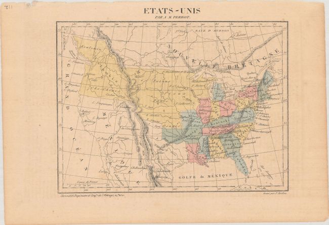
Auction 183, Lot 105
Subject: United States
[Lot of 2] Etats-Unis [and] Etats-Unis, 1821-41
Size: See Description
Estimate: $220 - $250
Sold for: $160
Closed on 6/9/2021
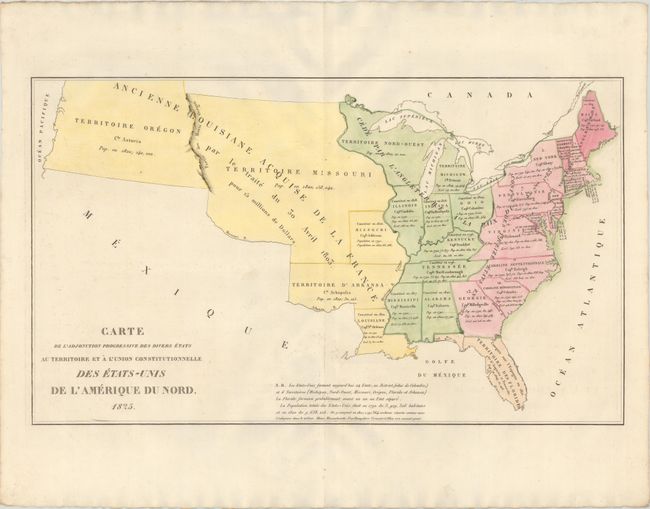
Auction 183, Lot 106
Subject: United States
Buchon, Jean Alexandre
Carte de l'Adjonction Progressive des Divers Etats au Territoire et a l'Union Constitutionnelle des Etats-Unis de l'Amerique du Nord, 1825
Size: 25.1 x 14.7 inches (63.8 x 37.3 cm)
Estimate: $220 - $250
Sold for: $350
Closed on 6/9/2021
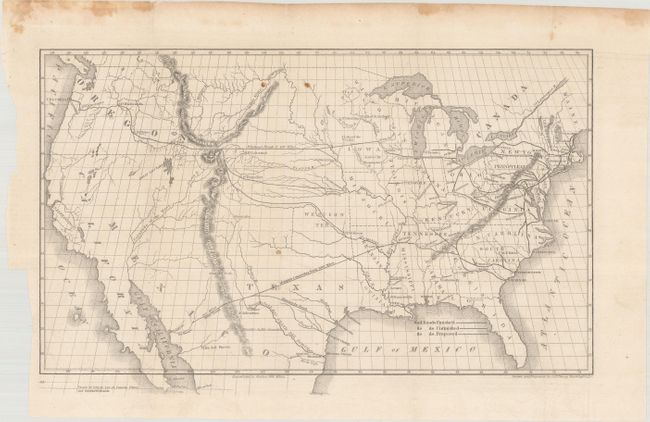
Auction 183, Lot 107
Subject: United States, Railroads
Throop, O. H.
[Untitled - Map of Proposed Routes of Western Railroads], 1846
Size: 15.9 x 10 inches (40.4 x 25.4 cm)
Estimate: $160 - $190
Sold for: $120
Closed on 6/9/2021
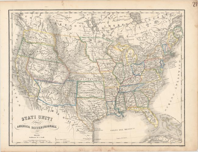
Auction 183, Lot 108
Subject: United States
[Lot of 2] Stati Uniti dell' America Settentrionale [and] United States North America, 1854-58
Size: See Description
Estimate: $200 - $230
Sold for: $150
Closed on 6/9/2021
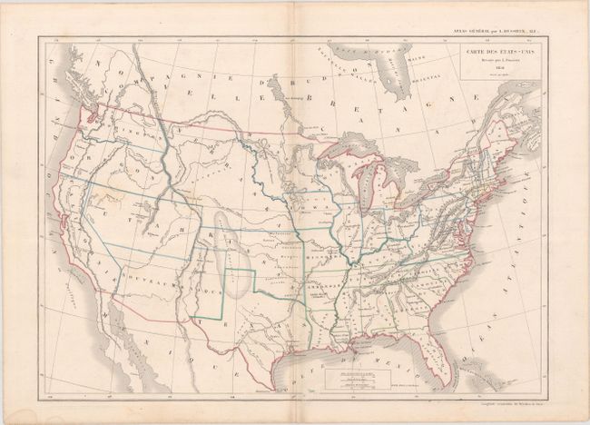
Auction 183, Lot 109
Subject: United States
Dussieux, Louis Entienne
Carte des Etats-Unis, 1856
Size: 15.3 x 10.9 inches (38.9 x 27.7 cm)
Estimate: $80 - $100
NO RESERVE
Sold for: $31
Closed on 6/9/2021
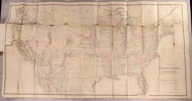
Auction 183, Lot 110
Subject: United States
General Land Office
[Map in Book] Map of the United States and Territories, Showing the Extent of Public Surveys and Other Details... [in] Report of the Commissioner of General Land Office, for the Year 1867, 1867
Size: 55.2 x 28.6 inches (140.2 x 72.6 cm)
Estimate: $300 - $375
Sold for: $220
Closed on 6/9/2021
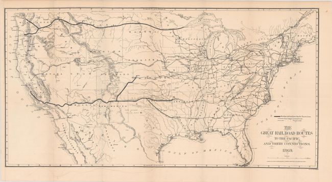
Auction 183, Lot 111
Subject: United States, Railroads
Gorlinski, Joseph
The Great Railroad Routes to the Pacific, and Their Connections, 1869
Size: 27.5 x 14.1 inches (69.9 x 35.8 cm)
Estimate: $250 - $325
Sold for: $180
Closed on 6/9/2021
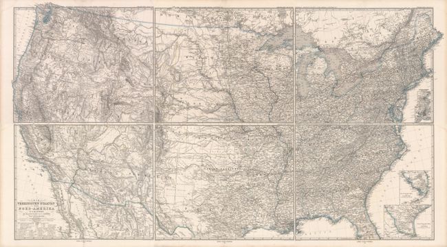
Auction 183, Lot 112
Subject: United States
Petermann, Augustus Herman
[On 6 Sheets] Die Vereinigte Staaten von Nord-Amerika in 6 Blattern, 1873
Size: 16 x 13.2 inches (40.6 x 33.5 cm)
Estimate: $200 - $230
Sold for: $135
Closed on 6/9/2021
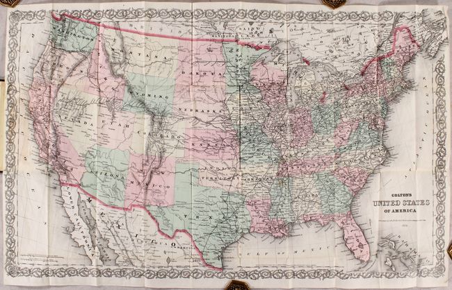
Auction 183, Lot 113
Subject: United States
Colton, G.W. & C.B.
Colton's United States of America, 1878
Size: 27.5 x 16.6 inches (69.9 x 42.2 cm)
Estimate: $275 - $350
Sold for: $200
Closed on 6/9/2021
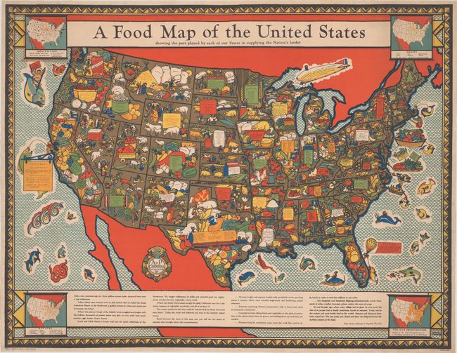
Auction 183, Lot 114
Subject: United States
A Food Map of the United States Showing the Part Played by Each of Our States in Supplying the Nation's Larder, 1933
Size: 43 x 33 inches (109.2 x 83.8 cm)
Estimate: $950 - $1,200
Sold for: $750
Closed on 6/9/2021
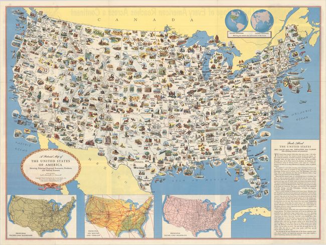
Auction 183, Lot 115
Subject: United States
[Lot of 2] A Pictorial Map of the United States of America Showing Principal Regional Resources, Products, and Natural Features [and] A Pictorial Map of the United States of America Showing Principal Resources, Products, and Recreational Features, 1950-56
Size: See Description
Estimate: $200 - $250
Sold for: $80
Closed on 6/9/2021
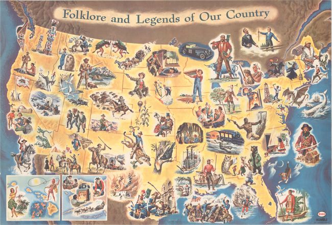
Auction 183, Lot 116
Subject: United States
Folklore and Legends of Our Country, 1962
Size: 33.5 x 22.7 inches (85.1 x 57.7 cm)
Estimate: $180 - $220
Sold for: $150
Closed on 6/9/2021
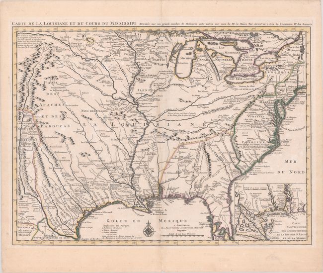
Auction 183, Lot 117
Subject: Colonial Eastern United States, Louisiana Territory
Delisle/Covens & Mortier
Carte de la Louisiane et du Cours du Mississipi Dressee sur un Grand Nombre de Memoires Entr' Autres sur ceux de Mr. le Maire, 1730
Size: 23.6 x 17.3 inches (59.9 x 43.9 cm)
Estimate: $1,900 - $2,200
Delisle's Influential Map of the Louisiana Territory
Sold for: $2,000
Closed on 6/9/2021
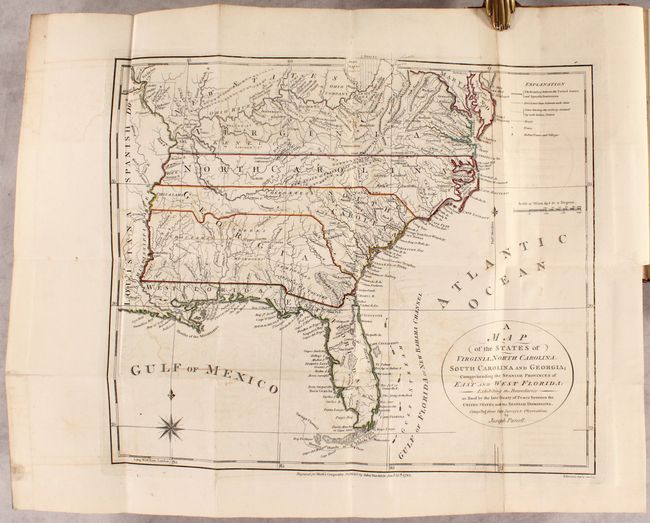
Auction 183, Lot 118
Subject: Eastern United States, Franklin
Morse, Jedidiah (Rev.)
[2 Maps in Book] A Map of the States of Virginia, North Carolina, South Carolina and Georgia; Comprehending the Spanish Provinces of East and West Florida... [and] A Map of the Northern and Middle States... [bound in] The American Geography..., 1792
Size: 14.4 x 12.4 inches (36.6 x 31.5 cm)
Estimate: $1,200 - $1,500
Includes Purcell's Map Locating the Proposed State of Franklin
Sold for: $1,600
Closed on 6/9/2021
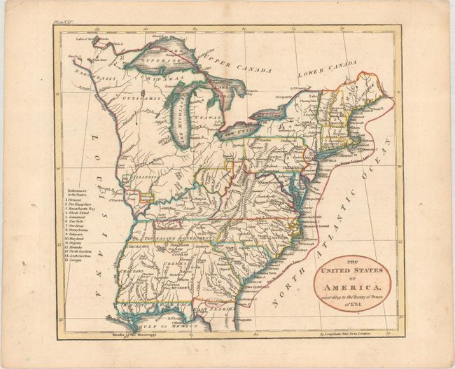
Auction 183, Lot 119
Subject: Eastern United States
Russell, John C.
The United States of America, According to the Treaty of Peace of 1784, 1801
Size: 7.9 x 7.1 inches (20.1 x 18 cm)
Estimate: $140 - $170
Sold for: $200
Closed on 6/9/2021
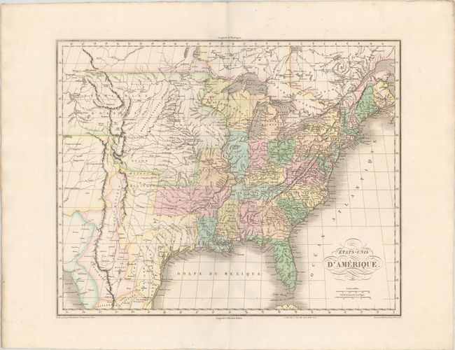
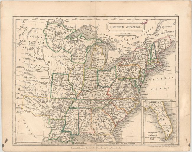
Auction 183, Lot 120
Subject: Eastern United States
Buchon, Jean Alexandre
Etats-Unis d'Amerique, 1825
Size: 20.8 x 16.7 inches (52.8 x 42.4 cm)
Estimate: $400 - $475
Sold for: $325
Closed on 6/9/2021
Auction 183, Lot 121
Subject: Eastern United States
Russell, John C.
United States, 1828
Size: 10.1 x 8 inches (25.7 x 20.3 cm)
Estimate: $220 - $250
Sold for: $160
Closed on 6/9/2021
Auction 183, Lot 122
Subject: Eastern United States
Hall, Sidney
United States, 1829
Size: 9.3 x 7.2 inches (23.6 x 18.3 cm)
Estimate: $160 - $190
Sold for: $120
Closed on 6/9/2021
Auction 183, Lot 123
Subject: Eastern United States
Fullarton, Archibald & Co.
United States, 1830
Size: 10.2 x 8 inches (25.9 x 20.3 cm)
Estimate: $160 - $190
Sold for: $140
Closed on 6/9/2021
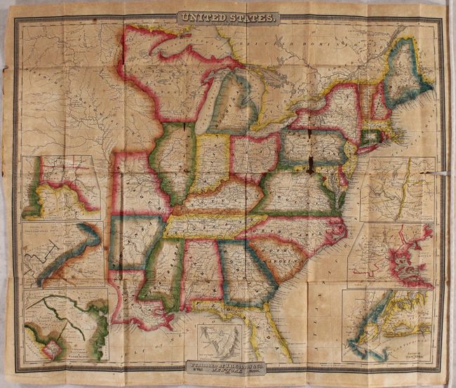
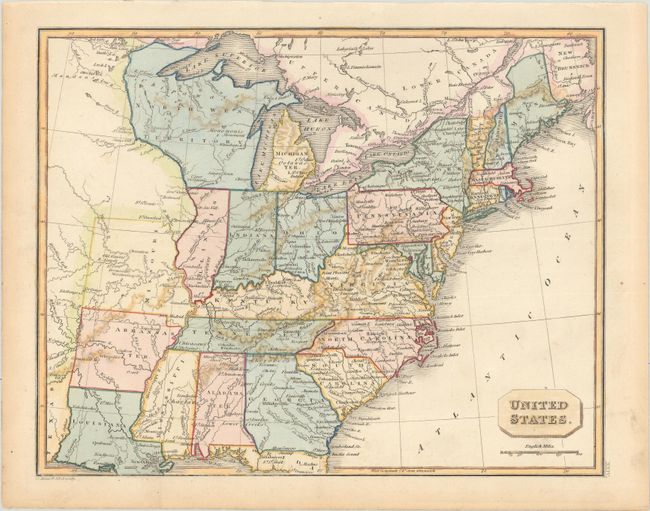
Auction 183, Lot 124
Subject: Eastern United States
Burr, David H.
United States, 1833
Size: 21.1 x 17.2 inches (53.6 x 43.7 cm)
Estimate: $800 - $950
Unsold
Closed on 6/9/2021
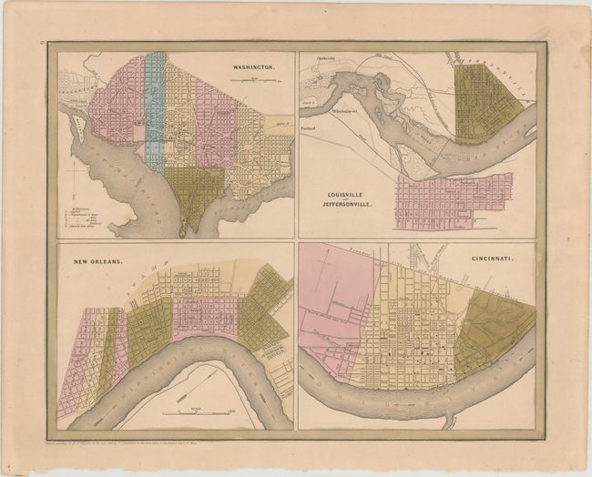
Auction 183, Lot 125
Subject: Eastern United States Cities
Bradford, Thomas Gamaliel
Washington [on sheet with] Louisville and Jeffersonville [and] New Orleans [and] Cincinnati, 1838
Size: 14.2 x 11.4 inches (36.1 x 29 cm)
Estimate: $70 - $90
NO RESERVE
Sold for: $275
Closed on 6/9/2021
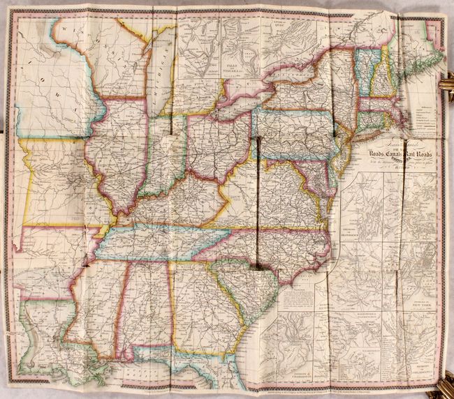
Auction 183, Lot 126
Subject: Eastern United States
Tanner, Henry Schenck
The Travellers Guide or Map of the Roads, Canals & Rail Roads of the United States... [in] The American Traveller; or Guide Through the United States..., 1840
Size: 21.3 x 18.3 inches (54.1 x 46.5 cm)
Estimate: $750 - $900
Sold for: $400
Closed on 6/9/2021
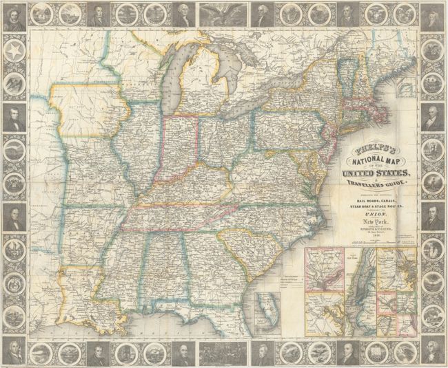
Auction 183, Lot 127
Subject: Eastern United States
Phelps, Ensigns & Thayer
Phelps's National Map of the United States, A Travellers Guide. Embracing the Principal Rail Roads, Canals, Steam Boat & Stage Routes, Throughout the Union, 1848
Size: 25.5 x 21 inches (64.8 x 53.3 cm)
Estimate: $700 - $850
Sold for: $500
Closed on 6/9/2021
Auction 183, Lot 128
Subject: Eastern United States
Garnier, Francis Marie Joseph
Etats-Unis de l'Amerique du Nord. Limites en 1835, 1860
Size: 19.6 x 13.2 inches (49.8 x 33.5 cm)
Estimate: $180 - $220
Sold for: $130
Closed on 6/9/2021
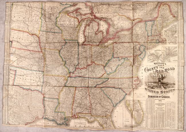
Auction 183, Lot 129
Subject: Eastern United States, Railroads
Watson, Gaylord
Watson's New County and Railroad Map of the United States and of the Dominion of Canada, 1871
Size: 52 x 36.5 inches (132.1 x 92.7 cm)
Estimate: $800 - $950
Sold for: $1,100
Closed on 6/9/2021
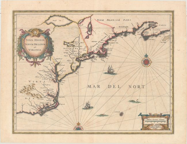
Auction 183, Lot 130
Subject: Colonial New England & Mid-Atlantic United States
Jansson, Jan
Nova Anglia Novum Belgium et Virginia, 1639
Size: 19.9 x 15.3 inches (50.5 x 38.9 cm)
Estimate: $1,400 - $1,700
Jansson's Influential Map of the East Coast
Unsold
Closed on 6/9/2021
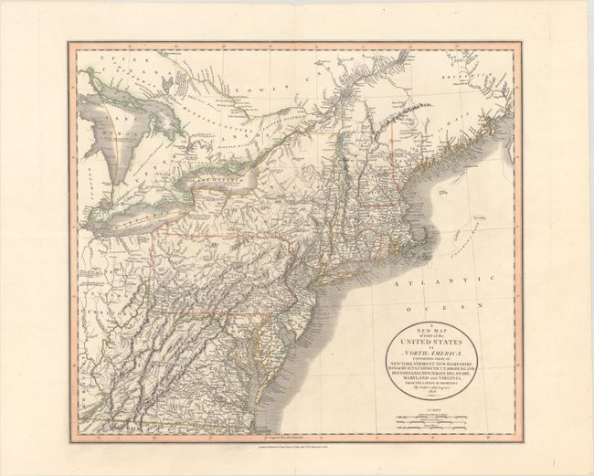
Auction 183, Lot 131
Subject: New England & Mid-Atlantic United States
Cary, John
A New Map of Part of the United States of North America, Containing Those of New York, Vermont, New Hampshire, Massachusets, Connecticut, Rhode Island. Pennsylvania, New Jersey, Delaware, Maryland and Virginia. From the Latest Authorities, 1806
Size: 20.3 x 17.9 inches (51.6 x 45.5 cm)
Estimate: $450 - $550
Sold for: $325
Closed on 6/9/2021
175 lots
Page 1 of 4