Subject: Colonial Great Lakes
Period: 1755 (dated)
Publication:
Color: Black & White
Size:
21.4 x 16.8 inches
54.4 x 42.7 cm
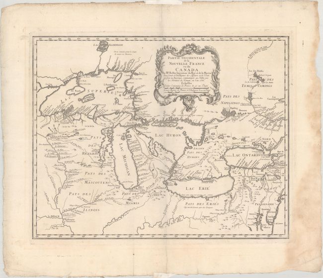
Superb map of the Great Lakes region illustrating strategic forts and the area claimed by the French just prior to the French and Indian War. Bellin's map, first published in 1744, dominated the cartography of the Great Lakes region for many years. It presented the first new material pertaining to New France since the maps of Guillaume Delisle three decades earlier. While this map summarizes the latest in French knowledge of the region, it is also notable for two cartographic myths: the mountain range in Michigan and the appearance of four fictitious islands in Lake Superior, including the infamous I Philippeaux Aut. I Minang that continued to appear on maps, and eluded explorers' searches for it, well into the 19th century. The map locates French forts, missions, new settlements, Indian villages, and includes an early appearance of Chicago, R. et Port de Checagou.. This version was published by Homann Heirs.
References: Karpinski (MI) p.138; Kershaw #950; Schwartz & Ehrenberg plt. 97; Sellers & Van Ee #19.
Condition: A
A nice impression on a sheet with a large fleur-de-lis watermark. There is dampstaining along the right margin that just touches neatline at bottom right. Remnants of hinge tape on recto.