Subject: Eastern United States, Franklin
Period: 1792 (published)
Publication:
Color: Hand Color
Size:
14.4 x 12.4 inches
36.6 x 31.5 cm
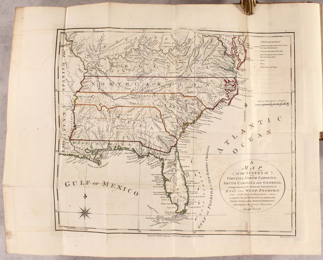
A. A Map of the States of Virginia, North Carolina, South Carolina and Georgia; Comprehending the Spanish Provinces of East and West Florida..., (14.4 x 12.4"). This fine map is a fascinating historical document of the United States following the Revolutionary War. It includes an early reference to the New State of Franklin in western North Carolina. The map includes a great amount of information including boundaries claimed by the various Indian Nations and trading paths on the western frontier. It shows early settlements, including a Moravian Settlement in North Carolina, and the Cumberland Settlements in present-day Tennessee. At the top of the map, in the nascent Northwest Territory, the 7 Ranges denote the first application of the Public Land Survey System. Several bounty land grants are shown including the Ohio Company, Wabash Company, New Jersey Company, Illinois Company, and the Donation Lands of the Commonwealth of Virginia. A triangular shaped plot of land in the region of present-day West Virginia is labeled Indiana. In 1785, settlers in present-day western North Carolina and eastern Tennessee organized a state government to be named in honor of Benjamin Franklin, Franklin or Frankland. Congress turned down their appeal but the state maintained a legislature and governor until 1788. This ephemeral state appeared on a small number of maps into the early part of the 19th century. References: Dotson & Baker (OWA) #6; Baynton-Williams (TMC-72) p. 16, #4; McCorkle (18th C. Geography Books) #300-1.
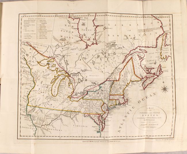
B. A Map of the Northern and Middle States; Comprehending the Western Territory and the British Dominions in North America from the Best Authorities, (15.4 x 12.3"). This uncommon and information-packed map describes the region from James Bay to the Chesapeake Bay and the confluence of the Mississippi and Ohio Rivers, and from the Lake of the Woods to the Gulf of St. Lawrence. A key in the upper left corner provides an explanation of the various symbols used in the map. Several of the districts and states are shown with distorted borders, but the most interesting feature of the map are the numerous Bounty Land Grants shown in the western frontier including Genl Clarks, Donation Lands from the Commonwealth of Virginia, and Ohio Company in Ohio, and Wabash Company, New Jersey Company, and Illinois Company in Illinois. Much of the information is taken from Amos Doolittle's map of the same title. This is the second state. Engraved by G. Allen Sanders, Wells Row, Islington. References: McCorkle #792.1; Kershaw #389.
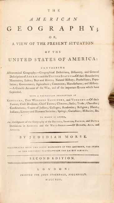
The two maps are still bound in Morse's The American Geography. Second edition, published by John Stockdale. 536 pages with folding table. Octavo, rebacked with original leather boards.
References: McCorkle (18th C. Geography Books) #300; Dotson & Baker (OWA) #6.1; Baynton-Williams (TMC-72) p. 16, #4.
Condition: B+
The folding maps are very good with light offsetting and short binding tears confined to the blank margins that have been closed on verso with archival tape. Text is remarkably clean and tight. Rebacked with original boards, which are worn with bumped corners.