Subject: Colonial Great Lakes, Canada
Period: 1778 (published)
Publication: The History of America...
Color: Black & White
Size:
10.1 x 8.1 inches
25.7 x 20.6 cm
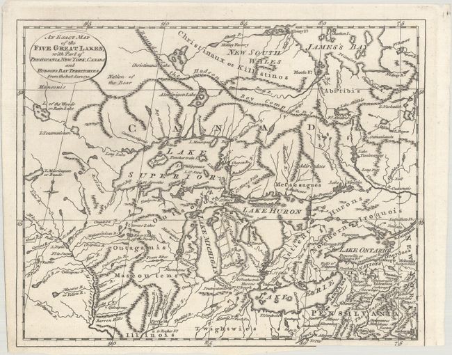
This handsome Revolutionary War era map of the Great Lakes and their surroundings was published in William Russell's The History of America. It extends from the eastern portion of present-day Minnesota to the western corner of Pennsylvania and north to James Bay. The intricate network of waterways in the region is captured in great detail, and mountains, forts, and Indian tribes are located. Several small islands appear in Lake Superior, including Isle Royale and Isle Phelipeaux, one of the fictitious Charlevoix-Bellin islands which was mentioned in the 1783 Treaty of Paris despite its non-existence. A notation reading Bounds of the Hudsons Bay Company identifies the southern boundary of the company's terrain. Features a compass rose topped with a fleur-de-lis.
References: Phillips (Maps) p. 859.
Condition: B+
A crisp impression on a clean sheet of watermarked paper. There is a binding trim at lower right with small loss of border and an associated tiny tear that has been closed on verso with archival tape.