Subject: Eastern United States
Period: 1828 (circa)
Publication:
Color: Hand Color
Size:
10.1 x 8 inches
25.7 x 20.3 cm
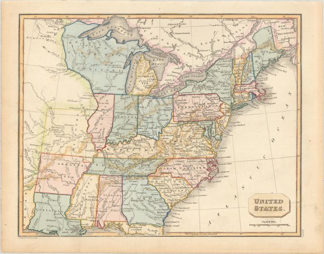
This small map covers the eastern United States, extending past the Mississippi River to include Louisiana, Arkansas Territory, and the new state of Missouri (established in 1821). Alabama is still noted as a territory despite achieving statehood in 1819. Interestingly, the states of Ohio, Indiana and Illinois are placed too far to the west with Indiana shown directly beneath Lake Michigan and Chicago is placed in North West Territory. The map is filled with details including settlements, Indian tribes, river systems, and topography.
References:
Condition: A
A hint of toning and soiling along the sheet edges, otherwise fine.